A surface soil water content-coupled regional scale maximum pore conductance calculation method
A technology of soil water content and surface soil, which is applied in the field of remote sensing monitoring of water resources and eco-hydrology, to achieve the effects of convenient calculation of time and space scales, strong mechanism and improved scientificity
- Summary
- Abstract
- Description
- Claims
- Application Information
AI Technical Summary
Problems solved by technology
Method used
Image
Examples
Embodiment Construction
[0062] In order to make the object, technical solution and advantages of the present invention clearer, the following examples are listed according to the accompanying drawings, and the present invention is further described in detail.
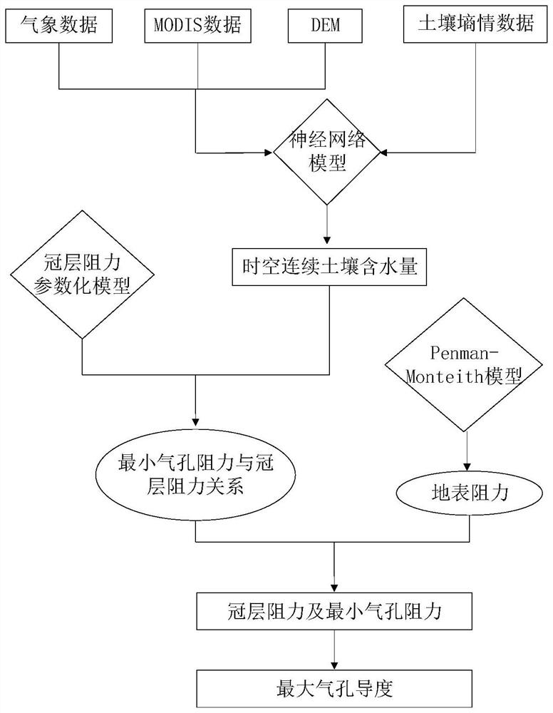
[0063] Such as figure 1 As shown, step a, according to the location of the study area, collect the data of various influencing factors related to the change of soil moisture content, and convert each influencing factor into daily data with a spatial resolution of 1km;
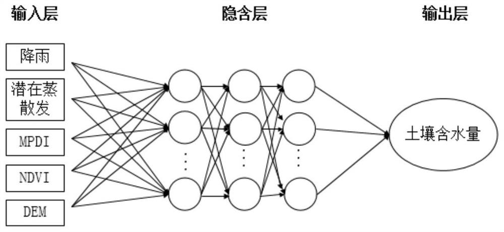
[0064] Based on the soil moisture observation data in Hebei Province, the surface soil moisture content of the whole province was retrieved, and the selected influencing factors of soil moisture content change included rainfall, potential evapotranspiration (E p ), Modified Vertical Drought Index (MPDI), Normalized Difference Vegetation Index (NDVI) and Surface Elevation (DEM);
[0065] Collect the observation data of rainfall stations in Hebei Province in 2018, and use the Ar...
PUM
 Abstract
Description
Claims
Application Information
 - R&D
- Intellectual Property
- Life Sciences
- Materials
- Tech Scout
- Unparalleled Data Quality
- Higher Quality Content
- 60% Fewer Hallucinations
Browse by: Latest US Patents, China's latest patents, Technical Efficacy Thesaurus, Application Domain, Technology Topic, Popular Technical Reports.
© 2025 PatSnap. All rights reserved.Legal|Privacy policy|Modern Slavery Act Transparency Statement|Sitemap|About US| Contact US: help@patsnap.com


