Base station longitude and latitude positioning method and device, computing equipment and computer storage medium

A positioning method and latitude and longitude technology, applied in wireless communication, electrical components, etc., can solve the problems of long acquisition period, large limitations, and poor reliability, and achieve the effect of overall quality improvement, strong reliability, and improved efficiency

Active Publication Date: 2021-06-29
CHINA MOBILE GROUP ZHEJIANG +1
View PDF6 Cites 0 Cited by
  • Summary
  • Abstract
  • Description
  • Claims
  • Application Information

AI Technical Summary

Problems solved by technology

[0003] In the process of implementing the embodiment of the present invention, the inventor found that the solution for positioning the latitude and longitude of the base station in the prior art has at least the following problems: First, the reliability is poor: it is completely dependent on the collection by the construction personnel on site, and it is impossible to know whether the positioning is accurate and lacks reliability; Second, the limitations are large: the traditional base station latitude and longitude collection method mainly uses the front desk engineer to locate and feed back data on site, and then update the base station latitude and longitude database, which can only be checked for individual sites, networks or cities, and cannot be checked and updated for the entire network; Third, the cycle is long: the collection of latitude and longitude of the base station requires a lot of manpower, material resources, and financial resources. is a big city) overall quality improvement of complex network structures

Method used


Image

  • Base station longitude and latitude positioning method and device, computing equipment and computer storage medium
  • Base station longitude and latitude positioning method and device, computing equipment and computer storage medium
  • Base station longitude and latitude positioning method and device, computing equipment and computer storage medium

Examples


Embodiment Construction

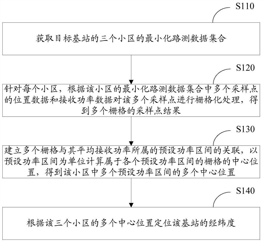
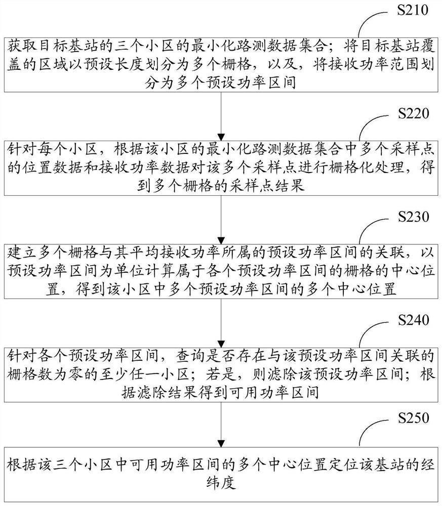
[0028] Exemplary embodiments of the present invention will be described in more detail below with reference to the accompanying drawings. Although exemplary embodiments of the present invention are shown in the drawings, it should be understood that the invention may be embodied in various forms and should not be limited to the embodiments set forth herein. Rather, these embodiments are provided for more thorough understanding of the present invention and to fully convey the scope of the present invention to those skilled in the art.

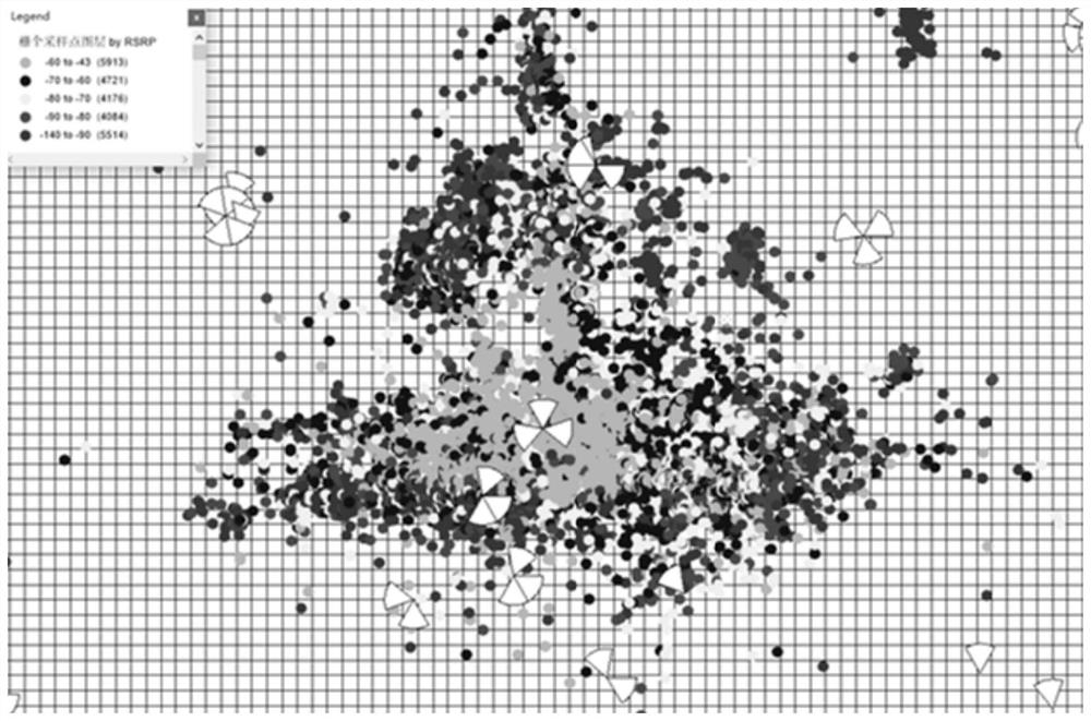
[0029] Before implementing the embodiment of the present invention, first, the following description is made on minimizing the Reference Signal Receiving Power (RSRP for short) in the drive test data:

[0030] There will be losses when the wireless signal propagates in space, and the signal strength received by the UE from the base station can be expressed by the following formula:

[0031] RSRP = RS Power - PL,

[0032] In the formula, RSRP i...


PUM


Abstract

The invention discloses a base station longitude and latitude positioning method and device, computing equipment and a computer storage medium. The method comprises the following steps of: acquiring a minimization drive test data set of three cells of a target base station; for each cell, rasterizing a plurality of sampling points according to the position data and the receiving power data of the plurality of sampling points in the minimization drive test data set of the cell to obtain sampling point results of a plurality of grids; establishing association between the plurality of grids and preset power intervals to which the average receiving power of the grids belongs, and calculating central positions of the grids belonging to the preset power intervals by taking the preset power intervals as units to obtain a plurality of central positions of the plurality of preset power intervals in the cell; and locating the longitude and latitude of the target base station according to the plurality of center positions of the three cells. Therefore, by adopting the base station longitude and latitude positioning method and the device, the longitude and latitude of the base station can be efficiently and accurately positioned, and effective checking of the longitude and latitude of the base station is further facilitated.

Description

technical field [0001] The present invention relates to the technical field of wireless communication networks, in particular to a base station longitude and latitude positioning method, device, computing equipment and computer storage medium. Background technique [0002] As an important network engineering parameter of the base station cell, the latitude and longitude of the base station affects all aspects of network planning, optimization and maintenance. If there is an obvious deviation in latitude and longitude, it will mislead daily network maintenance and optimization, and work efficiency is often half the effort. It can be seen that how to accurately locate the latitude and longitude of the base station has become an important link in the basic optimization work. At this stage, the collection and update of the latitude and longitude information of the base station mainly depends on the collection of latitude and longitude during the construction period of the projec...

Claims


Application Information

Patent Timeline
Patent Type & Authority Applications(China)
IPC IPC(8): H04W24/08H04W64/00
CPCH04W24/08H04W64/003Y02D30/70
Inventor 何建国
Owner CHINA MOBILE GROUP ZHEJIANG
Why Eureka
Try Eureka