

Rock-soil geological investigation method for building construction
A technology of geological survey and construction, which is applied in the fields of construction, earthwork drilling, site foundation soil survey, etc., and can solve problems such as inaccurate survey
- Summary
- Abstract
- Description
- Claims
- Application Information
AI Technical Summary
Problems solved by technology
Method used
Image

Examples
Embodiment Construction
[0034] In order to deepen the understanding of the present invention, the present invention will be further described below in conjunction with the examples, which are only used to explain the present invention, and do not constitute a limitation to the protection scope of the present invention.
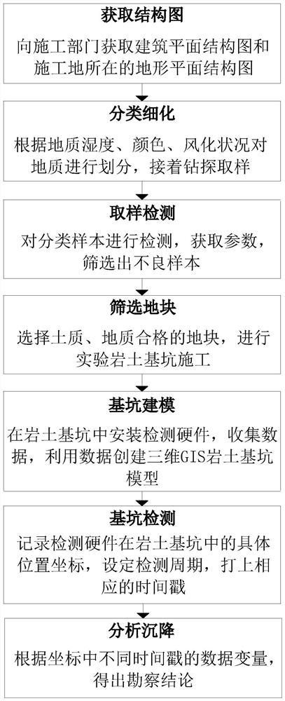
[0035] according to figure 1 As shown, the present embodiment proposes a geotechnical investigation method for building construction, comprising the following steps:
[0036] Step 1: Obtain the structure diagram
[0037] Obtain the general plan structure diagram of the building and the terrain plan structure diagram of the construction site from the construction department. At the same time, take aerial photos of the construction site through drones and high-definition cameras. The resolution of the photos is above 1080P, and the types and thickness of the rocks in the terrain and structure;
[0038] Step 2: Classification Refinement
[0039] In the structural diagram, the geology...
PUM
 Abstract
Description
Claims
Application Information