GNSS (Global Navigation Satellite System) measurement precision detector and use method

A technology of measurement accuracy and detector, applied in measurement devices, radio wave measurement systems, instruments, etc., can solve the problems of inconvenience, intuition, long measurement process, etc., and achieve the effect of short demonstration process time.

Pending Publication Date: 2021-07-09
南宁市自然资源信息集团有限公司
View PDF0 Cites 4 Cited by
  • Summary
  • Abstract
  • Description
  • Claims
  • Application Information

AI Technical Summary

Benefits of technology

This patented technology describes various technical features for accurately determining the precise location (the lift level or depth within millimeters). It involves providing multiple sensors along different directions simultaneously during the process of elevation control. These measurements help improve upon the overall performance of the system. Additionally, there may include calibration data points based on the initial stage and final stages of the lift motion. Overall, these technologies provide improved efficiency and reliability in achieving high dimensional resolution levels in industrial applications such as manufacture processes.

Problems solved by technology

This technical problem addressed in this patented text relates to finding accurate location data on an electronic device when navigating through different environments where there may exist obstacles like rocks or other obstructions. Existing methods require manual measurements while supporting these things during navigation, making them time-consuming and challenging at best.

Method used


Image

  • GNSS (Global Navigation Satellite System) measurement precision detector and use method
  • GNSS (Global Navigation Satellite System) measurement precision detector and use method
  • GNSS (Global Navigation Satellite System) measurement precision detector and use method

Examples


Embodiment 1

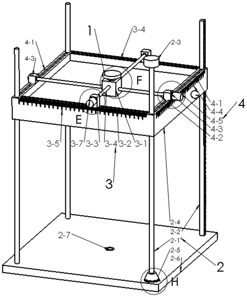
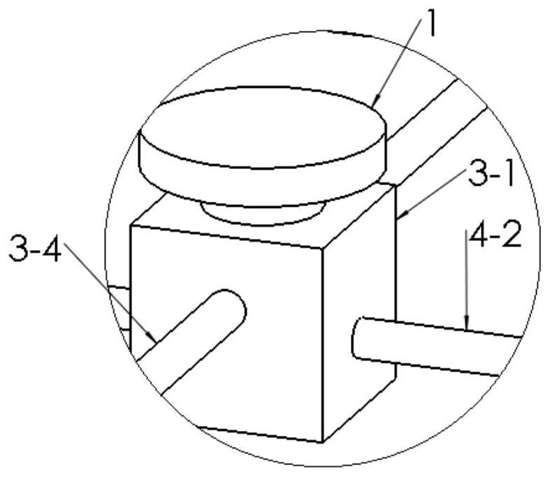
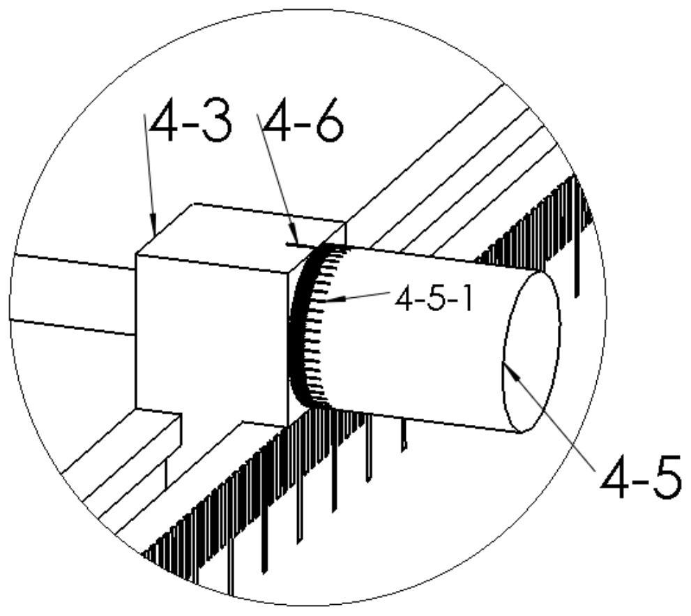
[0086] Example 1: Reference Figure 1 to Figure 16 , the technical scheme of the present invention is: a GNSS measurement accuracy detector, comprising: a GNSS module 1, the GNSS module 1 can be a GNSS board; a lift measurement mechanism 2, where the lift measurement mechanism 2 can be a scaled telescopic rod, The GNSS module 1 is connected to the lifting measuring mechanism 2, and the lifting measuring mechanism 2 is used to measure the lifting height of the GNSS module 1; The module 1 is connected to the lifting measuring mechanism 2 through the first level measuring mechanism 3, which is used to measure the displacement in the first horizontal direction of the GNSS module 1; the second level measuring mechanism 4, the GNSS module 1 and the Two horizontal measuring mechanisms 4 are connected, the second horizontal measuring mechanism 4 can be a scaled chute, the second horizontal measuring mechanism 4 is used to measure the displacement of the GNSS module 1 in the second hor...


PUM


Abstract

The invention discloses a GNSS measurement precision detector. The GNSS measurement precision detector comprises: a GNSS module; a lifting measurement mechanism, wherein the GNSS module is connected to the lifting measurement mechanism, and the lifting measurement mechanism is used for measuring the lifting height of the GNSS module; a first horizontal measurement mechanism, wherein the GNSS module is connected to the lifting measurement mechanism through the first horizontal measurement mechanism, and the first horizontal measurement mechanism is used for measuring the displacement of the GNSS module in the first horizontal direction; and a second horizontal measurement mechanism, wherein the GNSS module is connected with the second horizontal measurement mechanism, the second horizontal measurement mechanism is used for measuring the displacement of the GNSS module in the second horizontal direction, and the second horizontal direction is perpendicular to the first horizontal direction. The problems that in the prior art, carrying is inconvenient, and the measuring process is long and not visual are solved.

Description


Claims


Application Information

Patent Timeline
Owner 南宁市自然资源信息集团有限公司
Why Eureka
Try Eureka