
A Seabed Sand Wave Feature Recognition Method

A feature recognition and image recognition technology, applied in character and pattern recognition, instruments, calculations, etc., can solve the problems of sand wave height and wavelength difference, and achieve the effect of saving time and cost, fast speed, and eliminating the influence of subjective factors.

Active Publication Date: 2021-10-29
OCEAN UNIV OF CHINA
View PDF0 Cites 0 Cited by
  • Summary
  • Abstract
  • Description
  • Claims
  • Application Information

AI Technical Summary

Problems solved by technology

However, the profile method needs to manually determine the profile to be analyzed, and the selection of different profiles will lead to differences in the calculated sand wave height and wavelength

Method used


Image

  • A Seabed Sand Wave Feature Recognition Method
  • A Seabed Sand Wave Feature Recognition Method
  • A Seabed Sand Wave Feature Recognition Method

Examples


Embodiment 1

[0035] A large number of sand wave landforms are developed in the northern region of the South China Sea. The present invention will be further described below by taking this region as an example and referring to the accompanying drawings. The following examples are only used to illustrate the technical solution of the present invention more clearly, but not to limit the protection scope of the present invention.

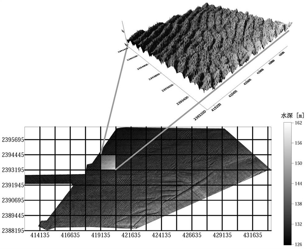
[0036] Step 1. There are a large number of seabed sand waves in the northern part of the South China Sea. The bathymetry map of a certain sand wave area in the South China Sea is obtained through actual bathymetry, as shown in figure 1 shown. In order to analyze the sand wave characteristics of this area, the area is divided into small areas with 7 rows and 17 columns, and the sand wave characteristics are analyzed area by area. Wave form see figure 1 upper right corner.

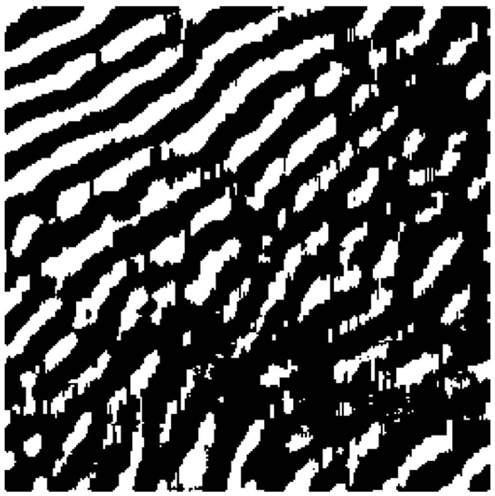
[0037] Step 2. Taking the selected water depth data in row 5 and column 6 (this position is...


PUM


Abstract

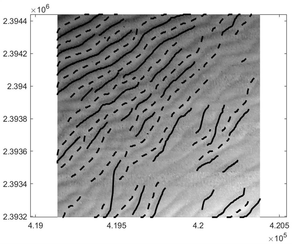
The invention discloses a seabed sand wave feature recognition method, and relates to the technical field of offshore marine engineering dynamic geological geomorphic environment. The present invention uses the measured water depth data, adopts the method of image recognition to obtain the crest line and trough line of the sand wave, and groups the crest line and trough line of the sand wave through linear fitting and coordinate conversion, and further utilizes the peak line and trough line of the sand wave Information automatically obtains characteristic information such as sand wave wavelength and wave height in a large area. The present invention can automatically identify the crest line and trough line of the seabed sand wave in a large area, and automatically classify and count the crest line and trough line of the sand wave, and then obtain a large amount of sand wave characteristic data, so as to further analyze the sand wave wavelength, wave height and water depth And the relationship between water and power etc. provides basic data, saves time and cost, and improves efficiency.

Description

technical field [0001] The invention relates to the technical field of offshore marine engineering dynamic geology and landform environment, in particular to a method for identifying seabed sand wave landform features. Background technique [0002] Submarine sand wave is a rhythmic and highly active submarine geomorphology, and the crest line of sand wave is usually perpendicular to the main direction of tidal current. As a special form of bed surface, sand waves are widely developed in estuaries, bays, straits, continental shelf slopes and other regions. Submarine sand waves will evolve and migrate under the strong influence of ocean dynamics such as waves, currents, storm surges, and internal waves. Sand wave migration can quickly change the shape of the seabed, causing submarine pipelines to be suspended or buried, resulting in instability of offshore platforms, etc., posing a serious threat to offshore oil and gas pipelines, submarine cables, oil platforms and other off...

Claims


Application Information

Patent Timeline
Patent Type & Authority Patents(China)
IPC IPC(8): G06K9/34G06K9/40G06K9/46
CPCG06V10/267G06V10/30G06V10/44
Inventor 王振鲁孟野谢波涛梁丙臣朱友生闫庆勋刘晓磊贾永刚
Owner OCEAN UNIV OF CHINA
Learn More