

Geodetic Line Matching Method, Device, and Ground Object Positioning Method Based on 3D Remote Sensing Images
A technology of remote sensing images and matching methods, applied in geographic information databases, instruments, calculations, etc., can solve problems such as follow-up processing interference, inestimability, and location errors of ground objects and targets, so as to avoid complex terrain and improve matching speed and matching Accuracy, the effect that is conducive to precise positioning
- Summary
- Abstract
- Description
- Claims
- Application Information
AI Technical Summary
Problems solved by technology
Method used
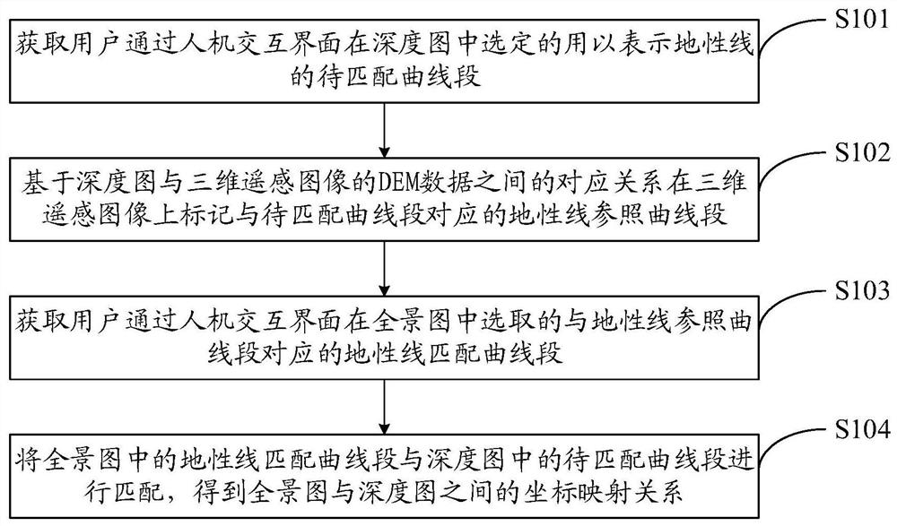
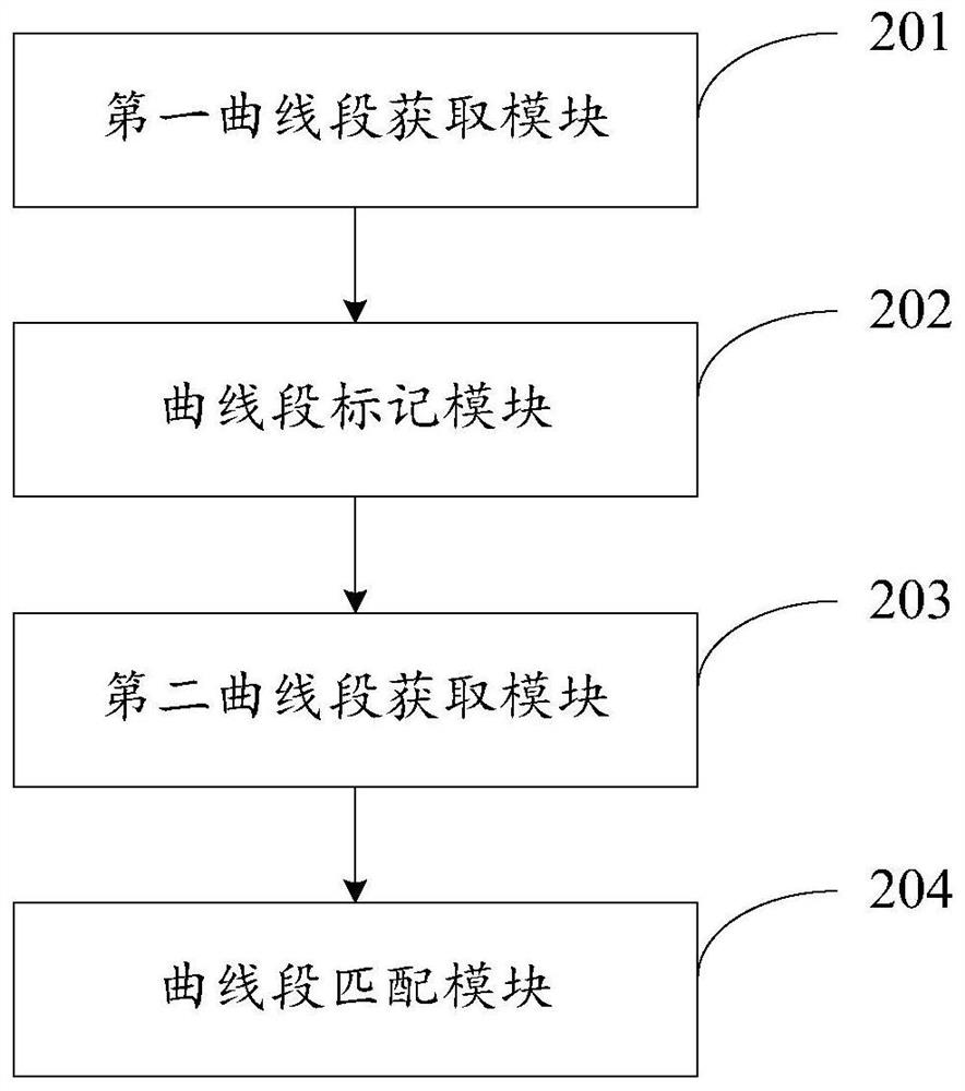
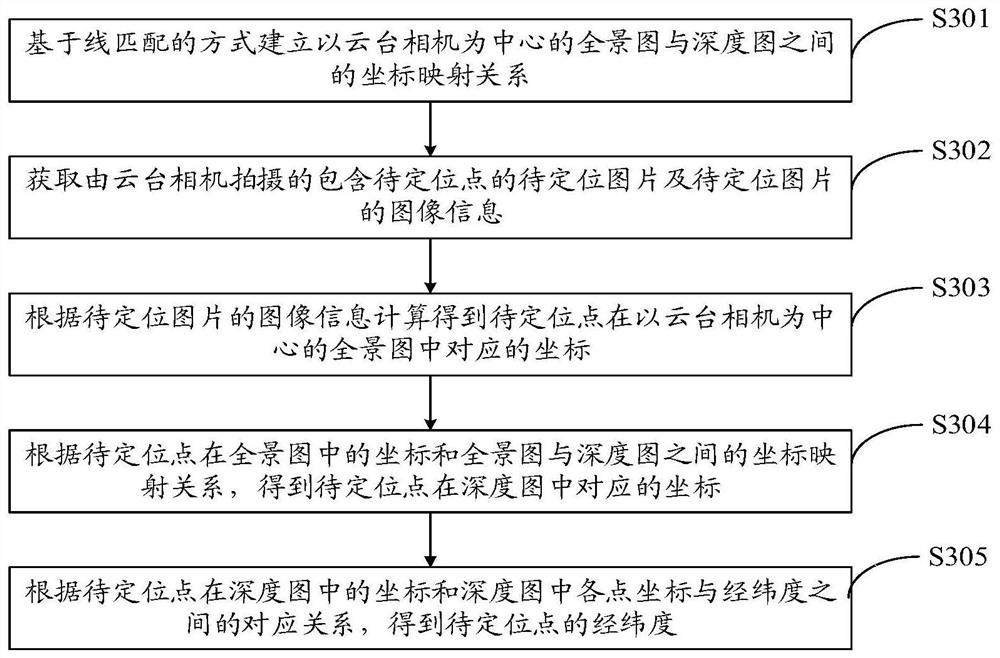
Image

Examples
Embodiment Construction
[0051] Exemplary embodiments of the present disclosure will be described in more detail below with reference to the accompanying drawings. Although exemplary embodiments of the present disclosure are shown in the drawings, it should be understood that the present disclosure may be embodied in various forms and should not be limited by the embodiments set forth herein. Rather, these embodiments are provided for more thorough understanding of the present disclosure and to fully convey the scope of the present disclosure to those skilled in the art.
[0052] Those skilled in the art can understand that, unless otherwise defined, all terms (including technical terms and scientific terms) used herein have the same meaning as commonly understood by those of ordinary skill in the art to which this invention belongs. It should also be understood that terms, such as those defined in commonly used dictionaries, should be understood to have meanings consistent with the meanings in the co...
PUM
 Abstract
Description
Claims
Application Information