Semi-aviation transient electromagnetic conductivity-depth imaging method and device
A technology of transient electromagnetic and imaging methods, which is applied in the field of geophysical aviation electromagnetic exploration to achieve the effect of ensuring continuity
- Summary
- Abstract
- Description
- Claims
- Application Information
AI Technical Summary
Problems solved by technology
Method used
Image
Examples
Embodiment 1
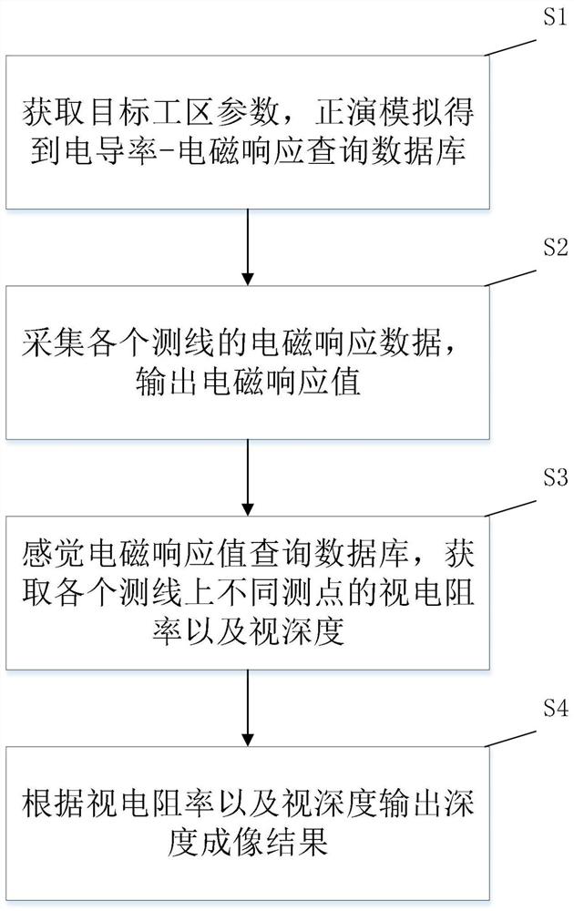
[0055] A semi-aerotransient electromagnetic conductivity-depth imaging method such as figure 1 shown, including the following steps:
[0056] S1: Obtain the work area parameters of the target work area, perform forward modeling according to the work area parameters, and obtain the conductivity-electromagnetic response query database; the work area parameters include the length of the line source, the length of the measuring line, the receiving height of the coil, the distance between the measuring points, and current intensity;
[0057] S2: Collect the electromagnetic response data of each survey line, and preprocess the electromagnetic response data, and output the electromagnetic response value; the above preprocessing includes extracting the data points on the corresponding survey line, and selecting the secondary field truncation time before proceeding Superposition and channel extraction of secondary field signals (discretization of continuous signals, that is, signals o...
Embodiment 2
[0085] The present embodiment is the concrete application example of embodiment 1:
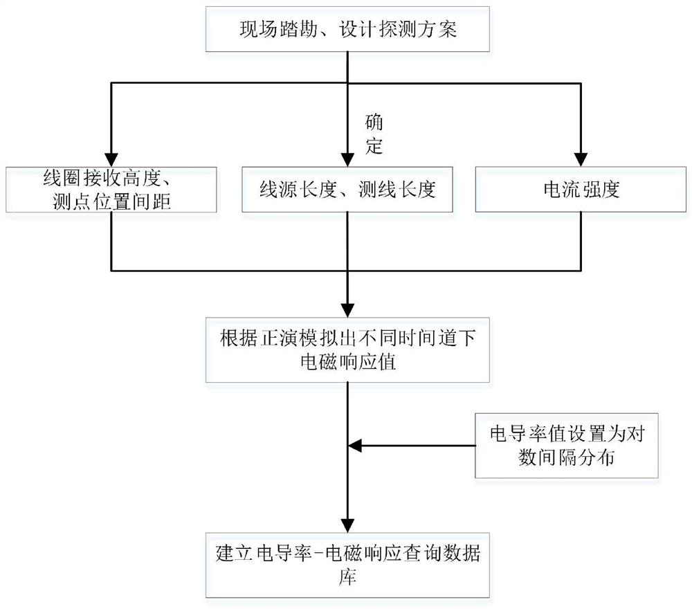
[0086] One, such as figure 2 As shown, the conductivity-electromagnetic response query database is established:
[0087] (1) Determine the parameters such as the length of the line source, the length of the measuring line, the receiving height of the coil, the distance between the measuring points and the current intensity according to the actual situation on site.
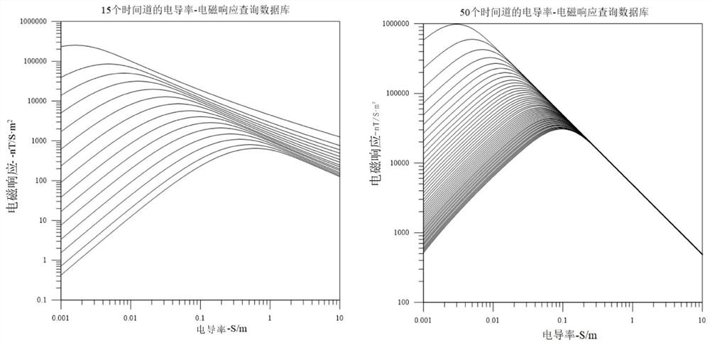
[0088] (2) Establish the conductivity-electromagnetic response query database according to the determined parameters, such as image 3 shown.
[0089] 2. SATEM-CDI imaging process:
[0090] (1) Single-point conductivity-depth SATEM-CDI imaging:
[0091] In order to verify the reliability of SATEM-CDI imaging, a three-layer H and K-type geological model and a four-layer geological body model for a single survey point were established in forward modeling. After the conductivity-electromagnetic response query database was establ...
Embodiment 3
[0097] Such as Figure 8 As shown, an electronic device includes at least one processor, and a memory communicated with the at least one processor; the memory stores instructions executable by the at least one processor, and the instructions are executed by the at least one processor. At least one processor is executed, so that the at least one processor can execute the semi-aerial transient electromagnetic conductivity-depth imaging method described in the foregoing embodiments. The input and output interfaces may include a display, a keyboard, a mouse, and a USB interface for inputting and outputting data; the power supply is used for providing electric energy for electronic equipment.
[0098] Those skilled in the art can understand that all or part of the steps for implementing the above-mentioned method embodiments can be completed by hardware related to program instructions, and the aforementioned programs can be stored in computer-readable storage media. The steps of t...
PUM
 Abstract
Description
Claims
Application Information
 - R&D
- Intellectual Property
- Life Sciences
- Materials
- Tech Scout
- Unparalleled Data Quality
- Higher Quality Content
- 60% Fewer Hallucinations
Browse by: Latest US Patents, China's latest patents, Technical Efficacy Thesaurus, Application Domain, Technology Topic, Popular Technical Reports.
© 2025 PatSnap. All rights reserved.Legal|Privacy policy|Modern Slavery Act Transparency Statement|Sitemap|About US| Contact US: help@patsnap.com


