Data processing method and device applied to urban planning, electronic equipment and medium
A technology of urban planning and data processing, applied in the field of data processing, can solve the problems of uncertain wind direction and heat, consume huge resources, affect people's normal life, etc., and achieve the effect of avoiding the heat island effect and reducing costs
- Summary
- Abstract
- Description
- Claims
- Application Information
AI Technical Summary
Problems solved by technology
Method used
Image
Examples
Embodiment 1
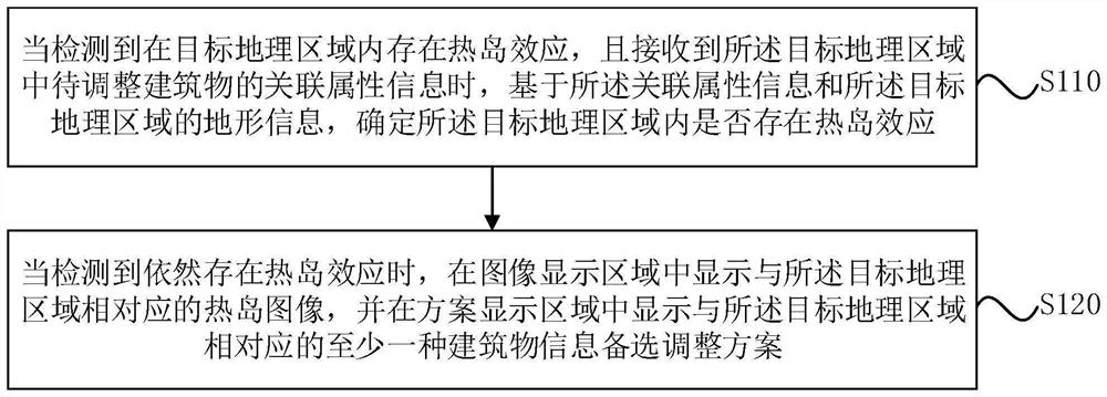
[0025] figure 1 It is a schematic flowchart of a data processing method applied to urban planning provided by the embodiment of the present invention. This embodiment is applicable to the situation of adjusting buildings associated with the heat island effect in urban planning. The method can It is executed by a data processing device applied to urban planning, and the device can be implemented in the form of software and / or hardware.
[0026] like figure 1 As described, the data processing method applied to urban planning in the embodiment of the present invention specifically includes the following steps:
[0027] S110. When it is detected that there is a heat island effect in the target geographic area, and the associated attribute information of the building to be adjusted in the target geographic area is received, based on the associated attribute information and the terrain information of the target geographic area, determine Whether there is a heat island effect in th...
Embodiment 2
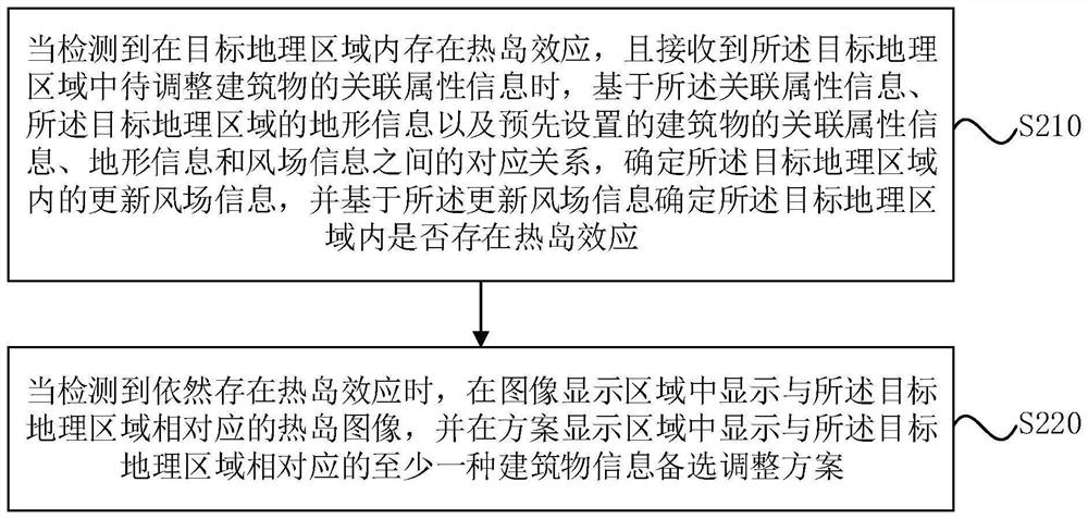
[0043] figure 2 It is a schematic flowchart of a data processing method applied to urban planning provided by the embodiment of the present invention. The embodiment of the present invention refines step 110 on the basis of the optional solutions of the above embodiments. The specific refinement process is in Detailed elaboration is made in the embodiments of the present invention. Wherein, technical terms that are the same as or similar to those in the foregoing embodiments will not be described in detail.
[0044] like figure 2 As mentioned above, the data processing method applied to urban planning provided by the embodiment of the present invention specifically includes the following steps:
[0045] S210. When it is detected that there is a heat island effect in the target geographic area, and the associated attribute information of buildings to be adjusted in the target geographic area is received, based on the associated attribute information, the terrain information...
Embodiment 3
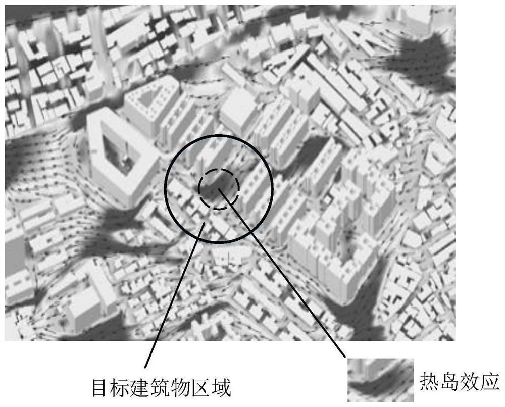
[0057] The technical solution of the embodiment of the present invention is an optional solution of the foregoing embodiment. The technical solution application and urban planning of the embodiment of the present invention. By displaying the target geographic area (target planning area) on the sand table, including terrain information, etc. Display buildings and wind field information in the target geographical area through the display device. Of course, the target geographic area can also be displayed by a display device. The display device includes a projection device, such as a projector, and may also be AR glasses, VR glasses, an Ipad, and the like.
[0058]In the embodiment of the invention, the building information in the target geographical area is obtained through CAD models, AIOT (Artificial Intelligence & Internet of Things, AIOT) data, etc., and the category of the building (school, hospital, etc.) and the height of the building are determined. , the location inf...
PUM
 Abstract
Description
Claims
Application Information
 - R&D
- Intellectual Property
- Life Sciences
- Materials
- Tech Scout
- Unparalleled Data Quality
- Higher Quality Content
- 60% Fewer Hallucinations
Browse by: Latest US Patents, China's latest patents, Technical Efficacy Thesaurus, Application Domain, Technology Topic, Popular Technical Reports.
© 2025 PatSnap. All rights reserved.Legal|Privacy policy|Modern Slavery Act Transparency Statement|Sitemap|About US| Contact US: help@patsnap.com


