

Map tile conversion method, system and equipment and storage medium
A technology of map tiles and tiles, which is applied in graphics and image conversion, image data processing, 3D modeling, etc., can solve the problems of cumbersome process and heavy workload, and achieve the effect of improving precision and accurate image data
- Summary
- Abstract
- Description
- Claims
- Application Information
AI Technical Summary
Problems solved by technology
Method used
Image

Examples
Embodiment 2
[0138] Based on the same idea as the map tile conversion method provided in Embodiment 1, such as Figure 9 As shown, this embodiment provides a map tile conversion system, including:
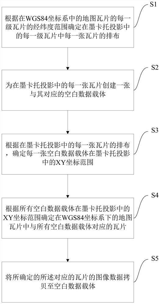
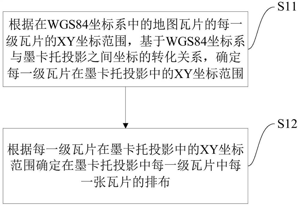
[0139] The longitude and latitude conversion module 100 is used to determine the arrangement of each tile in each level of tiles in the Mercator projection according to the latitude and longitude range of each level of tiles of the map tiles in the WGS84 coordinate system;
[0140] A blank carrier creation module 200, configured to create a corresponding blank data carrier for each tile in the Mercator projection;
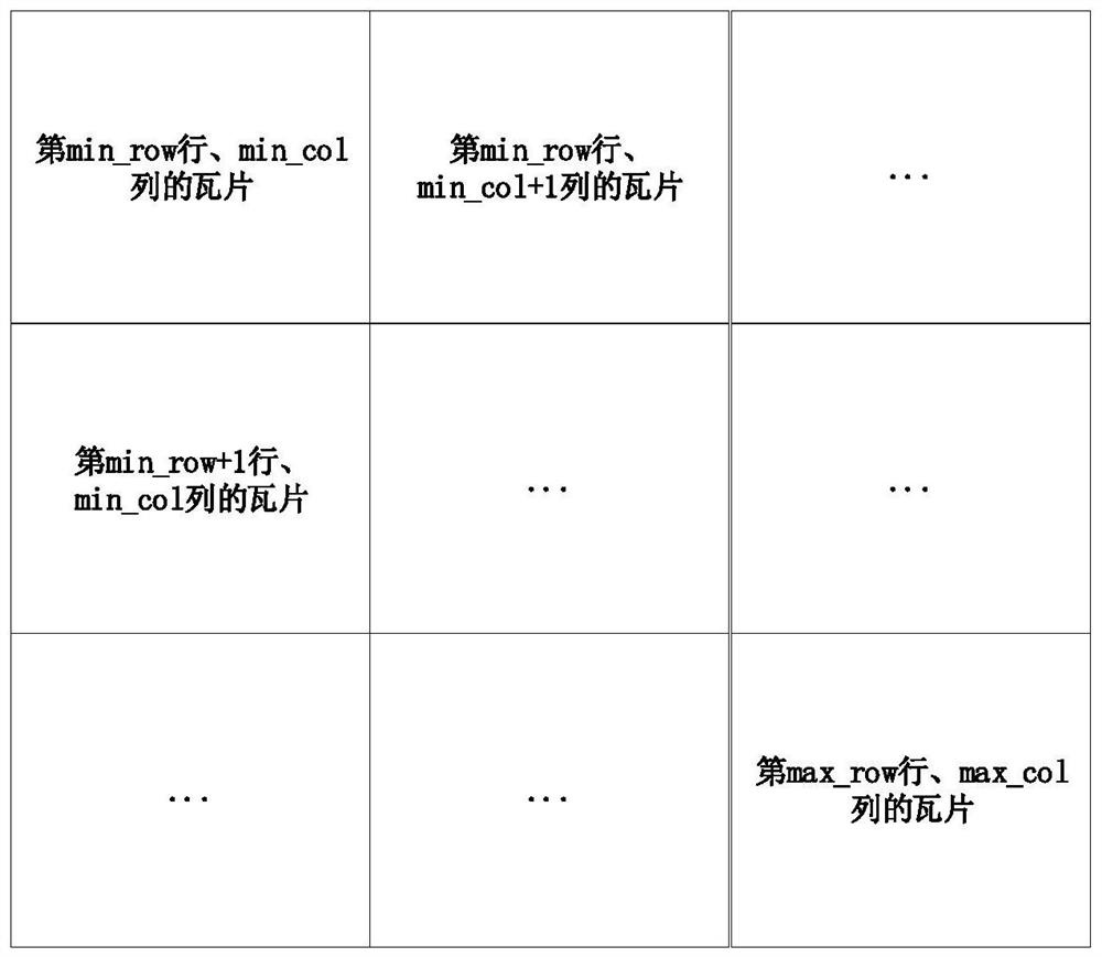
[0141] The blank carrier data processing module 300 is used to determine the XY coordinate range of each blank data carrier in the Mercator projection according to the arrangement of each tile in the Mercator projection; The XY coordinate range of the blank data carrier in the Mercator projection determines the tiles corresponding to all the blank data carriers in the map tiles in ...
Embodiment 3
[0159] Based on the same idea as the previous embodiment, this embodiment also provides a computer device, including a memory and a processor, the memory stores a computer program, and the processor implements the map described in Embodiment 1 when executing the computer program The tile conversion method has corresponding functions and beneficial effects.
Embodiment 4
[0161] Based on the same idea as the foregoing embodiment, this embodiment also provides a computer-readable storage medium, on which a computer program is stored, and when the computer program is executed by a processor, the map tile conversion method described in Embodiment 1 is implemented, It has corresponding functions and beneficial effects.
PUM
 Abstract
Description
Claims
Application Information