
Land space planning topographic survey device

A technology for spatial planning and terrain measurement, applied in photovoltaic power generation, photovoltaic modules, electrical components, etc., can solve the problems of inadequate connection, high error rate, large planning conflicts, etc., to facilitate handling, reduce error rates, and facilitate measurement. Effect

Pending Publication Date: 2022-03-08
刘群
View PDF0 Cites 1 Cited by
  • Summary
  • Abstract
  • Description
  • Claims
  • Application Information

AI Technical Summary

Problems solved by technology

[0002] At present, due to various reasons, land, planning, forestry and ocean management departments are not well connected in management, resulting in relatively large conflicts in land planning, urban planning, ecological and environmental protection planning, marine zoning and other related industry planning along the coastline. Each plan arranges different uses for the same area. my country's land and resources lack a unified data information management and application platform. The informatization of the land and resources industry is still in the stage of decentralized deployment of business systems by region. overall connection
[0003] At present, land space topographic survey generally requires the use of survey cameras for shooting and measurement, and when the shooting cameras are used, they are usually supported by a tripod, which is not convenient for the entire detection device to be transported, and manual data recording is required. Time-consuming and labor-intensive, high error rate

Method used


Image

  • Land space planning topographic survey device
  • Land space planning topographic survey device
  • Land space planning topographic survey device

Examples


Embodiment

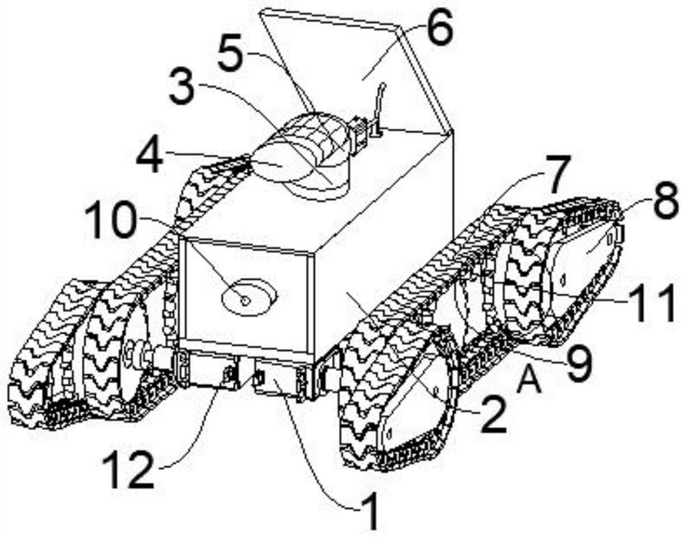
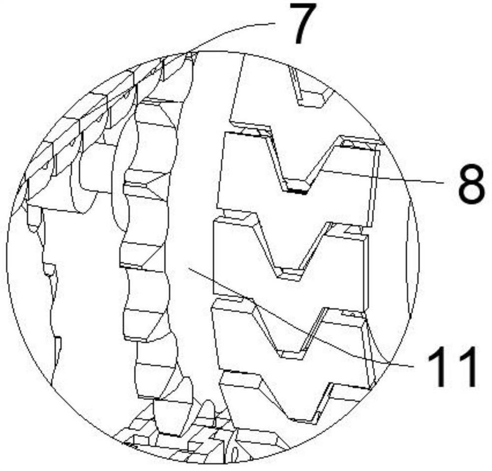
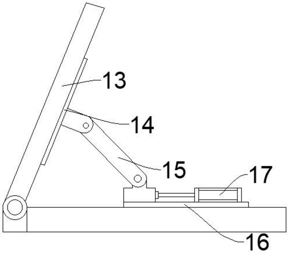
[0033] Please refer to Figure 1-Figure 4 , figure 1 It is a structural schematic diagram of an embodiment of the present invention; figure 2 for figure 1 Partial enlarged view of A in the center; image 3 It is a side view of the photovoltaic module of the embodiment of the present invention; Figure 4 It is a schematic diagram of the connection of electronic components in the embodiment of the present invention.

[0034]This embodiment provides a topographic surveying device for land space planning, including a vehicle 1, the vehicle 1 includes a mounting platform 2, a crawler belt 9 assembly and a control module 20, and the crawler belt 9 assembly includes a power wheel 11 and a transmission belt arranged on the power wheel 11, The power wheel 11 is provided with a climbing wheel 8, the climbing wheel 8 is rotationally connected with the power wheel 11, the input end of the power wheel 11 is provided with a drive motor 22, and the control module 20 is connected with th...


PUM


Abstract

The invention provides a territorial space planning topographic survey device, and relates to the field of territorial photogrammetry. A territorial space planning topographic survey device comprises a carrying tool, the carrying tool comprises a mounting table, a track assembly and a control module, the track assembly comprises a power wheel and a transmission belt arranged on the power wheel, the power wheel is provided with a climbing wheel, the climbing wheel is rotationally connected with the power wheel, and the input end of the power wheel is provided with a driving motor; the control module is connected with the driving motor; and the data acquisition assembly comprises a camera and a steering mechanism, the camera is arranged on the steering mechanism, and the steering mechanism is arranged on the mounting table. The territorial space planning topographic measurement device can be conveniently carried by a user, measurement of complex terrains is facilitated, data are directly generated, and the error rate of measurement is reduced.

Description

technical field [0001] The invention relates to the field of national land photogrammetry, in particular to a topographic measurement device for national land space planning. Background technique [0002] At present, due to various reasons, land, planning, forestry and ocean management departments are not well connected in management, resulting in relatively large conflicts in land planning, urban planning, ecological and environmental protection planning, marine zoning and other related industry planning along the coastline. Each plan arranges different uses for the same area. my country's land and resources lack a unified data information management and application platform. The informatization of the land and resources industry is still in the stage of decentralized deployment of business systems by region. overall connection. [0003] At present, land space topographic survey generally requires the use of survey cameras for shooting and measurement, and when the shooting ...

Claims


Application Information

Patent Timeline
IPC IPC(8): F16M11/04F16M11/08F16M11/10F16M11/18F16M11/42H02S20/30
CPCF16M11/42F16M11/043F16M11/08F16M11/18F16M11/10H02S20/30Y02E10/50
Inventor 刘群刘惠舒葛艳
Owner 刘群
Learn More