Remote sensing image space-time fusion method based on hybrid convolutional network
A remote sensing image, spatiotemporal fusion technology, applied in the field of remote sensing images, can solve problems such as easy loss of spatial details, inability to accurately invert land cover change areas, and performance degradation.
- Summary
- Abstract
- Description
- Claims
- Application Information
AI Technical Summary
Problems solved by technology
Method used
Image

Examples
Embodiment Construction
[0040] The technical solutions in the embodiments of the present invention will be described clearly and in detail below with reference to the accompanying drawings in the embodiments of the present invention. The described implementations are only some of the embodiments of the invention.
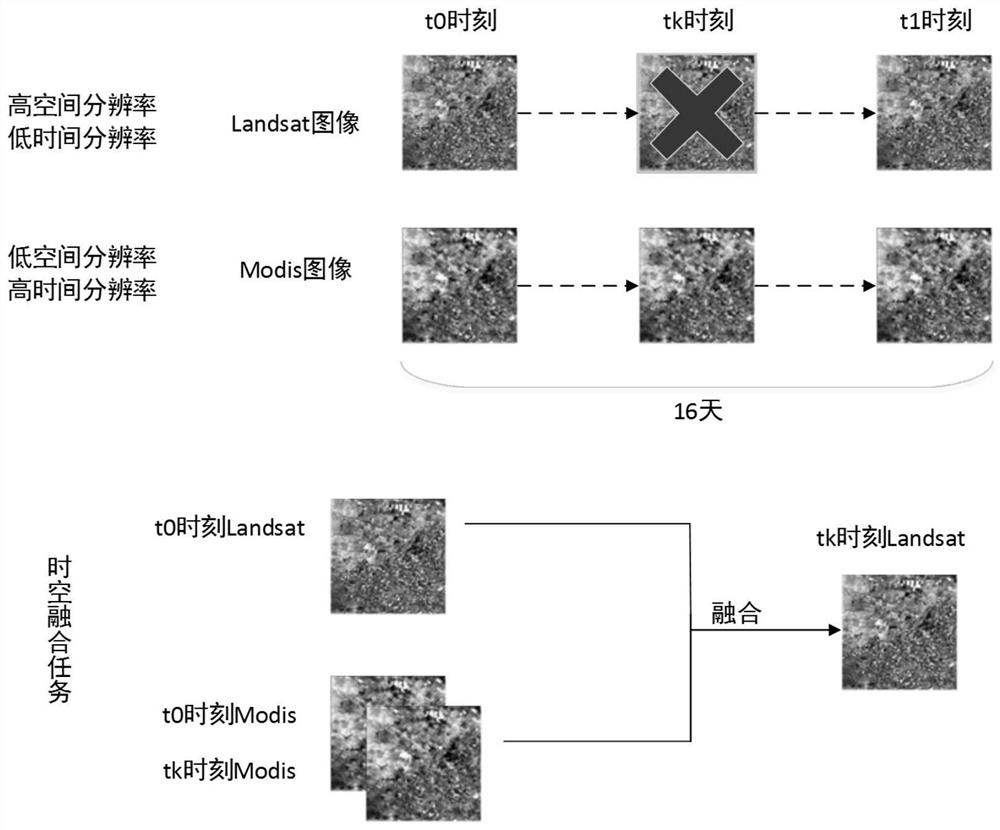
[0041] Symbol description, MDS and LST represent Modis and Landsat satellite images, respectively, and the subscripts represent images collected at different times, such as MDS 1 Represents the Modis multi-band image collected at time t1. If there is a superscript, it indicates that the image is a single-band image, such as MDS 1 i It represents the image of the i-th band of Modis collected at time t1.
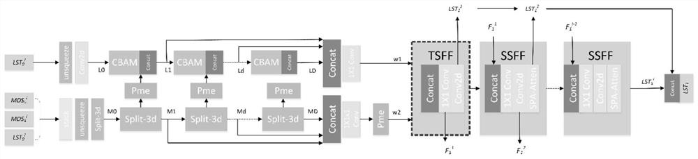
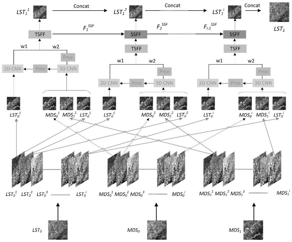
[0042] The invention intends to solve the problems that remote sensing images are restricted by spatial resolution and temporal resolution in practical applications, and are limited in applications such as earth observation. A spatiotemporal fusion model of remote sensing images based o...
PUM
 Abstract
Description
Claims
Application Information
 - R&D Engineer
- R&D Manager
- IP Professional
- Industry Leading Data Capabilities
- Powerful AI technology
- Patent DNA Extraction
Browse by: Latest US Patents, China's latest patents, Technical Efficacy Thesaurus, Application Domain, Technology Topic.
© 2024 PatSnap. All rights reserved.Legal|Privacy policy|Modern Slavery Act Transparency Statement|Sitemap