Method and system for determining position according to computing time

A technology of time and known position, used in satellite radio beacon positioning systems, electronic timers, changing time indications and other directions, can solve problems such as difficulty in implementation, and achieve the effects of cheap production, fast initialization time, and simple production

Inactive Publication Date: 2003-10-01
FURUNO ELECTRIC CO LTD +1
View PDF1 Cites 5 Cited by
  • Summary
  • Abstract
  • Description
  • Claims
  • Application Information

AI Technical Summary

Problems solved by technology

A direct search for the best x becomes impractical

Method used


Image

  • Method and system for determining position according to computing time
  • Method and system for determining position according to computing time
  • Method and system for determining position according to computing time

Examples


Embodiment Construction

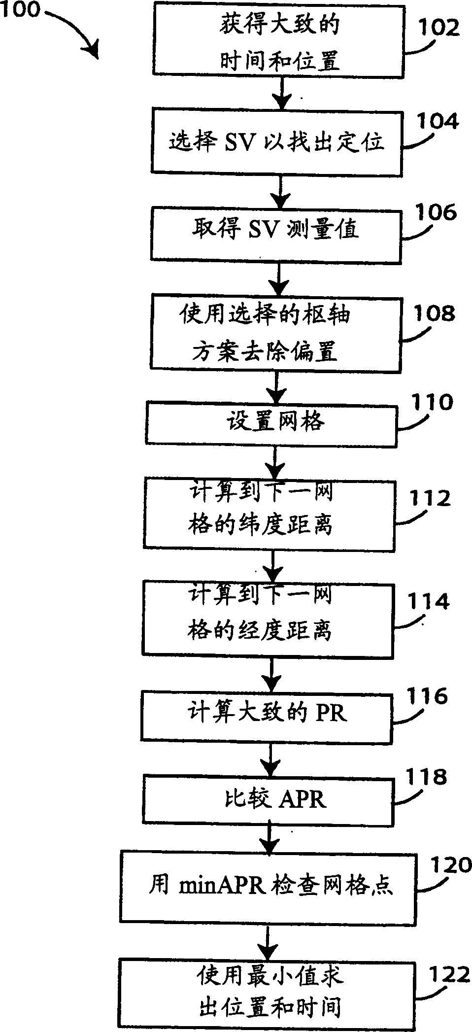
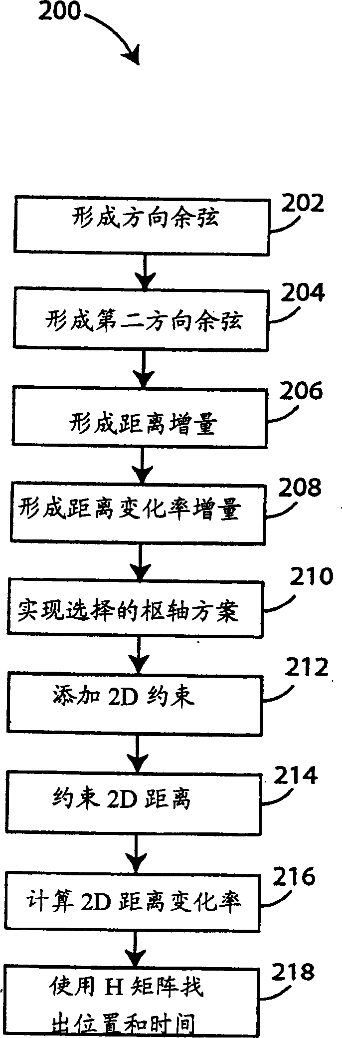
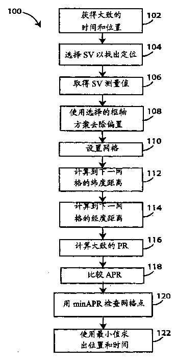
[0023] In general, the navigation satellite receiver embodiment of the present invention includes means for initializing to know time to within seconds and position to within 150 km ahead. A 2D grid of points sets a constant height representing the solution origin within a 150 km area. The fractional pseudoranges from each satellite in the constellation are examined to find the best initial fit to each point in the grid. Various time offset adjustments were also tried at the points within the time bounds to find the best fit point. This point is then used in the drive to find the final solution and generate the first positioning after a cold start.

[0024] figure 1 In , the first method embodiment of the invention for initializing a GPS receiver begins with the assumption that the time is correctly known to within a few seconds and that the user's location is correctly known to be within 150 kilometers of the true location. Method 100 begins at step 102 where the approxima...


PUM


Abstract

The navigation satellite receiver includes means for initialization, the time is known in advance within a few seconds and the position within 150 km. A 2D grid of points sets a constant height representing the solution origin within a 150 km area. Look at the fractional pseudoranges to each satellite in the constellation to find the best initial fit to the points in the grid. Also try various time offset adjustments to the points within the time bounds in order to find the best fit point. This point is then used to drive finding the final solution and to generate the first localization after a cold start.

Description

technical field [0001] The present invention relates to navigation satellite receivers and, more particularly, to methods and systems for assisting initialization of navigation satellite receivers with limited prior knowledge of time and position. Background technique [0002] A Global Positioning System (GPS) receiver uses signals received from several earth-orbiting satellites to determine a user's position and velocity, as well as other navigational data. A navigation receiver that has just been turned on does not yet know where it is, what is the error of its crystal oscillator, or what time it is. All of these need to be found and locked onto satellite transmissions, so all possible searches must be done. [0003] Since the receiver and satellite clocks are not perfectly synchronized, such clock drift manifests itself as an error in the distance to the satellite. The line-of-sight distance is called the "pseudorange" (PR). The clock error can be calculated by assumin...

Claims


Application Information

Patent Timeline
Patent Type & Authority Applications(China)
IPC IPC(8): G01S1/00G01S5/14G01S19/25G01S19/42G04G5/00
CPCG01S19/42
Inventor S·J·爱德华兹P·W·麦克博尼
Owner FURUNO ELECTRIC CO LTD
Why Eureka
Try Eureka