Differential type geographic location information coding algorithm based on region benchmark

A technology of geographical location information and coding algorithm, which is applied in the field of longitude and latitude coding compression algorithm, can solve the problem of insufficient space, etc., and achieve the effects of easy maintenance, saving storage space, and easy algorithm

Inactive Publication Date: 2006-07-26
江苏吉天科技有限公司
View PDF0 Cites 11 Cited by
  • Summary
  • Abstract
  • Description
  • Claims
  • Application Information

AI Technical Summary

Problems solved by technology

[0004] In view of this, the object of the present invention is to provide a differential geographical position information coding algorithm based on regional reference points, by compressing the information volume of longitude and latitude, to solve the contradiction that the space is not large enough when storing geographical position information

Method used


Image

  • Differential type geographic location information coding algorithm based on region benchmark

Examples


Embodiment Construction

[0008] The present invention proposes the "differential geographic position information coding based on regional reference point" algorithm, which

[0009] The specific implementation is as follows:

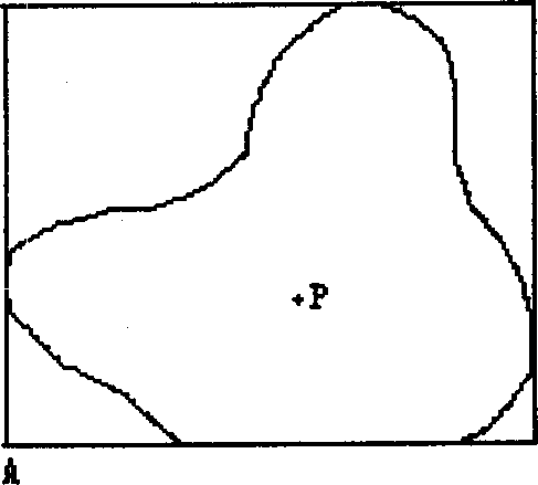
[0010] Step 1: Find the minimum rectangular envelope of area B. For any finite area, an infinite number of rectangular envelopes of area B can always be found, and the intersection of all these rectangular envelopes is the minimum envelope of the area.

[0011] Step 2: Determine the benchmark. The reference point is one of the vertices of the smallest rectangular envelope. This vertex has both the minimum longitude and latitude on area B. The accuracy requirements of the latitude and longitude values ​​of the datum point are relatively high.

[0012] Step 3: The latitude and longitude of all other points in area B except the reference point are greater than the reference point, but we only save the difference with the reference point.

[0013] The implementation process of t...


PUM


Abstract

The invention discloses a difference geographical position information coding algorithm based on area reference point, especially relates to a latitude and longitude coding compression algorithm for writing as much as possible latitude and longitude information into IC card. For any area, no mater where it is located on Earth, calculating its minimum rectangle envelope diagram and selecting one point from the four vertexes of the rectangle, the latitude and longitude of this point is the minimum in the area; only the difference value of latitude and longitude between target point and the reference point needs to be stored when storing other points latitude and longitude values in A area for saving storage space.

Description

technical field [0001] The invention relates to a latitude and longitude encoding compression algorithm, which is mainly used for writing as much latitude and longitude information as possible into an IC card. Background technique [0002] The mature development and application of GPS technology has involved more and more fields. At present, buses and taxis in some large cities have been equipped with GPS positioning technology, and some large logistics companies have also installed vehicle-mounted GPS equipment on their transport vehicles, and regularly send location information to the control center. You can know the driving situation of the vehicle at any time on the map. [0003] The geographical information data obtained from the GPS output device is large, and it is in text format. It takes more than ten bytes to save the latitude and longitude information. Therefore, when using the IC card to save the latitude and longitude information, the storage space becomes the ...

Claims


Application Information

Patent Timeline
Patent Type & Authority Applications(China)
IPC IPC(8): G01C21/32G06F17/30G01S1/00G01S5/00G09B29/00
Inventor 刘卫明
Owner 江苏吉天科技有限公司
Why Eureka
Try Eureka