Nevigation positioning reinforced in formation internet real-time broadcasting method based on P2 technology

A technology for navigation and positioning and information enhancement, applied in the Internet field, can solve problems such as inability to communicate and block buildings, achieve the effect of small network scale and relieve the pressure on the server side

Active Publication Date: 2006-10-25
TSINGHUA UNIV
View PDF0 Cites 15 Cited by
  • Summary
  • Abstract
  • Description
  • Claims
  • Application Information

AI Technical Summary

Problems solved by technology

[0043] The main broadcast method of satellite positioning enhanced information, that is, satellite-based enhanced information, is usually to use

Method used


Image

  • Nevigation positioning reinforced in formation internet real-time broadcasting method based on P2 technology
  • Nevigation positioning reinforced in formation internet real-time broadcasting method based on P2 technology
  • Nevigation positioning reinforced in formation internet real-time broadcasting method based on P2 technology

Examples


Embodiment Construction

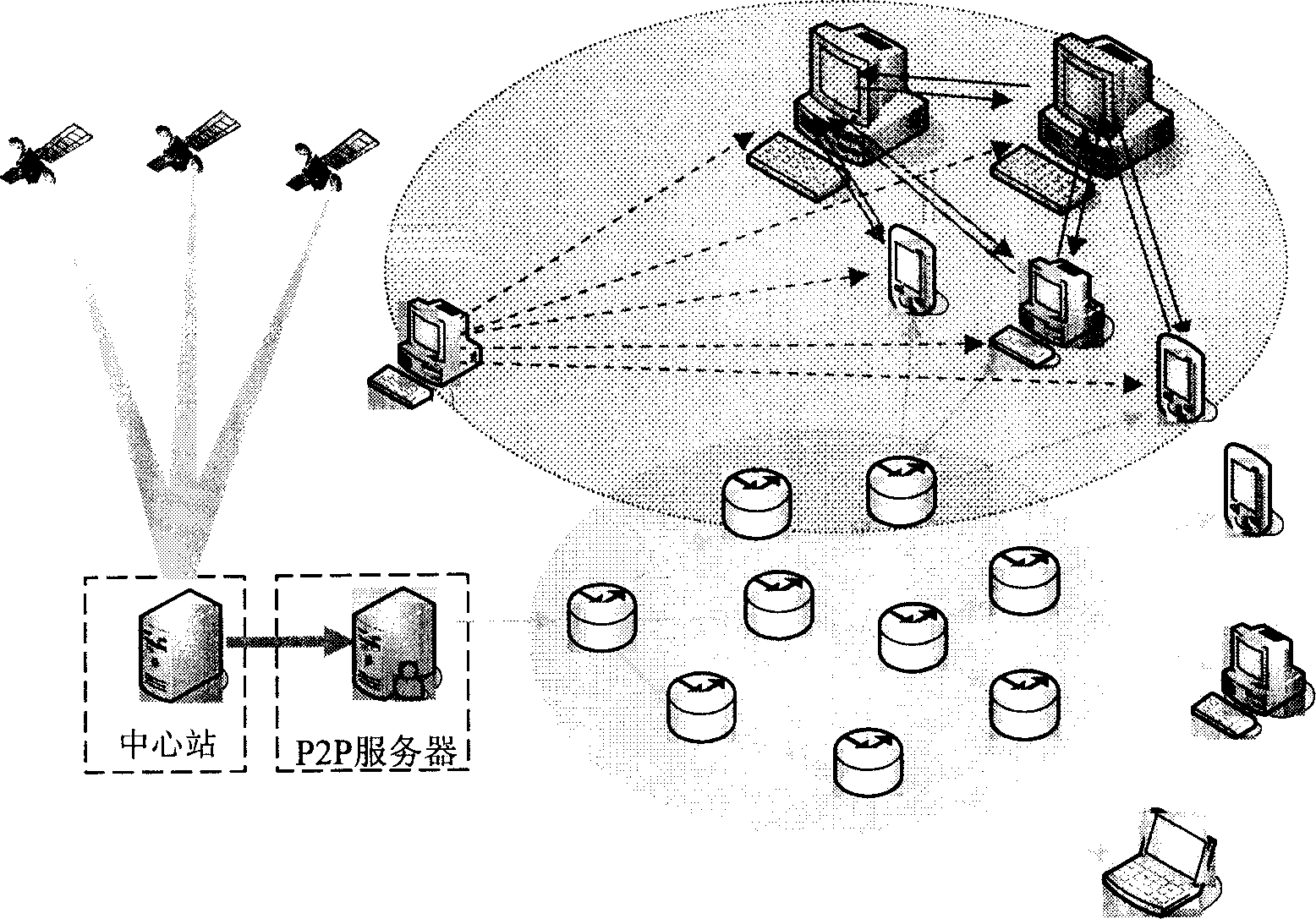
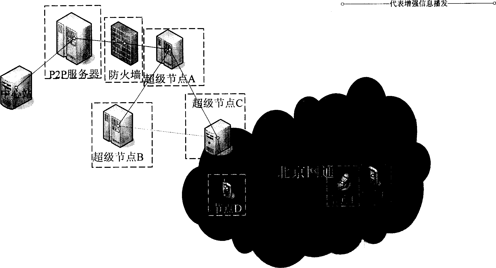
[0092] It takes several steps for an ordinary node to join a P2P network.

[0093] Step 1, join the P2P network (communication between nodes is based on udp protocol)

[0094] 1.1, first use the broadcast method to discover nodes in the local area network. When there is a P2P node in the local area network that can forward information, the node will give a response. The response content includes a list of forwardable nodes, and then join the P2P network.

[0095] 1.2, if there is no P2P node in the LAN that can forward, no response will be received. At this time, send a request to a known P2P super node, and the super node will query in the network composed of underlying super nodes according to the IP information of the node, and return a list of nodes that can forward enhanced information, and thus join the P2P network.

[0096] Step 2, get enhanced information

[0097] 2.1. After a node knows a list of forwarding nodes, it can obtain parameters such as the connection spee...


PUM


Abstract

This invention relates to a real time playing method for the navigation locating information strengthened internet based on the P2P technology including the following steps: networking the reference stations and the central station in the ground part to transmit various kinds of difference correction data, setting up P2P network among the navigation locating devices and taking them as the ordinary nodes and setting up node lists among them, the central station is connected with the P2P server by the P2P network after using the fire wall, said ordinary nodes and the reference stations get the navigation information from the locating system, the reference stations compute various kinds of difference correction data based on their own positions and satellite locating data to be sent to the central station, which forms navigation location strengthened information and plays it in the P2P network by the P2P server and the locating device receives it and regulates its own navigation locating information.

Description

technical field [0001] A method for broadcasting navigation and positioning enhanced information in real time on the Internet based on P2P technology belongs to the Internet field, and particularly relates to P2P technology and navigation and positioning enhanced information broadcasting technology. Background technique [0002] satellite navigation system [0003] The existing satellite navigation systems in the world include GPS of the United States, GLONASS of Russia and the GALILEO satellite system of Europe (under construction). In this way, the establishment of Russia's GLONASS and the ongoing establishment of GALILEO broke the situation that the United States is exclusive to satellite navigation, and reduced the worries brought to users by the US government's use of GPS to impose sovereign authority. [0004] (1) Global Positioning System (GPS) [0005] GPS was established by the U.S. Department of Defense for military purposes. It aims to completely solve the navig...

Claims


Application Information

Patent Timeline
IPC IPC(8): H04L12/16H04L12/46
Inventor 赵军王继龙管凌峰吴建平李星
Owner TSINGHUA UNIV
Why Eureka
Try Eureka