Solar irradiation modeling and forecasting using community based terrestrial sky imaging
a satellite and sky imaging technology, applied in the field of solar irradiation modeling and forecasting based on satellite imaging, can solve the problems of affecting the prediction procedure, affecting the prediction accuracy,
- Summary
- Abstract
- Description
- Claims
- Application Information
AI Technical Summary
Benefits of technology
Problems solved by technology
Method used
Image
Examples
Embodiment Construction
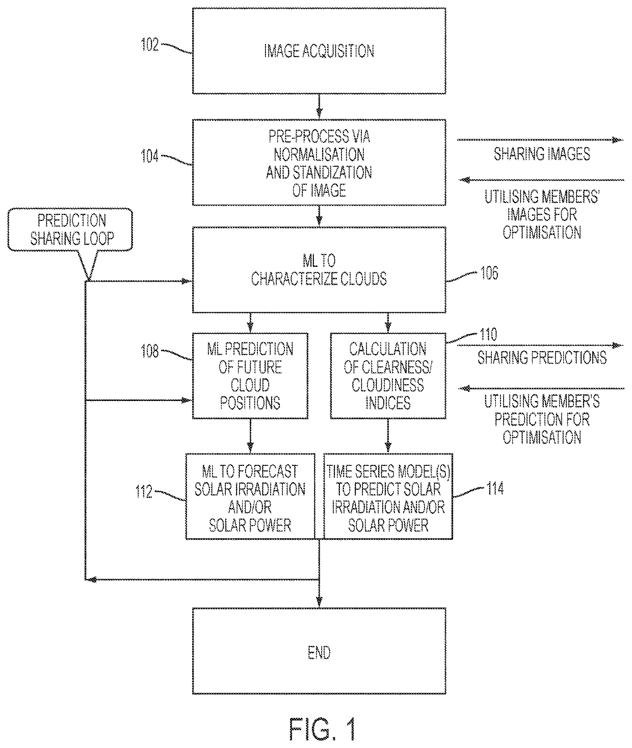
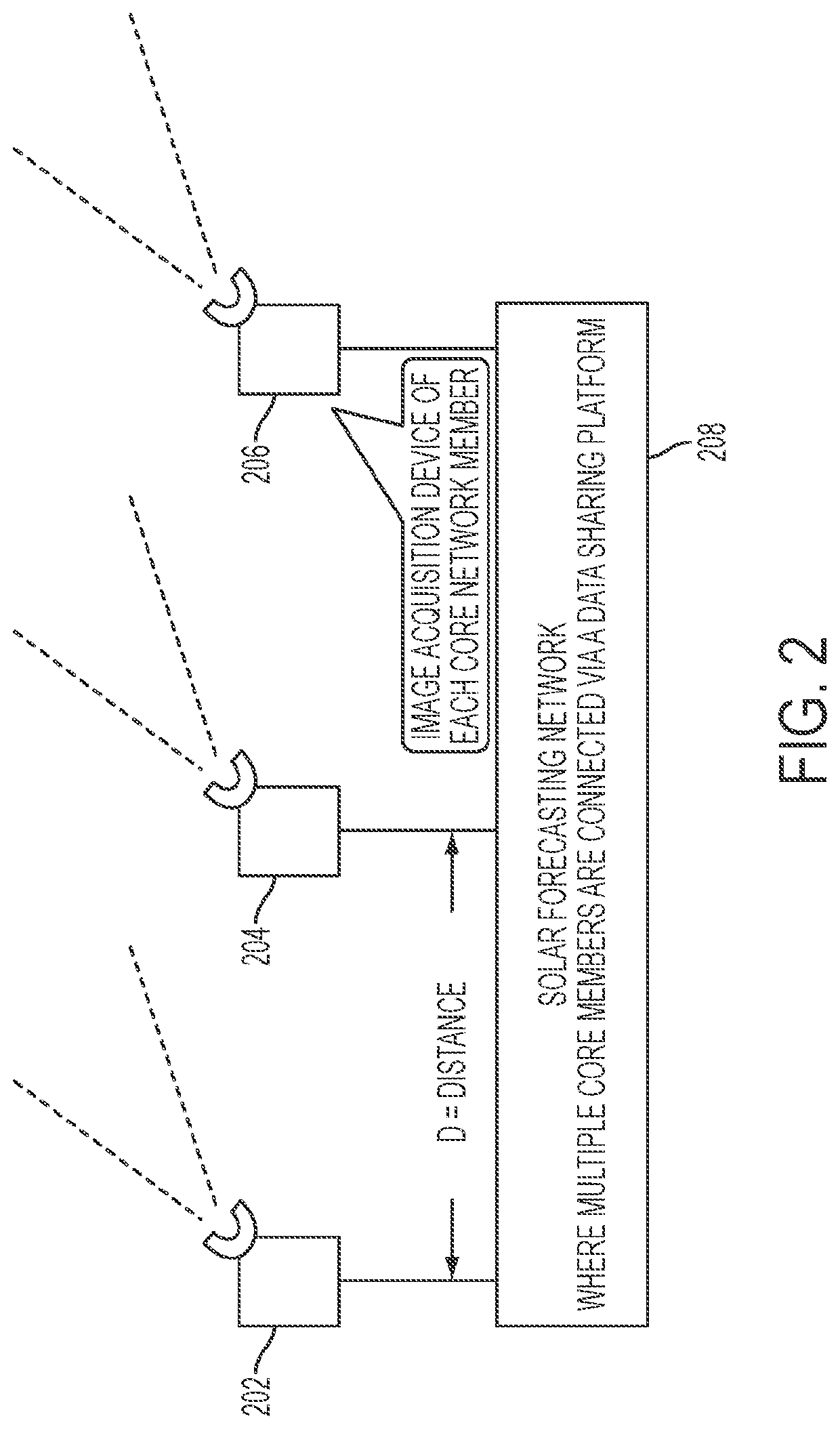
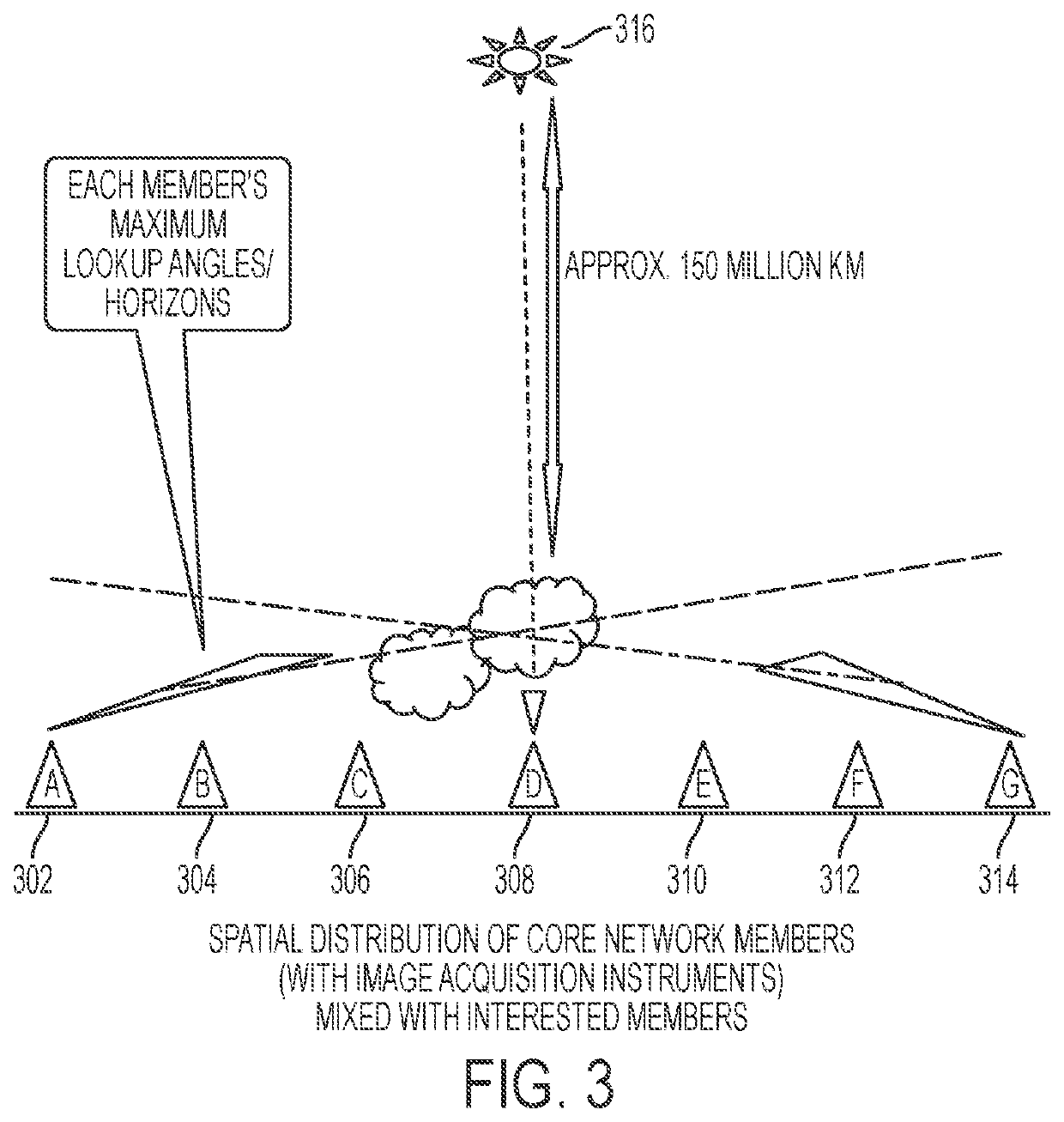
[0012]A system, method, computer program product and technique may be provided that predict solar irradiation values, for instance, using image analytic of sky imaging. In some embodiment, a system may utilize local sky imaging data as well as other (e.g., nearby within a threshold distance) predictive systems data to improve cloud movement prediction and / or construct a clear border of cloud covering the sun (referred to as circumsolar region challenge). The part of the cloud which is not clearly visible due to sun irradiation may be clearly visible from other sources with different angles or having a distance away from the primary location. In some embodiments, a system may leverage community network of individual predictive systems.
[0013]In some embodiments, a system, method, computer program product, and technique may be presented for the establishment of a community network for image acquisition and contribution for constructing dynamical models capable of predicting cloud cover...
PUM
 Abstract
Description
Claims
Application Information
 - R&D
- Intellectual Property
- Life Sciences
- Materials
- Tech Scout
- Unparalleled Data Quality
- Higher Quality Content
- 60% Fewer Hallucinations
Browse by: Latest US Patents, China's latest patents, Technical Efficacy Thesaurus, Application Domain, Technology Topic, Popular Technical Reports.
© 2025 PatSnap. All rights reserved.Legal|Privacy policy|Modern Slavery Act Transparency Statement|Sitemap|About US| Contact US: help@patsnap.com


