

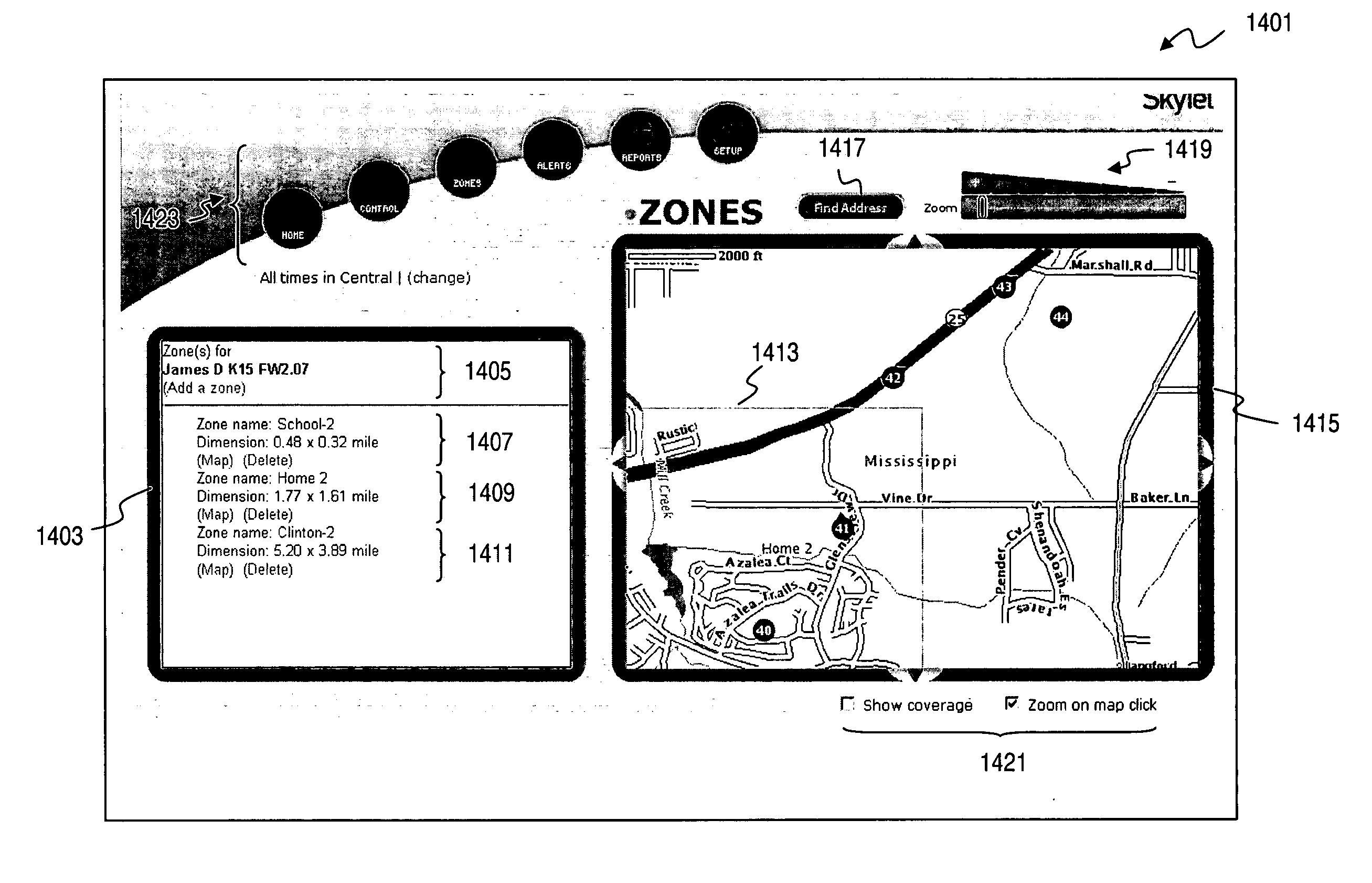
User interface for defining geographic zones for tracking mobile telemetry devices
a technology of geographic zone and user interface, applied in the field of data communication, can solve the problems of affecting the ability of the device, weak signals can be problematic, and hinder the effectiveness of the fleet management system,
- Summary
- Abstract
- Description
- Claims
- Application Information
AI Technical Summary
Benefits of technology
Problems solved by technology
Method used
Image

Examples
Embodiment Construction
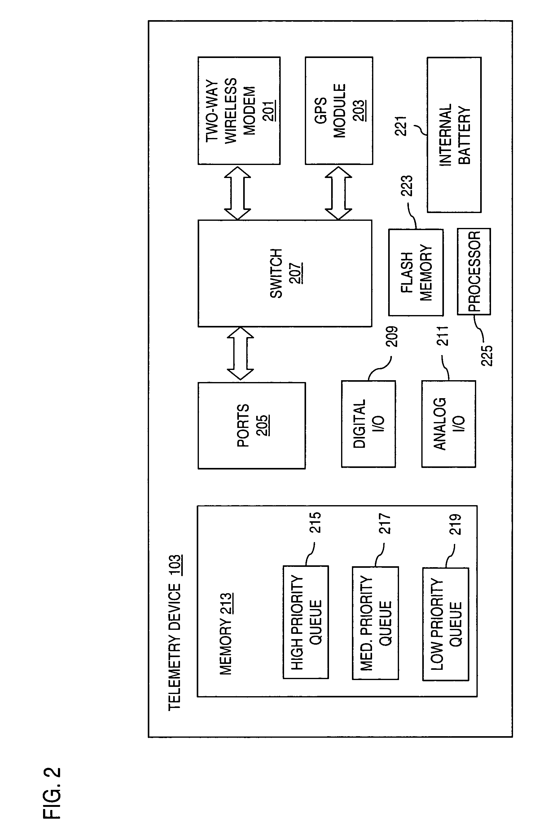
[0034] A system, method, and software for timely and prioritized communication of information from a mobile telemetry device are described. In the following description, for the purposes of explanation, numerous specific details are set forth in order to provide a thorough understanding of the present invention. It is apparent, however, to one skilled in the art that the present invention may be practiced without these specific details or with an equivalent arrangement. In other instances, well-known structures and devices are shown in block diagram form in order to avoid unnecessarily obscuring the present invention.
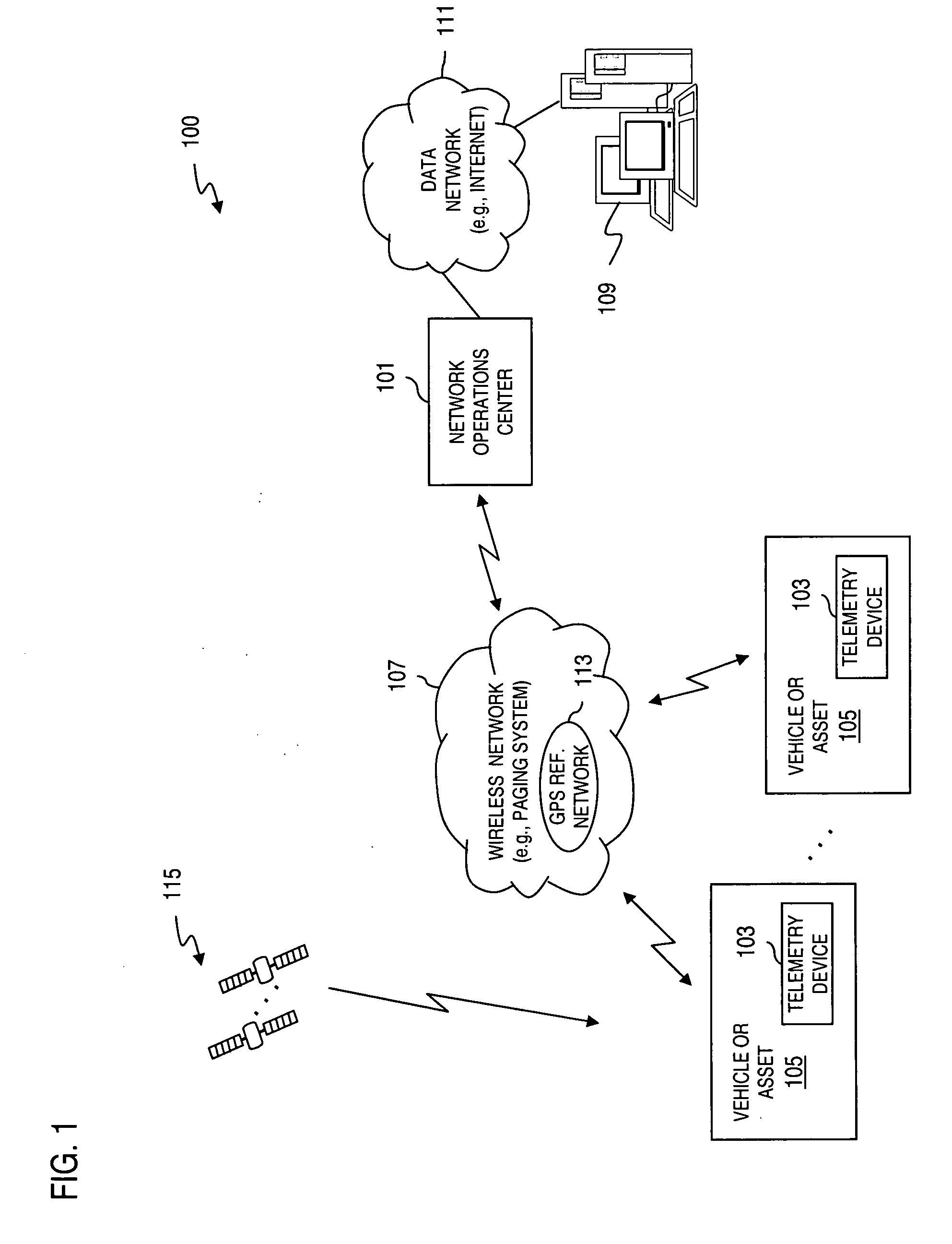
[0035]FIG. 1 shows a diagram of a fleet and asset tracking system, according to an embodiment of the present invention. The system 100, in contrast to the system of FIG. 17, utilizes a combination of autonomous GPS and Assisted GPS (A-GPS); in particular, mobile-centric A-GPS. The system 100 includes a Network Operation Center (NOC) 101 for tracking telemetry devices 1...
PUM
 Abstract
Description
Claims
Application Information