Method for correlating altitude and/or grade information with route points of a digital map
a digital map and route point technology, applied in traffic control systems, navigation instruments, instruments, etc., can solve the problems of small changes in grade that require the shifting of gears in transmission, loss of speed, and inability to respond to changes in grade in a predictive manner, so as to improve the meaningfulness of altitude and/or grade information
- Summary
- Abstract
- Description
- Claims
- Application Information
AI Technical Summary
Benefits of technology
Problems solved by technology
Method used
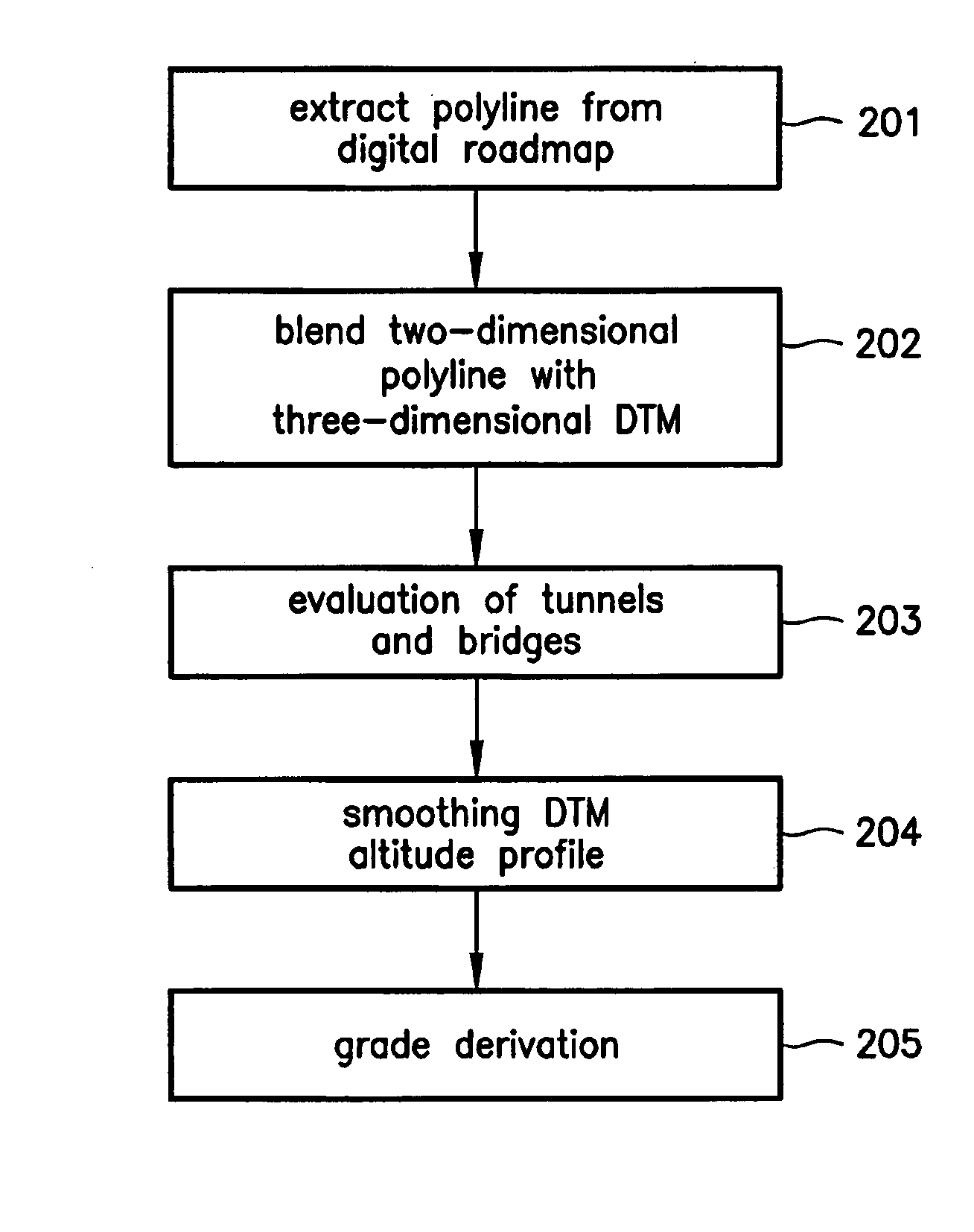
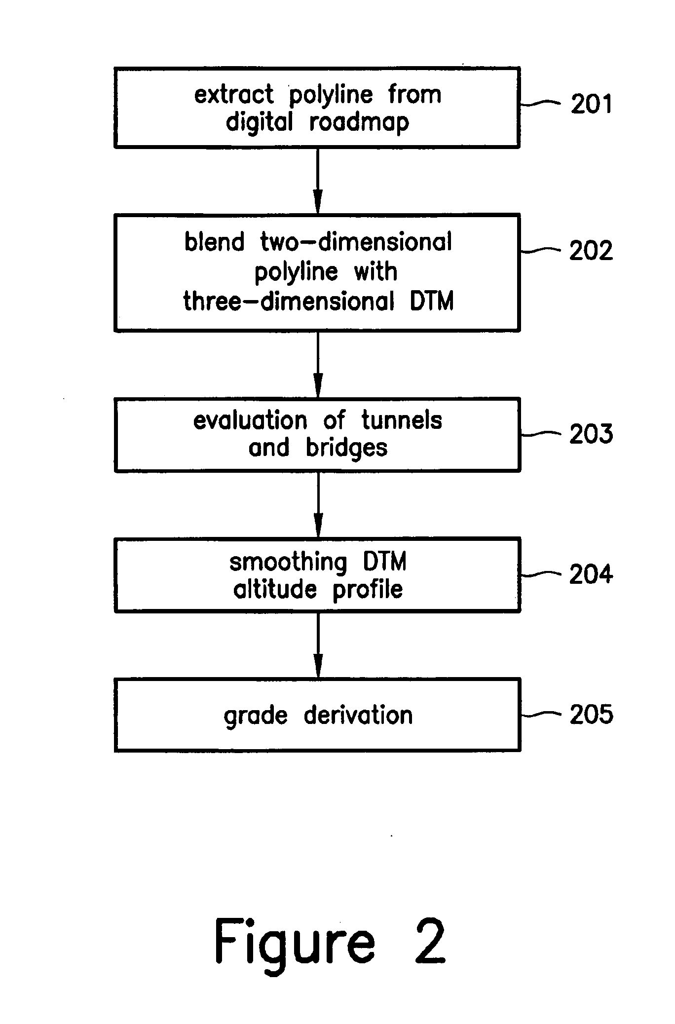
Image

Examples
Embodiment Construction
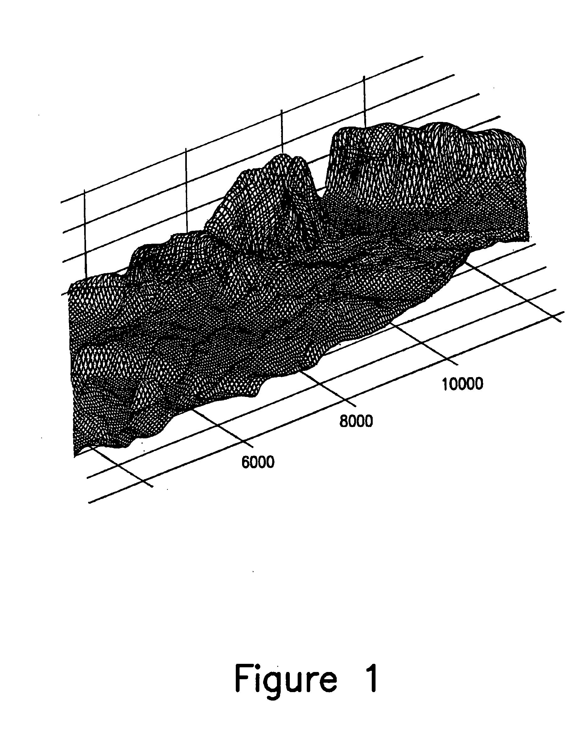
[0034] Using the method described herein, grade data can be obtained from digital terrain models in an inexpensive manner on an area-wide basis. Digital terrain models (DTM) describe the surface of the earth by a three-dimensional grid of equidistant grid points, as shown, for example, in FIG. 1. Each grid point contains altitude information. During the Shuttle Radar Topography Mission (SRTM) in the year 2000, NASA recorded, for example, altitude information from which a nearly worldwide DTM having a grid point spacing of 30 m and an absolute altitude accuracy of 16 m was generated. This DTM altitude data is available, for example, for the method described herein.
[0035] The German Guideline for Road Construction (RAS) stipulates, at least for the Federal Republic of Germany, the requirement that the routing of a road in terms of altitude should be such that it is adapted to the natural terrain to the best extent possible. Since the natural terrain is represented by the DTM, the alt...
PUM
 Abstract
Description
Claims
Application Information
 - R&D
- Intellectual Property
- Life Sciences
- Materials
- Tech Scout
- Unparalleled Data Quality
- Higher Quality Content
- 60% Fewer Hallucinations
Browse by: Latest US Patents, China's latest patents, Technical Efficacy Thesaurus, Application Domain, Technology Topic, Popular Technical Reports.
© 2025 PatSnap. All rights reserved.Legal|Privacy policy|Modern Slavery Act Transparency Statement|Sitemap|About US| Contact US: help@patsnap.com