
Space based monitoring of global maritime shipping using automatic identification system

a technology of automatic identification and global maritime shipping, applied in the field of automatic identification system, can solve the problem of inherent danger of navigation at sea and in waterways

Active Publication Date: 2008-04-17
ORBCOMM
View PDF5 Cites 33 Cited by
  • Summary
  • Abstract
  • Description
  • Claims
  • Application Information

AI Technical Summary

Problems solved by technology

Navigation at sea and in waterways is inherently dangerous.
However, a lack of positive identification of objects indicated by displays, time delays associated with processing information, and limitations of radar for observing and calculating the action and response of nearby vessels, all may prevent timely action to avoid a collision.
Although AIS may be used in navigation to avoid collisions, due to the limitations of radio characteristics of the system (and because not all vessels are equipped with AIS), the system is primarily used to determine risk of collision rather than as an automated collision avoidance system.

Method used


Image

  • Space based monitoring of global maritime shipping using automatic identification system
  • Space based monitoring of global maritime shipping using automatic identification system
  • Space based monitoring of global maritime shipping using automatic identification system

Examples


Embodiment Construction

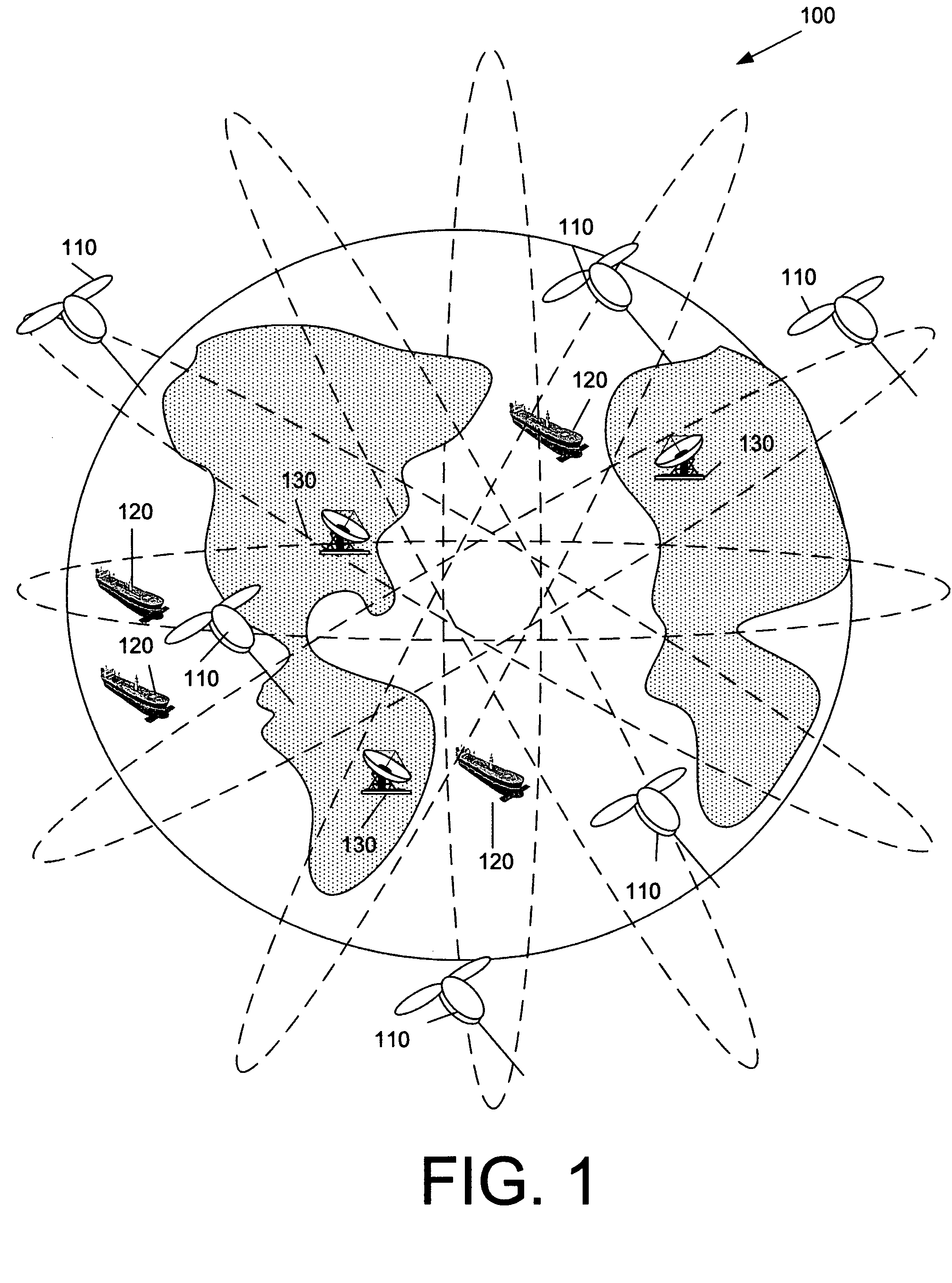
[0021] A low earth orbiting constellation system of satellites is described that implements a space based global AIS monitoring system. The constellation includes a plurality of low earth orbit (LEO) satellites that monitor all AIS equipped vessels on the worlds oceans and waterways, and process AIS signals described herein. The AIS satellite constellation and system are described in greater detail below with examples in reference to the corresponding drawings. One will appreciate that the drawings provided herein are not to scale and are exemplary only for the purpose of illustrating various embodiments described herein.

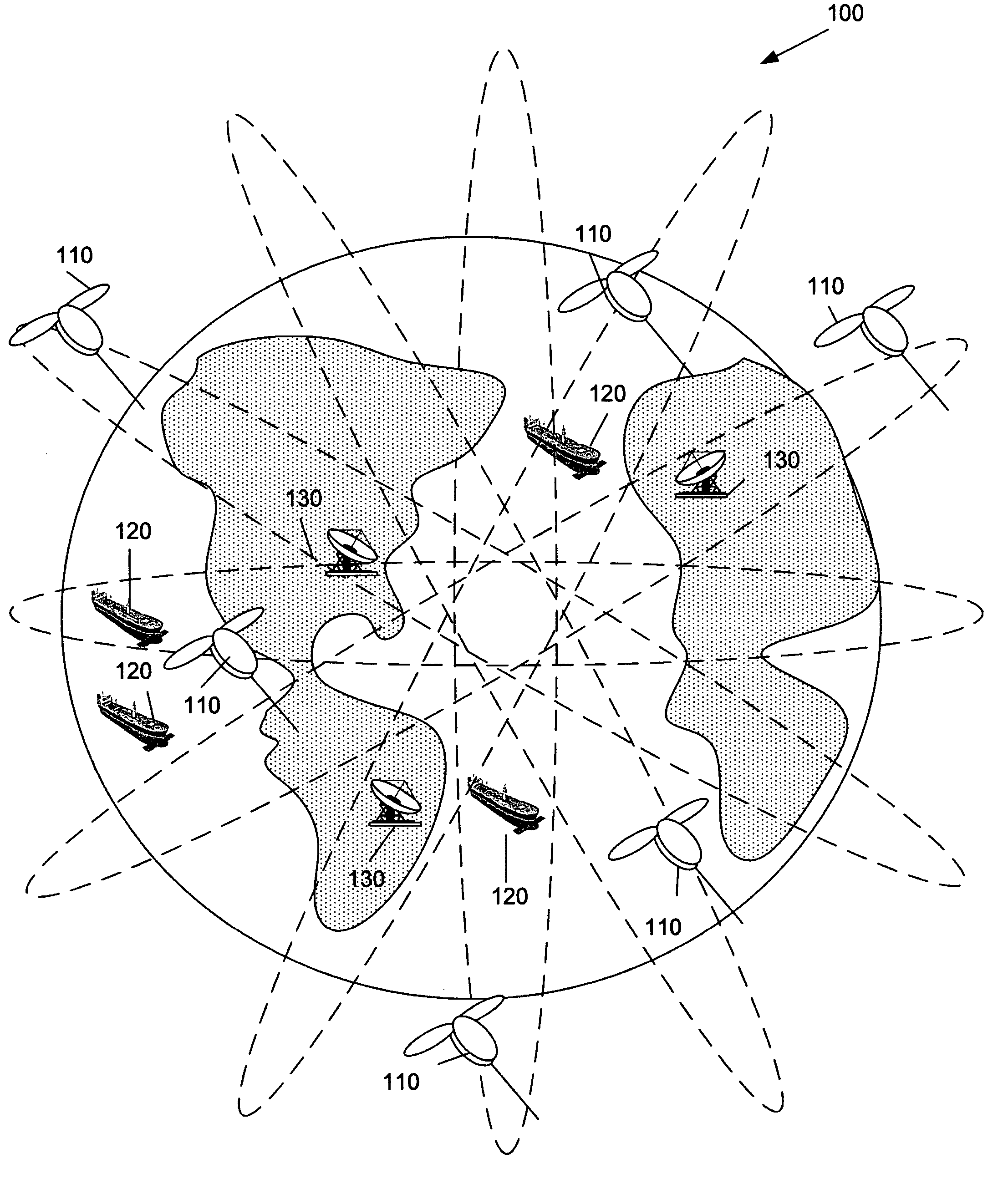
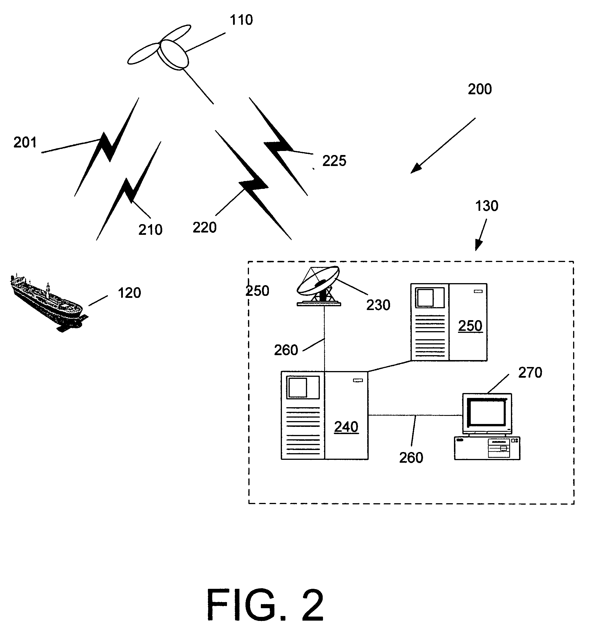
[0022]FIG. 1 shows an exemplary AIS satellite system 100. A constellation includes a number of AIS satellites 110 that communicate with vessels 120 and ground elements 130. The AIS satellite system 100 receives and transmits AIS information to and from nearly any vessel 120 via the AIS satellite link to anyplace in the world on a near real time basis.

[0023] As sho...


PUM


Abstract

An automatic identification system (AIS) communications payload for a space vehicle traveling in earth orbit includes an antenna; a receiver connected to the antenna to receive an AIS signal including a reported vessel position transmitted from a vessel; a processor to process the received AIS messages and determine the accuracy of the reported vessel position; and a transmitter to transmit the processed AIS messages and the determined accuracy to a ground earth element. The processor may be configured to determine a position of the space vehicle; compare the reported vessel position to the space vehicle position; and determine the accuracy of the reported vessel position based on the comparison. The processor also may be configured to flag the AIS message as suspect when the reported vessel position is determined to be inaccurate.

Description

PRIORITY [0001] This application claims priority from U.S. Provisional Application No. 60 / 809,011, filed May 30, 2006, and titled “Space-Based Network Architecture for Detection and Monitoring of Global Maritime Shipping Using Automatic Identification System,” which is hereby incorporated by reference in its entirety for all purposes.TECHNICAL FIELD [0002] The following description relates generally to an automatic identification system. More specifically, the description relates to space-based network architecture anti-spoofing of reported positions of vessels using an automatic identification system. BACKGROUND [0003] Navigation at sea and in waterways is inherently dangerous. When navigating, the movement and identity of other ships in the vicinity of a vessel is critical to making decisions to avoid collision and other dangers (e.g., shoals, reefs, bars, or rocks). Historically, navigators rely on a number of aids to prevent collision, such as visual observation (e.g., unaided, ...

Claims


Application Information

Patent Timeline
Patent Type & Authority Applications(United States)
IPC IPC(8): G08G1/123
CPCH04B7/18513
Inventor STOLTE, JOHNROBINSON, ANTHONYHOPKO, ANTHONY
Owner ORBCOMM
Learn More