Direct Mapping of Oil-Saturated Subsurface Formations
- Summary
- Abstract
- Description
- Claims
- Application Information
AI Technical Summary
Benefits of technology
Problems solved by technology
Method used
Image
Examples
Embodiment Construction
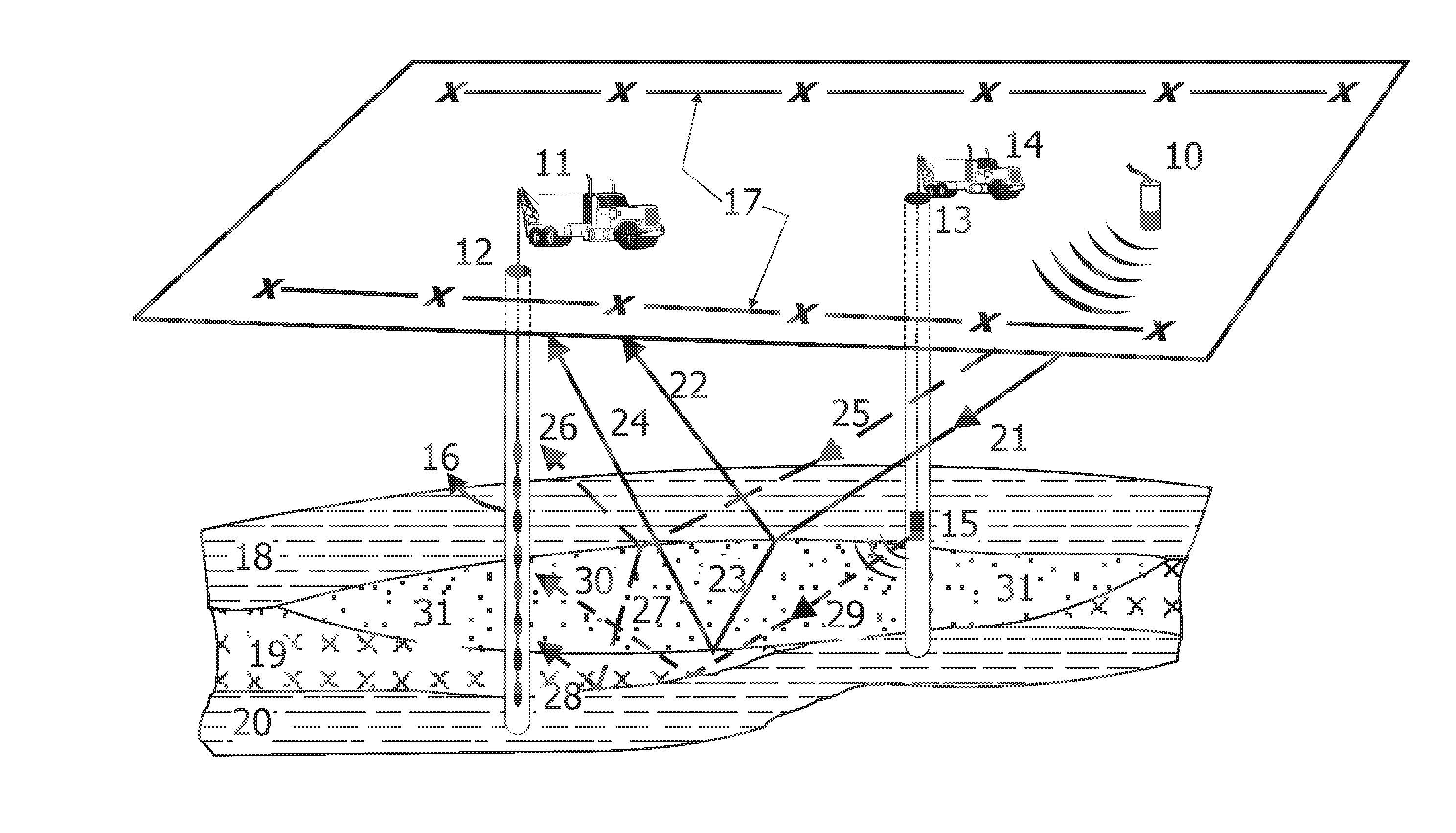
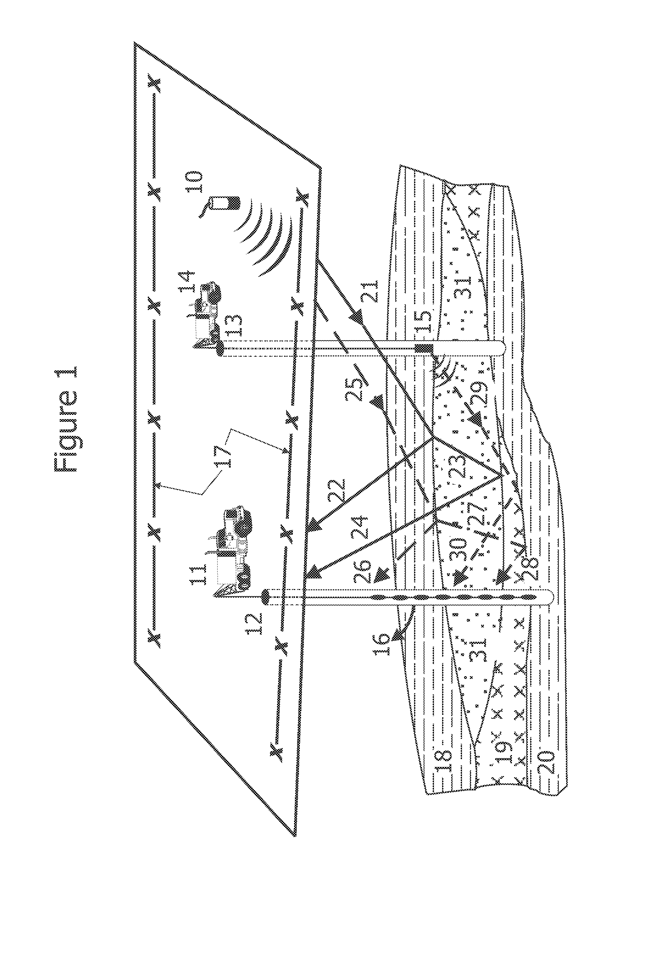
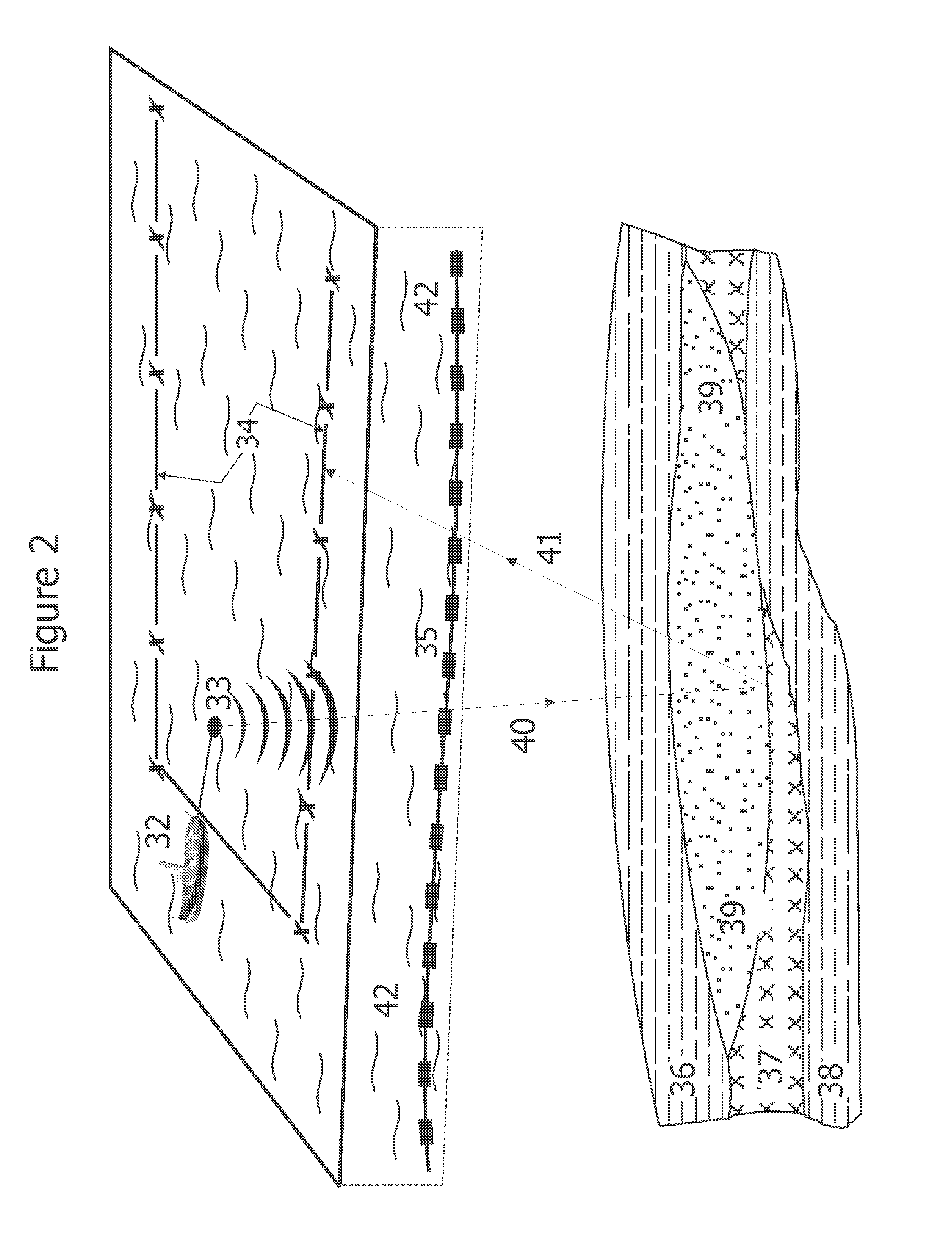
[0022]In the drawings, FIG. 1 schematically illustrates the concept of different configurations of land seismic field recording methods for this invention. This invention relates to different methods of seismic recording for mapping oil-bearing subsurface reservoir rocks. To improve the economics of hydrocarbon exploration, it is important to know if the subsurface reservoir rocks are oil-saturated or water-saturated. To drill on a seismic anomaly and find that there is no oil is expensive and a waste of exploration effort.
[0023]At present, seismic surveys are recorded to map the subsurface structural anomalies and decisions are made based on this information. To improve the reliability of the results, further analysis is carried out based on the variations in amplitude and velocities. The major shortcoming of the current seismic imaging methods that are currently being used is that none of them can identify the presence or absence and the type of reservoir fluids with any certainty...
PUM
 Abstract
Description
Claims
Application Information
 - R&D
- Intellectual Property
- Life Sciences
- Materials
- Tech Scout
- Unparalleled Data Quality
- Higher Quality Content
- 60% Fewer Hallucinations
Browse by: Latest US Patents, China's latest patents, Technical Efficacy Thesaurus, Application Domain, Technology Topic, Popular Technical Reports.
© 2025 PatSnap. All rights reserved.Legal|Privacy policy|Modern Slavery Act Transparency Statement|Sitemap|About US| Contact US: help@patsnap.com


