
Methods and apparatus for using position/attitude information to enhance a vehicle guidance system

Active Publication Date: 2009-12-17
AGCO CORP
View PDF27 Cites 25 Cited by
  • Summary
  • Abstract
  • Description
  • Claims
  • Application Information

AI Technical Summary

Benefits of technology

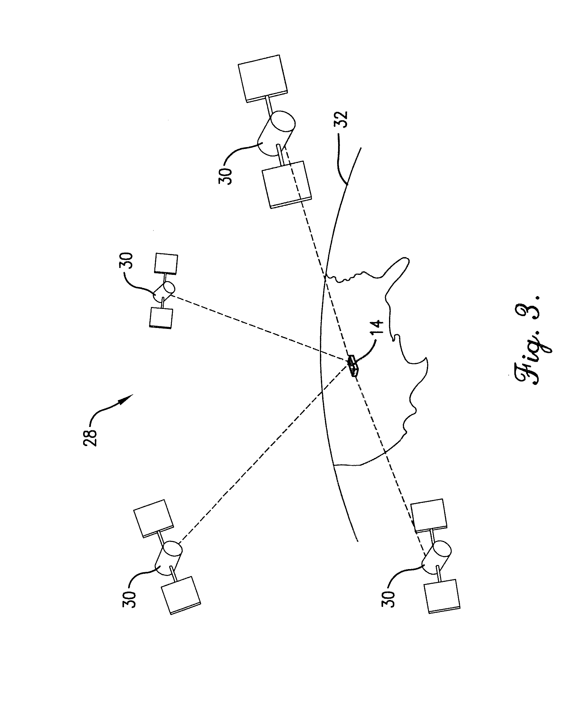
[0007]Embodiments of the present invention provide an enhanced vehicle guidance system that uses information from a global navigation satellite system (GNSS) receiver, such as latitude, longitude, and altitude, to infer or simulate attitude information without the use of an inertial sensor. Additionally, the enhanced guidance system may provide inertial correction factors to correct discrepancies in GNSS receiver position values caused by uneven terrain. The invention may also take advantage of the fact that topology (i.e. the rolling and pitching profile) of a field typically does not appreciably change from year to year. The guidance system therefore may use pre-recorded associated position and attitude information to increase the robustness of high-end position systems and remove the extra inertial sensor in lower cost positioning systems while still compensating for terrain undulation.
[0011]In various embodiments of the invention, the vehicle guidance system may use prerecorded position and attitude data to “look ahead” and preempt any variations in undulation so that performance can be maximized, rather than reacting when the undulations are just becoming apparent to the vehicle. For example, the vehicle guidance system implemented in a harvesting vehicle may adjust its blade altitude just before an upcoming undulation in a field, instead of making this adjustment after the undulation is sensed.

Problems solved by technology

Discrepancies may arise between the position information provided to the guidance system by the GNSS receiver and the actual ground position of the vehicle.
These discrepancies can cause a vehicle guidance system utilizing GNSS information to inaccurately guide and instruct the vehicle, because the guidance system assumes that the GNSS receiver latitude and longitude position is the same as the vehicle ground position.

Method used


Image

  • Methods and apparatus for using position/attitude information to enhance a vehicle guidance system
  • Methods and apparatus for using position/attitude information to enhance a vehicle guidance system
  • Methods and apparatus for using position/attitude information to enhance a vehicle guidance system

Examples


Embodiment Construction

[0024]The following detailed description of the invention references the accompanying drawing figures that illustrate specific embodiments in which the present invention can be practiced. The embodiments are intended to describe aspects of the invention in sufficient detail to enable those skilled in the art to practice the invention. Other embodiments can be utilized and changes can be made without departing from the scope of the present invention. The following detailed description is, therefore, not to be taken in a limiting sense.

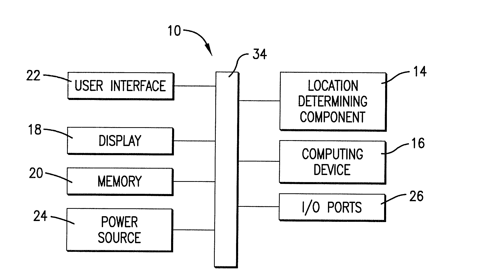
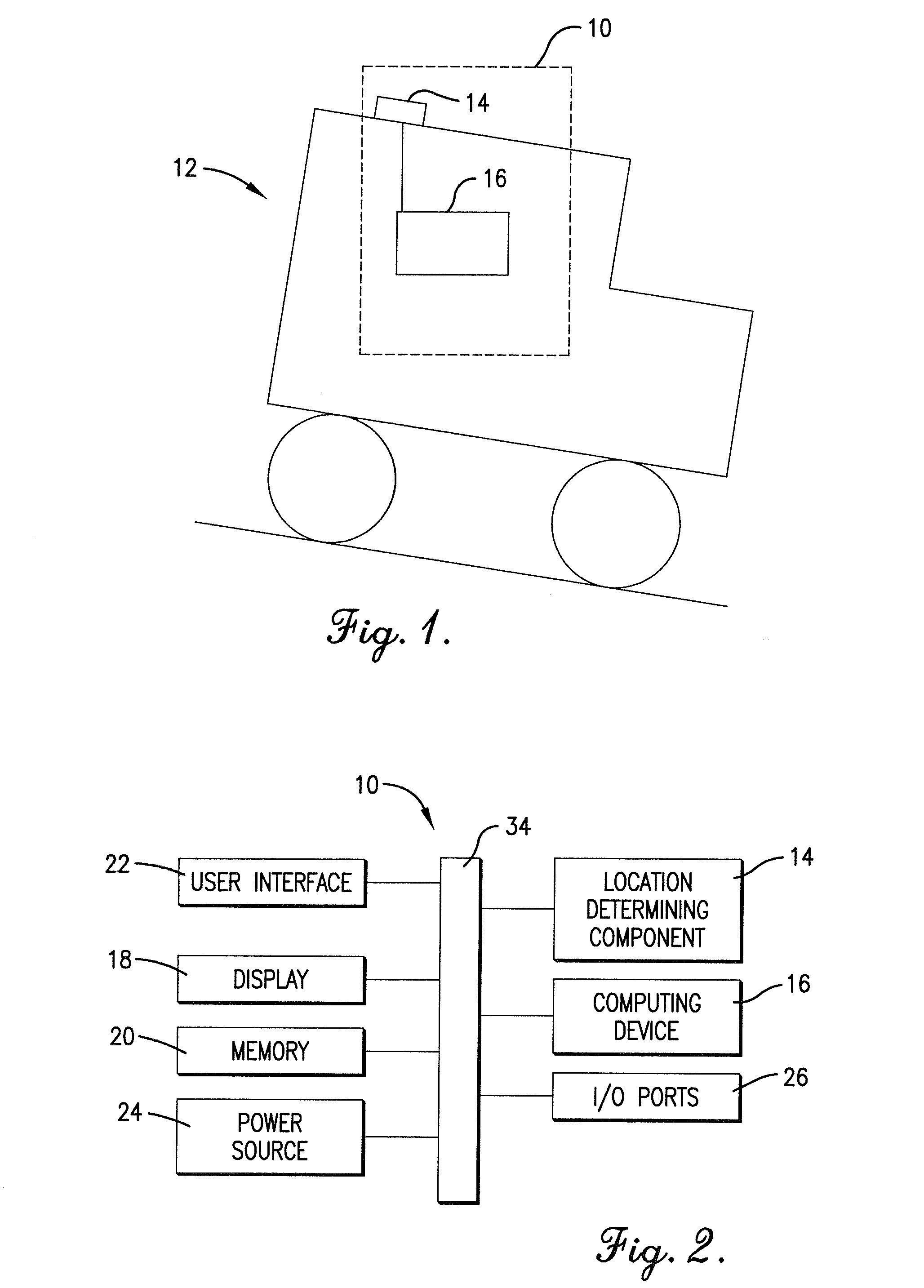
[0025]Embodiments of the present invention, as illustrated in FIG. 1, provide an enhanced vehicle guidance system 10 preferably incorporated as part of a land-based vehicle 12 such as an agricultural vehicle, automobile, all-terrain vehicle, or any other type of land-based vehicle known in the art. The vehicle guidance system 10 can be implemented in hardware, software, firmware, or a combination thereof. An exemplary embodiment of the vehicle guidance ...


PUM


Abstract

An enhanced vehicle guidance system comprising a global navigation satellite system (GNSS) receiver and a data processor with a memory component and a computing device. The method of enhancing a vehicle's guidance system may comprise calculating the altitude, latitude, and longitude of a GNSS receiver for each of a plurality of positions; calculating the incline angle between adjacent points; and using the calculated incline angles to infer the attitude of the vehicle at any of the plurality of positions. The attitude may be used to calculated an inertial correction factor to compensate for GNSS position inaccuracies induced as a result of the vehicle rolling and pitching on uneven terrain. The altitude, latitude, longitude, and attitude of the plurality of positions may be stored in the memory such that the system may look-up the attitude for a given position without recalculating the attitude and without using an inertial sensor.

Description

BACKGROUND[0001]1. Field[0002]Embodiments of the present invention relate to the enhancement of vehicle guidance systems. More particularly, the invention relates to correcting global navigation satellite system (GNSS) data using the measured or simulated attitude of a vehicle.[0003]2. Related Art[0004]A global navigation satellite system (GNSS), such as the global positioning system (GPS), is an electronic satellite navigation system which permits users to determine their position with respect to the Earth. Global positioning may be determined with a GNSS receiver which detects and decodes signals from a number of satellites orbiting the Earth. The signals from each of these satellites indicate the position of the satellite and the time at which the signals were sent. GNSS receivers may calculate latitude, longitude, and altitude based on satellite signals. This information is often used in vehicle guidance systems to guide a vehicle and direct it to perform certain tasks at a part...

Claims


Application Information

Patent Timeline
IPC IPC(8): G01C21/00
CPCG01C21/30G05D1/0278
Inventor MATTHEWS, PAUL
Owner AGCO CORP
Learn More