Method of using road signs to augment Global Positioning System (GPS) coordinate data for calculating a current position of a personal navigation device

a technology of global positioning system and coordinate data, which is applied in surveying and navigation, navigation instruments, instruments, etc., can solve the problems of insufficient gps coordinate data, gps receivers also producing erroneous position information, and loss of gps satellite reception

Inactive Publication Date: 2010-04-29
ZAMA INNOVATIONS LLC
View PDF2 Cites 83 Cited by
  • Summary
  • Abstract
  • Description
  • Claims
  • Application Information

AI Technical Summary

Benefits of technology

[0010]According to an exemplary embodiment of the claimed invention, a method of using road signs to augment Global Positioning System (GPS) coordinate data for calculating a current position of a personal navigation device is disclosed. The method includes obtaining recent GPS coordinate data with the personal navigation device, obtaining an image from a camera of the personal navigation device, the image showing areas surrounding a road on which the personal navigation device is traveling, recognizing a sign in the image by performing image processing on the image, and using a known position of the sign to augment the recent GPS coordinate data in order to more precisely determine an actual location of the personal navigation device.
[0...

Problems solved by technology

Loss of GPS satellite reception occurs when driving through areas with no clear view of the sky, such as when in tunnels.
GPS receivers also produce erroneous position information when navigating through dense “urban canyons” surrounded by tall buildings, such as in large cities.
In addition to situations kin which GPS satellite reception is lost, there may also be t...

Method used


Image

  • Method of using road signs to augment Global Positioning System (GPS) coordinate data for calculating a current position of a personal navigation device
  • Method of using road signs to augment Global Positioning System (GPS) coordinate data for calculating a current position of a personal navigation device
  • Method of using road signs to augment Global Positioning System (GPS) coordinate data for calculating a current position of a personal navigation device

Examples


Embodiment Construction

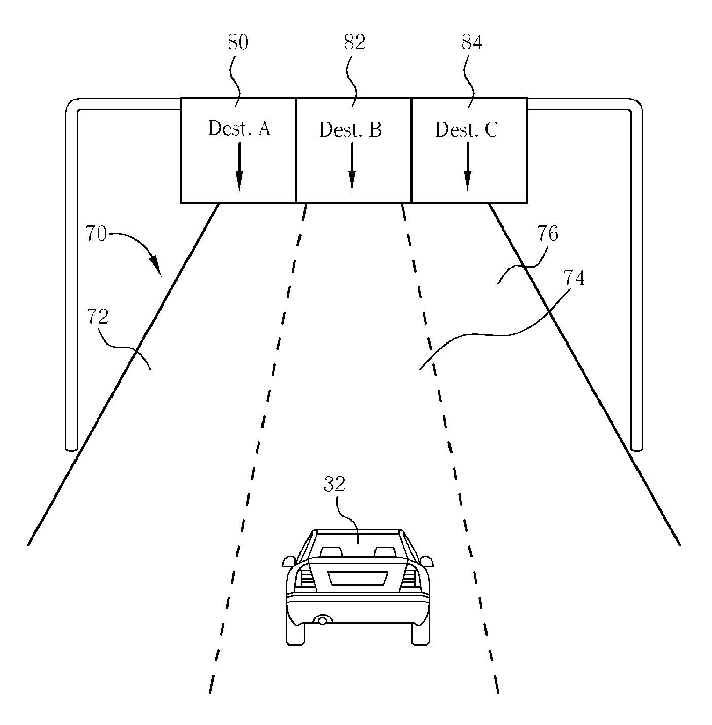
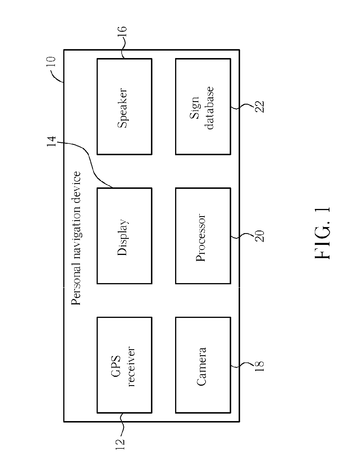
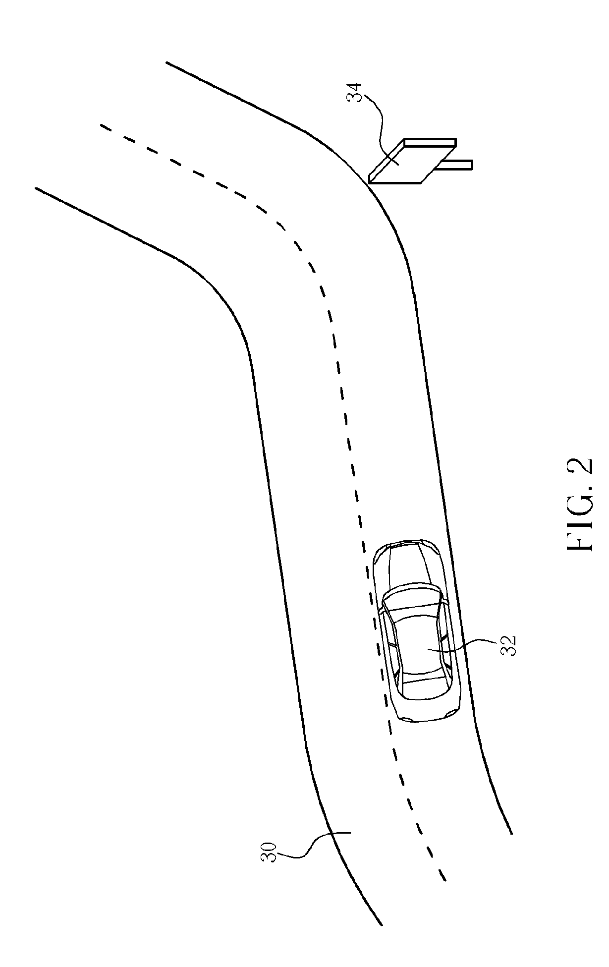
[0017]Initially, personal navigation devices were only able to rely on Global Positioning System (GPS) coordinate data received from GPS satellites in order to triangulate a current position of the personal navigation device. As the market for personal navigation devices has developed, more features have continually been added to the personal navigation devices. In the present invention, the personal navigation device is equipped with a camera, which allows the personal navigation device to use visual cues for determining the current location of the personal navigation device.

[0018]Please refer to FIG. 1. FIG. 1 is a functional block diagram of a personal navigation device 10 according to the present invention. The personal navigation device 10 contains a GPS receiver 12 for receiving GPS satellite signals and calculating coordinate data that estimates a current position of the personal navigation device 10. The personal navigation device 10 also contains a display 14 and a speaker ...


PUM


Abstract

A method of using road signs to augment Global Positioning System (GPS) coordinate data for calculating a current position of a personal navigation device includes obtaining recent GPS coordinate data with the personal navigation device, obtaining an image from a camera of the personal navigation device, the image showing areas surrounding a road on which the personal navigation device is traveling, recognizing a sign in the image by performing image processing on the image, and using a known position of the sign to augment the recent GPS coordinate data in order to more precisely determine an actual location of the personal navigation device.

Description

BACKGROUND OF THE INVENTION[0001]1. Field of the Invention[0002]The invention relates to a method of utilizing a personal navigation device to perform map matching or dead reckoning, and more particularly, to a method of using known positions of identified road signs to augment GPS coordinate data in order to calculate a more precise location of a personal navigation device.[0003]2. Description of the Prior Art[0004]Global Positioning System (GPS) based personal navigation devices are well known and are widely employed as in-car personal navigation devices. Common functions of a personal navigation device include providing a map database for generating navigation instructions that are then shown on a display of the personal navigation device. These personal navigation devices are often mounted on or in the dashboard of a vehicle using a suction mount or other mounting means.[0005]The term “personal navigation device” refers to a device that enables a user to navigate to a pre-define...

Claims


Application Information

Patent Timeline
IPC IPC(8): G01S5/14
CPCG01S19/49G01S19/48G01C21/3602G01S19/485
Inventor BROADBENT, MATT
Owner ZAMA INNOVATIONS LLC
Why Eureka
Try Eureka