
High-resolution urban true orthoimage creation

a high-resolution, urban technology, applied in the field of correction of digital images or photographs, can solve the problems of inability to orthorectify displacement caused by traditional methods, insufficient control information on the top of a high building, and insufficient approach, so as to reduce the cost of orthophoto generation, increase the accuracy, and cost a significant amount of money

Inactive Publication Date: 2011-12-01
OLD DOMINION UNIVERSITY RESEARCH FOUNDATION
View PDF0 Cites 20 Cited by
  • Summary
  • Abstract
  • Description
  • Claims
  • Application Information

AI Technical Summary

Benefits of technology

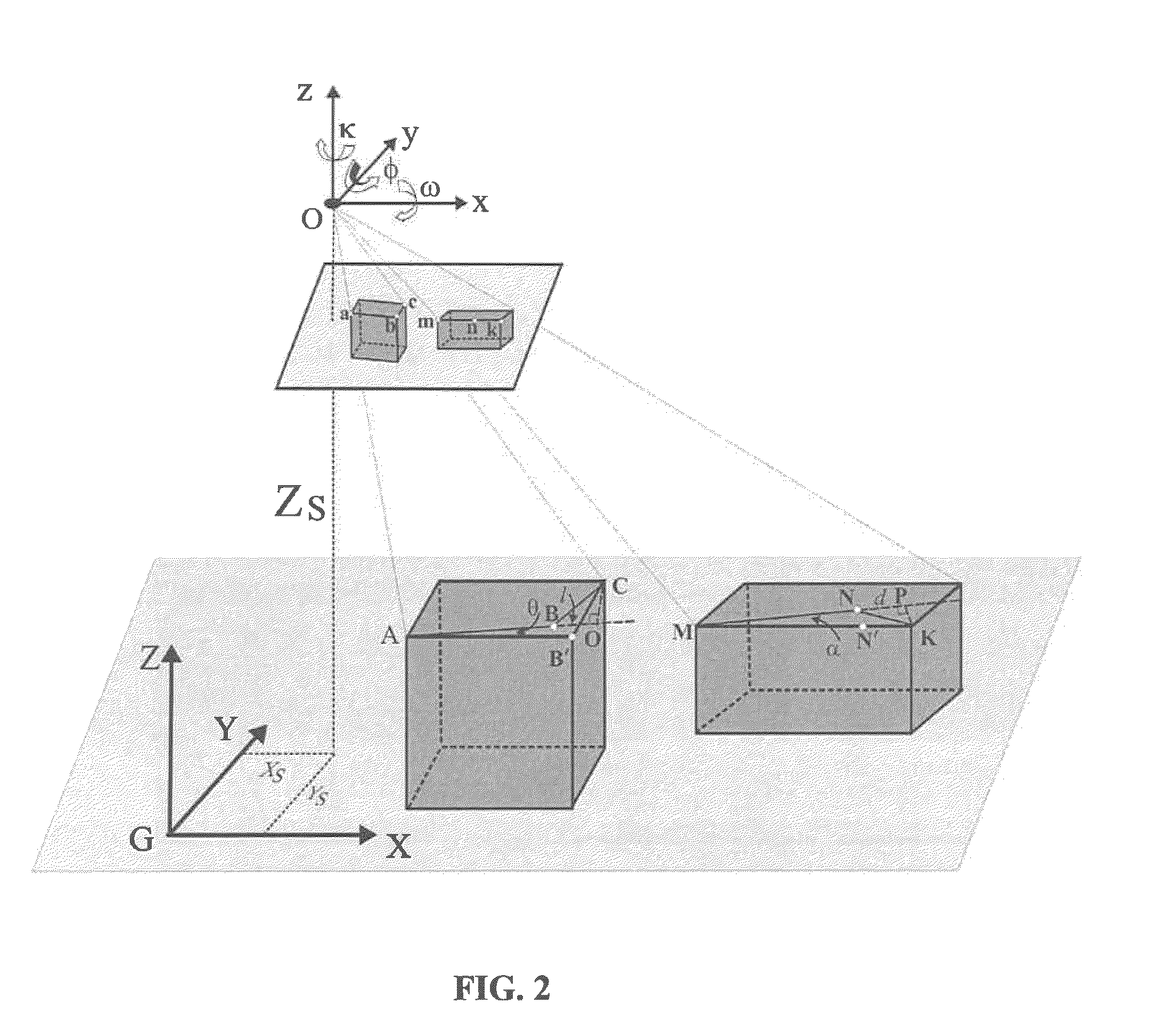
[0016]Compared to the existing methods, the present method and system can largely increase the accuracy, and reduce the cost of orthophoto generation, since the invented method only needs a small number of GCPs, which traditionally cost a significant amount of money. An aspect of the present method and system is that they have little negative impacts caused by the height of the buildings, since the constraint controls are directly from the buildings themselves. The higher the buildings, the more effective the constraint controls.
[0017]Test results demonstrated that embodiments of the new approach can improve the accuracy from 2-5 feet for those buildings over 50 m high, and 5-7 feet for those buildings in the margin of imagery. An aspect of the new approach is that it has been shown to meet the requirements of the National Large Scale Orthophoto Standard of the National Geospatial Data Committee (NGDC). Thus, embodiments of the invention have been verified using international standard test methods, and will thus be conducive to the development of international products and services.

Problems solved by technology

For urban areas, particularly for very high buildings within urban areas, traditional methods have not been capable of orthorectifying the displacements caused by the height of such buildings.
This approach has its limitations because the location and distribution of GCPs impact the accuracy of orthorectification, while most of the current GCPs are distributed on the ground, which means that the top of a high building has no sufficient control information.

Method used


Image

  • High-resolution urban true orthoimage creation
  • High-resolution urban true orthoimage creation
  • High-resolution urban true orthoimage creation

Examples


Embodiment Construction

I. Introduction

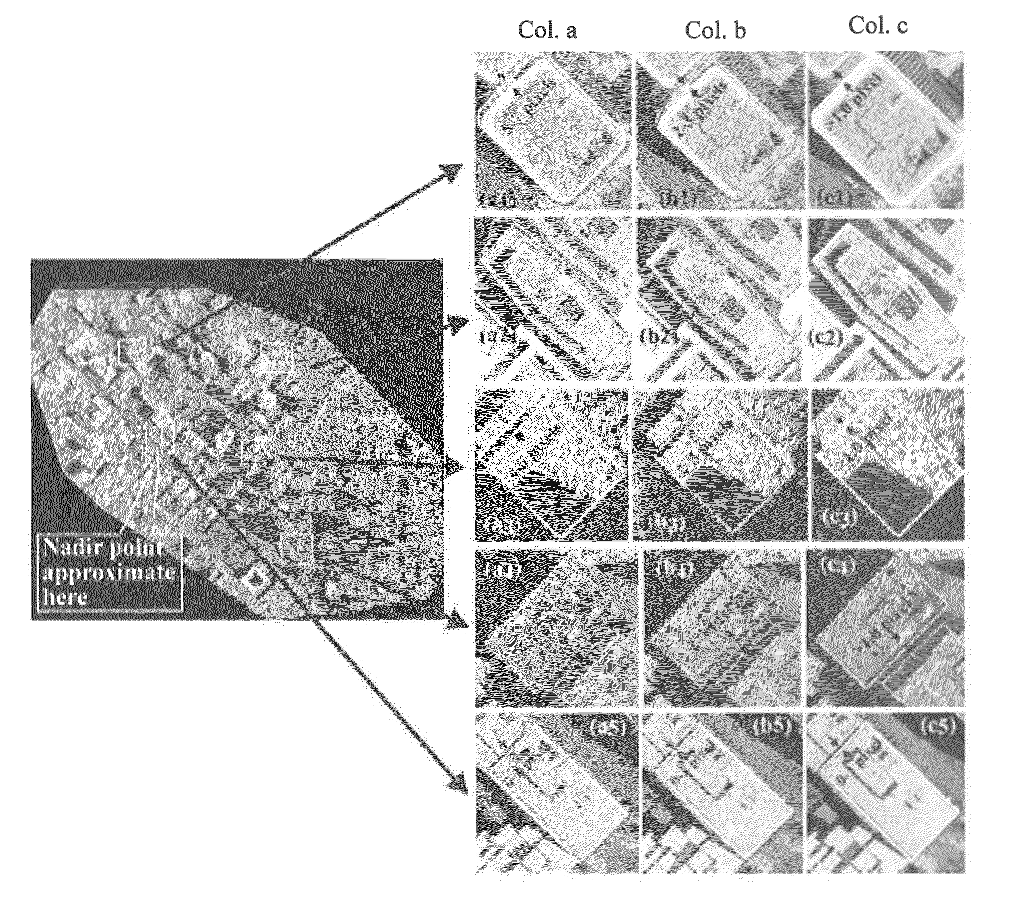
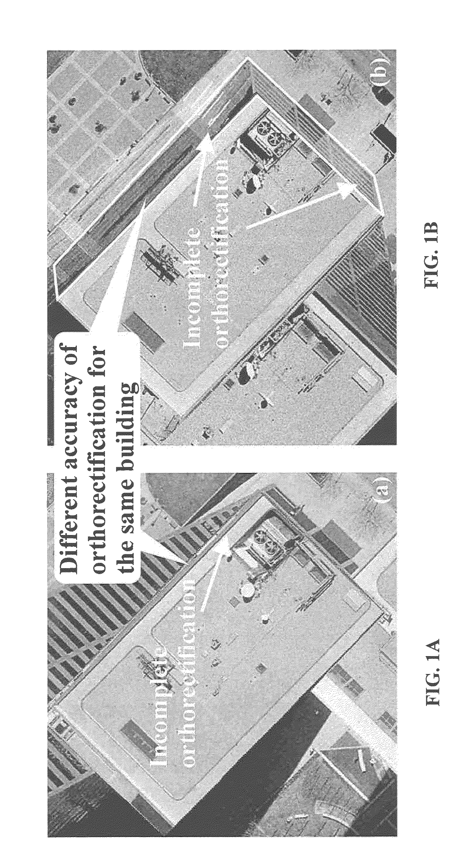
[0046]In attempting to create true orthoimages for high buildings, such as those over 75 m, it was discovered that some high buildings cannot be completely orthorectified into an upright and correct position, i.e., the building's walls can be viewed in the orthoimage (FIG. 1A). In examining the types of errors that might cause this incomplete orthorectification, the same building was orthorectified in two different aerial images using the same digital-building-model (DBM) and overall method. The building was completely orthorectified in one image, as shown in FIG. 1A, but not in the other image, as shown in FIG. 1B.

[0047]This revealed that the DBM, by itself, was not the cause. In other words, the incomplete orthorectification is probably directly caused by the inexact exterior orientation parameters or EOPs, because the conventional orthorectification algorithm largely depends on both the accuracy and the distribution of the ground control points or GCPs. Moreover, t...


PUM


Abstract

A method, system, and computer readable medium for producing orthoimages of the images of a (typically) high-resolution imager of an urban area, the orthoimages of high buildings being imaged with improved accuracy by increasing constraint conditions on the building edges, such as perpendicularity, collinearity. These constraint conditions are merged into an orthorectification model for orthorectifying the images captured at a predetermined elevation, whether by airborne or spaceborne. Constraint conditions may be formed by the building edge points, such as corners, and may be used with a digital building model. Thus, an aspect of embodiments is that the constraint conditions may be directly formed from the building themselves. The higher the buildings, the more effective the constraint controls.

Description

RELATED APPLICATIONS[0001]This application claims the benefit under 35 USC 119(e) of U.S. Provisional Patent Application No. 61 / 281,885, filed Nov. 24, 2009, the entire disclosure of which is hereby incorporated by reference.STATEMENT REGARDING GOVERNMENT SUPPORT[0002]This invention was made in part with government support under Grant No(s). 0131893, titled: “Urban True Orthophoto Generation and Its Standard Initiative—Phase II” and 0735879, titled: “National Large-Scale City True Orthophoto Mapping and Its Standard Initiative—Phase I,” awarded by the National Science Foundation.BACKGROUND OF THE INVENTION[0003]1. Field of the Invention[0004]The present invention relates generally to the correction of digital images or photographs, in particular, the orthorectifying of high-resolution digital images (such as 6 inch or one foot), acquired from an airborne and spaceborne imager, with improved accuracy in the correction of images of tall buildings in urban settings, using the buildings...

Claims


Application Information

Patent Timeline
IPC IPC(8): H04N7/18G06K9/00
CPCH04N7/18G01C11/02
Inventor ZHOU, GUOQINGXIE, WENHAN
Owner OLD DOMINION UNIVERSITY RESEARCH FOUNDATION
Learn More