Use of inertial sensor data to improve mobile station positioning

a technology of inertial sensor and mobile station, applied in the field of positioning system, can solve the problems of receiver being unable to solve all four variables, receiver being unable to calculate position, and model being conservative and sub-optimal

Active Publication Date: 2011-12-15
QUALCOMM INC
View PDF7 Cites 24 Cited by
  • Summary
  • Abstract
  • Description
  • Claims
  • Application Information

AI Technical Summary

Benefits of technology

Some embodiments of the present invention provide for a mobile station comprising: an inertial sensor, wherein the inertial sensor provides inertia measurements; inertia measurement processor coupled to the inertial sensor to accept the inertia measurements and to determine an uncertainty based on the inertia measurements; navigation position filter coupled to the inertia measurement processor to receive the uncertainty and to determine a position estimate based on the uncertainty, whe...

Problems solved by technology

In these situations, the receiver will be unable to resolve all four variables of the position solution: latitude, longitude, altitude and time.
If fewer than three signals are available, the receiver may be unable to calculate its position.
Unfortunately, the choice of how much varia...

Method used


Image

  • Use of inertial sensor data to improve mobile station positioning
  • Use of inertial sensor data to improve mobile station positioning
  • Use of inertial sensor data to improve mobile station positioning

Examples


Embodiment Construction

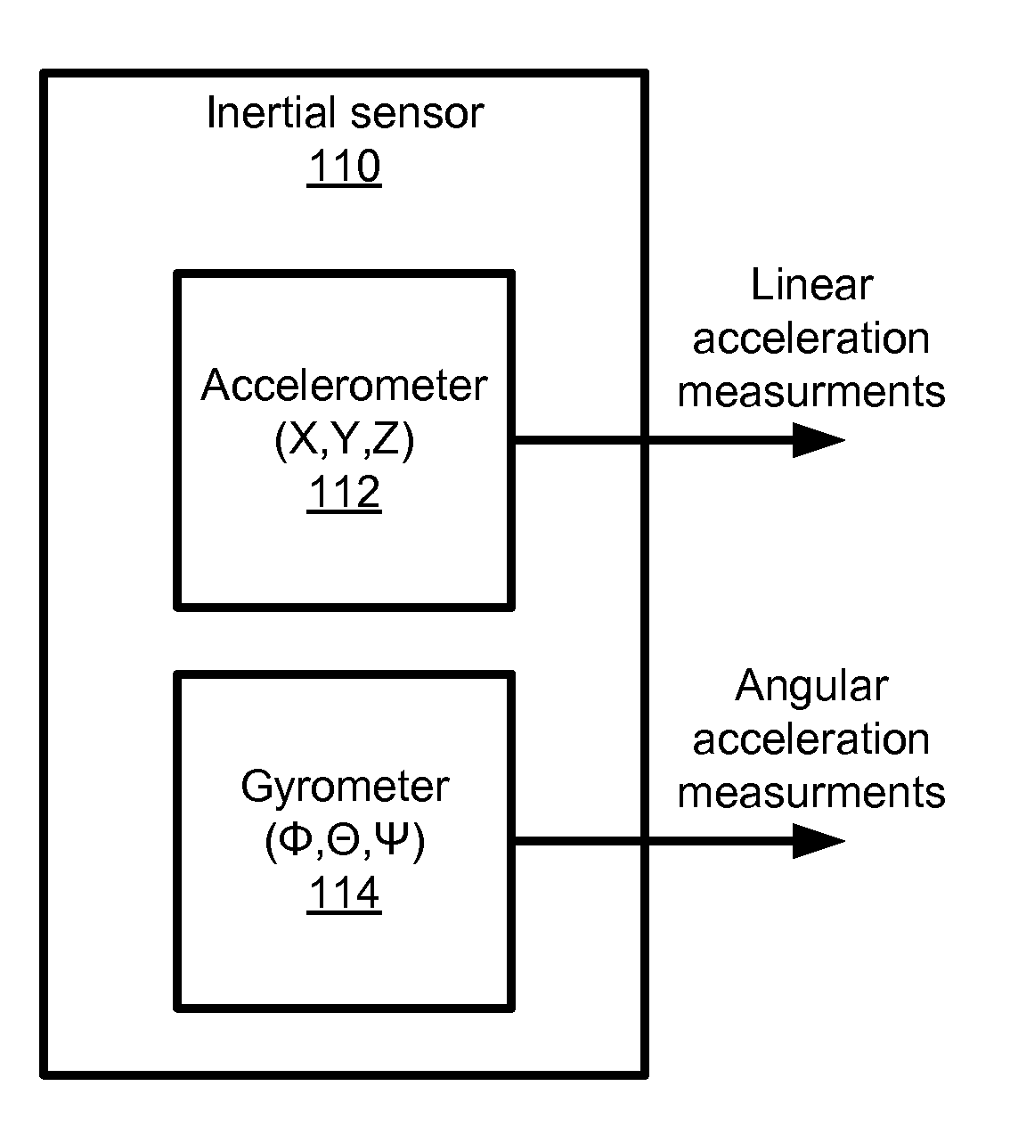
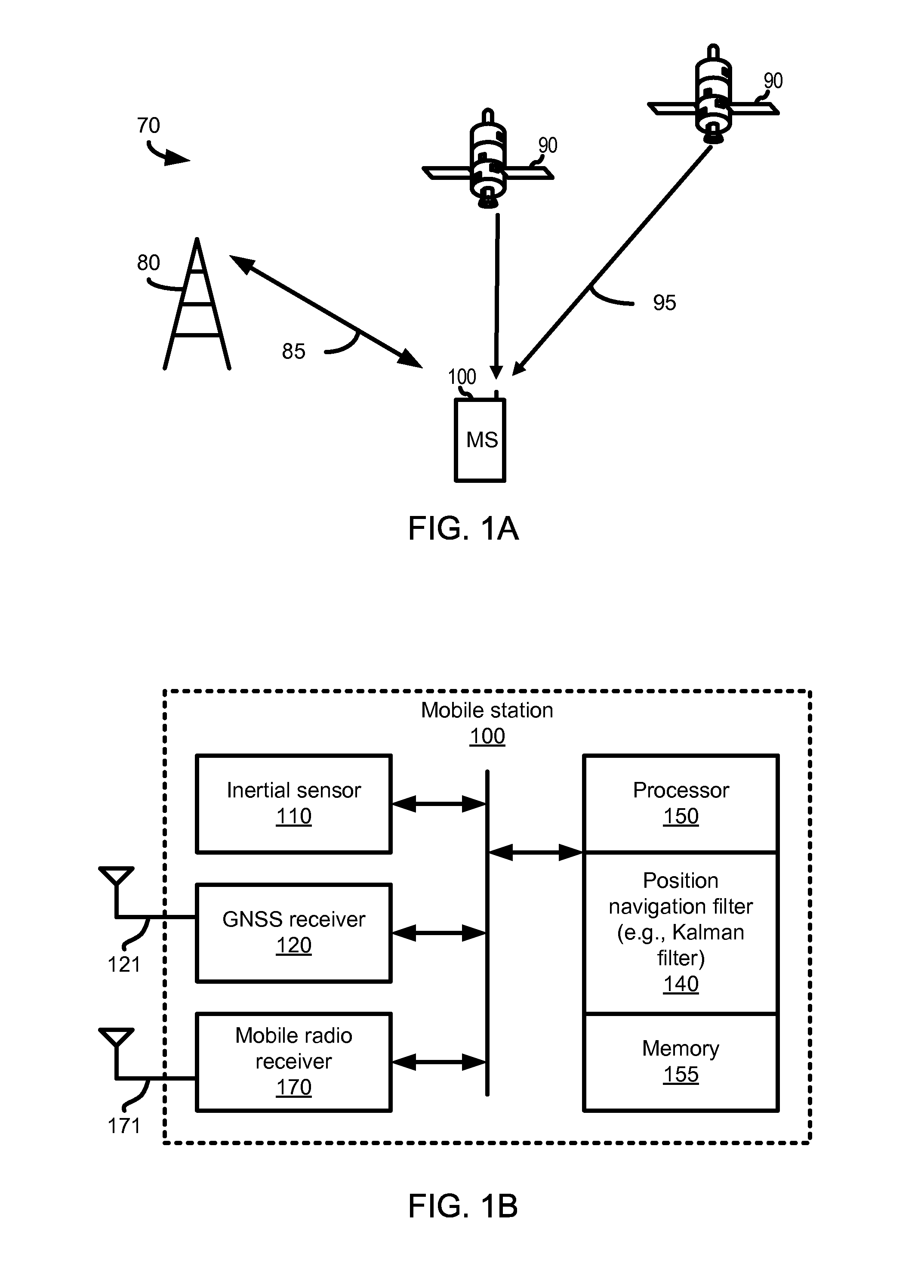
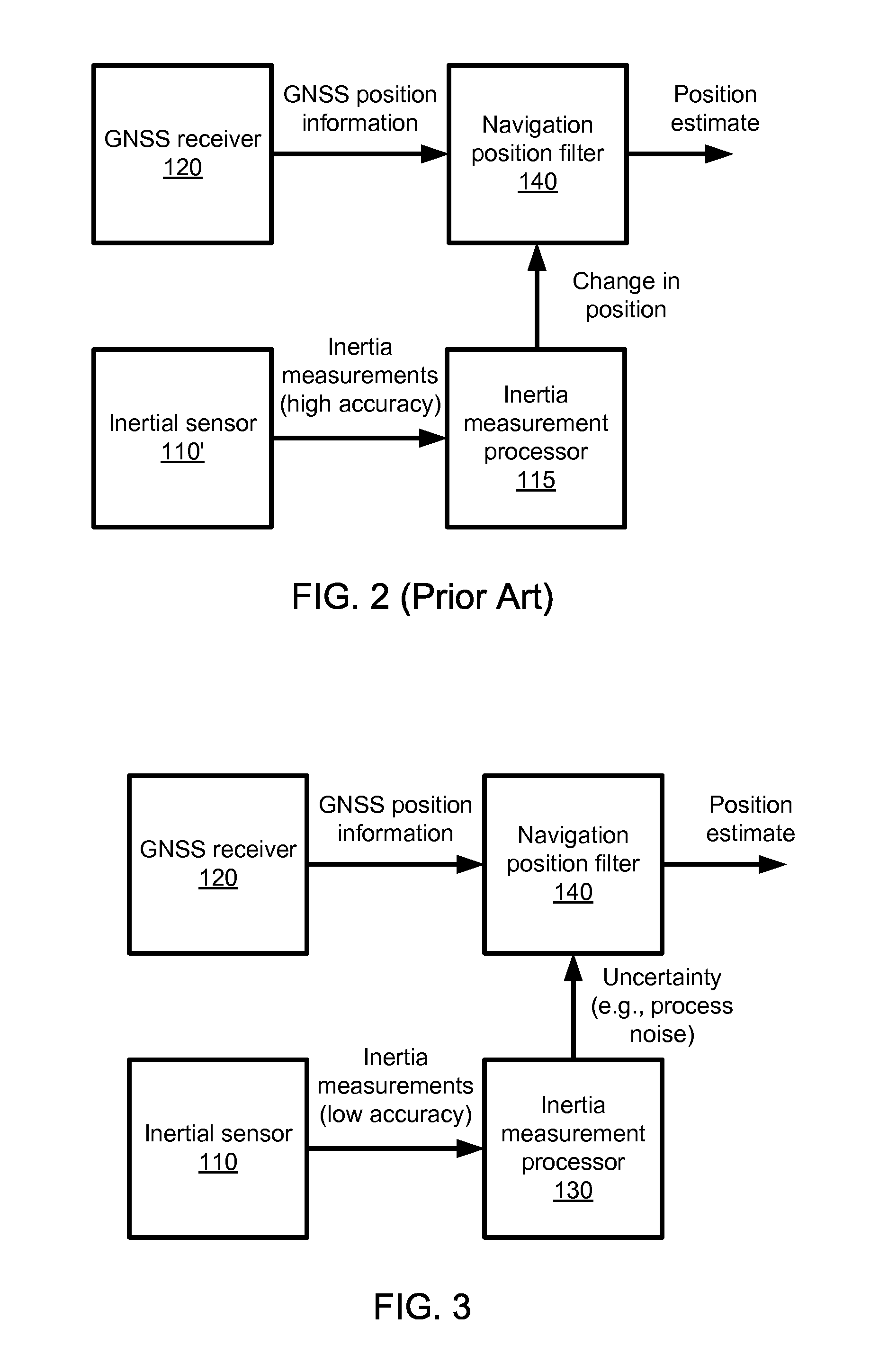
In the following description, reference is made to the accompanying drawings, which illustrate several embodiments of the present invention. It is understood that other embodiments may be utilized and mechanical, compositional, structural, electrical, and operational changes may be made without departing from the spirit and scope of the present disclosure. The following detailed description is not to be taken in a limiting sense. Furthermore, some portions of the detailed description that follows are presented in terms of procedures, steps, logic blocks, processing, and other symbolic representations of operations on data bits that can be performed in electronic circuitry or on computer memory. A procedure, computer executed step, logic block, process, etc., are here conceived to be a self-consistent sequence of steps or instructions leading to a desired result. The steps are those utilizing physical manipulations of physical quantities. These quantities can take the form of electri...


PUM


Abstract

An implementation of a system and method for using inertial sensor data to improve mobile station positioning is provided. Many mobile devices include an inertial sensor. These inertia measurements typically produce low resolution inertial measurements, which may be used to generate an uncertainty value and/or to select a positioning filter model. In some embodiments, this uncertainty value is used as a process noise input signal into a Kalman filter or similar filter. In some embodiments, one position estimate is selected from multiple navigation position filter models operate concurrently, each computing a separate position estimate. In these embodiments, a position estimate is selected based on either the uncertainty value or based on another characteristic of the inertia measurements.

Description

CROSS-REFERENCE TO RELATED APPLICATIONSNot applicable.BACKGROUND OF THE INVENTION1. Field of the InventionThis disclosure relates to positioning systems and, more particularly, to the computation of position solutions for mobile receivers.2. Background of the InventionThe Global Positioning System (GPS) is a satellite navigation system, or satellite positioning system, designed to provide position, velocity and time information almost anywhere in the world. GPS was developed by the Unites States Department of Defense, and currently includes a constellation of twenty-four operational satellites. Other types of satellite navigation systems include the Wide Area Augmentation System (WAAS), the Global Navigation Satellite System (GLONASS) deployed by the Russian Federation, and the Galileo system planned by the European Union. As used herein, “satellite positioning system” (SPS) will be understood to refer to GPS, Galileo, GLONASS, NAVSTAR, GNSS, a system that uses satellites from a com...

Claims


Application Information

Patent Timeline
IPC IPC(8): G01C21/20
CPCG01C21/165G01C21/28H04W64/006G01C21/18G01C21/188
Inventor RILEY, WYATT THOMAS
Owner QUALCOMM INC
Why Eureka
Try Eureka