Method of identifying a temporarily located road feature, navigation apparatus, system for identifying a temporarily located road feature, and remote data processing server apparatus

a technology for identifying temporary locations and road features, applied in traffic control systems, navigation instruments, instruments, etc., can solve the problems of only relating camera data, pnds are typically not able to provide alerts to users, and the inability to acquire necessary information, so as to save user time and inconvenience, improve user experience, and reduce driver workload

Active Publication Date: 2012-09-27
TOMTOM GLOBAL CONTENT
View PDF6 Cites 21 Cited by
  • Summary
  • Abstract
  • Description
  • Claims
  • Application Information

AI Technical Summary

Benefits of technology

[0030]The method may further comprise: accessing data identifying locations of known permanent road features of the same type as the temporarily located road feature; and wherein the remote data processing resource may compare the identified location of the temporarily located road feature with the locations of the known permanent road features in order to eliminate incorrectly identifying a location of a permanent road feature as a location of a temporarily located road feature.
[0049]It is thus possible to provide a navigation apparatus, a server apparatus, a system and a method capable of supporting the provision of a location of a mobile safety camera in a manner that does not solely rely upon active reporting of the mobile safety cameras by road users. Furthermore, the likelihood of data errors as a result of false or erroneous alerts being provided is mitigated. The navigation apparatus, the server apparatus, system and method thus provide an improved user experience in relation to the navigation apparatus, as well as the possibility of saving the user time and inconvenience. Indeed, the ability to provide alerts as to the existence of mobile safety cameras reduces driver workload as it is no longer necessary for a driver to listen specifically for such alerts whilst driving. Additionally, the user has increased flexibility in relation to choice of radio station to which to listen, because the driver is not necessarily constrained to listen to radio stations that make announcements as to the locations of mobile safety cameras.

Problems solved by technology

However, the safety camera data used only relates to fixed safety cameras and not to mobile safety cameras.
Consequently, PNDs are typically not capable of providing alerts to users as to when mobile safety cameras are being approached.
Hence, if there is apathy amongst road users (in an area near a mobile safety camera) to report the presence of the mobile safety camera, the necessary information will not be acquired and hence other road users will not be advised.
Additionally, in respect of a vocal radio broadcast, there is a limit to the number of safety cameras that can be mentioned, i.e. there is a limit to the number of locations of safety cameras that a broadcaster is willing to announce without spoiling a show.
Also, there can be a delay between the initial advice of a location of a safety camera and the announcement to all interested road users, by which time the mobile safety camera may have changed location.

Method used


Image

  • Method of identifying a temporarily located road feature, navigation apparatus, system for identifying a temporarily located road feature, and remote data processing server apparatus
  • Method of identifying a temporarily located road feature, navigation apparatus, system for identifying a temporarily located road feature, and remote data processing server apparatus
  • Method of identifying a temporarily located road feature, navigation apparatus, system for identifying a temporarily located road feature, and remote data processing server apparatus

Examples


Embodiment Construction

[0062]Throughout the following description identical reference numerals will be used to identify like parts.

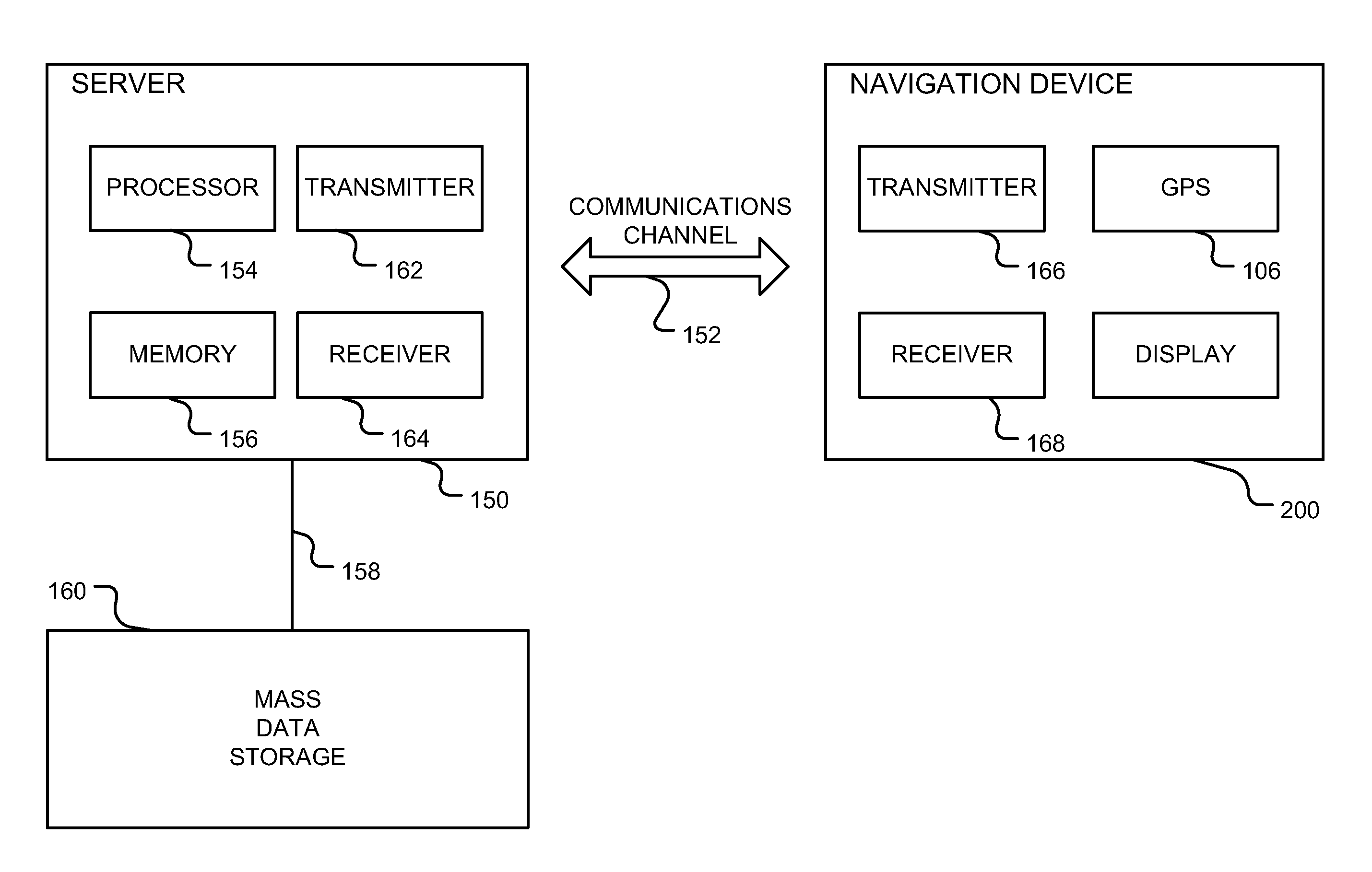
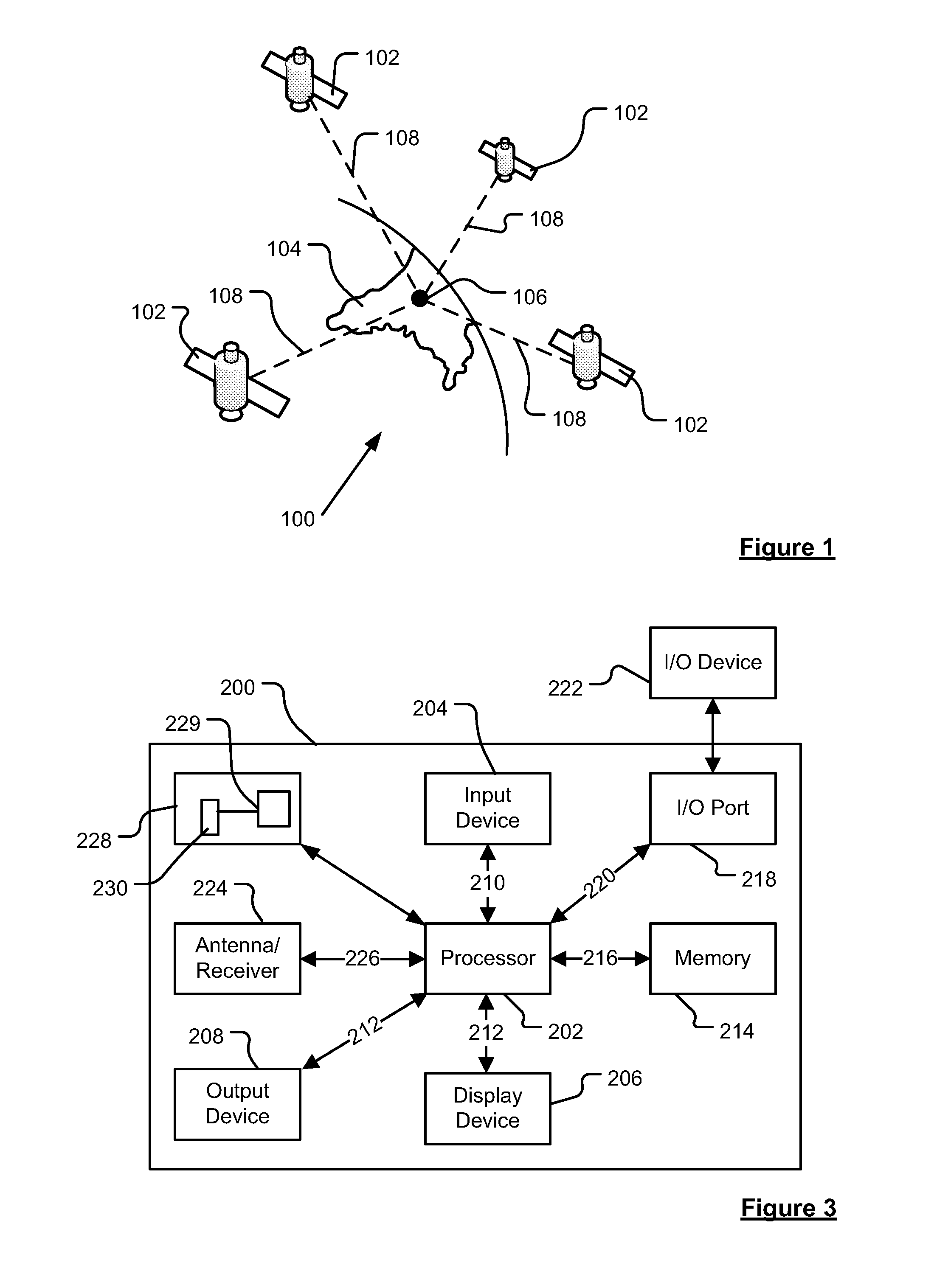
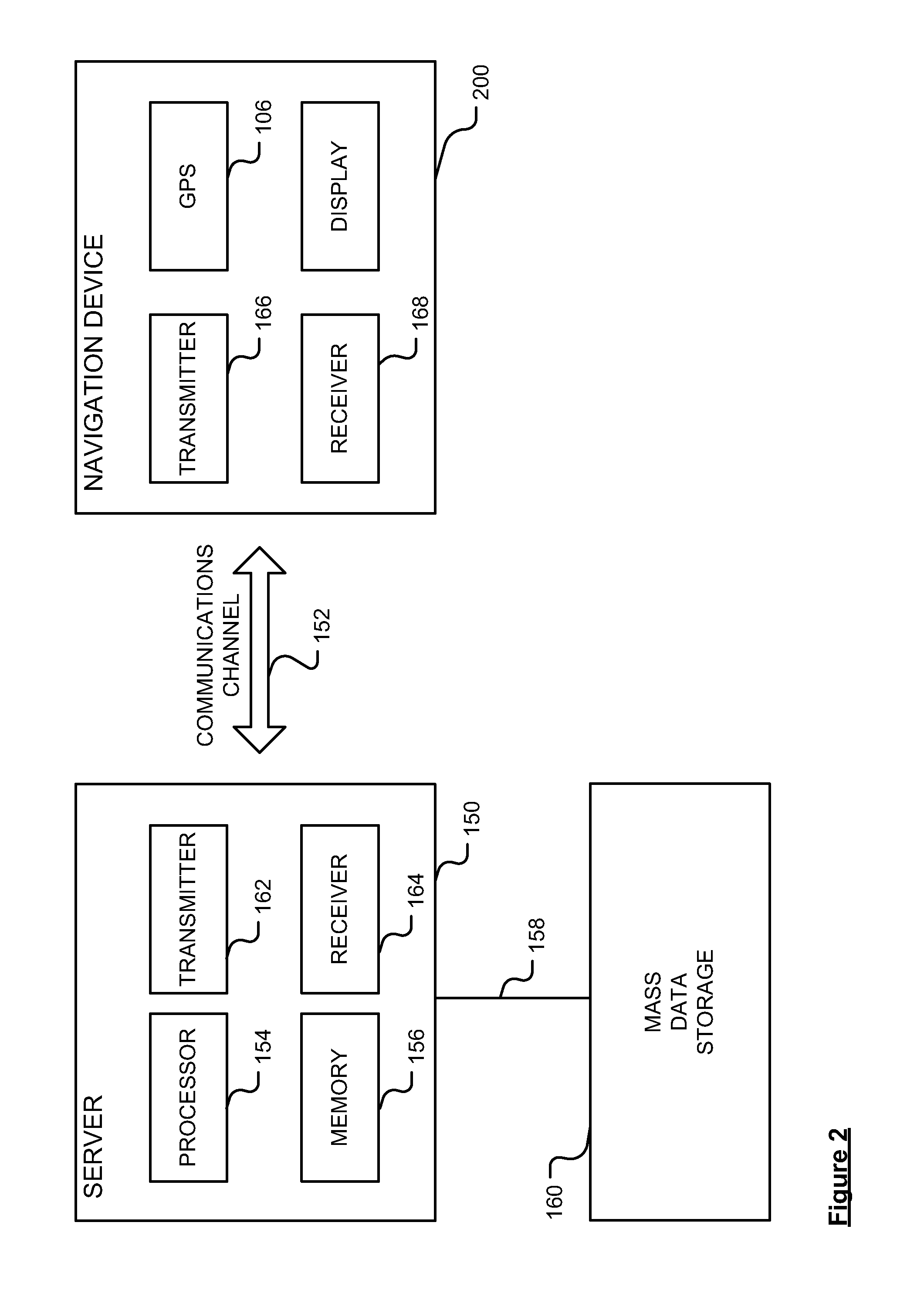
[0063]Embodiments of the present invention will now be described with particular reference to a PND. It should be remembered, however, that the teachings herein are not limited to PNDs but are instead universally applicable to any type of processing device that is configured to execute navigation software in a portable and / or mobile manner so as to provide route planning and navigation functionality. It follows therefore that in the context of the embodiments set forth herein, a navigation apparatus is intended to include (without limitation) any type of route planning and navigation apparatus, irrespective of whether that device is embodied as a PND, a vehicle such as an automobile, or indeed a portable computing resource, for example a portable personal computer (PC), a mobile telephone or a Personal Digital Assistant (PDA) executing route planning and navigation software.

[0...


PUM


Abstract

A method of identifying a temporarily located road feature that engenders vehicular speed behaviour change comprises a navigation apparatus monitoring speed thereof or a parameter associated therewith. The method also comprises the navigation apparatus generating a message in response to detection of a profile associated with speed of the navigation apparatus and that corresponds to a predetermined speed change profile associated with the presence of the temporarily located road feature.

Description

FIELD OF THE INVENTION[0001]The present invention relates to a method of identifying a temporarily located road feature, the method being of the type that, for example, analyses changes of location data. The present invention also relates to a navigation apparatus of the type that, for example, generates location data associated with a location of the navigation apparatus. The present invention also relates to a system for identifying a temporarily located road feature of the type that, for example, analyses changes of location data. The present invention further relates to a remote data processing server apparatus of the type that, for example, identifies a location of a temporarily located road feature.BACKGROUND TO THE INVENTION[0002]Portable computing devices, for example Portable Navigation Devices (PNDs) that include GPS (Global Positioning System) signal reception and processing functionality are well known and are widely employed as in-car or other vehicle navigation systems...

Claims


Application Information

Patent Timeline
Patent Type & Authority Applications(United States)
IPC IPC(8): G01C21/26
CPCG01C15/002G09B29/10G06T15/40G01C21/32G01C21/26G09B29/003G01S19/52G08G1/091G08G1/0967
Inventor VAN DOORSELAER, BART
Owner TOMTOM GLOBAL CONTENT
Why Eureka
Try Eureka