

Rock property measurements while drilling
a technology of property measurement and drilling, applied in the field of rock property measurement while drilling, can solve the problems of increasing the difficulty of learning task, time-consuming and expensive function, and affecting the accuracy of drilling results
- Summary
- Abstract
- Description
- Claims
- Application Information
AI Technical Summary
Benefits of technology
Problems solved by technology
Method used
Image

Examples
Embodiment Construction
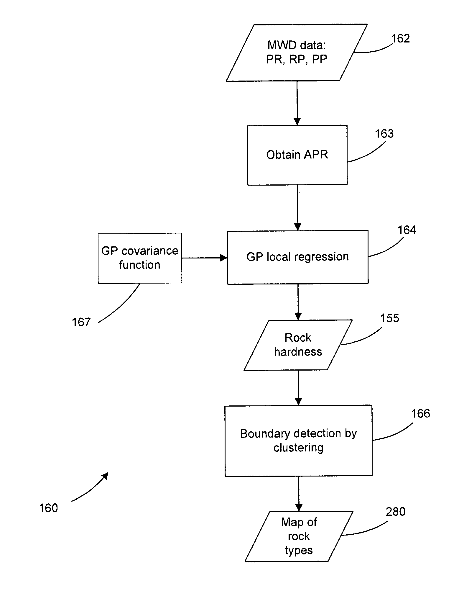
[0055]Identifying rock types is conventionally done manually by geologists from rock samples collected on site. This can be a dangerous, time intensive and expensive function, providing motivation to seek for an automated solution. It is therefore desirable to enable automated rock recognition, preferably from data that is already available during the course of mining operations.
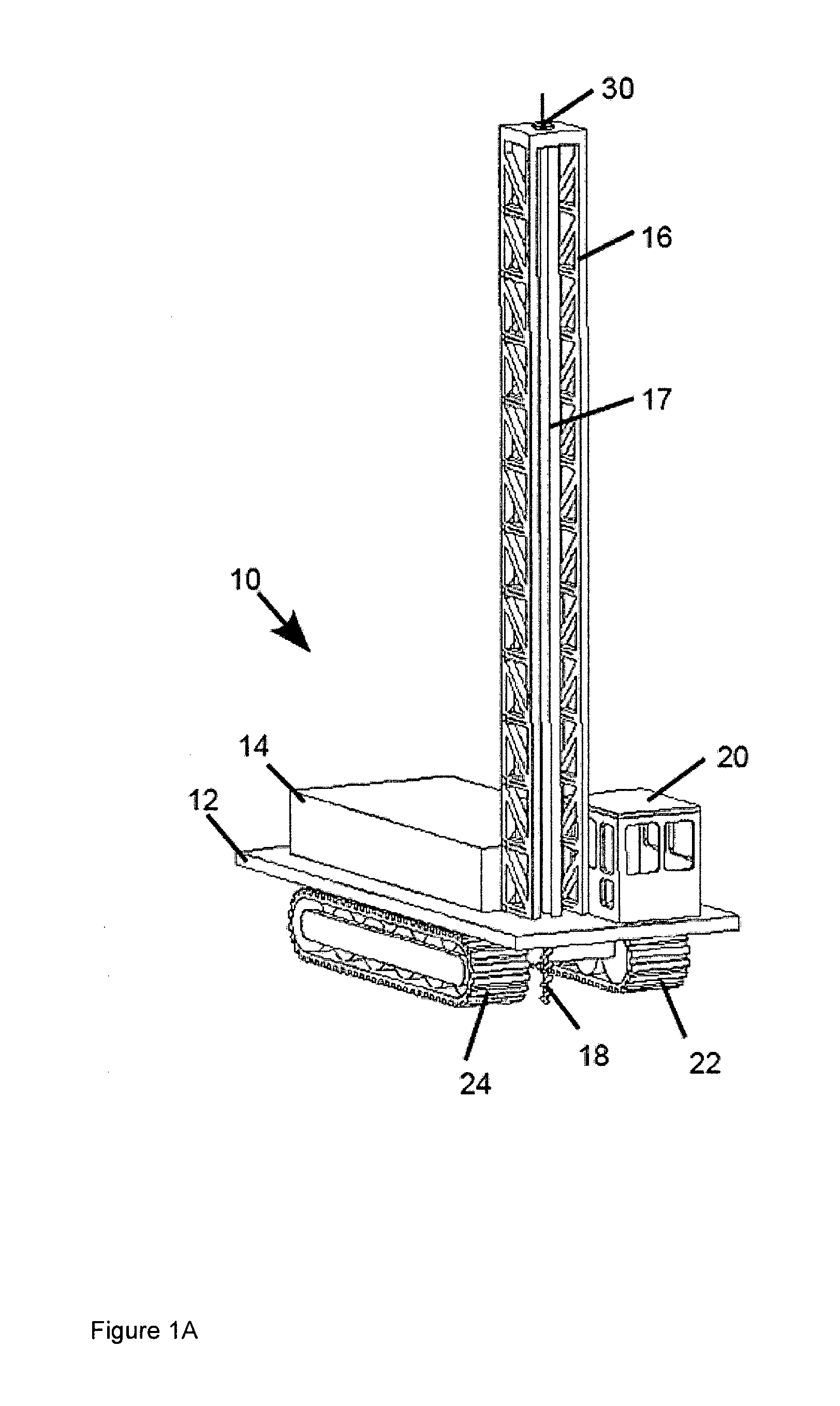
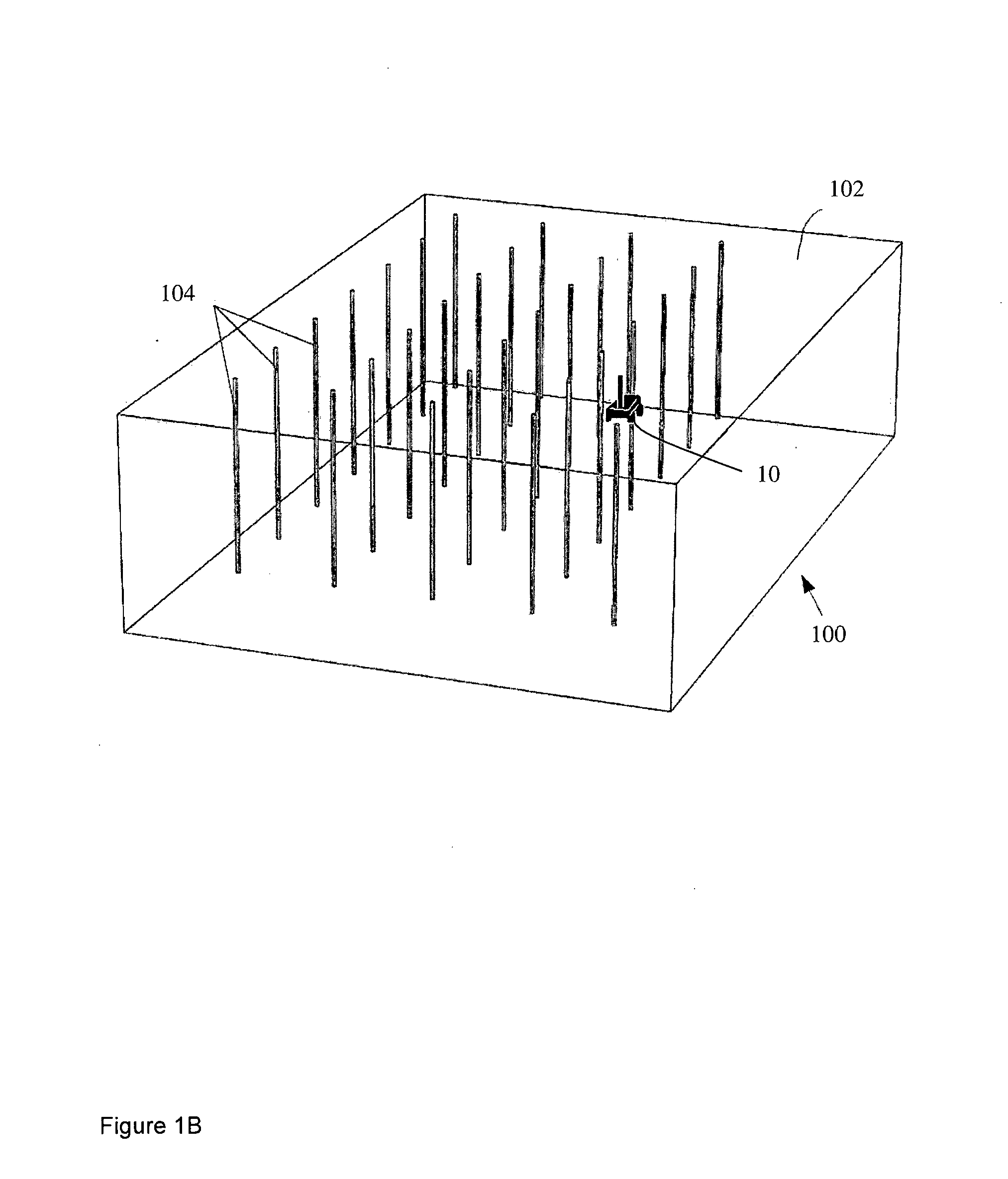
[0056]Open-pit mining, a widely used economical mining method, usually involves operating large mining equipment in remote and potentially hazardous environments. It is therefore desirable to develop automation technology in this field to achieve higher efficiency and safety. In a large scale environment like an open-cut mine spatial modelling of geography and geology can have many uses in planning, analysis and operations within the mining environment. In the case of automated mining, a geographical model or terrain map can be used to guide robotic vehicles, whilst an in-ground geological model of the ore b...
PUM
 Abstract
Description
Claims
Application Information