
Weather avoidance tool system

a tool system and weather technology, applied in the field of weather avoidance tool system, can solve problems such as confusion for users, confusion for end users, and affecting the flight of atmospheric turbulence,

Active Publication Date: 2013-08-29
BLUE EAGLE FUND
View PDF1 Cites 80 Cited by
  • Summary
  • Abstract
  • Description
  • Claims
  • Application Information

AI Technical Summary

Benefits of technology

The present invention provides a method for planning a path of air travel through a three-dimensional travel region with multiple types of travel hazards that vary in intensity. The method involves accumulating data about each hazard, converting the data to a common atmospheric state intensity scale, and establishing travel tolerance parameters for each hazard. The method can then use these parameters to plan a path of air travel through the three-dimensional travel region while monitoring the levels of the hazards and making adjustments to the path as needed. The invention also includes a weather avoidance system that utilizes the method for planning a path of air travel.

Problems solved by technology

This can often lead to confusion for the end user whose familiarity with the various components varies widely.
The descriptors for weather often can be confusing to users who do not have an in depth knowledge of the various components.
Business and general aviation can struggle with this widely varying array of products.
Atmospheric turbulence has plagued aviation since its earliest days.
Although PIREPs are firsthand accounts of actual pilot experiences, they have by their very nature limitations.
In addition, the relatively few PIREPs recorded are often broadcast too late to avoid similar encounters by nearby or trailing aircraft.
The lack of real time, objective turbulence data for pilots, dispatchers and controllers in an area where unexpected turbulence is present can lead to unnecessary and sometimes unsafe turbulence encounters for multiple aircraft, whereas the presence of better defined data could lead to mitigation or avoidance tactics and far fewer cabin injuries.
But because data in this airspace is inadequate both quantitatively and qualitatively, word of moderate turbulence at FL330 is propagated often for hours, resulting in the potentially significant underutilization of en route airspace.
The reality of day-to-day operations, however, reveals a problem of much greater magnitude, as conscientious users in a given area routinely avoid numerous en route altitudes just for light turbulence.
It is also worth noting that these data do not account for the number of flights that never achieved the most efficient flight planned altitude due to mere rumors of turbulence over the ATC frequency.
Although airline dispatchers work diligently to arrive at the best compromise of ride comfort and economy in generating flight plan cruise altitudes, they lack accurate objective data to aid in their decisions due to the above issues.
Even when they are able to provide good recommendations, such efforts are routinely and unnecessarily undermined by the repeated occurrence of the above scenario.
Of course, all of this maneuvering has yet a third consequence in that it significantly reduces airline fuel economy and increases carbon emissions.
Though expensive in its own right for airlines, wasted fuel also has significant social and environmental costs in the form of excessive carbon emissions, as well as delay costs for the traveling public via the overall poor allocation of airspace.
These inefficiencies exacerbate the challenges to commerce presented by stubbornly high energy prices, which are now being borne by air travelers in the form of fuel surcharges and higher ticket prices.
The present system for handling initial flight plans and any subsequence changes called reroutes is very labor intensive, especially with changes due to weather.
In a dynamic weather situation, this process can be tedious and cumbersome often resulting in delays.
The arrival times are dependent on these delays and often result in a long string of aircraft based on first come first served in the arrival sequence.
Many users have no training in weather basics or the products produced by the governing agencies.

Method used


Image

  • Weather avoidance tool system
  • Weather avoidance tool system
  • Weather avoidance tool system

Examples


Embodiment Construction

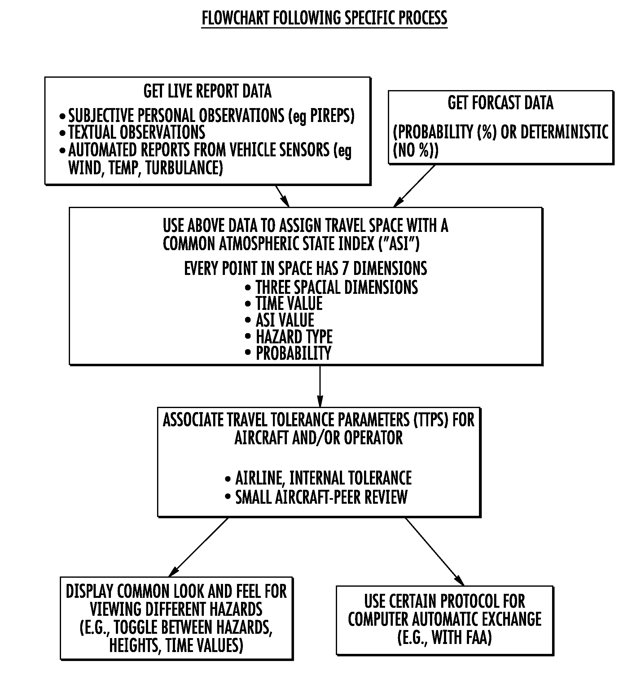
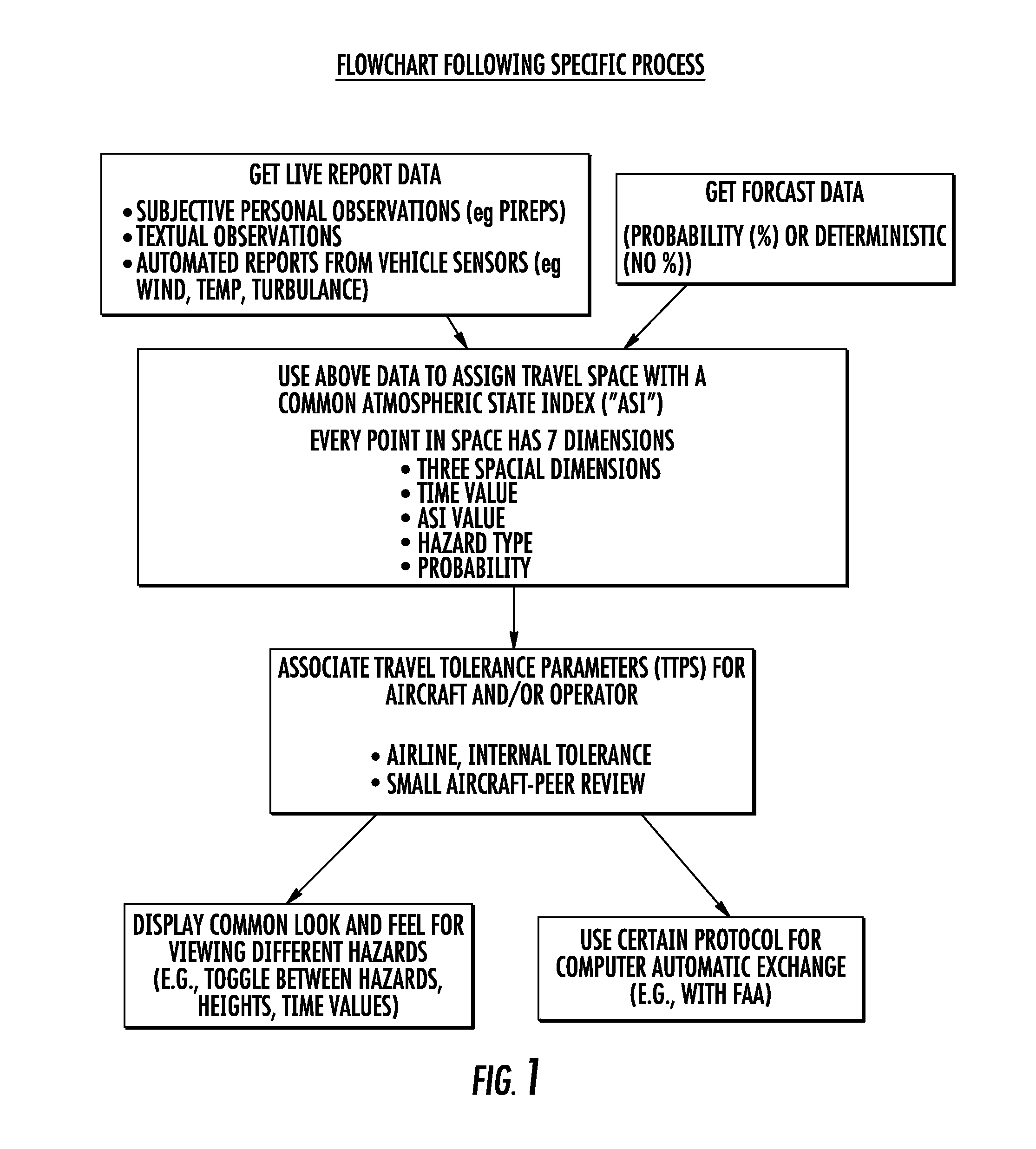
[0022]According to various embodiments of the present invention, a method is provided for planning a path of air travel through a three dimensional travel region having at least two different types of travel hazards each having varying degrees of intensity. Various embodiments of the method comprise the steps of: A) accumulating data relating to each of the two different types of travel hazards, the two hazards being “Hazard 1” and “Hazard 2”; B) converting each of the sets of data (“Hazard 1 Data” and Hazard 2 Data”) to fit to a common atmospheric state intensity scale, such that Hazard 1 Data can be used to report the intensity of Hazard 1 along the common atmospheric state intensity scale, and such that Hazard 2 Data can be used to report the intensity of Hazard 2 along the intensity scale; and C) using both sets of converted data to plan a path of air travel through the three dimensional travel region.

[0023]According to various embodiments of the present invention, a method is p...


PUM


Abstract

This invention relates to a method of providing a simplified practice for dealing with aviation turbulence and other weather hazards that allows the end users to better communicate turbulence as a state of the atmosphere metric and the additional weather threats affecting the flight. The invention will provide an Atmospheric State Index (ASI) that will allow all the users to work with a standardized metric that describes the turbulence as the state of the atmosphere and a similar scale for other weather risks to the flight. This system will make the correlation between the forecast and aircraft reports for turbulence easier to interpret for the end users. This approach would concentrate on turbulence as one of the weather hazards with a more objective and easier to use metric. This invention would provide a transition for moving from a system based on turbulence PIREPS to a more objective data driven process in the future air traffic environment. This invention would provide an end solution for the future air traffic system commonly referred to as NextGen for both turbulence and other weather hazards.

Description

CROSS REFERENCE TO RELATED APPLICATIONS[0001]This application claims priority to and the benefit of U.S. Application No. 61 / 604,022 entitled, “Turbulence Detection and Reporting System” that was filed on Feb. 28, 2012, the entirety which is hereby incorporated by reference herein.BACKGROUND[0002]1. Technical Field[0003]Embodiments of the present invention described herein relate generally to the appraisal of various weather hazards, including but not limited to such hazards as they affect air, ground, and water travel.[0004]2. Description of Related Art[0005]Weather has long been known the affect travel, including air, ground and sea travel. It has also long been known to attempt to better understand current and forecast weather data in order to provide for safer and more efficient travel for recreational and professional consumers.[0006]Weather is a very complex phenomenon, and the descriptions of its various components are generally produced by people with an intimate knowledge of...

Claims


Application Information

Patent Timeline
Patent Type & Authority Applications(United States)
IPC IPC(8): G01C21/34
CPCG08G5/0021G01W2001/003G08G5/0091G01C21/3407G08G5/0034
Inventor WATTS, WILLIAM HENRY
Owner BLUE EAGLE FUND
Learn More