Eureka AIR delivers breakthrough ideas for toughest innovation challenges, trusted by R&D personnel around the world.

System and method for identifying and learning actionable opportunities enabled by technology for urban services

Inactive Publication Date: 2014-06-12
CITYSCAN
View PDF11 Cites 9 Cited by
  • Summary
  • Abstract
  • Description
  • Claims
  • Application Information

AI Technical Summary

Benefits of technology

The invention provides a system that helps level the playing field for vendors and operators who are seeking street-level licenses and permits. This means that data is collected and analyzed to make it easier for street-level activities to get started. The invention also allows municipalities to have a more efficient eye on what is happening at the street level, without needing to make significant capital investments. Finally, the streamlined processes help to get results quicker, compared to current methods.

Problems solved by technology

A complex challenge facing urban planners is trying to effectively link a plethora of digital geo-spatial reference models to changes in the built environment and to citizen activity.
Across the nation, many municipalities are facing budget concerns.
With respect to understaffed departments and inadequate resources, municipalities nationwide have been unable to adequately monitor the asset inventories for a variety of assets classes in their jurisdictions including but not limited to billboards, on premise signs, valet spots, loading zones, construction activity, and many more.
In addition, regulations around these assets classes often go unenforced and the corresponding fines have been rarely collected.
As noted, because of the expense and complexity of maintaining asset databases manually, municipalities have fallen behind in asset enforcement in the current financial downturn.
Large cities are unable to answer even the most basic questions about the assets within their jurisdiction.
For example, municipalities commonly do not know how many assets were erected in the last year, what percentage of those erected have proper permits, how often do inspections occur, and at what cost.
Further, municipalities commonly do not have reliable data related to the proportion of assets that were inspected over the last year, how licensing policies are enforced, the amount of revenue that is lost from uncollected licensing fees and illegally placed signs.
Every year municipal fees go uncollected on about 150,000 billboards nationally, and cities are failing to collect over $50 million per year of revenue.
This problem exists not just for billboards but also for other classes of infrastructure assets such as on-premise signs, construction fixtures and more.
Even when regulations exist, violations cause public safety issues.
Cities are faced with serious decisions regarding enforcement due to limited resources.
Further, the current methods employed by governments to inventory assets in their jurisdiction for their municipal permitting, enforcement, and planning efforts are expensive and inefficient.
However, even as data acquisition systems and imaging systems proliferate, significant complexity remains in object extraction and correlation of extracted objects in the physical space with existing municipal records, zoning rules and licensing codes.
A primary complexity is that these data sets normally use different methods to identify a specific location, not to mention the location, size, and other characteristics in the built environment.
Despite its size, the current out-of-home marketing intelligence and measurement models rely heavily on sample surveys and visibility simulations, which are inaccurate and predictive.
The out-of-home media industry is driven by sales channel strength, not market demand, with large disparities in billboard pricing resulting from the lack of transparency.
It is not surprising that proponents of OOH tout a $4 CPM rates as the lowest among other mass media classes while failing to recognize that this proportionally low cost can be mainly attributed to the lack of real value delivered.
While the SCOUT program is useful, it fails to provide outdoor knowledge with accurate measurements that can effectively improve the observation on dozens of object classes that can help improve the street level quality of life in city neighborhoods, while enhancing the responsiveness of city government to quality of life conditions.
Until now, capturing data for large areas approaching the size of modern cities was prohibitively expensive.
Just as current systems are inefficient at identifying location-specific out-of-home marketing opportunities, the current systems are also inefficient at identifying actionable opportunities to improve public safety, quality of life, etc.

Method used


Image

  • System and method for identifying and learning actionable opportunities enabled by technology for urban services
  • System and method for identifying and learning actionable opportunities enabled by technology for urban services
  • System and method for identifying and learning actionable opportunities enabled by technology for urban services

Examples


Embodiment Construction

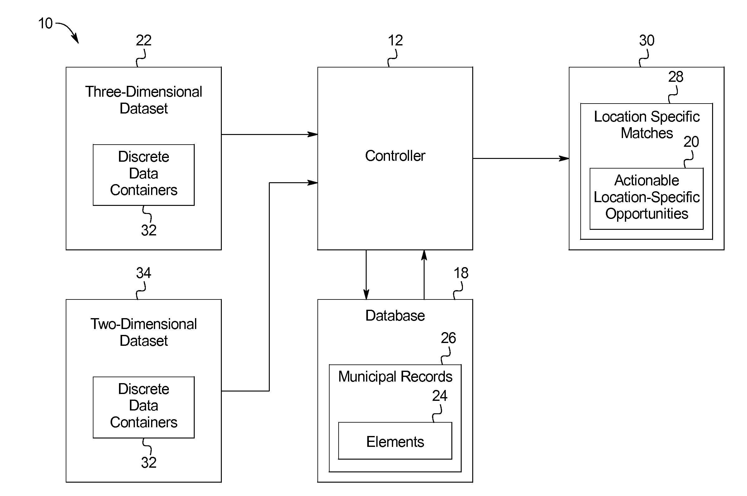
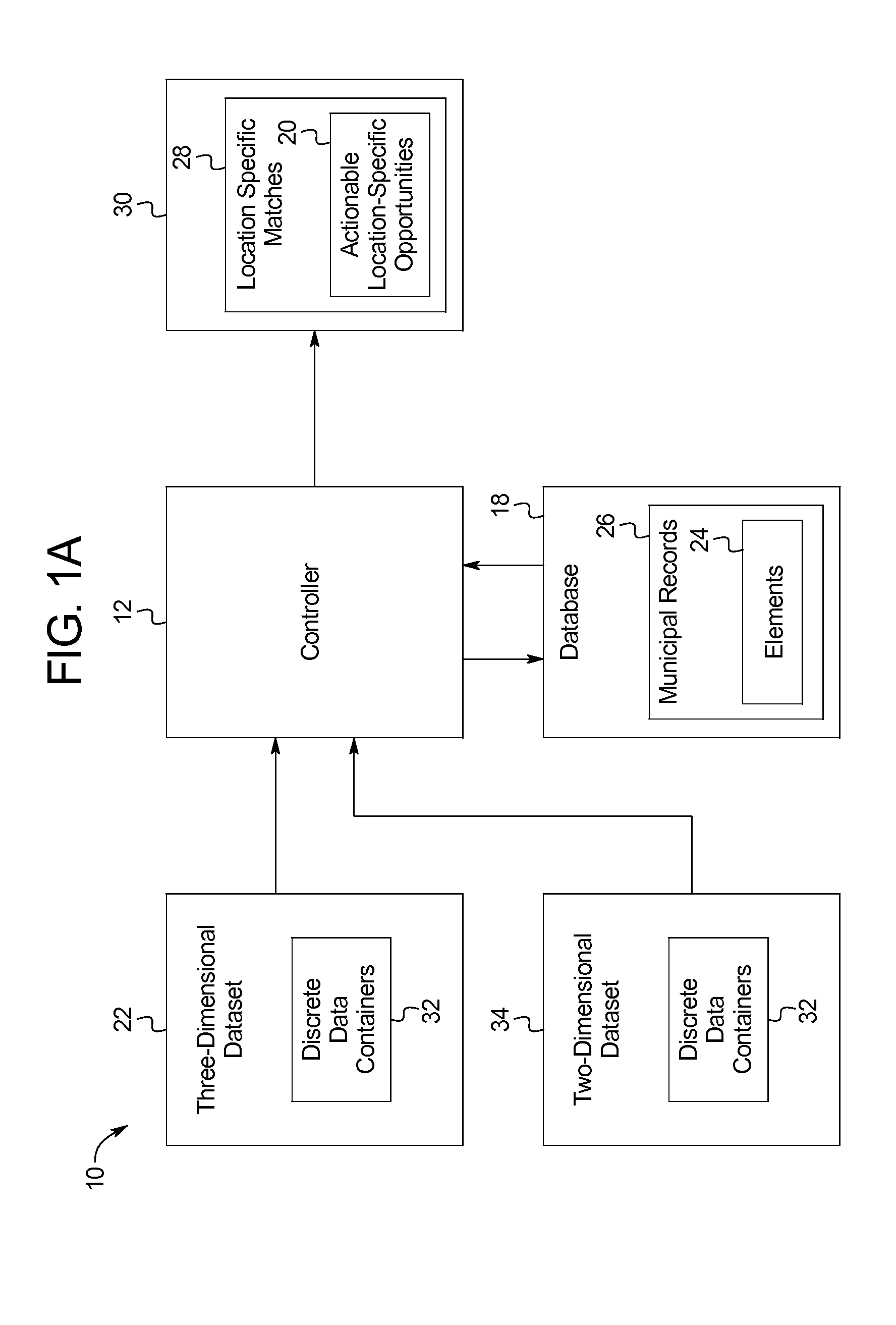
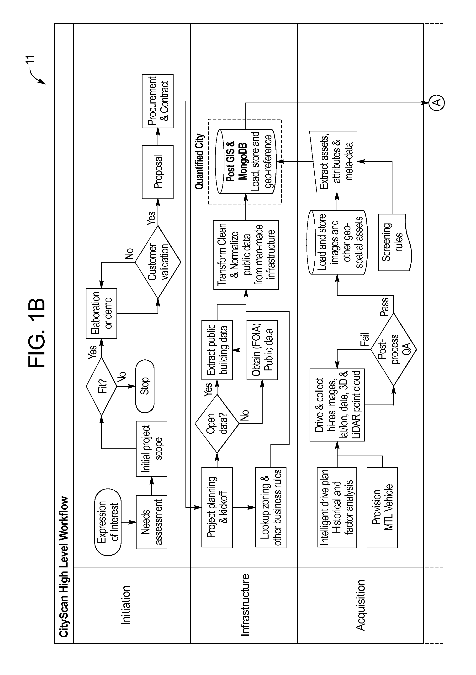
[0061]The present disclosure provides systems 10 and methods 11 in which municipal records 26 are analyzed in combination with three-dimensional (3D) datasets 22 using contextual heuristics to identify actionable location-specific opportunities 20 that are potential revenue generating opportunities for municipalities. For example, as shown in FIGS. 1A-1B, the systems 10 and methods 11 provided herein may be adapted to analyze municipal records 26 in combination with three-dimensional datasets 22 using contextual heuristics to identify location-specific opportunities 28 to improve safety, quality of life, and other factors.

[0062]In an example, the actionable location-specific opportunities 20 are economic opportunities. As discussed above, the actionable location-specific opportunities 20 may include sources of revenue for municipalities. For example, the system 10 may identify an invalid permit associated with a street sign or building, as the actionable location-specific opportunit...


PUM


Abstract

The present disclosure provides systems and methods of identifying actionable location-specific opportunities using the steps of: receiving a three-dimensional dataset forming a model of an urban landscape; analyzing other third-party private and / or public dataset and including elements of municipal records and rules to identify location-specific matches; and using heuristic algorithms to evaluate the location-specific matches to create a data compilation that identifies one or more actionable location-specific opportunities.

Description

CROSS-REFERENCE TO RELATED APPLICATIONS[0001]This application incorporates by reference and claims priority to U.S. Provisional Application 61 / 634,468 filed on Feb. 11, 2013.BACKGROUND OF THE INVENTION[0002]The present subject matter relates generally to systems and methods for identifying, learning, and integrating actionable knowledge and location specific opportunities driven to improve safety, quality of life, and increase municipal revenue by providing cost recovery opportunities.[0003]Mobile mapping infrastructure and its' associated technology can play a key role in improving life safety and community sustainability in an urban environment. Used well, such infrastructure and technology can provide a positive economic impact in the communities in which it is employed. A complex challenge facing urban planners is trying to effectively link a plethora of digital geo-spatial reference models to changes in the built environment and to citizen activity.[0004]Across the nation, many...

Claims


Application Information

Patent Timeline
IPC IPC(8): G06Q50/16G06F17/50G06Q30/00
CPCG06Q50/16G06Q30/018G06F17/5009
Inventor GUTTMAN, DAVIDSAEZ, ORLANDO
Owner CITYSCAN
Why Eureka
Eureka Blog
Learn More