
System and Method for Providing Real-time Location Previews

a technology of real-time location and preview, applied in the field of mobile computerized devices and applications, can solve the problems of not showing environmental conditions, information provided by such web services, and information that is not current and consistent enough to adequately approximate real-time information particularly

Inactive Publication Date: 2015-05-14
LEOW CHON HOCK +1
View PDF5 Cites 53 Cited by
  • Summary
  • Abstract
  • Description
  • Claims
  • Application Information

AI Technical Summary

Benefits of technology

The patent describes a system that continuously collects and updates video and sound data from a location. This data can be used to provide real-time information to users, allowing them to make informed decisions based on the activity levels and environmental conditions at the location. The system can also analyze the sound data to identify specific characteristics and map the relative sound levels of different areas within the location. Additionally, the system can compare current data with historical data to predict future environmental conditions and help users understand likely changes in the location. Overall, the system provides a valuable tool for monitoring and analyzing activity levels and environmental conditions in real-time.

Problems solved by technology

Though helpful, the information provided by such web services is often static and / or not entirely current.
And there is no information showing environmental conditions at the actual time a person is considering going to that location.
But even though the information provided by these crowd-sourced web resources is more current than static sites such as Yelp! and Google Maps, the information they provide is not current and consistent enough to adequately approximate real time information particularly with regard to information about activity and environmental conditions at particular locations.
As a result, users cannot rely on them to accurately preview a location and determine whether a particular location will suit their needs at the present moment or by the time they arrive at the location.
But, the user cannot determine which cafés currently have lines, how fast those lines are moving, or whether there are likely to be open tables in areas that are quiet enough to hold a conversation comfortably.
Prior art methods and systems for providing information that approximate real time also have significant limitations.
For example, while it is possible for a commercial establishment to provide live video streaming on a website that might show present activity and conditions, very few do this because of privacy concerns.
Owners of these establishments are often concerned that patrons do not want their whereabouts, activities or conversations broadcast to the general public, and owners may be worried about liability for violating privacy laws.
In addition, live streaming to determine activity levels is not very effective because it is difficult for the user to interpret contextually.
She may have to review a live video stream for 10 to 15 minutes to estimate how fast a queue (i.e. line of persons waiting to be served) is moving, which is not practical.
And, there is no additional information that is provided to help the user understand whether the presently viewed stream shows normal activity and conditions or an anomaly which will change by the time the user travels to the location.
In fact, present methods and systems utilized by current web resources provide very little in the way of contextual information.
A user cannot determine, for example, whether the current activity and environmental conditions are normal for a particular time of day or day of the week.
And there is no information provided which would allow a user to determine whether the present conditions are likely to change by the time she arrives at a selected location.
A bar located near a theater may be very busy before and after show times. Prior art methods and systems do not account for such events.
Prior art methods and systems simply do not provide this level of real time detail.
While it may be possible to access popular social media based posting and communication sites such as Twitter, Facebook, and others to locate contextual information and historical “hot spots” of activity, this information is generally anecdotal, and can be inaccurate, outdated, and presented in a haphazard and inconsistent style.
Importantly, they also do not provide readily accessible information showing real time activity levels or the location of resources and amenities close to areas of activity.
Prior art methods and systems fail to deliver real time information about activity levels, environmental conditions, and historical and contextual factors to allow users to determine whether a particular location will suit their needs and desires at the time they intend to go there.

Method used

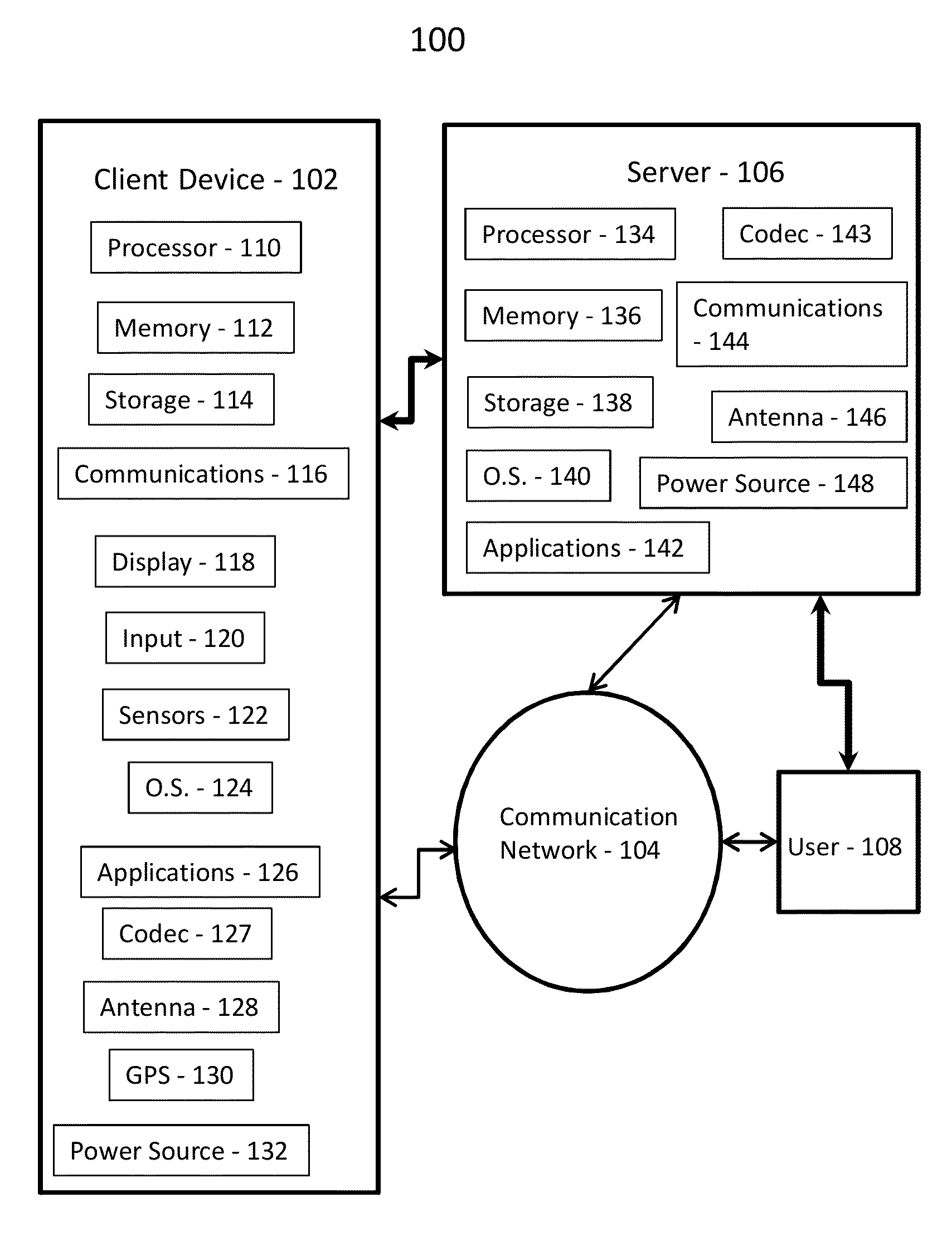
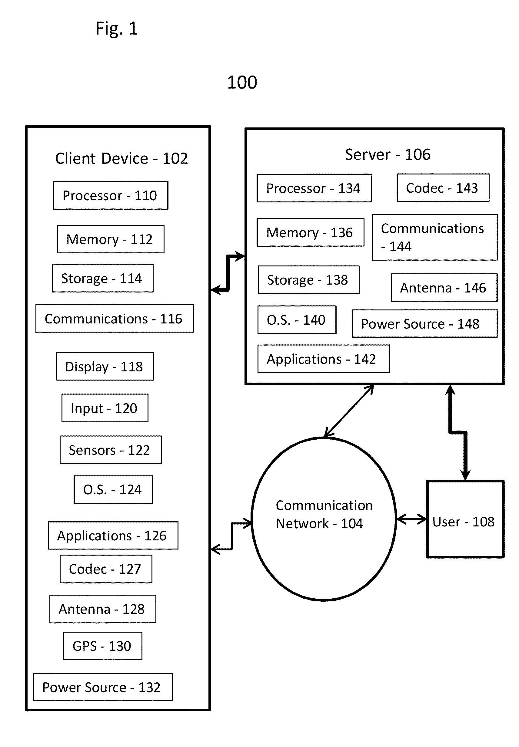
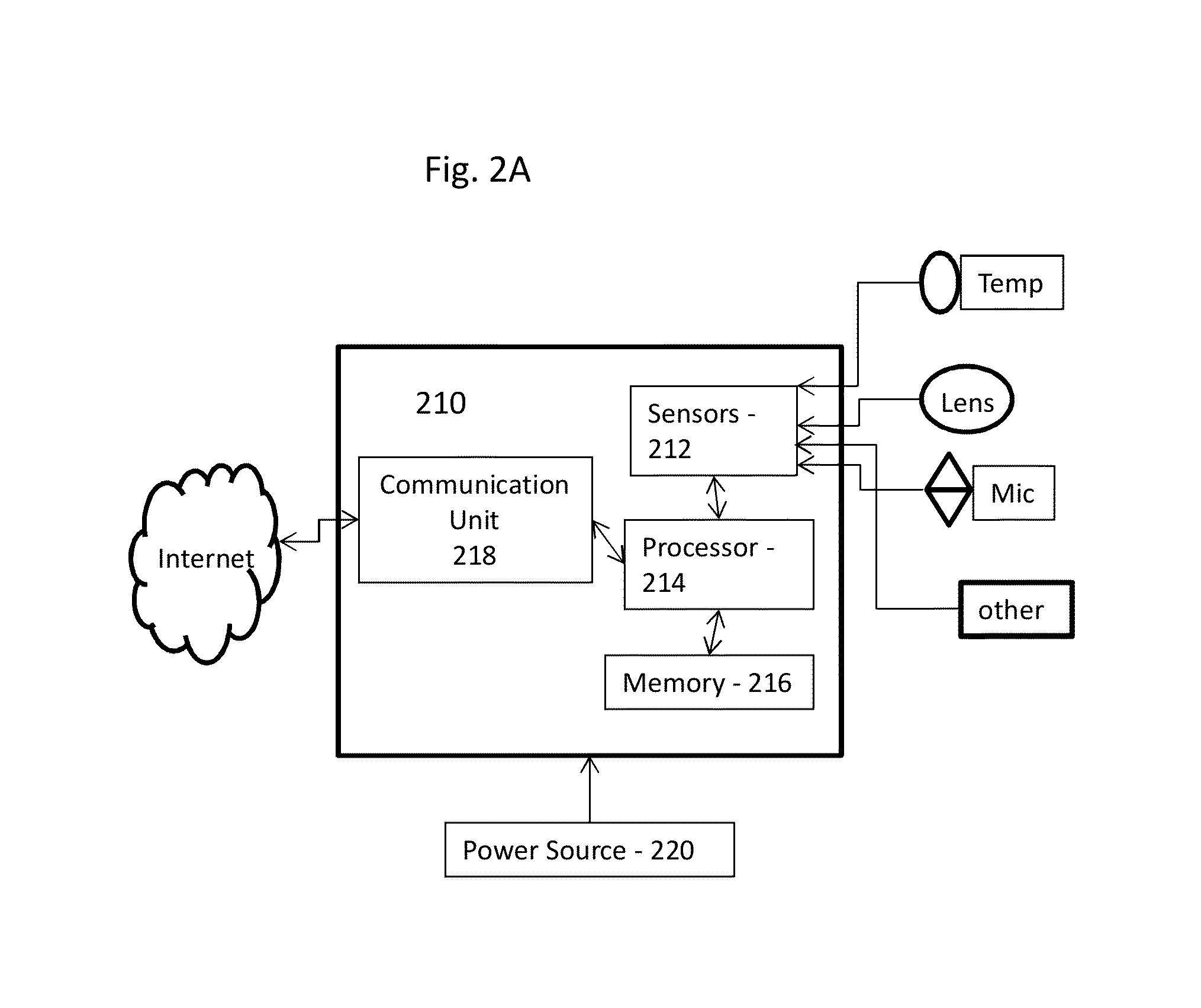

Image

  • System and Method for Providing Real-time Location Previews
  • System and Method for Providing Real-time Location Previews
  • System and Method for Providing Real-time Location Previews

Examples


Embodiment Construction

[0040]In the following detailed description, numerous specific details are set forth in order to provide a thorough understanding of some embodiments. However, it will be understood by persons of ordinary skill in the art that some embodiments may be practiced without these specific details. In other instances, well-known methods, procedures, components, units and / or circuits have not been described in detail so as not to obscure the discussion.

[0041]Although portions of the discussion herein relate, for demonstrative purposes, to wired links and / or wired communications, some embodiments are not limited in this regard, and may include one or more wired or wireless links, may utilize one or more components of wireless communication, may utilize one or more methods or protocols of wireless communication, or the like. Some embodiments may utilize wired communication and / or wireless communication.

[0042]Some embodiments may be used in conjunction with various devices and systems, for exa...


PUM


Abstract

Method and system for providing real-time location previews. For example, a system and method for collecting data about activity levels, including persons waiting in queues and density of persons, as well as environmental conditions of a location from one or more client devices and / or user devices; processing the collected data to remove privacy concerns, calculate queue times, density levels and other activity levels within a defined location, and retrieve contextual and historical information, including scheduled events, relevant to determining anticipated level of activity and environmental conditions within and around a location; and making processed data available to users via communications network for purpose of previewing a location.

Description

FIELD[0001]Embodiments consistent with the principles of the invention relate to mobile computerized devices and applications.BACKGROUND[0002]Smartphones and other web-enabled mobile devices have had a dramatic effect on how people make decisions about where to go and what to do. Using a web-enabled device, a person can readily access an increasing array of web resources to determine location options, reviews, environmental conditions and other information concerning specific places they wish to visit. For example, a group of people getting together can decide in-the-moment to go to a restaurant, and can access web-based resources to determine what restaurants are available in a particular location, what reviewers have said about that restaurant, and even book a table. In addition, they can access to some detailed information about the location and amenities. They can locate the restaurant on a map, view photographs or video clips showing the décor and available amenities, and read ...

Claims


Application Information

Patent Timeline
Patent Type & Authority Applications(United States)
IPC IPC(8): G06Q30/02
CPCG06Q30/0205G06Q50/01G06F16/29H04L12/2854H04W88/02
Inventor LEOW, CHON HOCKLEOW, MARK DAVID DEYONG
Owner LEOW CHON HOCK
Learn More