System and method for aerial video traffic analysis

a traffic analysis and video technology, applied in the field of system and method for aerial video traffic analysis, can solve the problems of degrading the utility and effectiveness of the simulated human driver environment, further complicated image occlusion problems, and classic color-based methods for shadow detection or removal do not work

Active Publication Date: 2019-04-11
TUSIMPLE INC
View PDF2 Cites 41 Cited by
  • Summary
  • Abstract
  • Description
  • Claims
  • Application Information

AI Technical Summary

Benefits of technology

[0004]A system and method for aerial video traffic analysis is disclosed herein. Aerial video traffic analysis includes the task of extracting traffic information, including the shape, heading, and trajectories of ground vehicles, from aerial videos captured by aerial vehicles (e.g., UAVs) positioned directly above a road surface at a desired geographical location and altitude. Aerial video is an inexpensive way to collect traffic information. Aerial video traffic analysis as disclosed herein can provide important insights into human driving behaviors in real-world traffic environments and conditions. These human driving behavior insights can be used to train a human driving behavior model, which can be used with a simulation environment for configuring autonomous vehicle control systems. In the various example embodiments disclosed herein, solutions are presented for accomplishing aerial video traffic analysis by combining classic and deep computer vision methods with a specially tailored deep learning model. The example embodiments disclosed herein can achieve pixel-level accuracy in most conditions. The example embodiments also solve another challenging problem caused by the diversity of vehicles in typical traffic environments. The example embodiments disclosed herein can recognize all types of vehicles from tiny ones like motorcycles to huge ones like car carrier trailers. The disclosed example embodiments are insensitive to the size of vehicles, making the various embodiments suitable for all types of vehicles.

Problems solved by technology

Because this information, including images from the vehicle cameras, can be subject to image occlusion and unreliable image reconstruction accuracy, the utility and effectiveness of the simulated human driver environment is degraded.
Additionally, the image occlusion problem is further complicated by shadows cast by both the vehicles themselves and overhead objects such as trees, buildings, construction equipment, and the like.
Classic color-based methods for shadow detection or removal do not work in this case; because of the diversity of vehicle types and colors.
Because of these problems with the image data gathered for configuring the simulated human driver environment, the effectiveness of the control systems of autonomous vehicles based on the degraded simulated human driver environment can be compromised.

Method used


Image

  • System and method for aerial video traffic analysis
  • System and method for aerial video traffic analysis
  • System and method for aerial video traffic analysis

Examples


Embodiment Construction

[0012]In the following description, for purposes of explanation, numerous specific details are set forth in order to provide a thorough understanding of the various embodiments. It will be evident, however, to one of ordinary skill in the art that the various embodiments may be practiced without these specific details.

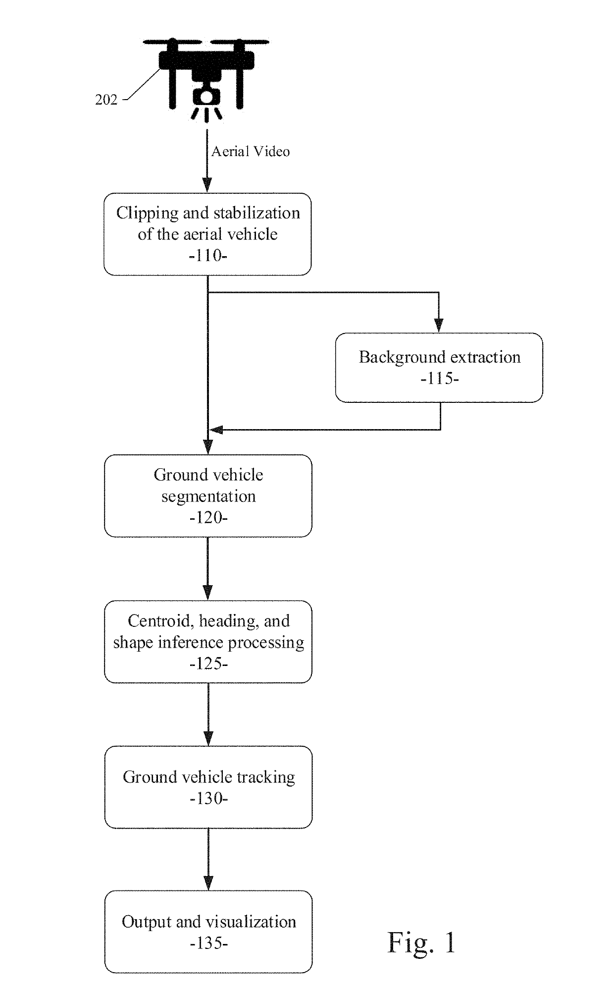
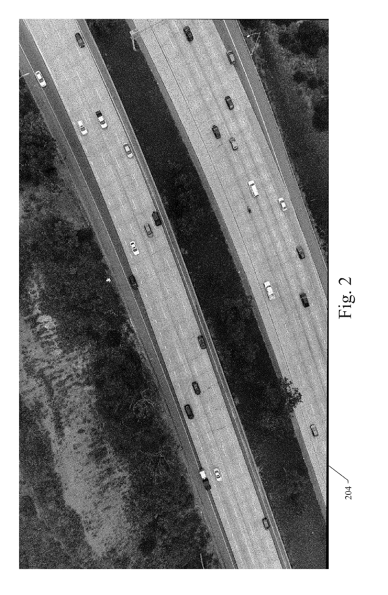
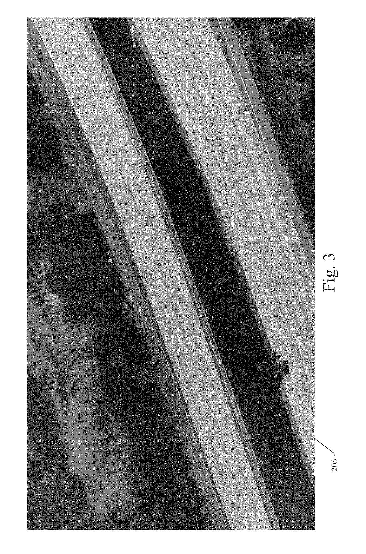
[0013]FIG. 1 is an operational flow diagram illustrating an example embodiment of a system and method for traffic data collection using unmanned aerial vehicles (UAVs). FIGS. 2 through 5 illustrate an example scenario of the operations shown in FIG. 1, wherein a UAV is configured with a camera and positioned at a certain location to be monitored at an elevated position to record video of the traffic activity at the location within the UAV's field of vision. Referring now to FIG. 1, a system and process for aerial video traffic analysis in an example embodiment starts with collecting aerial video image data taken by UAVs 202 that fly directly above a certain location to...


PUM


Abstract

A system and method for aerial video traffic analysis are disclosed. A particular embodiment is configured to: receive a captured video image sequence from an unmanned aerial vehicle (UAV); clip the video image sequence by removing unnecessary images; stabilize the video image sequence by choosing a reference image and adjusting other images to the reference image; extract a background image of the video image sequence for vehicle segmentation; perform vehicle segmentation to identify vehicles in the video image sequence on a pixel by pixel basis; determine a centroid, heading, and rectangular shape of each identified vehicle; perform vehicle tracking to detect a same identified vehicle in multiple image frames of the video image sequence; and produce output and visualization of the video image sequence including a combination of the background image and the images of each identified vehicle.

Description

COPYRIGHT NOTICE[0001]A portion of the disclosure of this patent document contains material that is subject to copyright protection. The copyright owner has no objection to the facsimile reproduction by anyone of the patent document or the patent disclosure, as it appears in the U.S. Patent and Trademark Office patent files or records, but otherwise reserves all copyright rights whatsoever. The following notice applies to the disclosure herein and to the drawings that form a part of this document: Copyright 2016-2017, TuSimple, All Rights Reserved.TECHNICAL FIELD[0002]This patent document pertains generally to tools (systems, apparatuses, methodologies, computer program products, etc.) for human driver modeling, trajectory generation and motion planning, vehicle control systems, autonomous driving systems, and autonomous driving simulation systems, and more particularly, but not by way of limitation, to a system and method for aerial video traffic analysis.BACKGROUND[0003]The contro...

Claims


Application Information

Patent Timeline
Patent Type & Authority Applications(United States)
IPC IPC(8): G06K9/00G06K9/20G06K9/62B64C39/02B64D47/08G06V10/26G06V10/42G06V10/56G06V20/13G06V20/17
CPCG06K9/0063G06K9/209G06K9/00765G06K9/6256B64C39/024B64D47/08G06K2209/21B64C2201/123G08G1/012G06T7/11G06T7/254G06T7/194G06T2207/10032G06T2207/20224G06T2207/30236G06T2207/20084G06T2207/20081G08G1/0129G08G1/0175G06V20/13G06V20/54G06V10/255G06V10/62G06V10/26G06V10/42G06V10/757G06V10/56G06V20/17G06V10/82B64U2101/30G06V20/49G06V2201/07G06F18/214
Inventor WANG, YIJIEWANG, PANQUCHEN, PENGFEI
Owner TUSIMPLE INC
Why Eureka
Try Eureka