Methods And Devices For Unmanned Aerial Vehicle Based Site Inspection And Scale Rendered Analysis

a scale rendering and scale technology, applied in the field of site inspections, can solve the problems of inability to send a manned camera mission to collect images, inconvenient and laborious, and inefficient, and achieve the effect of preventing timely and extensive inspection and analysis, and reducing the cost of traditional survey methods

Active Publication Date: 2021-02-04
HALKIN INC
View PDF5 Cites 7 Cited by
  • Summary
  • Abstract
  • Description
  • Claims
  • Application Information

AI Technical Summary

Problems solved by technology

Traditional inspection and scale rendered analysis of building, construction sites, agricultural plots and the like often require inspection and evaluation of hard-to-access areas that are risky and complex to inspect.
In some situations, it may be difficult, dangerous, or inefficient to send a manned camera mission to collect images necessary for routine inspection, analysis and documentation.
Traditional survey methods are known to be slow and expensive, thereby inhibiting timely and extensive inspection and analysis.
This can be problematic in buildings, industrial complexes, agricultural operations and infrastructure that require regular assessment.
Furthermore, in cases of emergency or damage, it can be extremely problematic to wait days or weeks to assess the full scope of an issue as the location will be prone to weather that may cause further damage, and operations may be required to cease throughout the lifetime of evaluation and repair, further increasing the total cost.

Method used


Image

  • Methods And Devices For Unmanned Aerial Vehicle Based Site Inspection And Scale Rendered Analysis
  • Methods And Devices For Unmanned Aerial Vehicle Based Site Inspection And Scale Rendered Analysis
  • Methods And Devices For Unmanned Aerial Vehicle Based Site Inspection And Scale Rendered Analysis

Examples


Embodiment Construction

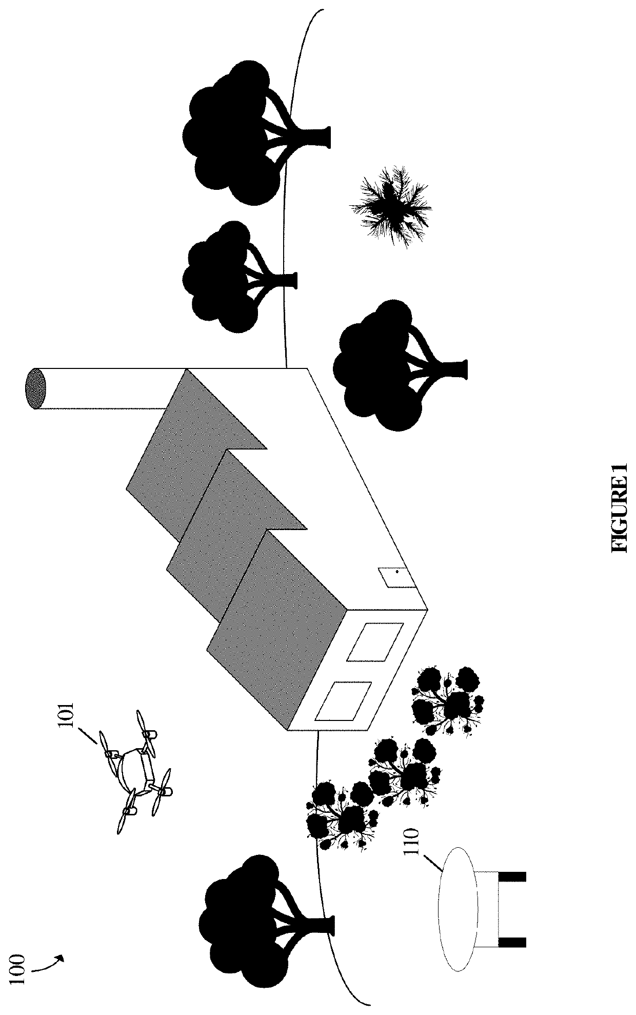
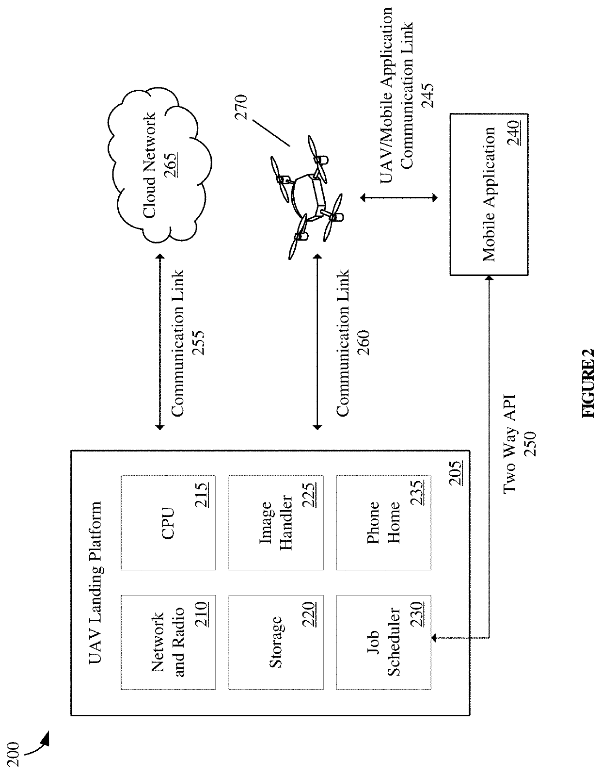
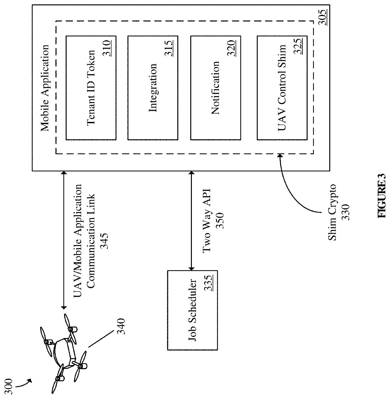
[0031]Various embodiments of the present technology generally relate to systems, methods, and computer-readable media for unmanned aerial vehicle (UAV) inspection analysis and scale rendering analysis. More specifically, some embodiments relate to software for the generation and analysis of models produced from UAV orthoimages. UAV technology can be used to map large areas and display detailed images. The ability to cover large areas quickly and get up-close images makes UAVs a superior alternative to traditional imaging and photographing, especially in places that may be undesirable, unsafe, or difficult to access in person. UAVs can be implemented in professional industrial environments to help reduce costs, save time, and gather important data related to decision-making, safety, or other operations. In some scenarios, businesses, homes, or other environments may need a snapshot of a current situation or area, especially for routine maintenance and repairs. At other times, UAV use...


PUM


Abstract

Various embodiments of the present technology generally relate to unmanned aerial vehicle (UAV) scale rendered analysis, orthomosaic, and 3D mapping and landing platform systems. More specifically, some embodiments relate to systems, methods, and means for the collection and processing of images captured during a UAV flight sequence. In some embodiments, the UAV landing platform retrieves flight information and initial map information over a unidirectional virtual private network from a multitenant cloud-based scheduling application. The UAV landing platform sends the initial map information to a UAV over a WiFi, Bluetooth, or radio frequency network and initiates a drone flight sequence once the drone flight sequence has been approved by a local user. The UAV landing platform receives property image data from a UAV after a UAV flight sequence has ended and transmits the received property image data back to the cloud application.

Description

CROSS-REFERENCE TO RELATED APPLICATIONS[0001]The present application claims priority to U.S. Provisional Application No. 62 / 881,664 filed Aug. 1, 2019 titled “Methods and Devices for Unmanned Aerial Vehicle Based Site Inspection and Scale Rendered Analysis” which is incorporated herein by reference in its entirety for all purposes.TECHNICAL FIELD[0002]Various embodiments of the present technology generally relate to site inspections. More specifically, some embodiments relate to system, methods, and devices for unmanned aerial vehicle based site inspections, scale rendered analysis and agricultural analysis.BACKGROUND[0003]Traditional inspection and scale rendered analysis of building, construction sites, agricultural plots and the like often require inspection and evaluation of hard-to-access areas that are risky and complex to inspect. For example, a piece of equipment may be placed on a rooftop or a location where the atmosphere is hazardous. Unmanned aerial vehicles (UAVs) may p...

Claims


Application Information

Patent Timeline
Patent Type & Authority Applications(United States)
IPC IPC(8): G08G5/00G06T7/00H04L29/08B64C39/02G06Q10/06
CPCG08G5/0069G06T7/0004H04L67/125G08G5/003G06T2207/30164G06Q10/06311G06T2207/30168G06T2207/10032B64C39/024Y02P90/80G06T2207/10048G06T2207/10024G06T2207/10028G06T2207/30184G06T2207/30188G08G5/0034G08G5/0013H04L67/61
Inventor HALL, RYANHALL, GRANT
Owner HALKIN INC
Why Eureka
Try Eureka