Geographic mapping system for resource positioning optimization within an environment

a geo-mapping system and resource technology, applied in the field of geo-mapping system for resource positioning optimization within an environment, can solve the problems of limited data scope and limited availability of data for users establishing new resource sites

Active Publication Date: 2021-12-23
BANK OF AMERICA CORP
View PDF0 Cites 4 Cited by
  • Summary
  • Abstract
  • Description
  • Claims
  • Application Information

AI Technical Summary

Benefits of technology

[0002]The following presents a simplified summary of one or more embodiments of the invention in order to provide a basic understanding of such embodiments. This summary is not an extensive overview of all contemplated embodiments and is intended to neither ident

Problems solved by technology

Typically, users establishing a new resource site have limited data for driving decisioning for a selection of a geographic

Method used


Image

  • Geographic mapping system for resource positioning optimization within an environment
  • Geographic mapping system for resource positioning optimization within an environment
  • Geographic mapping system for resource positioning optimization within an environment

Examples


Embodiment Construction

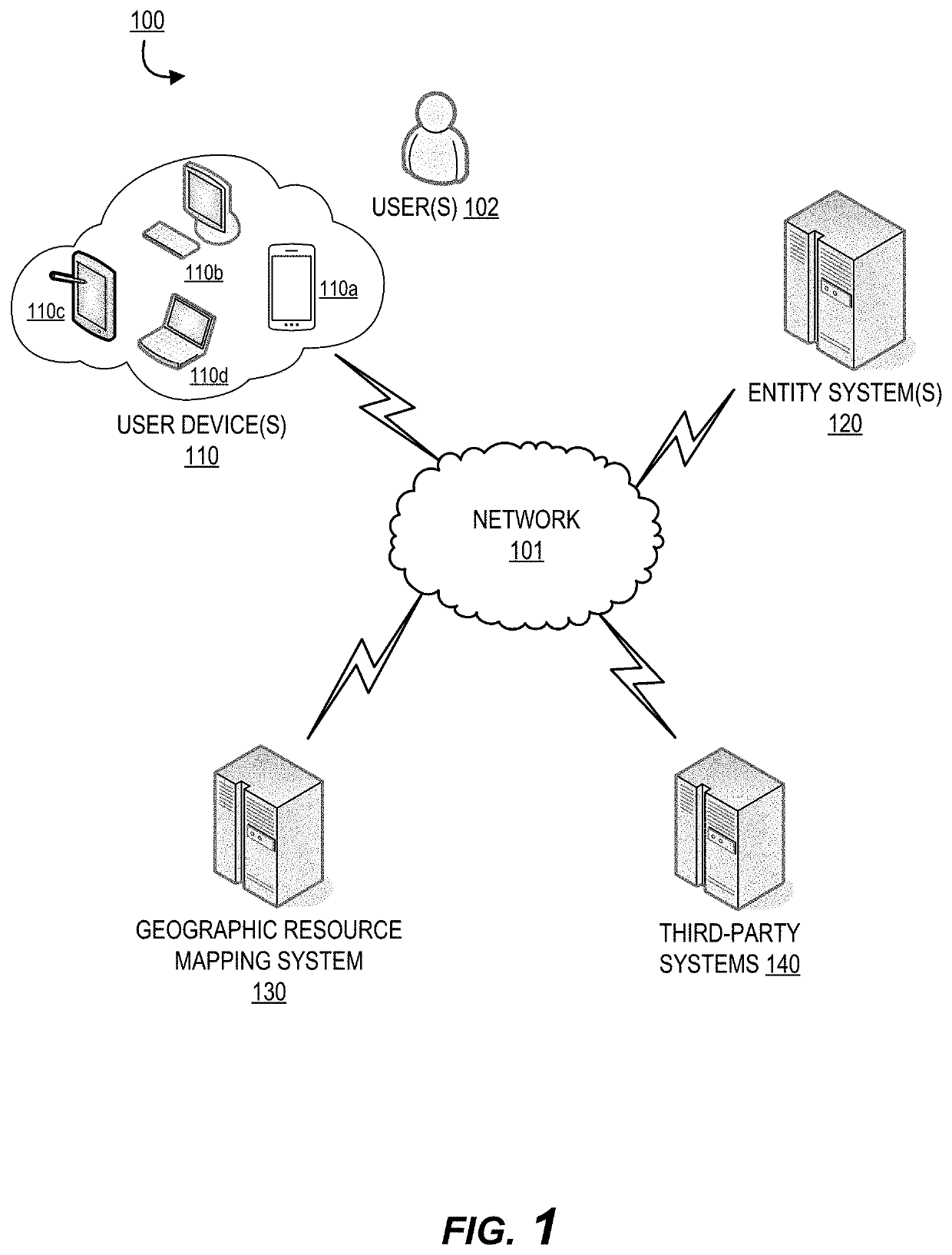
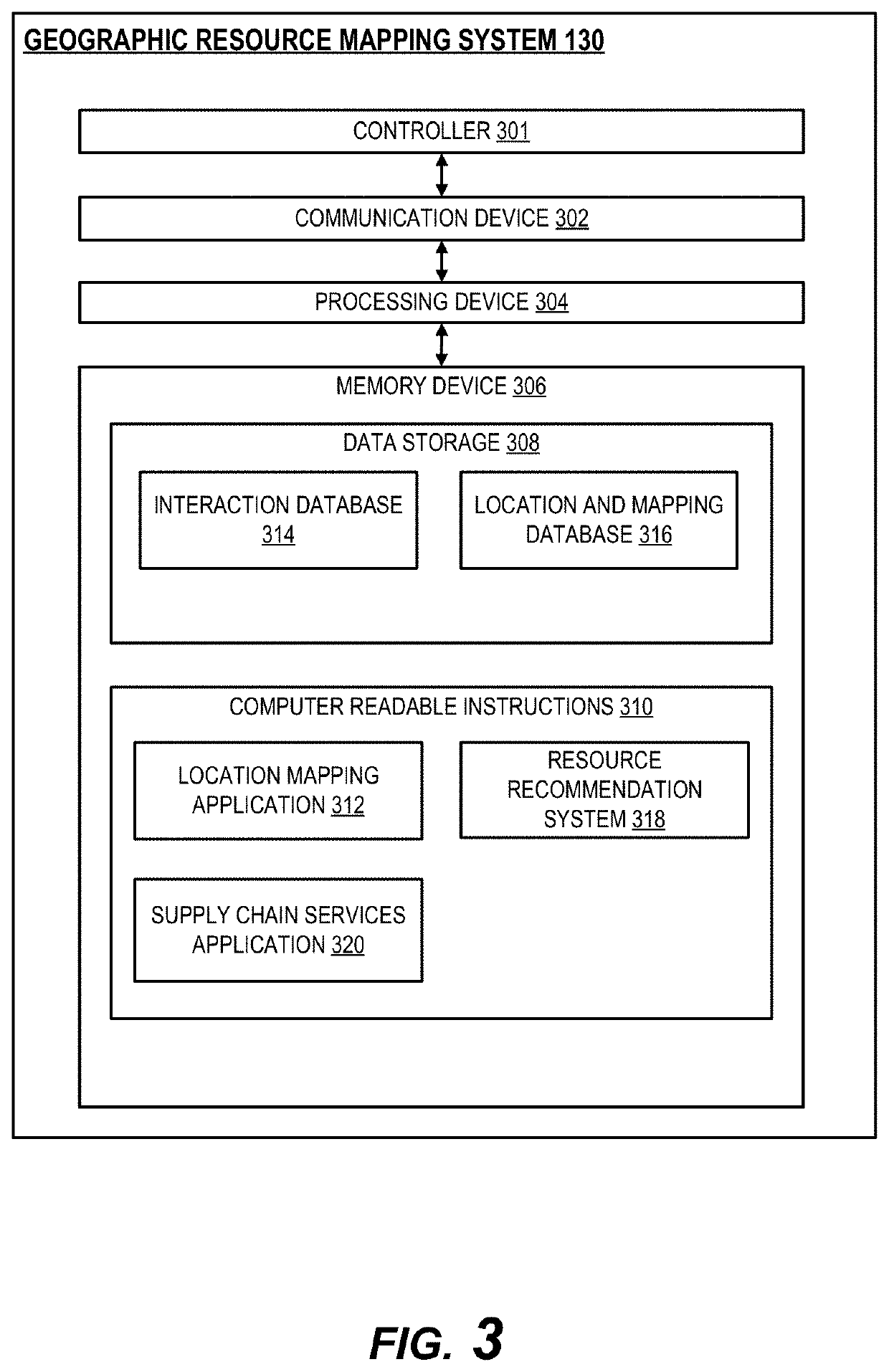
[0024]The system of the invention is configured to receive and analyze a proposed geographic location (e.g., a specific location, a neighborhood, area code, region, or the like) from a user for a new or proposed resource site. The system is configured to communicate with an interaction database that may be maintained by an entity and extract historical interaction information associated with the geographic location and the user. This historical interaction information may comprise, for example, previous and / or other current resource sites associated with the geographic location as well as interaction data such as historical interaction location data, interaction amounts, resource types, resource amounts, and device data associated with interaction. Using this extracted data, the system is configured to generate a resource map for the geographic location to model the resource and / or resource site distribution for the geographic location. Furthermore, the system leverages the resource...


PUM


Abstract

A system for geographic resource mapping is provided. The system comprises: a memory device with computer-readable program code stored thereon; a communication device connected to a network; a processing device, wherein the processing device is configured to execute the computer-readable program code to: receive a geographic location for a proposed resource site from a user; extract historical interaction information associated with the geographic location and the user from an interaction database; generate a resource map for the geographic location based on the historical interaction information and the proposed resource site; calculate a landscape score for the proposed resource site at the geographic location, wherein the landscape score compares the proposed resource site with other resource sites associated with the geographic location based on the generated resource map; and based on the landscape score falling below a predetermined threshold, reject the proposed resource site at the geographic location.

Description

BACKGROUND[0001]Typically, users establishing a new resource site have limited data for driving decisioning for a selection of a geographic location. Available data may be limited in scope without providing a holistic view of a defined geographic region of interest. As such, there exists a need for an improved location mapping and recommendation system for enabling informed placement of resource sites based on real-time data.BRIEF SUMMARY[0002]The following presents a simplified summary of one or more embodiments of the invention in order to provide a basic understanding of such embodiments. This summary is not an extensive overview of all contemplated embodiments and is intended to neither identify key or critical elements of all embodiments, nor delineate the scope of any or all embodiments. Its sole purpose is to present some concepts of one or more embodiments in a simplified form as a prelude to the more detailed description that is presented later.[0003]A system for geographic...

Claims


Application Information

Patent Timeline
IPC IPC(8): G06Q30/02G06Q50/16G06Q50/28G06Q10/06G06Q10/04G06F16/2457H04W4/021G01V99/00
CPCG06Q30/0205G06Q50/165G06Q50/28G01V99/005G06Q10/04G06F16/24578H04W4/021G06Q10/06375H04W4/022G06F16/29
Inventor CASTINADO, JOSEPH BENJAMINFRANTZ, LEE BARRYPROUD, LEE ANNTA, ANN
Owner BANK OF AMERICA CORP
Why Eureka
Try Eureka