

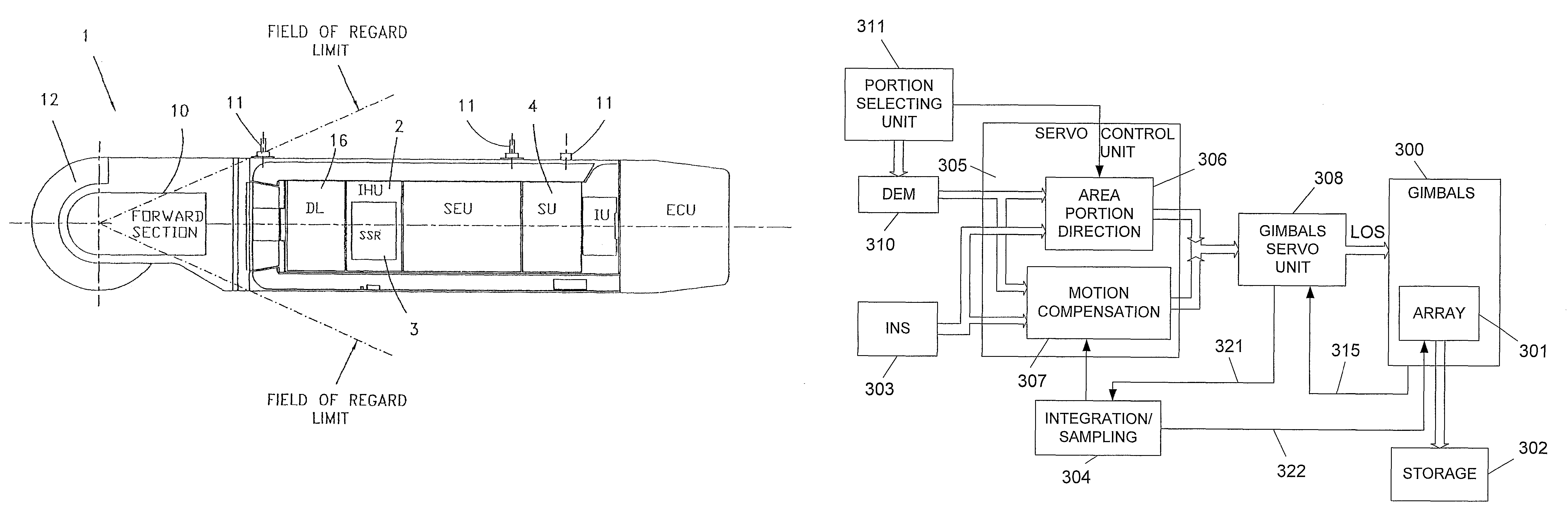
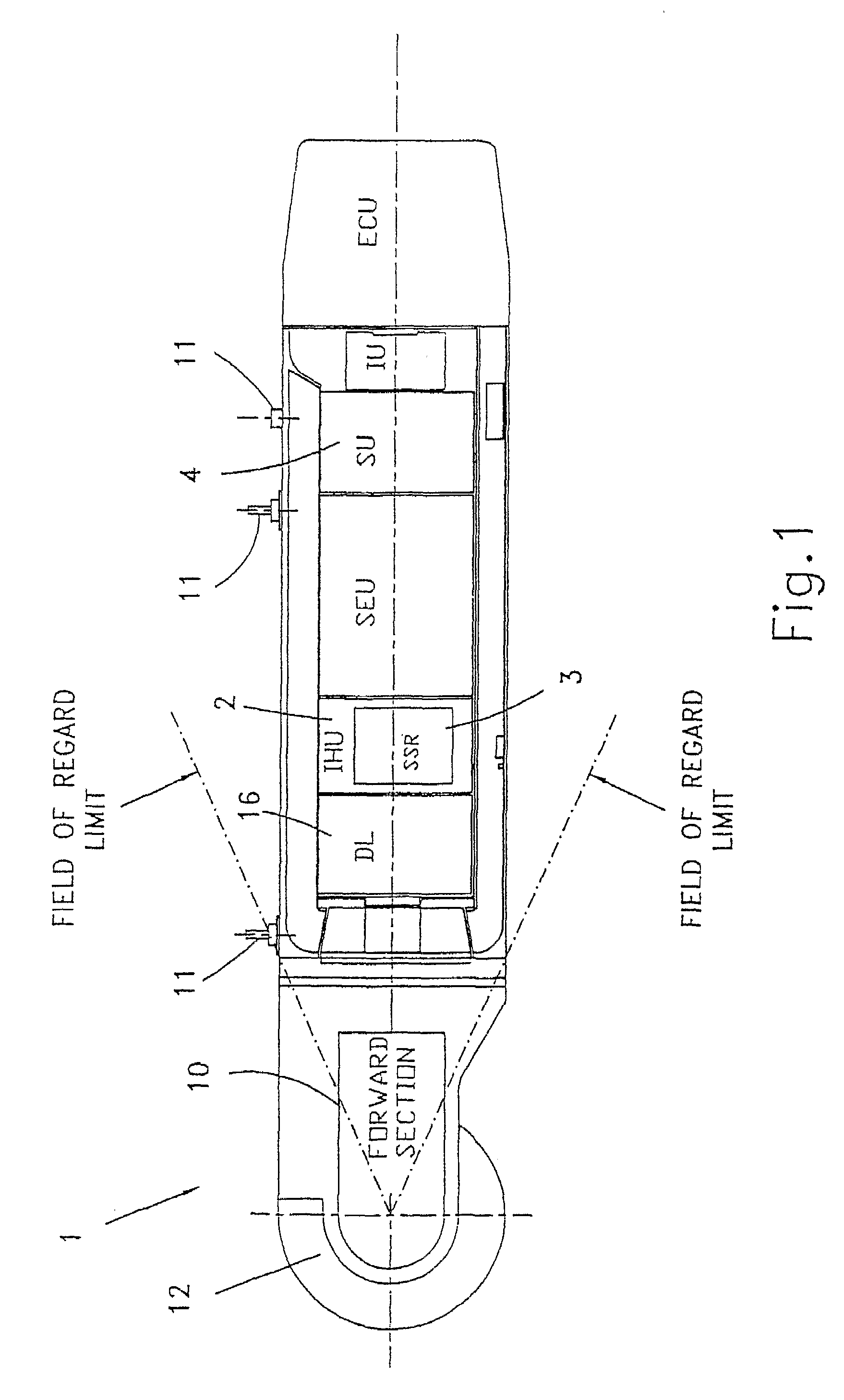
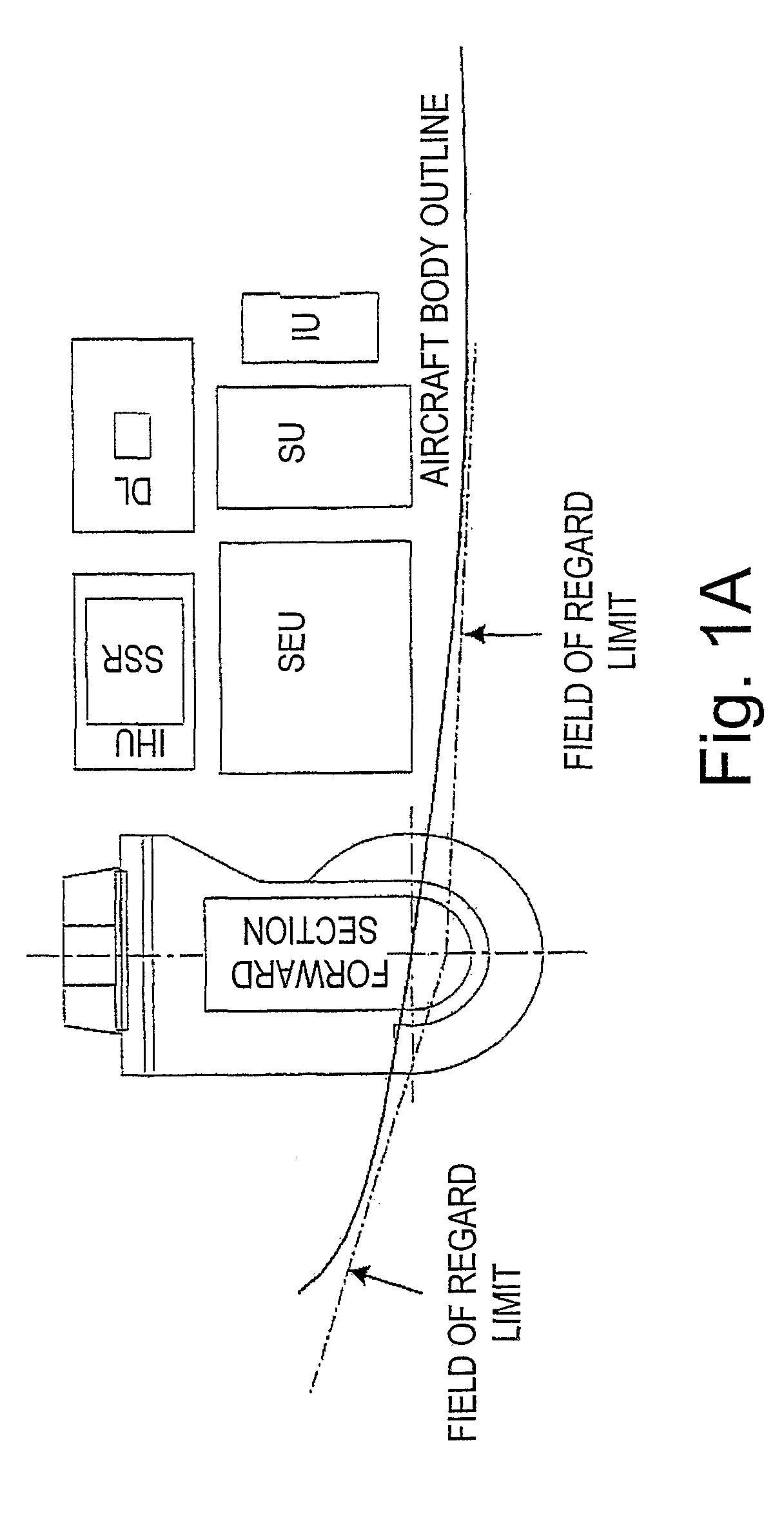
Airborne reconnaissance system
a reconnaissance system and airborne technology, applied in the field of airborne reconnaissance system, can solve the problems of significantly increasing flying costs and risks, length of time required for film development, and inability to tolera
- Summary
- Abstract
- Description
- Claims
- Application Information
AI Technical Summary
Benefits of technology
Problems solved by technology
Method used
Image

Examples
example 1
[0132]The following is a numeric example for assessing the pixels smear in the prior art systems when capturing a terrain with large variations, showing a forward oblique scenario: Aircraft flying at a velocity of 250 m / s, range from the aircraft to scene of 10 km to level ground, exposure time of 10 ms, and assuming mountain 757 is at ½ range (i.e. 5 km), and altitude of aircraft is 5 km.
[0133]Therefore, the angular velocity of the LOS is approximately 12.5 milirad / s (aircraftVelocity / aircraftAltitude)×SIN2(LOSdepressionAngle), and the angular travel of the aircraft during integration time is 12.5×0.01=125 microrad. The angle 752 is therefore 125 microrad; for a typical pixel Instantaneous FOV (IFOV) of 30 microrad this means a smear of more than 4 pixels.
[0134]The situation is even worse for a side oblique scenario, where, in this example, the angular velocity is 250 / 10,000=25 milirad / s, and the resulting smear is 8 pixels.
[0135]For the system of the invention, the pixel smear is ...
example 2
[0147]The following is an example showing the saving in the amount of data which the system of the invention handles (i.e. storing, transmitting to a ground station, etc.), in comparison with a pushbroom or a large-sized array reconnaissance system:[0148]Mission duration: 2 hours;[0149]FIG. 12 illustrates this scenario. Area of high priority targets with respect to the photographed area: 40% for snap shooting. The term “snapshot”, refers herein to a manner in which all the array pixels are simultaneously exposed to light from an area portion, and data from all the array pixels simultaneously is read at the end of the said exposure; 5% for pushbroom or large-sized array—due to the efficiency of LOS and FOR mission planning (this an assumption resulting from the ability of the system of the invention to better select high priority targets within an area of interest, and to ignore area portions of no interest);[0150]Sensors' data throughput rate uncompressed: 20 Mbytes / s[0151]Low compr...
example 3
[0161]The invention was successfully implemented with the following parameters:
[0162]Airborne pod configuration;
[0163]Number of pixels: Visual array: 2000×2000, IR array 640×480;
[0164]Integration times: 1-15 ms;
[0165]Operational ranges: up to 30 km and altitude up to 10 km;
[0166]Snapshot rate: 3 per second, both sensors arrays operating simultaneously.
[0167]:FOR: full spherical coverage, excluding a±30 degrees backward looking cone;
[0168]See also FIGS. 11 and 11A that are the result of an actual simulation of the scanning and overlapping process.
[0169]As said, in the embodiment of the invention as described above, the area scanning operation is performed by the gimbals that first direct the center of the array's LOS to the center of the relevant area portion, then, an exposure of the array to the light coming from the area portion occurs (i.e., the array starts integration of light from the area portion), and at the end of the exposure period the image of the area portion is capture...
PUM
 Abstract
Description
Claims
Application Information