System and method of assisted aerial navigation

a technology of aerial navigation and assistive technology, applied in the field of aerial navigation, can solve problems such as difficulty in seeing the pointer display, and achieve the effect of improving the situational awareness of the pilo

Active Publication Date: 2011-10-11
GARMIN INT
View PDF38 Cites 50 Cited by
  • Summary
  • Abstract
  • Description
  • Claims
  • Application Information

AI Technical Summary

Benefits of technology

[0005]Embodiments of the present invention provide a distinct advance in the art of aerial navigation systems. More particularly, embodiments of the invention provide a system and method of assisted aerial navigation that enhances a pilot's situational awareness by presenting a virtual target flight path to the pilot during final landing approaches using data received from a local positioning system, such as an instrument landing system.

Problems solved by technology

Furthermore, the pointer display may be difficult to see because, for example, the pilot may be shifting his / her view between the runway 32, the first indicator 88, and the second indicator 90.

Method used


Image

  • System and method of assisted aerial navigation
  • System and method of assisted aerial navigation
  • System and method of assisted aerial navigation

Examples


Embodiment Construction

[0044]The following detailed description of the invention references the accompanying drawings that illustrate specific embodiments in which the invention can be practiced. The embodiments are intended to describe aspects of the invention in sufficient detail to enable those skilled in the art to practice the invention. Other embodiments can be utilized and changes can be made without departing from the scope of the present invention. The following detailed description is, therefore, not to be taken in a limiting sense. The scope of the present invention is defined only by the appended claims, along with the full scope of equivalents to which such claims are entitled.

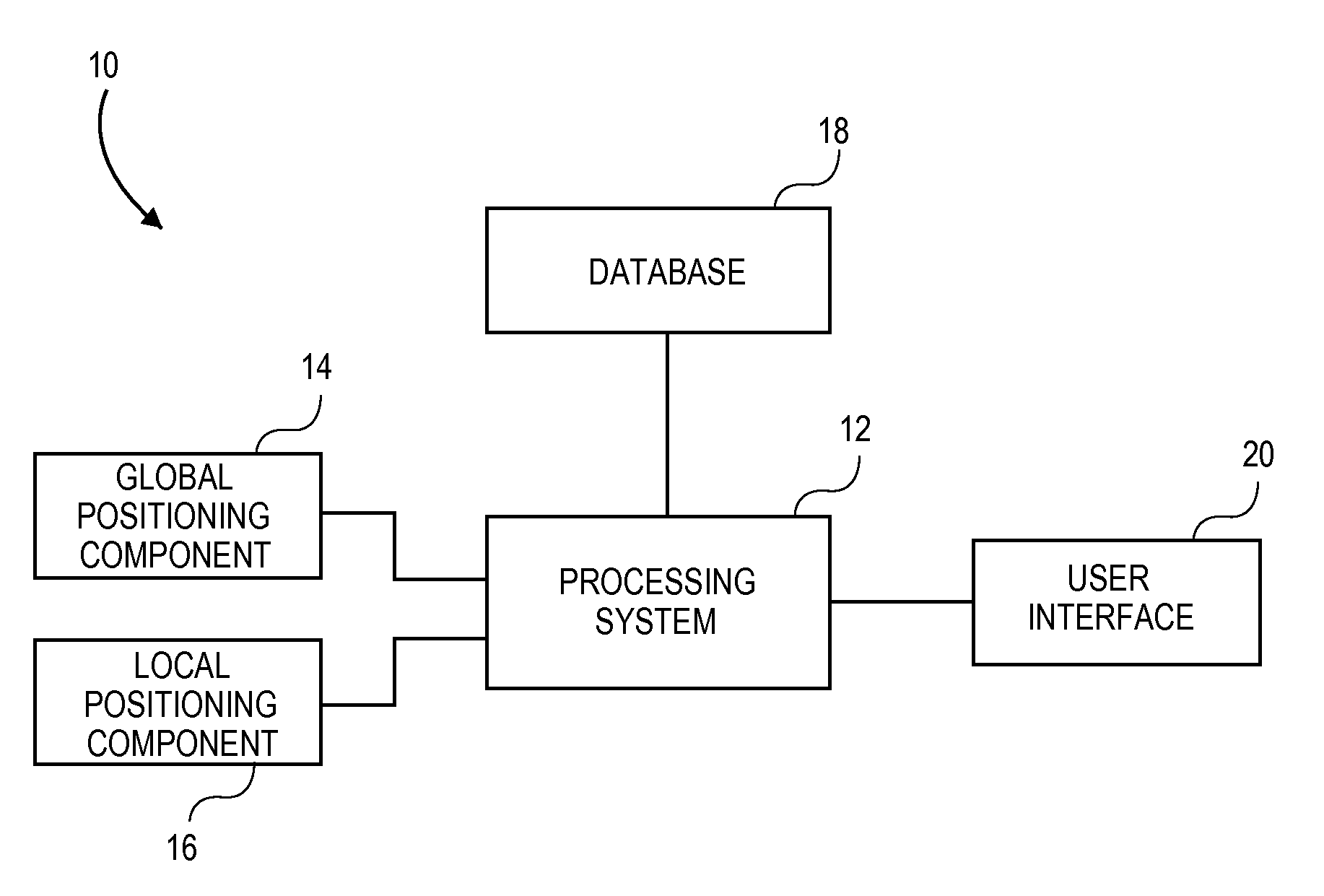
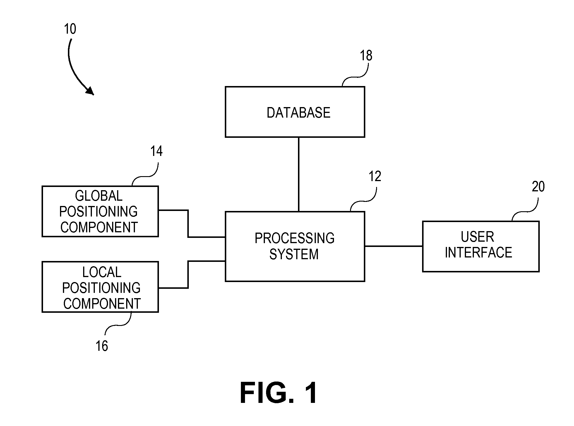
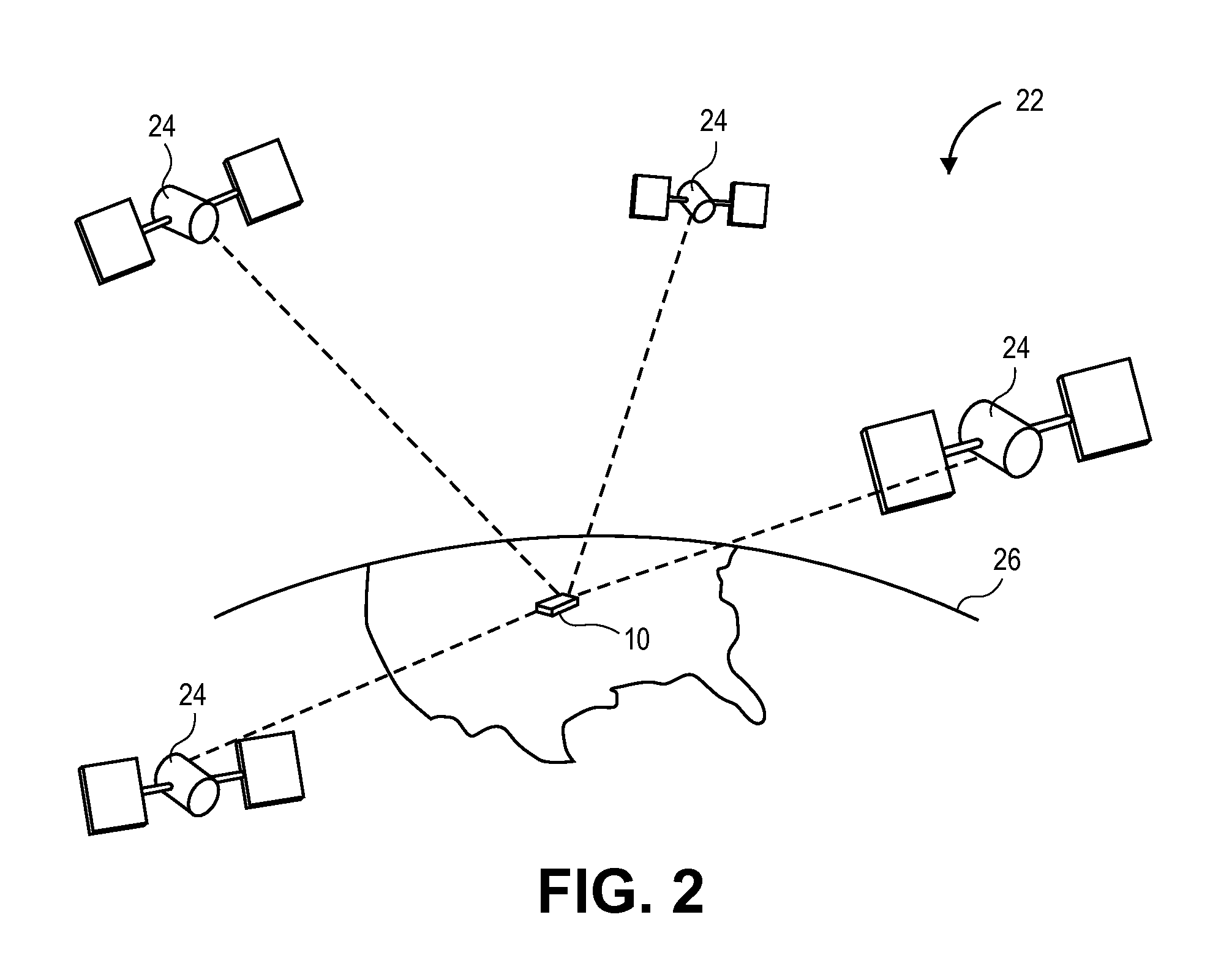
[0045]A system embodying principles of the present invention is illustrated in FIG. 1 and designated generally by the reference numeral 10. The system 10 comprises a processing system 12, a global positioning component 14, a local positioning component 16, a database 18, and a user interface 20.

[0046]The processing syst...


PUM


Abstract

A system and method of providing aerial navigation. Techniques are described for receiving global positioning system data, receiving local positioning system data such as instrument landing system data, generating a virtual target flight path using the global positioning system data and the local positioning system data, and presenting a virtual target flight path indicator corresponding to the virtual target flight path. In one implementation, the system includes a user interface, a global positioning component, a local positioning component, and a processing system.

Description

BACKGROUND[0001]Embodiments of the present invention relate to aerial navigation. More particularly, embodiments of the invention involve a system and method of assisted aerial navigation that enhances a pilot's situational awareness by presenting a virtual target flight path to the pilot during final landing approaches using data received from a local positioning system.[0002]Landing an aircraft can be the most challenging stage of a flight, particularly in reduced visibility conditions, such as at night or in inclement weather. Thus, automated guidance systems such as the instrument landing system (ILS) have been developed to assist pilots when landing aircraft. The ILS is a ground-based system that provides guidance signals to an ILS receiver onboard aircraft that are approaching a runway, wherein onboard instrumentation indicates to pilots when they have deviated from a desired final approach path to the runway.[0003]Unfortunately, the ILS suffers from various limitations. For e...

Claims


Application Information

Patent Timeline
Patent Type & Authority Patents(United States)
IPC IPC(8): G05D1/00G01S7/04G01C13/00G01S7/00
CPCG01C23/005G01S19/48G01S19/15
Inventor FLANIGAN, DANIEL KEEGANFLATLAND, JAY R.JAMES, MERLIN R.SCHLEF, ERIC D.
Owner GARMIN INT
Why Eureka
Try Eureka