High resolution ratio satellite remote-sensing image architecture profile extraction method

A satellite remote sensing image, high-resolution technology, which is applied to the field of building contour extraction in high-resolution satellite remote sensing images, can solve the problems of wrong and missing object extraction, and achieves a high degree of automation.

Inactive Publication Date: 2008-02-20
BEIJING JIAOTONG UNIV
View PDF0 Cites 29 Cited by
  • Summary
  • Abstract
  • Description
  • Claims
  • Application Information

AI Technical Summary

Problems solved by technology

At present, the traditional single-scale image information extraction method based on pixel spectral features has obvious defects in the extraction of artificial ground objects in high-resolution satellite remote sensing images.
For example, in the pro...

Method used


Image

  • High resolution ratio satellite remote-sensing image architecture profile extraction method
  • High resolution ratio satellite remote-sensing image architecture profile extraction method
  • High resolution ratio satellite remote-sensing image architecture profile extraction method

Examples


Embodiment Construction

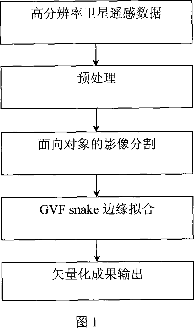
[0025] The present invention will be further described in detail below in conjunction with the accompanying drawings and specific embodiments.

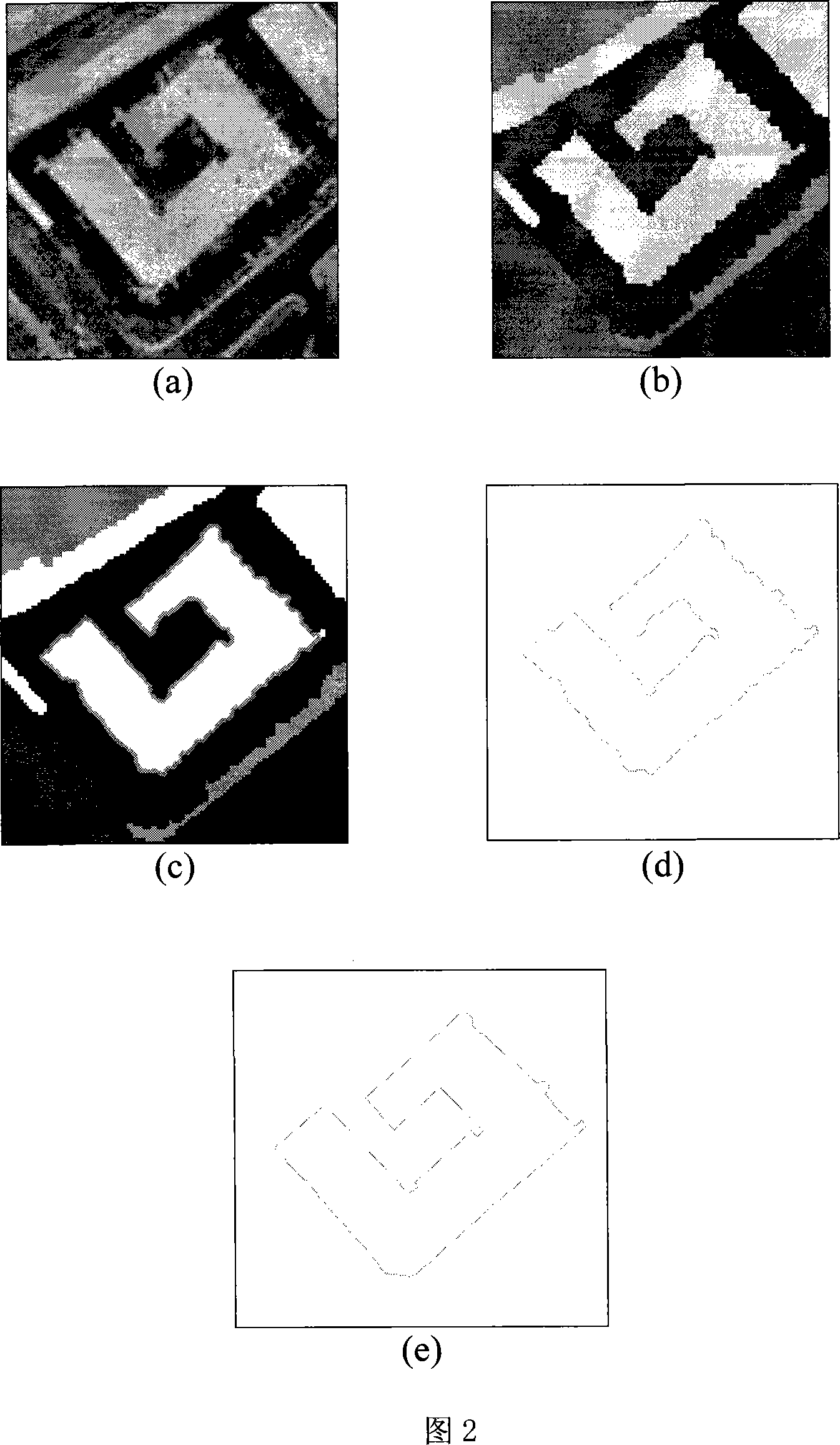
[0026] Taking the extraction of a certain building in a high-resolution digital remote sensing image as an example, the method of the present invention is used to perform segmentation and boundary fitting on the high-resolution remote sensing image, and finally output vector data. The processing flow is shown in Figure 1, and its working process is described as follows:

[0027] (1) Preprocessing the image: including radiation correction, denoising processing, geometric correction, etc., to correct the geometric and radiation distortion in the original image and improve the clarity of the image. Through preprocessing, the geometrically and radiatively real image can be obtained as much as possible, the noise in the image can be eliminated, and the useful real information can be restored; in the preprocessing process, the contrast betw...


PUM


Abstract

The utility model discloses an extracting method of building contour in a high resolution remote sensing image of satellite, comprising the following steps: (1) the image is pretreated to improve the definition of the image; (2) a parameter of the split minimum area is defined by the size of the extracted building, the split of the high solution remote sensing image is performed based on the objective; (3) the edge of the split image is fitted using the dynamic contour model calculation based on the gradual vector flow; (4) vectorization; (5) optimizing processing. The utility model has advantages that the method is able to reflect the actual contour of the building and the output is of vector format, which is able to update the vector data of GIS directly.

Description

technical field [0001] The invention relates to a method for extracting the outline of a structure in a high-resolution satellite remote sensing image, and belongs to the application field of high-resolution satellite remote sensing image processing and information extraction technology. Background technique [0002] Automatic recognition of object types from remote sensing images and accurate measurement of their shape and size are hotspots and difficulties in remote sensing image information extraction and photogrammetry research, and are also key issues in the eventual highly automated acquisition of basic geographic information from images. At present, the progress of high-resolution remote sensing image data processing and information extraction methods is relatively slow, and manual interpretation and interpretation are still common working methods, which are time-consuming and labor-intensive, and have become the main bottleneck factor restricting the wide application ...

Claims


Application Information

Patent Timeline
IPC IPC(8): G01S17/89G01S7/48G06K9/46
Inventor 谭衢霖魏庆朝杨松林
Owner BEIJING JIAOTONG UNIV
Why Eureka
Try Eureka