Road topology data model for navigation and calculation method

A calculation method and technology of topological data, applied in the data model field of road analysis and calculation, to achieve reasonable analysis of calculation results, improve efficiency, and ensure connectivity

Inactive Publication Date: 2008-03-26
上海上大鼎正软件股份有限公司
View PDF0 Cites 38 Cited by
  • Summary
  • Abstract
  • Description
  • Claims
  • Application Information

AI Technical Summary

Problems solved by technology

[0004] The technical problem to be solved by the present invention is: how to mainly solve the problem of limited resource consumption in the route calculation process and the incremental update of road network data through the segmentation storage and local reference of multi-layer and multi-block road network data; Static pre-statistics of multi-layer and multi-block three-dimensional road data, retain the heuristic data of route calculation, and improve the efficiency of route calculation; how to achieve reasonable long-distance and large-scale through the selective connection of multi-layer and multi-block three-dimensional road data route calculation and other related technical issues

Method used


Image

  • Road topology data model for navigation and calculation method
  • Road topology data model for navigation and calculation method
  • Road topology data model for navigation and calculation method

Examples


Embodiment Construction

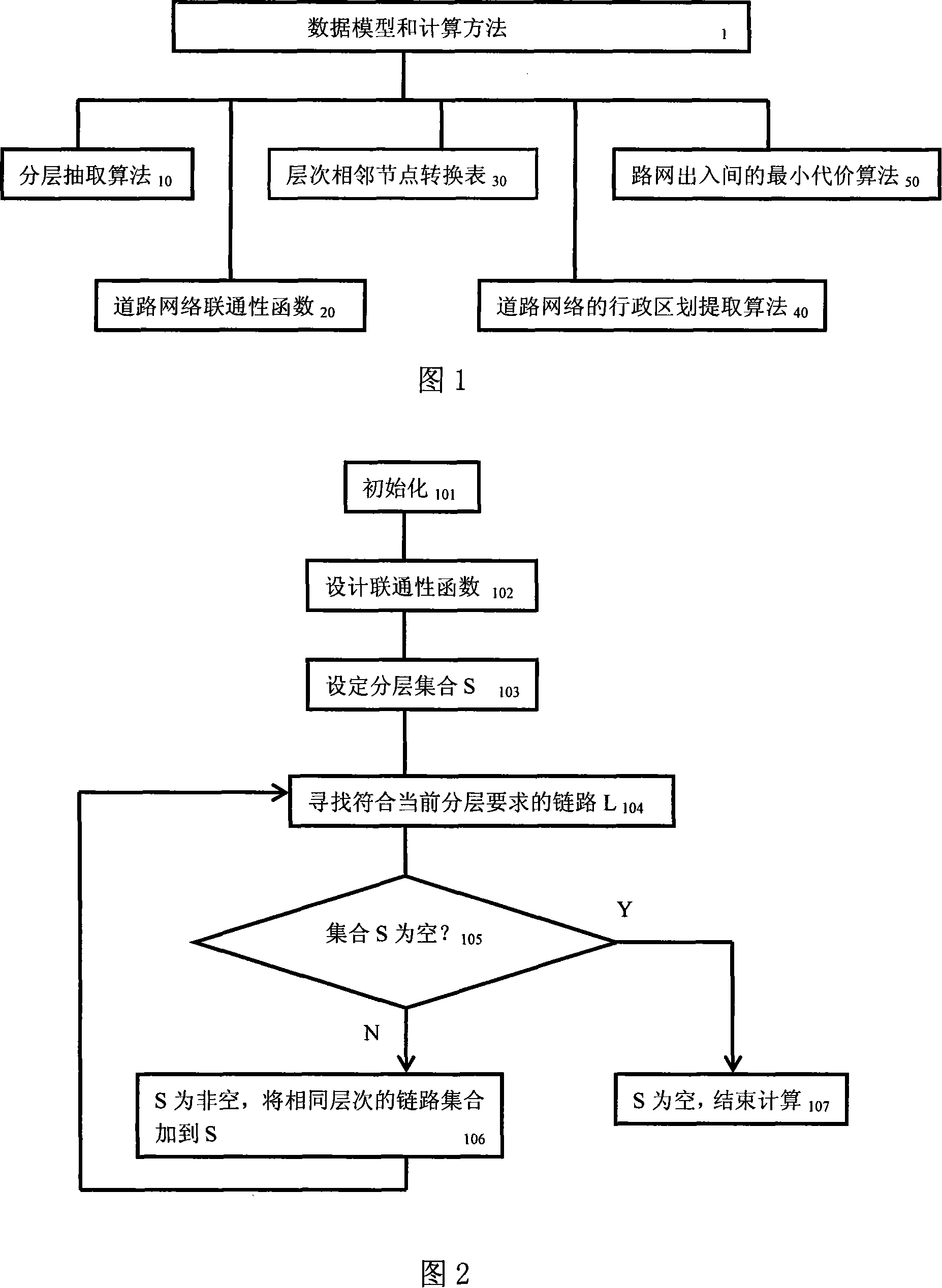
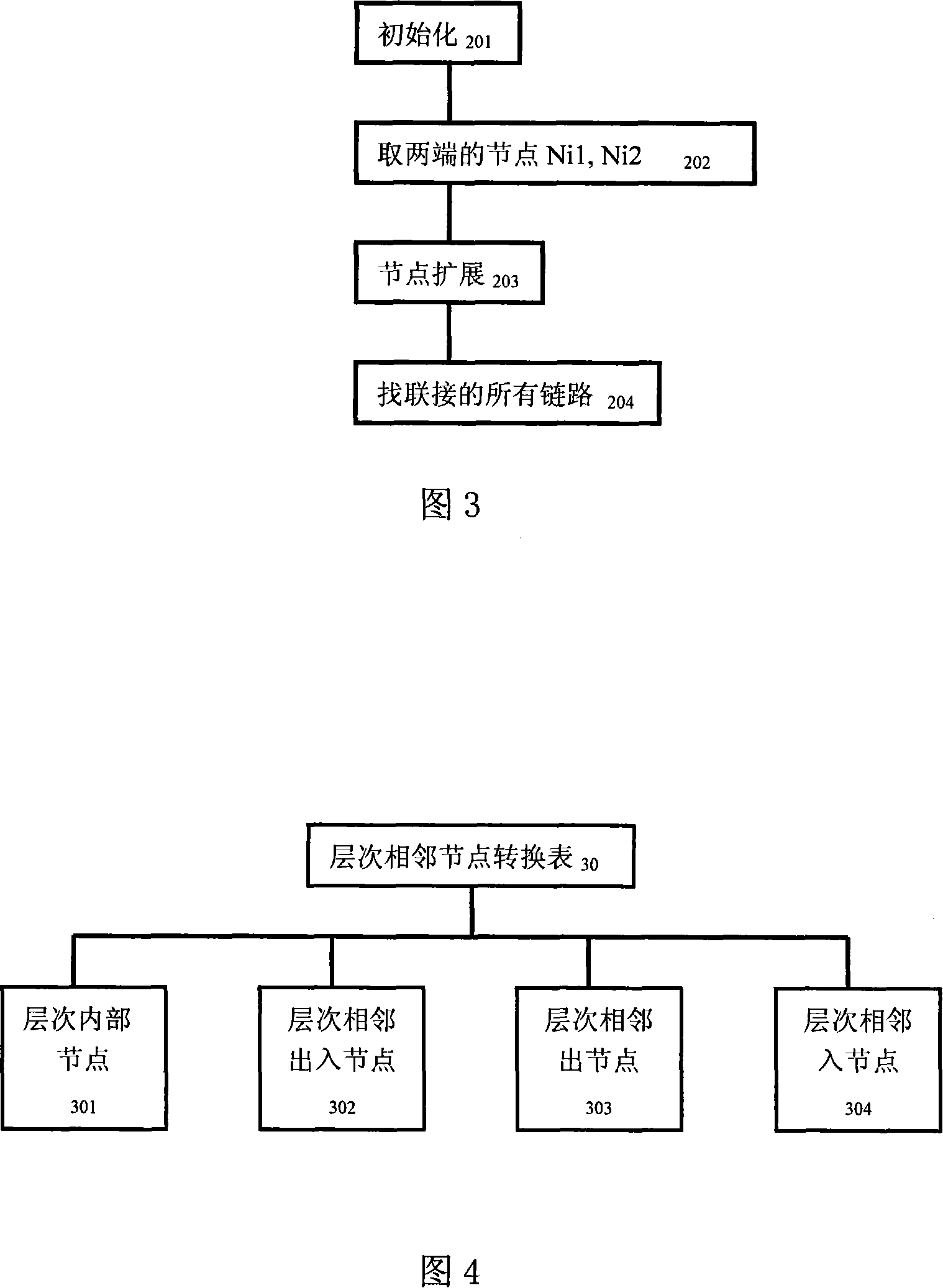
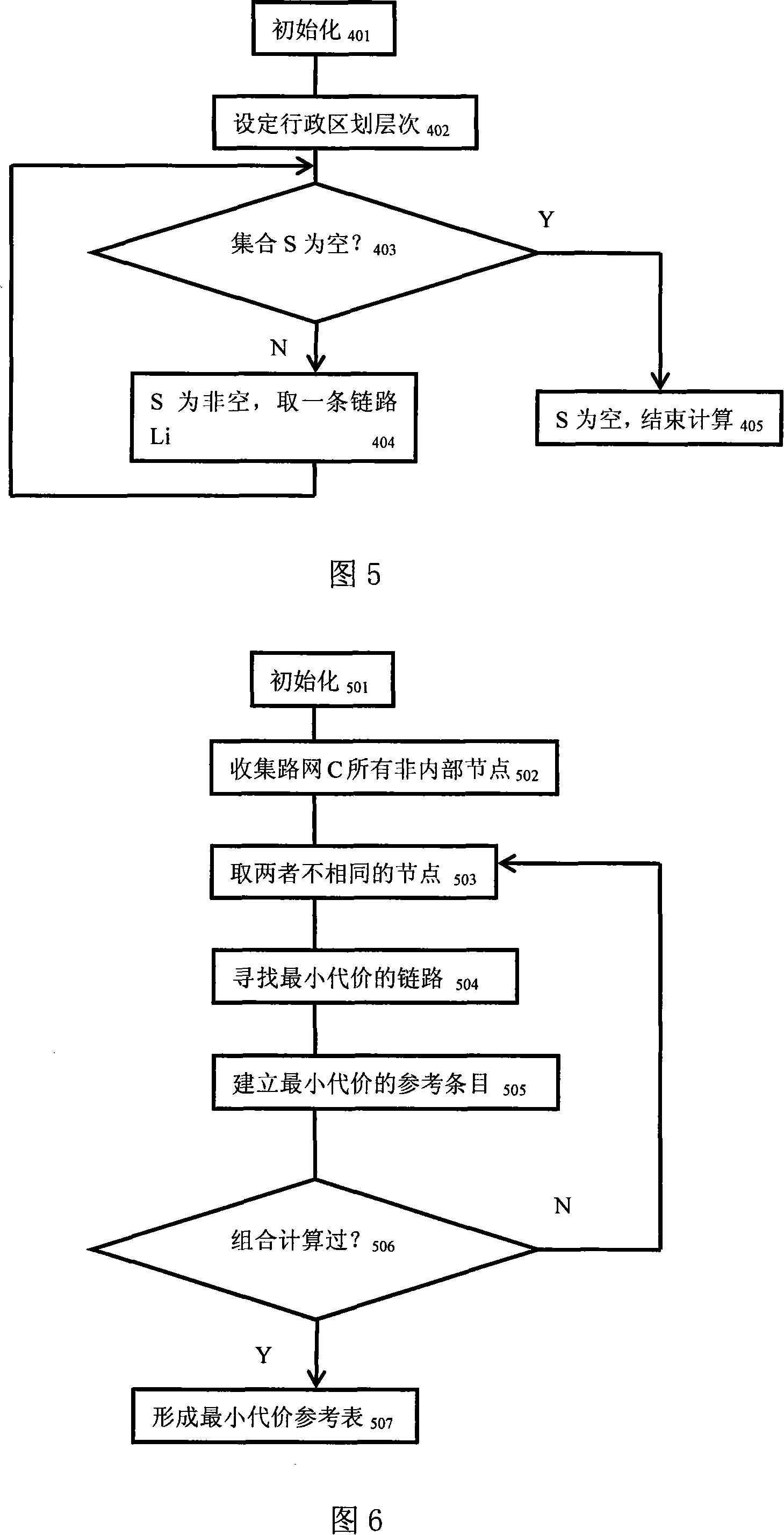
[0096] Please refer to accompanying drawings 1, 2, 3, 4, 5, and 6, the method of the present invention utilizes various attribute data of the road network, such as grade, average vehicle speed, administrative division affiliation, traffic function, between road links It converts the flat road network with any data capacity into a multi-layer and multi-block three-dimensional road network, and marks the connection nodes between the road links of each layer and block to ensure the connectivity of the overall road network.

[0097] Through the segmented storage and local reference of multi-layer and multi-block road network data, limited resource consumption in the route calculation process and incremental update of road network data are achieved.

[0098] Through the static pre-statistics of multi-layer and multi-block three-dimensional road data, the heuristic data of route calculation is preserved, and the efficiency of route calculation is improved.

[0099] Through the selec...


PUM


Abstract

An application technology field relates to the navigation, especially the analysis and picking method of the road topological data used in the navigation and setting the data model, which is a road topological data model and computing method used in navigation to treat the road with big area and long distance in navigation map data. The method includes the stratified extracting arithmetic, the road connection calculation function, the hierarchical adjacent node transition table, the road web canton extracting arithmetic and the least cost arithmetic of road net in-out; it mainly solves the technology problem of route calculation of long distance and big area. The invention can insure the connection of whole road web; it can store the starting data of route calculation and improves the route calculation efficient; so it can get the logical analysis result in the logical time and cost range.

Description

technical field [0001] The invention relates to the technical field of navigation-related applications, in particular to a method for analyzing and extracting road topology data dedicated to navigation, and establishing a data model based on it, which can handle large-area and long-distance data in navigation map data. Data model and calculation method for road analysis and calculation. Background technique [0002] In the navigation map data, the road topology network is the core data, which provides the data basis for several main functions of navigation, such as route planning and real-time navigation. With the increase of highway mileage and the increasingly complex road network, the amount of road topology data covered in a large geographical area is quite huge. Compared with the limitation of processing capabilities of navigation embedded devices, a method that can handle large areas is required. , the data model and calculation method for long-distance road analysis ...

Claims


Application Information

Patent Timeline
Patent Type & Authority Applications(China)
IPC IPC(8): G01C21/26G01C21/32G01C21/34G01C21/20G06Q10/00G06Q10/04
Inventor 柏挺峰
Owner 上海上大鼎正软件股份有限公司
Why Eureka
Try Eureka