A flood submerging analysis method oriented to a large city disaster demonstration

An analysis method, a technology for large cities, applied in the fields of filling planes with attributes, generation of 2D images, image data processing, etc., can solve problems such as submerged range and rough water depth distribution, and achieve the effect of saving storage space and improving computing speed.

Inactive Publication Date: 2008-05-28
ZHEJIANG UNIV
View PDF0 Cites 21 Cited by
  • Summary
  • Abstract
  • Description
  • Claims
  • Application Information

AI Technical Summary

Problems solved by technology

The current flood inundation analysis methods only perform simple plane simulation, discarding the influence of complex terrain factors, and the output of the submerged range and water depth distribution is quite rough

Method used


Image

  • A flood submerging analysis method oriented to a large city disaster demonstration
  • A flood submerging analysis method oriented to a large city disaster demonstration

Examples


Embodiment Construction

[0031] The present invention will be further described below in conjunction with accompanying drawing and embodiment:

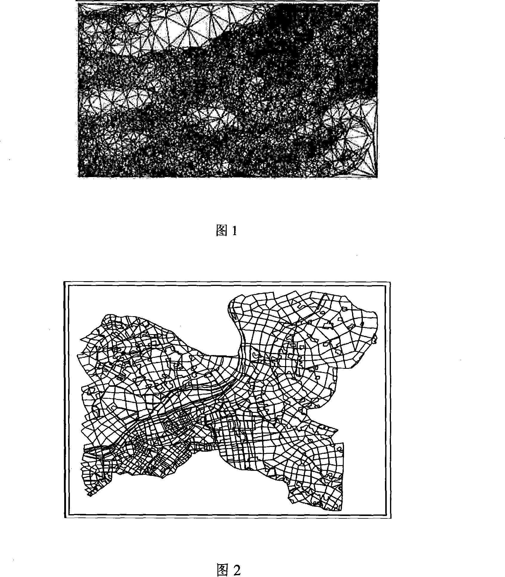
[0032] Figure 1 shows the generated triangular grid, which is the triangular cell grid model to be used for flood analysis.

[0033] Figure 2 shows the generated triangular grid, that is, the triangular cell grid model to be analyzed for flooding.

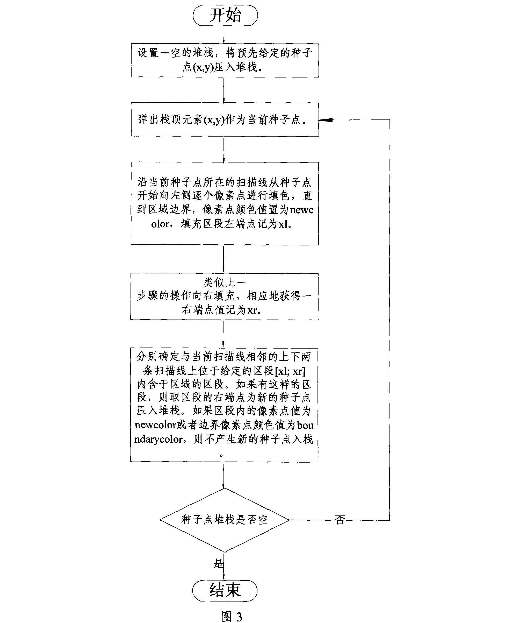
[0034] Figure 3 shows the flow of the seed point filling algorithm. The process consists of six steps:

[0035] Step 1, initialize an empty stack, and push the given seed point (x, y) onto the stack.

[0036] Step 2, pop a seed from the stack as the current seed point.

[0037] Step 3: Fill in color pixel by pixel from the seed point to the left along the scan line where the current seed point is located, until the area boundary, set the color value of the pixel point as new color, and mark the left end point of the filled segment as xl.

[0038] Step 4, the operation similar to step 3 is filled to the right, ...


PUM


Abstract

The invention relates to a flood-waterlog analysis method for the disaster display in the megalopolis. The method includes the specific steps that a researched flooding area is determined; firstly, a largest possible flooding range is determined, two banks of a river are divided into a left half and a right half for treatment, and the border close to the river is treated as a water inflowing border of the flooding area; secondly, according to the DEM data with the ratio of 1/10000 provided by the State Topographic Administration, the largest possible flooding range is cut out to obtain an area that is the range for the flood analysis research; a required grid model is generated; a floodwater inundation communication algorithm adopts a filling algorithm having seed points. The invention has the advantages that the characteristics of the flood inundation are consistent to the size distribution characteristics of the grid, so adopting the grid can better simulate the inundation characteristics of the flood; a triangle grid model and a polylateral grid model are adopted to better simulate the irregular border.

Description

technical field [0001] The invention relates to the field of disaster information management, and mainly relates to a method for analyzing flood and inundation oriented to disaster display in large cities. Background technique [0002] The foundation of the flood inundation analysis method applied in the large city disaster display is based on GIS technology. Under the two conditions of given flood water level and flood volume, based on triangular grid model and arbitrary polygonal grid model, the plane simulation method is used to simulate the distribution of flood submergence range and water depth, and the results of flood submergence range and depth are obtained respectively. Based on the known flood level and flood volume, this method can obtain more accurate flood submersion range and water depth distribution, and provide accurate data support for disaster display. [0003] Natural disasters occur frequently in our country, among which flood disasters are particularly ...

Claims


Application Information

Patent Timeline
Patent Type & Authority Applications(China)
IPC IPC(8): G06T11/00G06T11/40
Inventor 吴健周少林李莹邓水光施炜尹建伟吴朝晖
Owner ZHEJIANG UNIV
Why Eureka
Try Eureka