Method for rapidly constructing three-dimensional architecture scene through real orthophotos

A building and image technology, applied in photogrammetry/video metrology, measuring devices, instruments, etc., can solve the problems of digital surface model normalization, texture coordinates difficult positioning, texture mapping and other problems, so as to reduce manual operations Time, Easy Texture Coordinates, Outlined Effects

Inactive Publication Date: 2008-10-22
关鸿亮
View PDF0 Cites 49 Cited by
  • Summary
  • Abstract
  • Description
  • Claims
  • Application Information

AI Technical Summary

Problems solved by technology

However, the digital surface model data itself has no color, and the point sets are distinguished by distance. The amount of data is large, and it is difficult to perform real texture map

Method used


Image

  • Method for rapidly constructing three-dimensional architecture scene through real orthophotos
  • Method for rapidly constructing three-dimensional architecture scene through real orthophotos
  • Method for rapidly constructing three-dimensional architecture scene through real orthophotos

Examples


Embodiment Construction

[0043] The preferred embodiments of the present invention will be described in more detail below in conjunction with the accompanying drawings of the present invention.

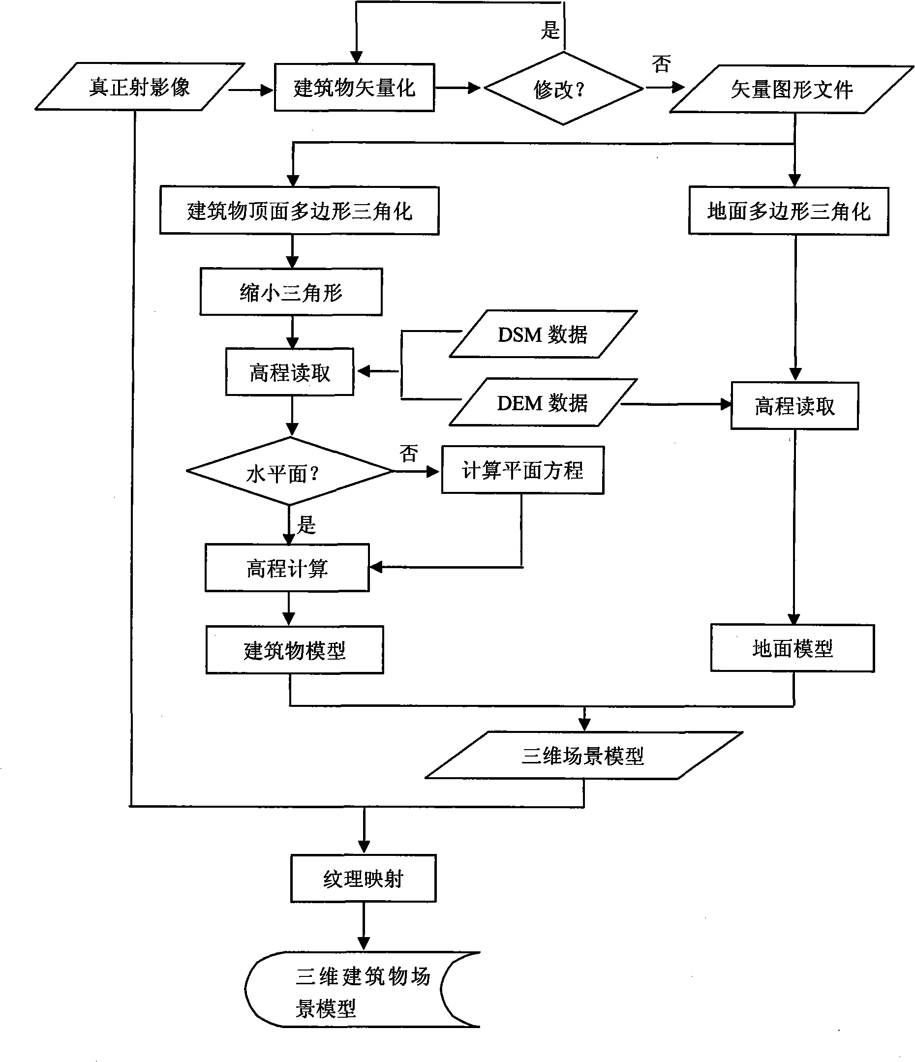
[0044] According to the method for quickly constructing a three-dimensional building scene through real orthoimages according to the present invention, it specifically includes the following steps:

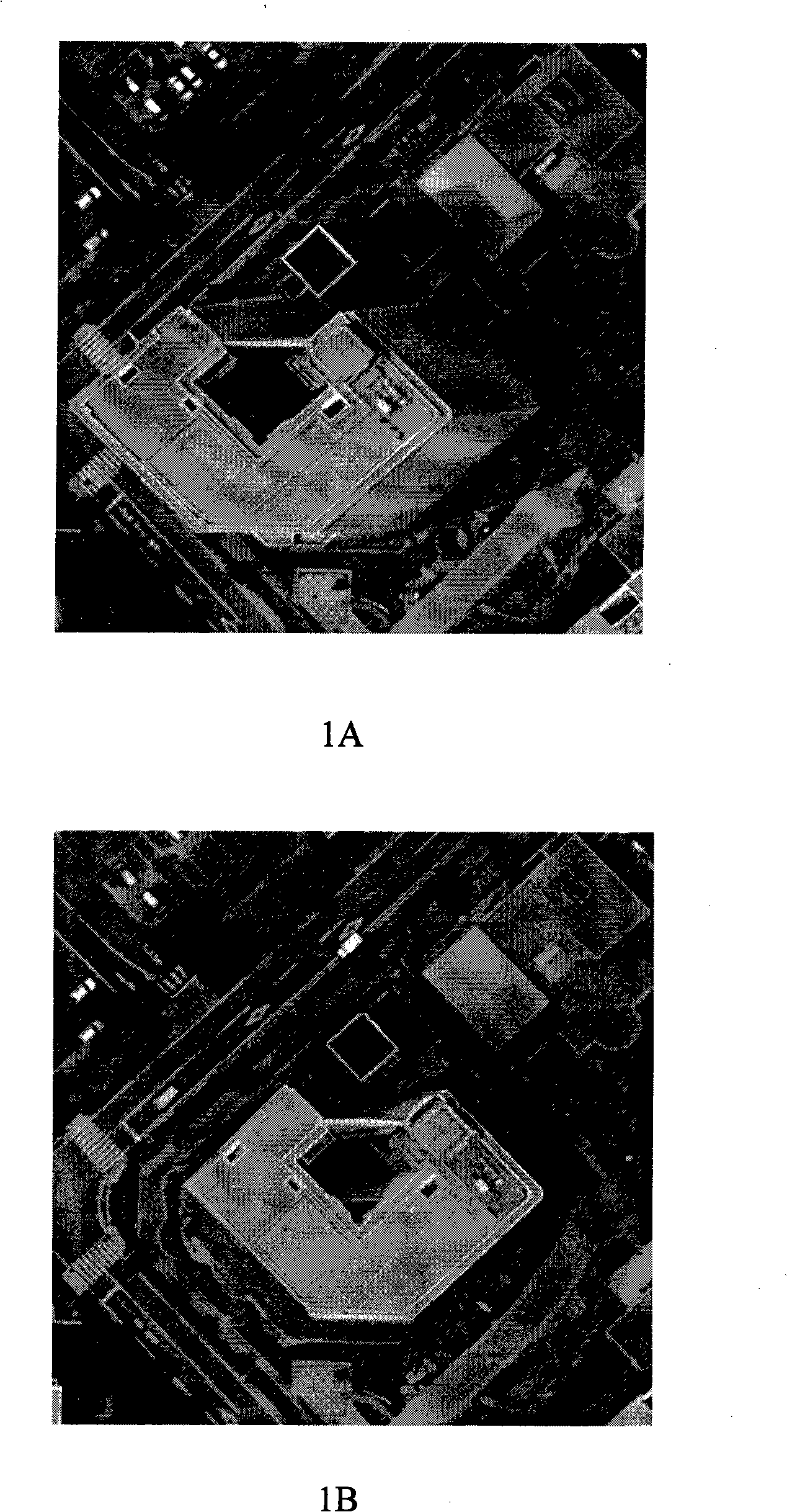
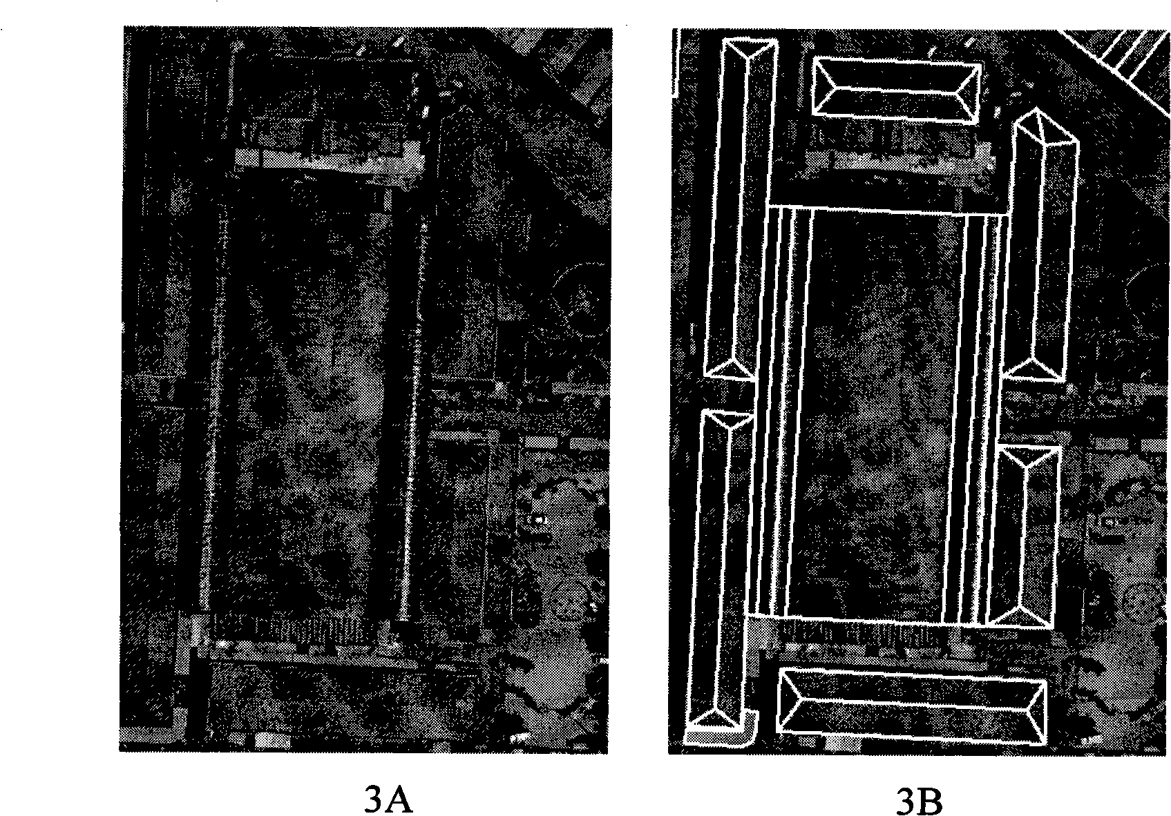
[0045] 1) Extract the top surface of the building through the true orthographic image to obtain a plane vector graphic, and at the same time obtain the plane coordinates of the vector

[0046]Use the French Pixel Factory (Pixel Factory) system equipment to process aerial images to generate true orthophotos, digital surface models and digital elevation models. The three are independent products, and there is a relationship between them.

[0047] Then use ESRI's ArcGIS software to vectorize the real orthographic image, that is, connect the corner points with straight lines to obtain a plane vector graphic file with...


PUM


Abstract

The invention provides a method for rapidly constructing a three-dimensional building scene through an actual projective image, which concretely comprises following steps of: firstly, extracting the top surface of a building through the actual projective image, obtaining a plane vector diagram, and simultaneously obtaining a vector plane coordinate; secondly, respectively carrying out building top surface triangularization process and ground polygonal triangularization process for the plane vector diagram obtained from the first step and generating a building model and a ground model through combining digital surface model data and digital height model data; thirdly, combining the building model and the ground model to form a three-dimensional scene model; fourthly, carrying out veining mapping superposition for the three-dimensional scene model and the actual projective image and generating the three-dimensional building scene. The method accelerates the modeling speed of the three-dimensional building scene and reduces the manual operation time of modeling mapping design. When the method is used, once modeling and vein mapping can be carried out to a specific zone; true and effective three-dimensional visual effect is obtained; and the working capacity of scene modeling is greatly lowered.

Description

technical field [0001] The present invention relates to a method for constructing a three-dimensional scene, and more precisely, the present invention relates to a method for rapidly constructing a three-dimensional building scene through real orthoimages. Background technique [0002] Traditional photogrammetry methods generally use aerial images to reconstruct a three-dimensional model, and to observe the three-dimensional effect requires wearing stereo glasses, which is inconvenient for stereo observation. [0003] With the development of photogrammetry technology, there are two commonly used methods for constructing 3D scenes: [0004] 1. Use traditional orthophotos and digital elevation models to construct 3D scenes [0005] Aerial images are formed through central projection, while orthophotos are images that are close to vertical projection obtained by correcting aerial images. The traditional orthophoto has a shortcoming, that is, it ignores the height of towering ...

Claims


Application Information

Patent Timeline
IPC IPC(8): G01C11/00
Inventor 关鸿亮江恒彪
Owner 关鸿亮
Why Eureka
Try Eureka