Method and system for compensating inability of positioning, tracking and navigation of GPS system

A technology of GPS systems and components, applied in the field of GPS systems, can solve problems such as failure to continue, affecting the effect of GPS satellite positioning systems, and inability of GPS systems to achieve positioning, tracking and navigation.

Inactive Publication Date: 2008-11-05
WINGTECH COMM
View PDF0 Cites 6 Cited by
  • Summary
  • Abstract
  • Description
  • Claims
  • Application Information

AI Technical Summary

Problems solved by technology

Some artificial buildings will become the signal dead spots of the GPS system 2, which will affect the effect of the GPS satellite positioning system
Once the vehicle with GPS device 1 enters these signal dead spots 2, it will lose satellite information and cannot continue positioning, tracking, navigation, etc., such as ...

Method used


Image

  • Method and system for compensating inability of positioning, tracking and navigation of GPS system
  • Method and system for compensating inability of positioning, tracking and navigation of GPS system
  • Method and system for compensating inability of positioning, tracking and navigation of GPS system

Examples


Embodiment 1

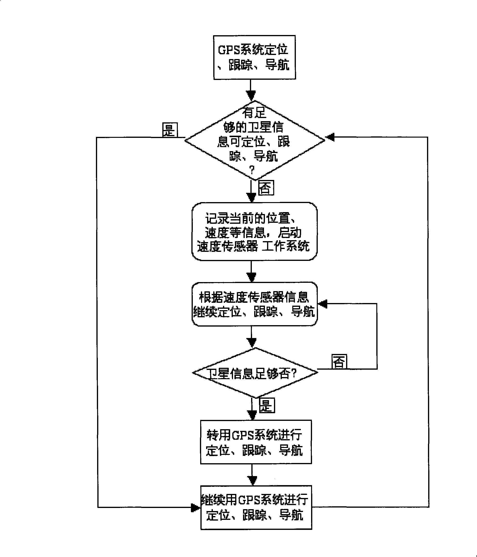
[0040] The following is a method and system for making up the gap when there is no signal in the navigation with the GPS system on the car.

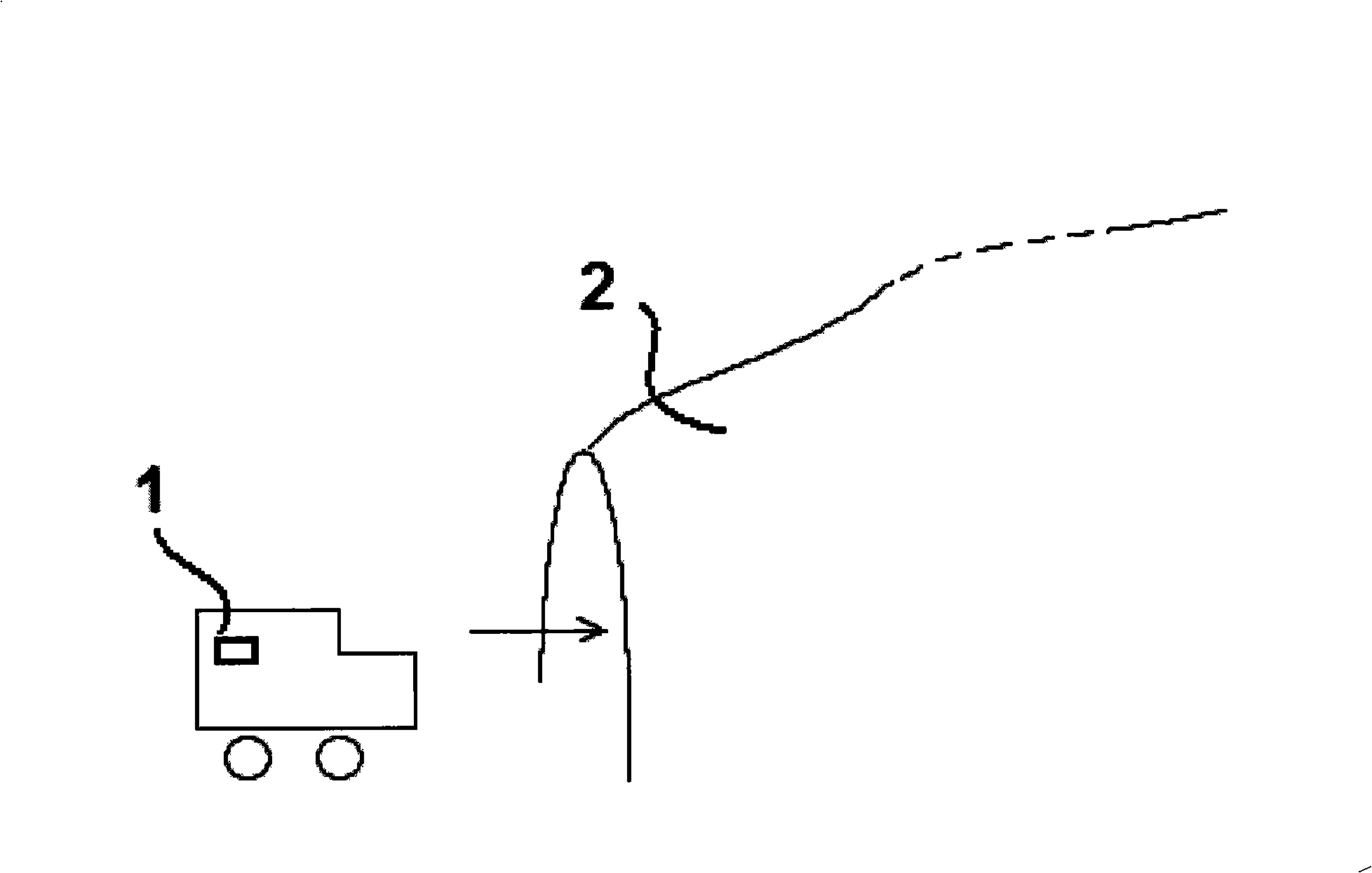
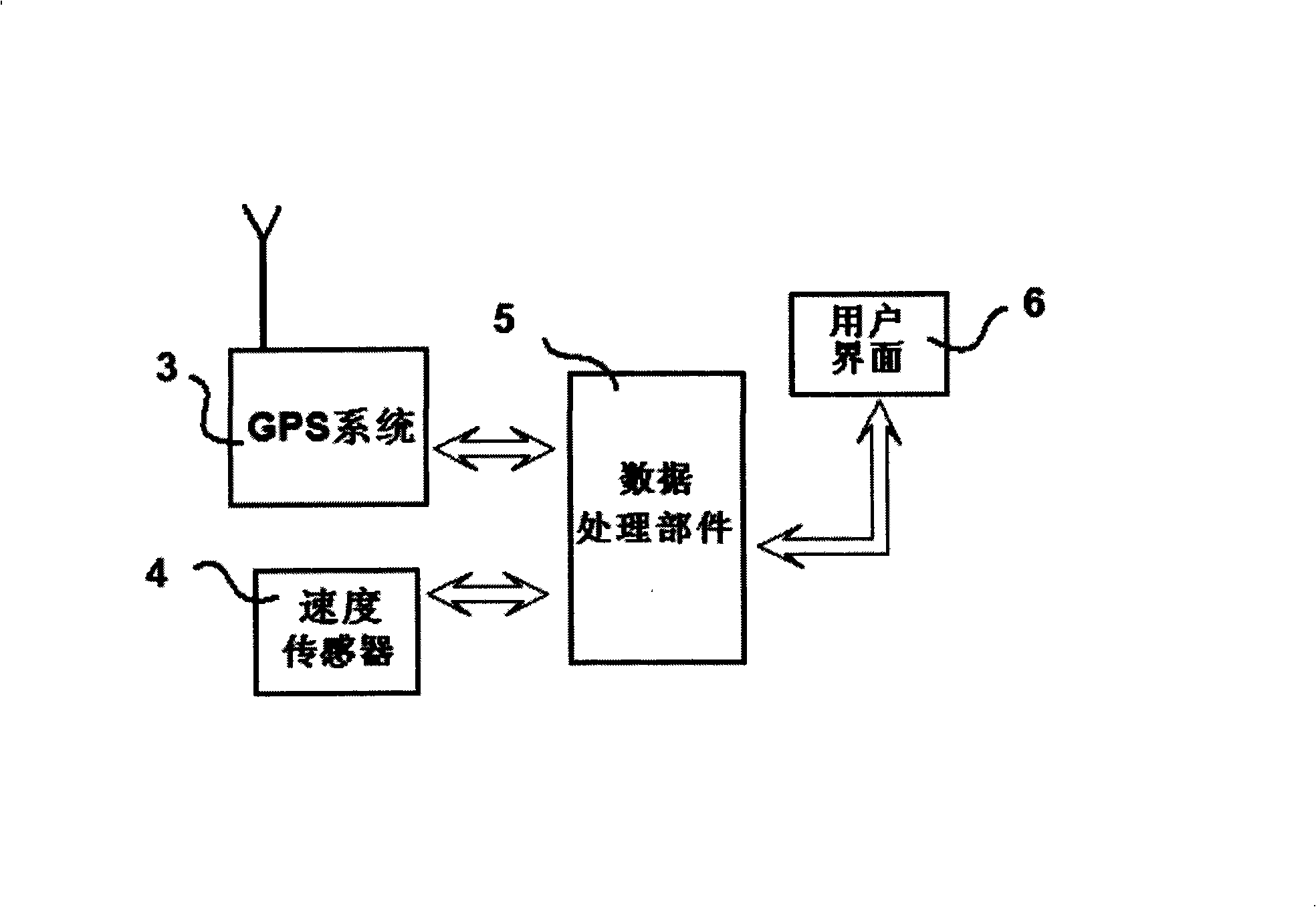
[0041] The structural features of this system are as follows, the composition and structure of the GPS system in the car are the same image 3 In the state where the car passes through the overpass, the working method of the system in this embodiment includes the following steps:

[0042] ①Start the vehicle-mounted GPS system, and the device carrying GPS signal receiving equipment will perform normal positioning, tracking and navigation. The GPS signal receiving equipment will perform data processing after receiving the GPS signal, and then inform the user of its specific location through the user interface, and proceed Real-time tracking and navigation;

[0043] ②Real-time detection of whether the GPS system can accept sufficient satellite signals. If so, the user interface will display normal images and data to the driver, or the voice syst...


PUM


Abstract

The invention relates to a method which makes up the GPS system not to orientate, track and navigate, including the following steps: (1) normally orientating, tracking and navigating of the GPS system; (2) detecting the GPS system whether to accept the ample satellite signals, if so, going to executing the step (1), if not going to the step (2); (3) recoding the present position, the speed information, starting the speed sensor working system; (4) continuously transmitting the measured acceleration to the data processing part by the speed sensor, wherein the data processing part computes the position and the speed and transmits to the UI and display to the users according to the acceleration, the position and the speed information; (5) detecting the size of the satellite signal, if satisfying the requirement then executing the step (6), if not going on to the step (4); (6) invocating the GPS system to orientate, track and navigate, closing the speed sensor. The invention uses the speed sensor to make the defect of the GPS system not to orientate, track and navigate, and the perfect system is formed by the GPS system and the speed sensor.

Description

Technical field [0001] The invention relates to a GPS system, in particular to a method and a system for making up for the gap when the GPS system cannot locate, track and navigate. Background technique [0002] The GPS system is an intelligent positioning, tracking and navigation system that has developed rapidly in recent years. It uses multiple satellites to form a network to track, locate or navigate equipment that has signal receiving on the ground. This is good information for vehicles such as cars, and it can help vehicles equipped with GPS devices in a moving state to better identify road information. In addition, these objects equipped with GPS devices can be located or tracked. [0003] However, as an accurate positioning, tracking and navigation system, the GPS system has shortcomings such as weak signal capability and susceptibility to interference. Once the signal cannot be received effectively, the GPS system is in an invalid working state. If the GPS device cannot ...

Claims


Application Information

Patent Timeline
IPC IPC(8): G01C21/26G01C21/16G01S5/02G01S1/02G01S19/49
Inventor 马琼英
Owner WINGTECH COMM
Why Eureka
Try Eureka