Navigation device and method

A technology of a navigation device and a navigation method, applied in the field of navigation, can solve problems such as inability to perform correction, drift, and being susceptible to electromagnetic interference.

Active Publication Date: 2009-04-08
SHENZHEN COSHIP ELECTRONICS CO LTD
View PDF0 Cites 63 Cited by
  • Summary
  • Abstract
  • Description
  • Claims
  • Application Information

AI Technical Summary

Problems solved by technology

[0003] Although the above-mentioned GPS navigation equipment can navigate in the blind area of ​​the GPS signal through the inertial navigation method, this inertial navigation method needs to transmit the data of the vehicle speed to the GPS navigation equipment through wire

Method used


Image

  • Navigation device and method
  • Navigation device and method
  • Navigation device and method

Examples


Embodiment Construction

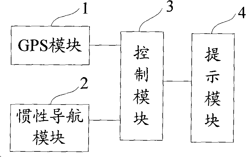
[0022] The navigation device and method of the embodiment of the present invention generates GPS navigation data and inertial navigation data collected in real time by receiving GPS signal analysis, corrects the GPS navigation data and inertial navigation data according to the strength of the GPS signal, and provides navigation information to the user. Tips, so as to achieve the purpose of reducing electromagnetic interference and improving navigation accuracy.

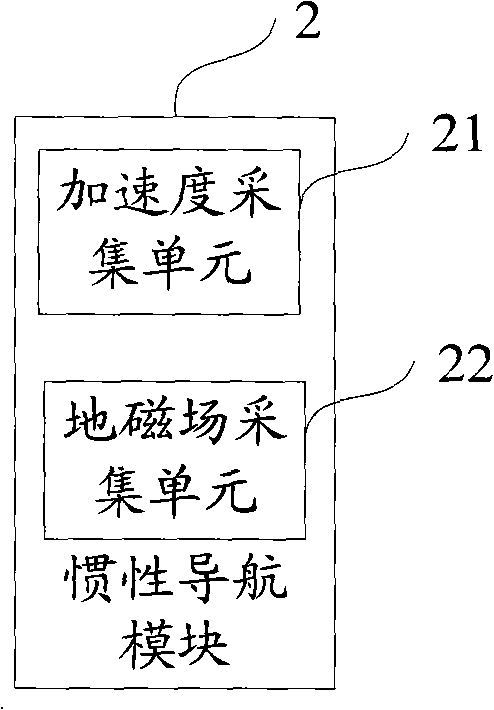
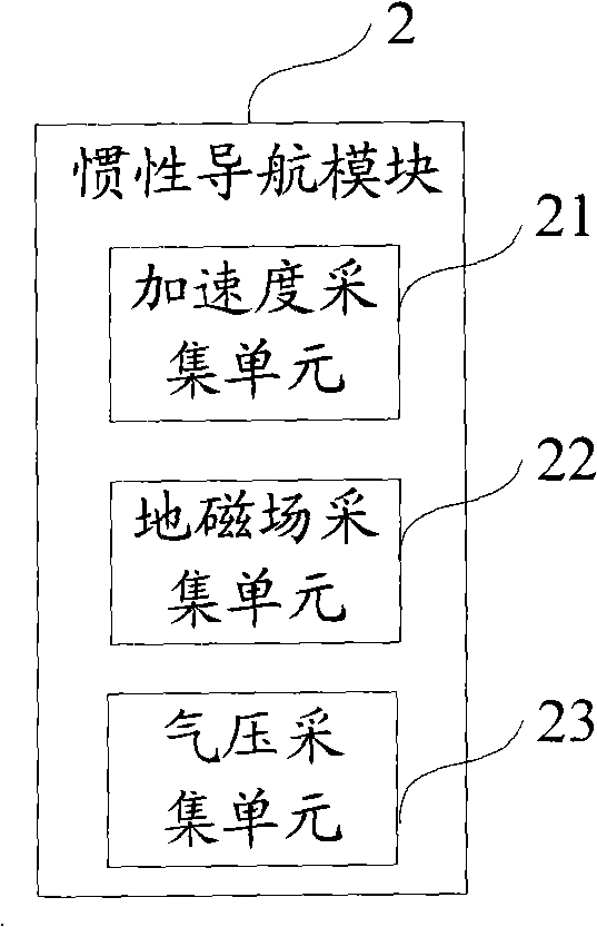
[0023] Such as figure 1 and figure 2 As shown, the first embodiment of the navigation device of the present invention is proposed. This navigation device comprises: GPS module 1, is used for receiving GPS signal, and described GPS signal is analyzed and processed, generates GPS navigation data; Inertial navigation module 2, is used for collecting inertial navigation data; Control module 3, according to described GPS The strength of the signal corrects the inertial navigation data and GPS navigation data to generate...


PUM


Abstract

The invention provides a navigation device, which comprises a receiving GPS signal, a GPS module which analyzes the GPS signal to generate GPRS navigation data, an inertial navigation module which collects inertial navigation data, a control module which calibrates the inertial navigation data and the GPS navigation data according to the GPS signal strongness or weakness determined by the GPS navigation data, and a hint module which outputs in an image or a sound mode. The invention also provides a navigation method, which comprises the steps of: receiving the GPS navigation signal, and resolving to generate the GPS navigation data; collecting the inertial navigation data; calibrating the inertial navigation data and the GPS navigation data according to the GPS signal strongness or weakness determined by the GPS navigation data, and generating the navigation information; and outputting the navigation information. The inertial navigation data and the GPS navigation data are calibrated according to the GPS signal strongness or weakness, and the navigation information is generated, therefore, the navigation accuracy can be improved.

Description

technical field [0001] The invention relates to the technical field of navigation, in particular to a navigation device and method combining GPS navigation and inertial navigation. Background technique [0002] Existing GPS (Global Position System, Global Positioning System) navigation device realizes GPS navigation by receiving GPS signals, but because GPS signals are different in strength due to different areas, when in areas with weak GPS signals, GPS navigation The device easily leads to inaccurate navigation; or when there is no GPS signal area, the so-called "blind zone", such as bridges, tunnels and other places, GPS navigation cannot be performed. To solve this problem, the specific location can be determined by inertial navigation. For example, when the car enters the GPS signal blind area from the GPS signal area, the sensor collects data such as the speed, acceleration, and heading of the car, and the speed data is sent to the controller through wireless. Accelera...

Claims


Application Information

Patent Timeline
IPC IPC(8): G01C21/26G01C21/16G01S1/02G01S5/02
Inventor 章先鑫
Owner SHENZHEN COSHIP ELECTRONICS CO LTD
Why Eureka
Try Eureka