Real time roaming and scaling method of vector map in mobile navigation equipment

A vector map and navigation equipment technology, which is applied to road network navigators, special data processing applications, instruments, etc., can solve the problems of wasting storage space, redundancy and uneven distribution in loading, and achieve the effect of improving efficiency.

Inactive Publication Date: 2009-05-20
SICHUAN CHANGHONG ELECTRIC CO LTD
View PDF0 Cites 23 Cited by
  • Summary
  • Abstract
  • Description
  • Claims
  • Application Information

AI Technical Summary

Problems solved by technology

Because the distribution of feature objects (points of interest, roads, etc.) in the map is generally uneven, the distribution of the number of feature objects in each grid is unreasonable, thus wasting storage space
And because there is no reasonable division of the entire vector map, etc., it is prone to redundancy when loading, and it is not real-time
The existing technology lacks a method for real-time roaming and zooming of vector maps in mobile navigation devices

Method used


Image

  • Real time roaming and scaling method of vector map in mobile navigation equipment
  • Real time roaming and scaling method of vector map in mobile navigation equipment

Examples


Embodiment Construction

[0016] The present invention will be further described below in conjunction with the accompanying drawings.

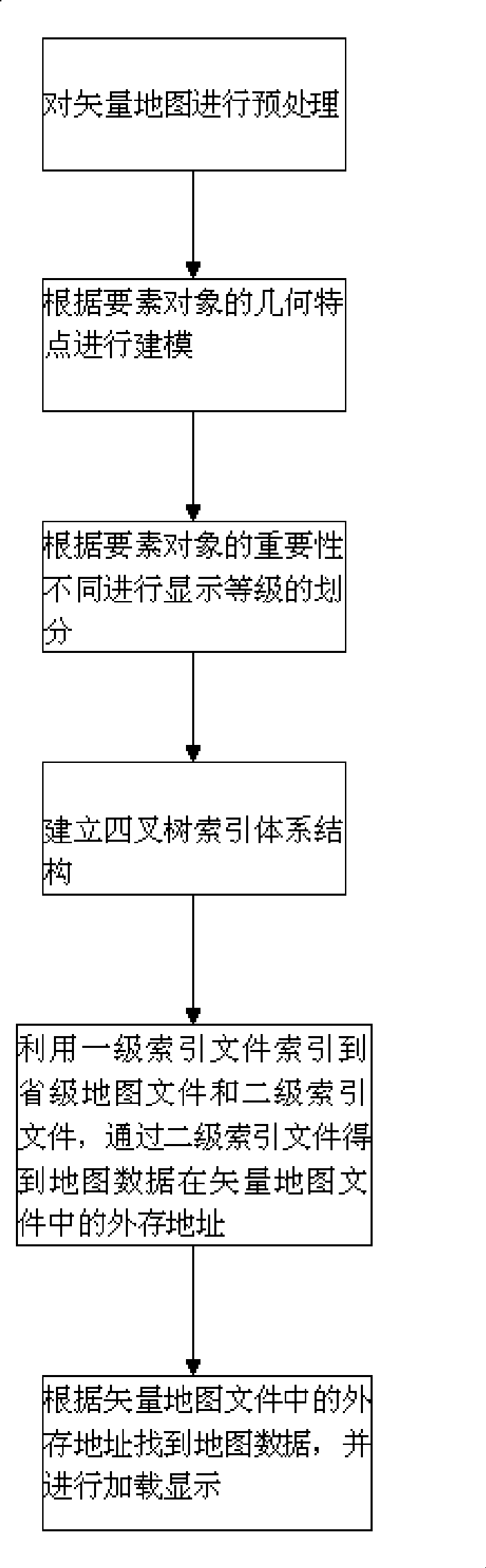
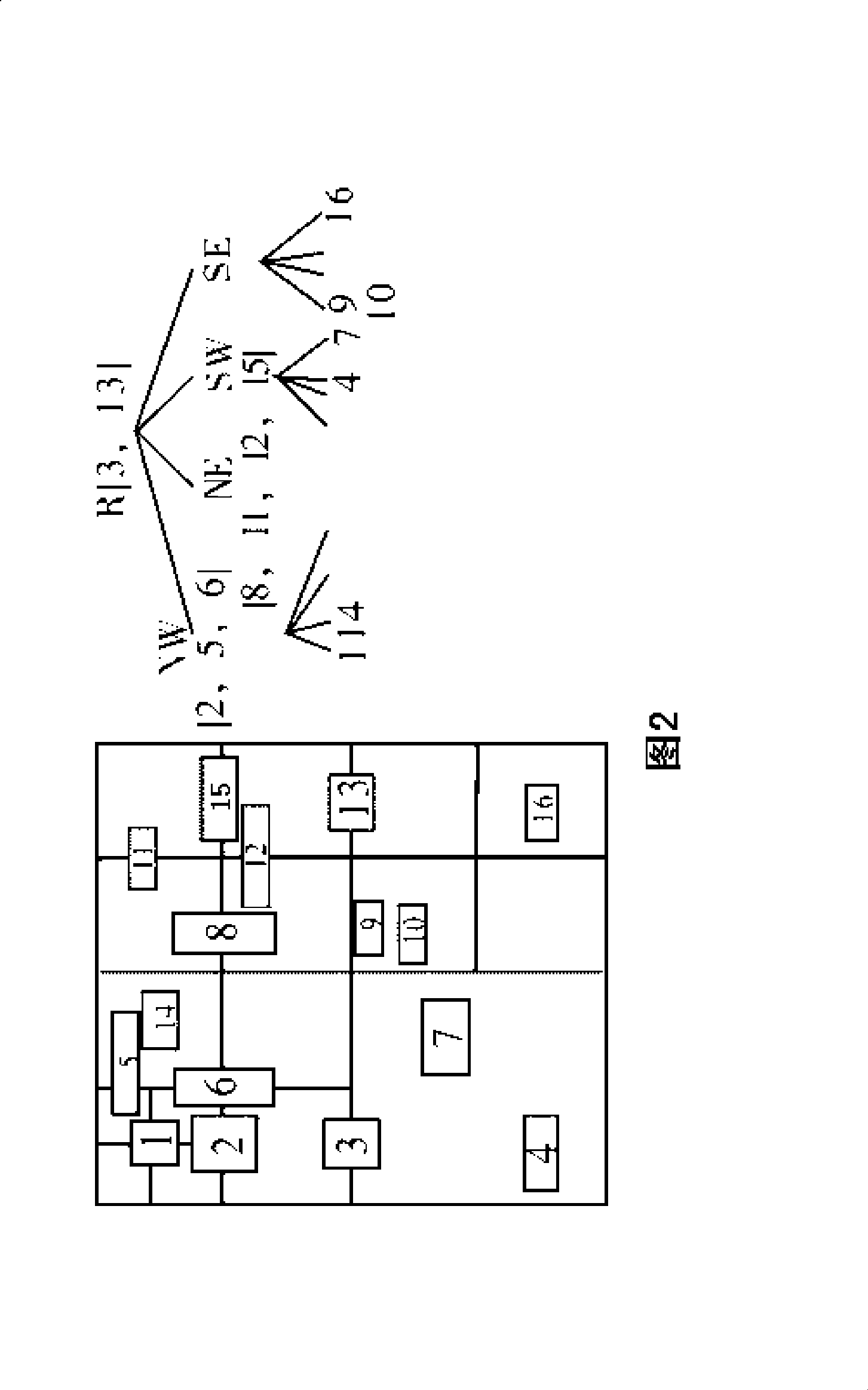
[0017] Such as figure 1 As shown, the real-time roaming and zooming method of the vector map in the mobile navigation device in the present invention comprises the following steps: a. the vector map is preprocessed, including data compression and merging of element objects; b. according to the vector map Modeling based on the geometric characteristics of feature objects; c. Dividing display levels according to the importance of feature objects; d. Establishing a quadtree index system structure, including primary index files and secondary index files; e. Using primary The index file is indexed to the provincial map file and the secondary index file, and the external storage address of the map data in the vector map file is obtained through the secondary index file; f. Find the map data according to the external storage address in the vector map file, and load it show. ...


PUM


Abstract

The invention relates to a method for making real-time roaming and zooming operations on a vector map in the mobile navigation equipment. Aiming at the defect of the prior art that the vector map can not be roamed and zoomed in real time, the invention provides a method for making real-time roaming and zooming operations on the vector map in the mobile navigation equipment. The key points of the technical proposal include: a, the vector map is pre-treated; b, according to geometrical characteristics of essential objects in the vector map, a model is built; c, according to different importance of the essential objects, display grading is divided; d, a quad tree index system structure is established, wherein the structure includes a first grade index file and a second grade index file; e, by utilizing the first grade index file, the province-level map file and the second grade index file are indexed, and by the second grade index file, the external storage address of the map data in the vector map file is obtained; and f, according to the external storage address in the vector map file, the map data are found and loaded to display. The method has the advantages of making the roaming and zooming operations on the vector map in real time.

Description

technical field [0001] The invention relates to image processing and display technology, in particular to a method for real-time roaming and zooming of a vector map in a mobile navigation device. Background technique [0002] With the rapid development of embedded computer technology and the rapid promotion of social needs, GIS (Geographic Information System) technology has been widely used in embedded systems such as urban intelligent transportation systems, vehicle navigation systems, and personal location service systems. Economic and social benefits Obviously, most of them perform functions such as map display by accessing vector map data format. Compared with desktop computers or graphics workstations, general embedded GIS processors are slower, have smaller memory capacity and lack floating-point coprocessors, and the contradiction is that geographic information has a large amount of data, complex data types and computing tasks. Heavy. Therefore, frequent map panning...

Claims


Application Information

Patent Timeline
IPC IPC(8): G01C21/36G06F17/30
Inventor 明爽
Owner SICHUAN CHANGHONG ELECTRIC CO LTD
Why Eureka
Try Eureka