
Latitude and longitude estimation method based on sun shadow track in video

A technology of mid-range, longitude and latitude in video, applied in the fields of image processing and geographic information systems, which can solve problems such as complex modeling, large errors, and no consideration of the interaction between light and light on screen pixels

Inactive Publication Date: 2009-07-29
TIANJIN UNIV
View PDF0 Cites 26 Cited by
  • Summary
  • Abstract
  • Description
  • Claims
  • Application Information

AI Technical Summary

Problems solved by technology

However, this method has many restrictions, such as: linear sensors are required, Lambertian planes are required, the interaction of light on the screen pixels is not considered, only sunlight and ambient light are considered, and the modeling is complex and the error is large

Method used


Image

  • Latitude and longitude estimation method based on sun shadow track in video
  • Latitude and longitude estimation method based on sun shadow track in video
  • Latitude and longitude estimation method based on sun shadow track in video

Examples


Embodiment Construction

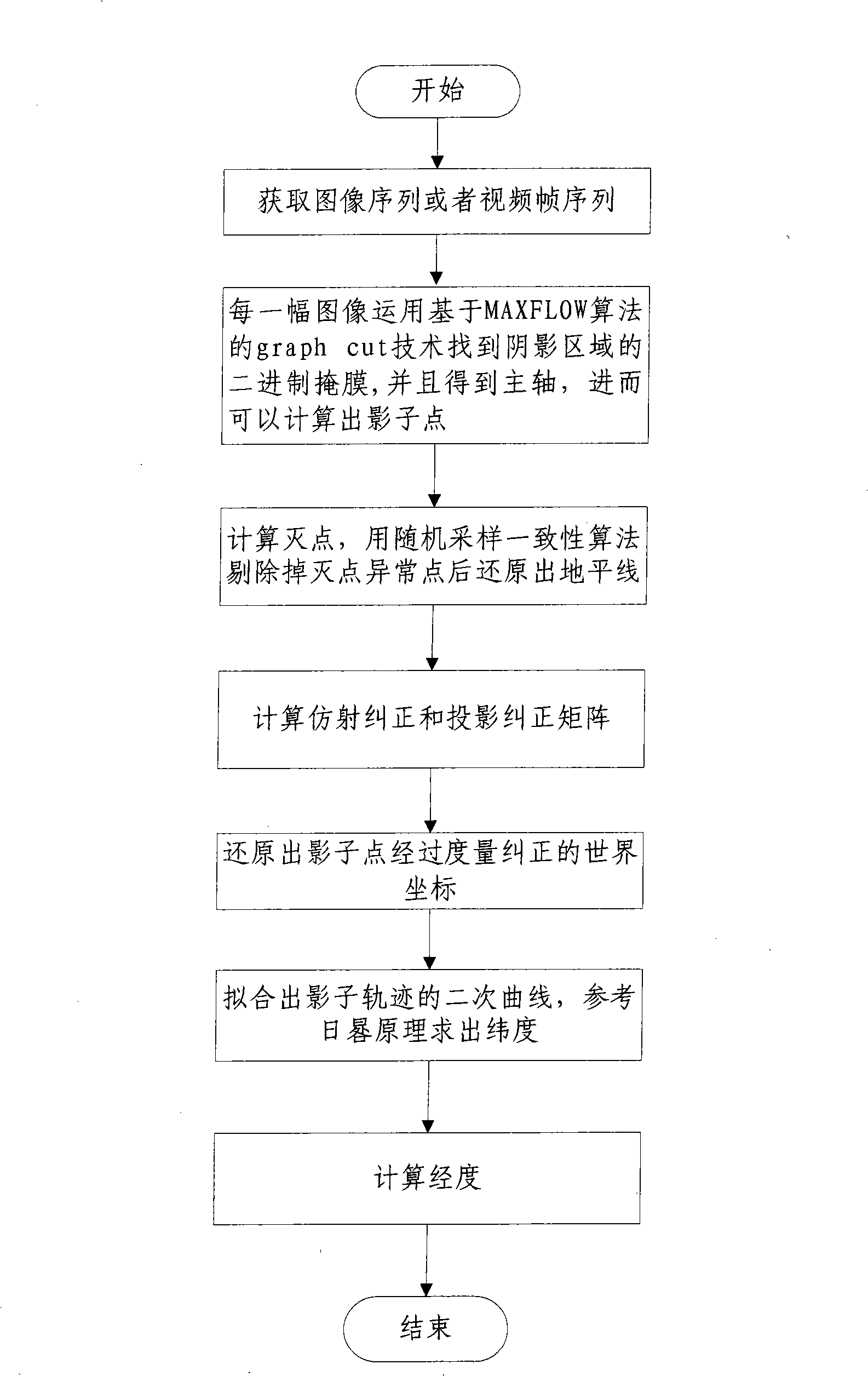
[0041] The technical scheme of the present invention is as follows: first obtain the natural image sequence or video frame, and use the graph segmentation (graph cut) technology based on maximum flow (MAX FLOW) algorithm to detect the binary mask of shadow area for each frame of image, then find The main axis of the binary mask in the shadow area, and the intersection point between the main axis and the edge of the binary mask area is the required trajectory point of the shadow.

[0042] Then, the intersection of the straight line determined by two different points in the same shadow track and the straight line determined by two points in another shadow track at the corresponding time is a vanishing point, so that multiple vanishing points can be determined. The random sampling consensus algorithm is used to fit the horizon after eliminating outliers. Fit mutually perpendicular vanishing points v x , v y , calculate the affine correction and projection correction matrix to o...


PUM


Abstract

The invention belongs to the technical field of image processing and geographical information system, relating to an estimation method of latitude and longitude based on sun shadow track in a video; the method comprises the following steps: a natural image sequence or a video frame is firstly obtained, and a track point of the shadow for each image frame is detected; a plurality of vanishing points are then determined, and the horizon line is fitted; mutually vertical vanishing points are fitted, and affine rectification and projection rectification matrixes are calculated; measured and rectified world coordinates are restored; the track of the shadow point in the world coordinates is then fitted, sundial design is referred, and the latitude is estimated by using similarity relation; the time difference is calculated by using the extreme point of a secondary curve so as to efficiently restore the latitude and longitude information of the photographed images. The method has lower complexity and higher precision, which is a method for realizing latitude and longitude estimation by using the natural image sequence or video frame and can obtain the latitude and longitude information of the photographed images according to the position of uncalibrated shadow.

Description

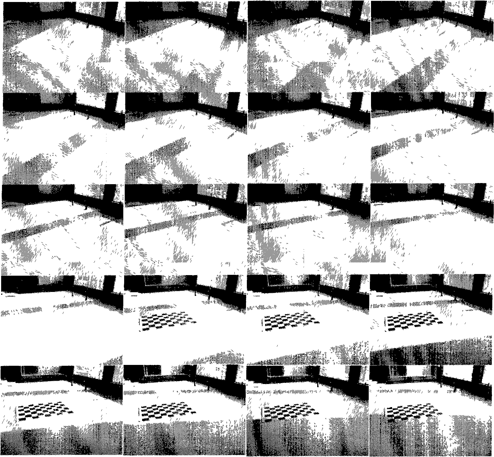
technical field [0001] The invention belongs to the technical fields of image processing and geographic information systems, and in particular relates to a method for estimating latitude and longitude. Background technique [0002] The estimation of latitude and longitude is widely used in both military and civilian applications, and it also has great application potential in the fields of forensic science, security, and navigation. The present invention uses the shadow track in the video without camera calibration to estimate the latitude and longitude information of the photo collection location. Its input is: video frames captured with a fixed pinhole camera containing real-world vertical relations and two shadow trajectories in the same scene, such as figure 1 shown. The output of the technology of the present invention is: collecting the longitude and latitude information of the photo location. [0003] The background technology used in the present invention has: (1)...

Claims


Application Information

Patent Timeline
Patent Type & Authority Applications(China)
IPC IPC(8): G01C1/00
Inventor 操晓春曲彦龄孙济洲武琳郭晓杰张炜
Owner TIANJIN UNIV
Learn More