Identification method of remote sensing image building

A recognition method and remote sensing image technology, applied in the field of remote sensing target image recognition, can solve problems such as false detection and missed detection of buildings

Inactive Publication Date: 2009-12-09
HUAZHONG UNIV OF SCI & TECH
View PDF0 Cites 38 Cited by
  • Summary
  • Abstract
  • Description
  • Claims
  • Application Information

AI Technical Summary

Problems solved by technology

[0007] The invention provides a remote sensing image building recognition method, which overcomes the problems of building

Method used


Image

  • Identification method of remote sensing image building
  • Identification method of remote sensing image building
  • Identification method of remote sensing image building

Examples


Embodiment

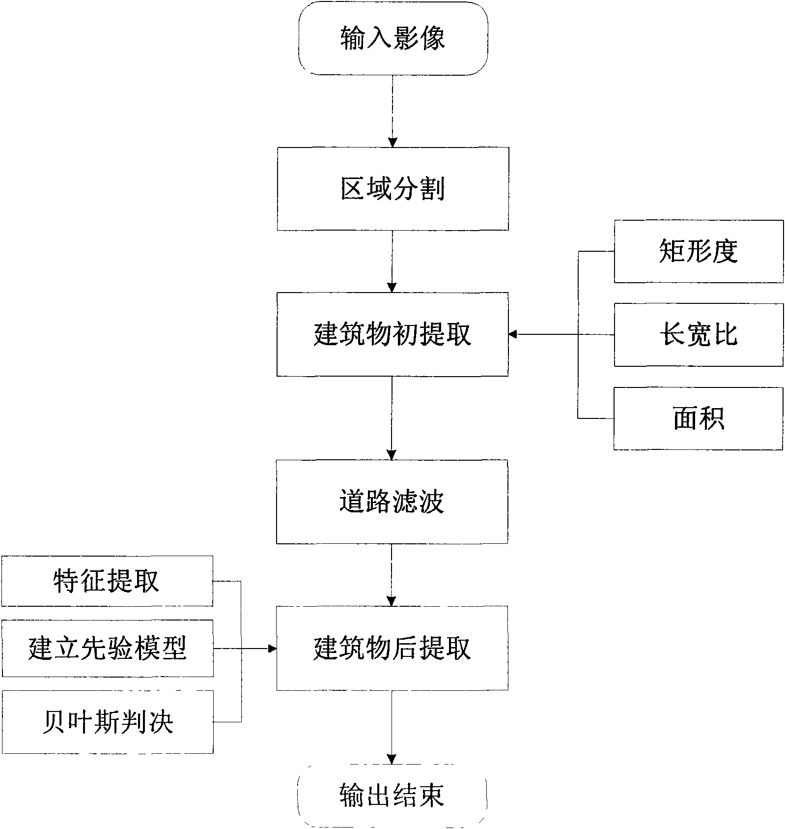
[0062] Embodiment: Utilize the present invention to carry out building recognition on high-resolution images of the Chicago area in the United States;

[0063] 1. Regional segmentation

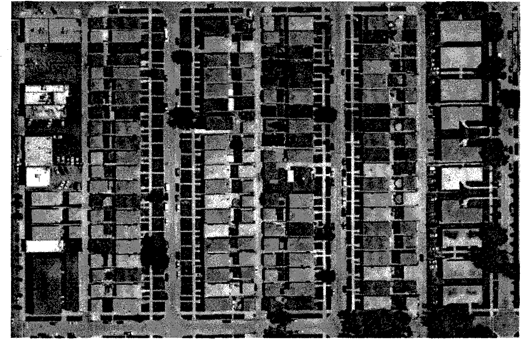
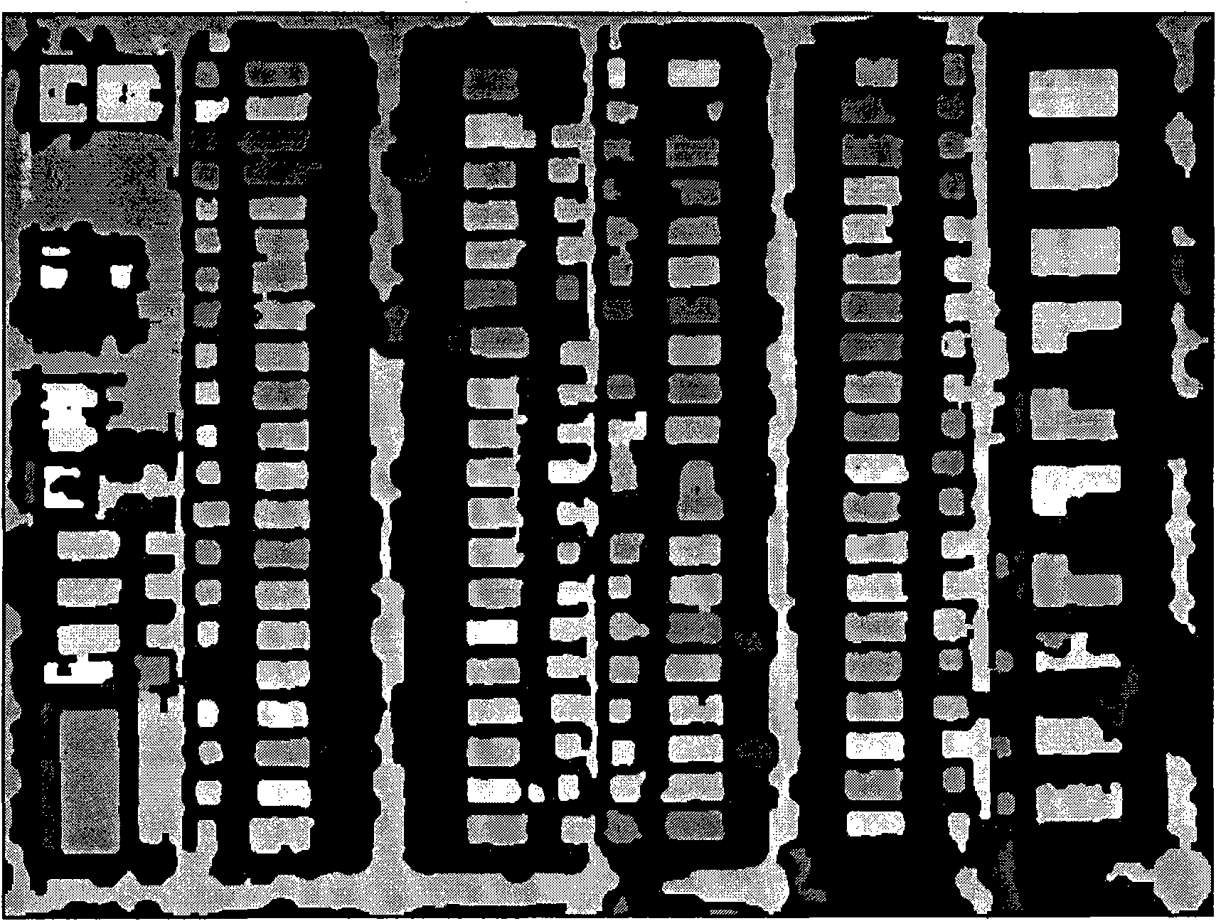
[0064] Enter a picture figure 2 The 1m resolution urban remote sensing image u shown 1 , for u 1 Calculate the likelihood function to get the image LS(u 1 ) and normalize it to [0, 255], (in the likelihood function, the support domain radius is 7, and β is 0.5), and the segmentation threshold is selected to be 35, and the image LS(u 1 ) in which the pixels smaller than the threshold value are assigned as 0, and the pixels larger than the threshold value retain their original gray value to obtain the thresholded image u 2 , and then use the region growing method to image u 2 Segment the region with non-zero pixel value to obtain the image u including multiple candidate building object regions 3 , and finally use the spectral characteristics of the green field to separate the green field ...


PUM


Abstract

The invention relates to an identification method of a remote sensing image building, belonging to an identification method of a remote sensing target image; the method overcomes the problems of false detection and miss-detection of the building in the existing detecting method of the building for improving the accurate detecting rate. The identification method sequentially comprises the following steps: region division, initial extraction of the building, road filtration and following extraction of the building. The identification method has good stability and strong environment adaptive capacity, and can solve the problem that the buildings and the roads close to the adjacent optical spectrum are confused, and the method can detect the building target with different shape structure and optical spectrum characteristics in the same image, the extracting result of the building has high accurate rate and good robustness, and the method can effectively extract various building targets under the remote sensing images with high resolution, therefore, the identification method has practical value in the construction of a geographical information system and a digital city system.

Description

technical field [0001] The invention belongs to a remote sensing target image recognition method, in particular to an object-oriented high-resolution remote sensing image building recognition method. Background technique [0002] Remote sensing images can quickly obtain information on the earth's surface, especially with the application of high-resolution remote sensing images, making it an important source of information for GIS databases and map updates. However, how to automatically obtain feature information from high-resolution remote sensing images has always been an important issue in remote sensing applications. Buildings are an important feature of urban areas. Due to their importance for urban construction, GIS system updates, digital cities, and military reconnaissance applications, building recognition from remote sensing images has become a research hotspot in the past 20 years. Scholars have also proposed many models and strategies for building detection, whic...

Claims


Application Information

Patent Timeline
IPC IPC(8): G06K9/00G01S7/48
Inventor 谭毅华陶超蔡华杰田金文
Owner HUAZHONG UNIV OF SCI & TECH
Why Eureka
Try Eureka