Method for generating navigation information and navigation system thereof

A technology of navigation information and generation method, applied in the field of navigation system, can solve the problems of the discount of navigation system efficiency, difficult to determine the landmark of the road ahead, the driver misses the planned navigation route, etc., so as to improve the recognizability and avoid taking the wrong route. Effect

Inactive Publication Date: 2010-03-03
MITAC COMP (SHUN DE) LTD
View PDF0 Cites 18 Cited by
  • Summary
  • Abstract
  • Description
  • Claims
  • Application Information

AI Technical Summary

Problems solved by technology

However, in the existing navigation systems, most of the fixed guide names are used to prompt the user, such as "500 meters ahead, please keep right" or "please turn right at the intersection ahead". For drivers, the so-called intersection ahead It is an object that is difficult to observe, especiall...

Method used


Image

  • Method for generating navigation information and navigation system thereof
  • Method for generating navigation information and navigation system thereof
  • Method for generating navigation information and navigation system thereof

Examples


Embodiment Construction

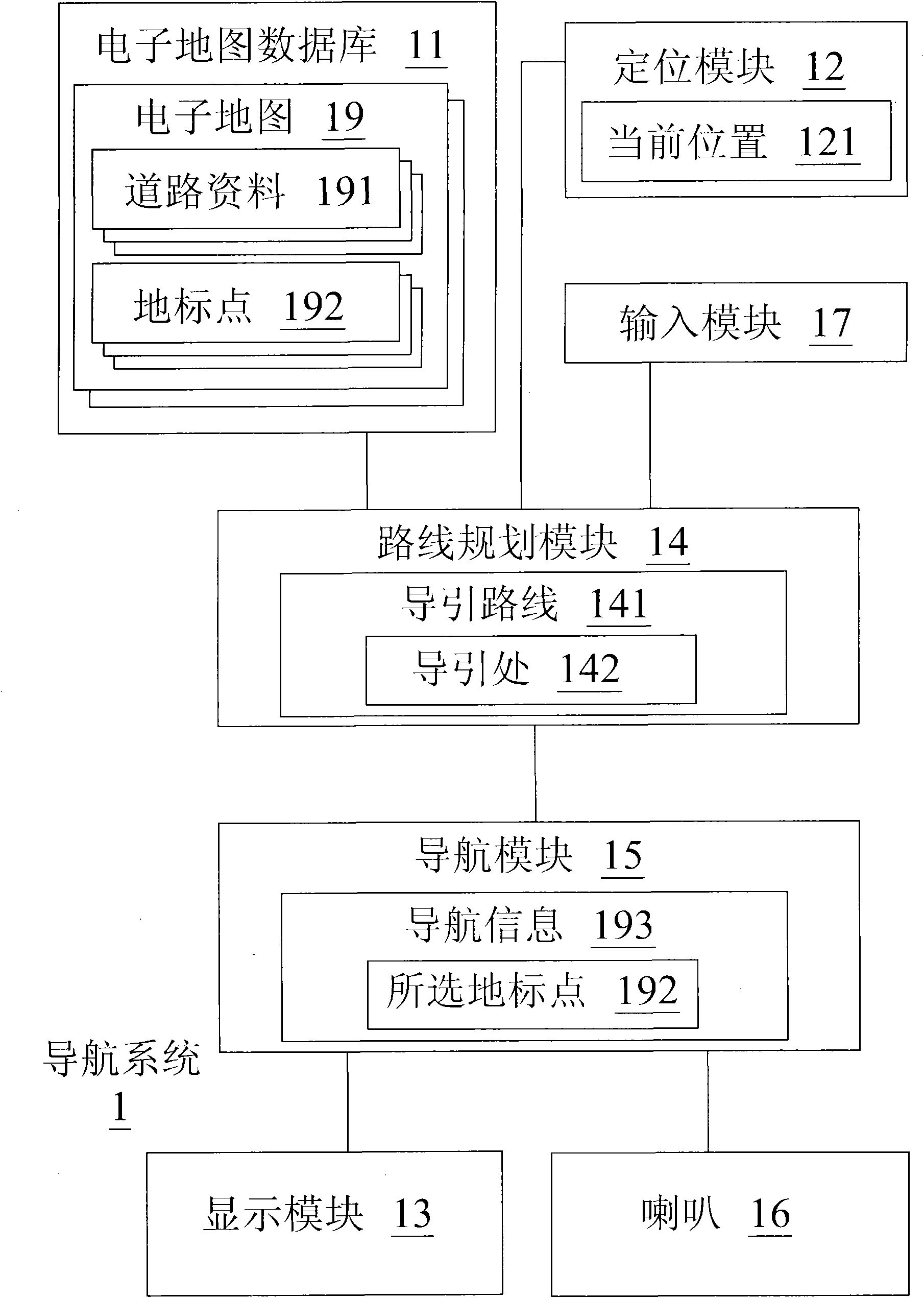
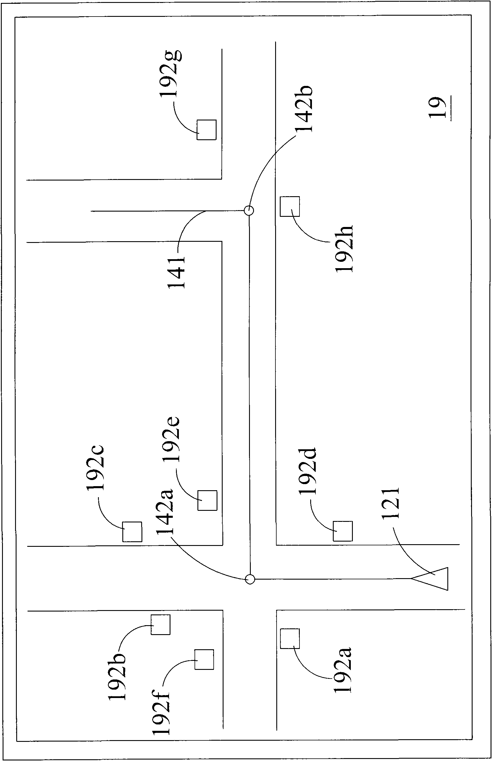
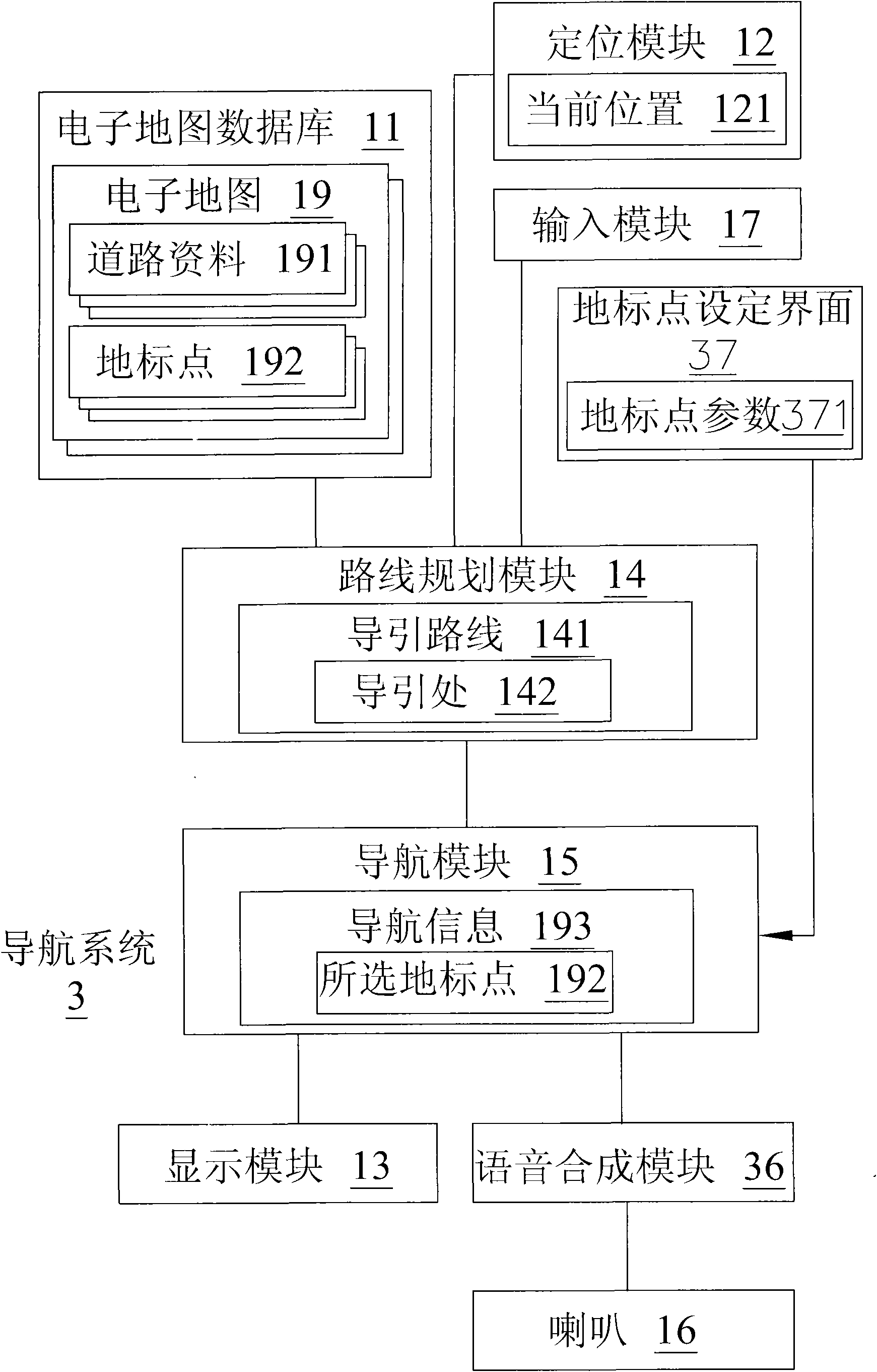
[0021] see figure 1 , which is a block diagram of the first embodiment of the navigation system of the present invention. In the figure, the navigation system 1 includes an electronic map database 11 , a positioning module 12 , a display module 13 , a route planning module 14 , a navigation module 15 , a speaker 16 and an input module 17 . The electronic map database 11 stores at least one electronic map 19, the electronic map 19 includes at least several road data 191 and several landmark points 192, and the road data 191 includes road shapes, road names, road intersections, attributes, two-dimensional coordinates or other data. Landmark points 192 include buildings with clearly identifiable features or signs, such as chain stores, schools, post offices, banks, police stations, or famous buildings. The electronic map database 11 can be a hard disk, an optical storage medium (DVD or CD), a memory card or other storage media with the same function,

[0022] The positioning m...


PUM


Abstract

The invention discloses a method for generating navigation information and a navigation system thereof. The navigation system is characterized in that navigation information contains landmark points which are near turnings and have obvious cognizable features or marks so as to ensure that a user can more easily judge the turnings for avoiding going to a wrong way. In addition, the user can also set types, priority levels and names of landmark points known by the user so as to further generate personalized navigation information.

Description

【Technical field】 [0001] The present invention relates to a navigation system, in particular to a navigation information generating method for generating navigation information containing obvious punctuation information and a navigation system thereof. 【Background technique】 [0002] As the technology of the satellite navigation system becomes more and more mature and the manufacturing cost becomes lower and lower, the satellite navigation device has become one of the necessary electronic devices for car drivers. The satellite navigation device estimates its own longitude and latitude information by receiving at least four satellite signals, and compares the longitude and latitude information with the electronic map to obtain the location information of the device. Then, the satellite navigation device executes the route planning function and the navigation function, and uses the navigation information system to guide the user to reach the destination. However, in the exist...

Claims


Application Information

Patent Timeline
IPC IPC(8): G01C21/34G01C21/36
Inventor 胡泽敏
Owner MITAC COMP (SHUN DE) LTD
Why Eureka
Try Eureka