A method for creating distance maps based on monocular machine vision

A machine vision and distance map technology, applied in instrumentation, image enhancement, image analysis, etc., can solve the problems of difficulty in creating distance maps and expensive distance measurement equipment.

Active Publication Date: 2011-12-07
INST OF SEMICONDUCTORS - CHINESE ACAD OF SCI
View PDF0 Cites 1 Cited by
  • Summary
  • Abstract
  • Description
  • Claims
  • Application Information

AI Technical Summary

Problems solved by technology

[0008] Aiming at the special structure of the car road, the present invention proposes a distance map creation method based on monocular machine vision. Through the calibration of the vehicle-mounted camera, the corresponding relationship between the scene and the CCD target surface is established, and the difficulty in creating the distance map when the model is defogged is solved. , the problem of expensive distance measurement equipment

Method used


Image

  • A method for creating distance maps based on monocular machine vision
  • A method for creating distance maps based on monocular machine vision
  • A method for creating distance maps based on monocular machine vision

Examples


Embodiment Construction

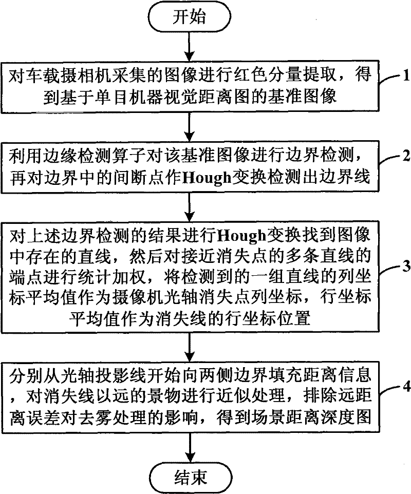
[0030] In order to make the objectives, technical solutions and advantages of the present invention clearer, the present invention will be further described in detail below with reference to specific embodiments and accompanying drawings.

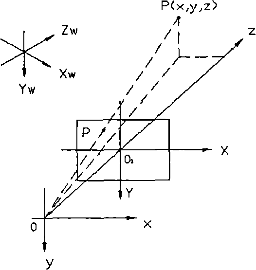
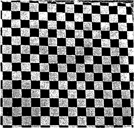
[0031] The method for creating a distance map based on monocular machine vision provided by the present invention completes the construction of a distance and depth map of a road scene through the principle of monocular machine vision, and solves the key problem of dehazing the atmospheric scattering model. In order to obtain the depth information of the target scene, the experimental camera is first calibrated to obtain the calibration parameters, and then the linear imaging model is used to establish the scene depth map. For the driving road, the x value at the position of the camera's central axis is zero, and the projection equation is simplified to z and y. relationship, such as Figure 4 shown:

[0032] z = ...


PUM


Abstract

The invention discloses a method for creating a distance map based on monocular machine vision, which includes: extracting the red component of an image collected by a vehicle-mounted camera to obtain a reference image; Hough transform is used to detect the boundary line at the discontinuous point in the boundary; the Hough transform is performed on the result of the above boundary detection to find the straight line existing in the image, and then the endpoints of the multiple straight lines close to the vanishing point are statistically weighted, and a group of detected The average value of the column coordinates of the straight line is used as the column coordinates of the disappearing point of the camera optical axis, and the average value of the row coordinates is used as the row coordinate position of the vanishing line; the distance information is filled from the optical axis projection line to the boundaries on both sides respectively, and the scene farther than the vanishing line is calculated. Approximate processing eliminates the influence of long-distance errors on defogging processing, and obtains the scene distance and depth map. The invention solves the problems of difficulty in creating a distance map and expensive distance measuring equipment when the model is defogged.

Description

technical field [0001] The invention relates to the technical field of image processing of vehicle-mounted assisted driving systems, in particular to a method for creating a distance map based on monocular machine vision. Background technique [0002] At present, the research on driver assistance systems is mostly focused on the automatic driving of vehicles in fine weather, and there is little research on scene restoration in bad weather. The research on image dehazing at home and abroad mainly focuses on the following methods: 1. Histogram equalization algorithm; 2. Dehaze image based on color constancy theory to restore color and contrast; 3. Restoration method based on atmospheric scattering model. [0003] Among them, the histogram equalization algorithm is a commonly used simple and effective enhancement method. It is based on probability theory and corrects the histogram of the image through grayscale mapping to make it have a flat distribution. The haze degraded ima...

Claims


Application Information

Patent Timeline
Patent Type & Authority Patents(China)
IPC IPC(8): G06T7/00G06T5/00
Inventor 刘红军周燕王新伟
Owner INST OF SEMICONDUCTORS - CHINESE ACAD OF SCI
Why Eureka
Try Eureka