Real-scene status consulting system and coordinate offset method based on GPS location and direction identification

A GPS positioning and direction recognition technology, applied in the field of navigation and positioning systems, can solve problems such as deviation, inability to match points of interest, and inability to accurately locate, and achieve the effect of improving accuracy and precision

Inactive Publication Date: 2010-08-04
上海易标信息科技有限公司
View PDF6 Cites 36 Cited by
  • Summary
  • Abstract
  • Description
  • Claims
  • Application Information

AI Technical Summary

Problems solved by technology

Therefore, the precise coordinates received by GPS positioning cannot be accurately positioned on the offset map, resulting in relatively large deviations
In order to accurately mark on the offset map, the coordinates of all points of interest have been offset. Us

Method used


Image

  • Real-scene status consulting system and coordinate offset method based on GPS location and direction identification
  • Real-scene status consulting system and coordinate offset method based on GPS location and direction identification
  • Real-scene status consulting system and coordinate offset method based on GPS location and direction identification

Examples


Embodiment Construction

[0068] A preferred embodiment of the present invention will be specifically introduced below in conjunction with the accompanying drawings.

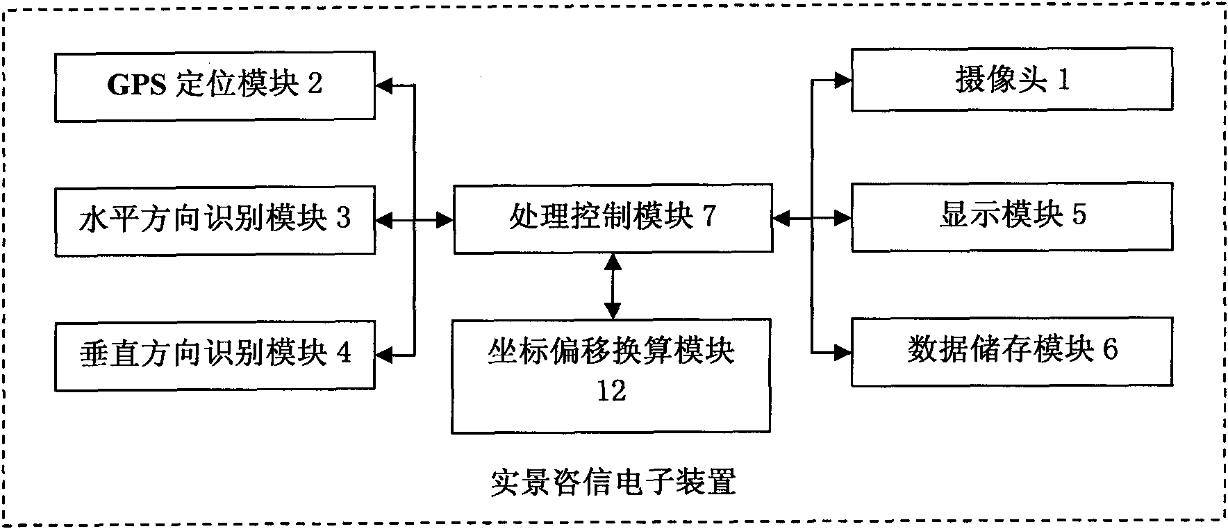
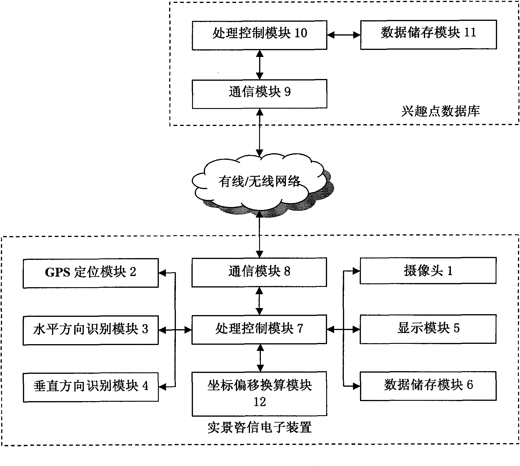
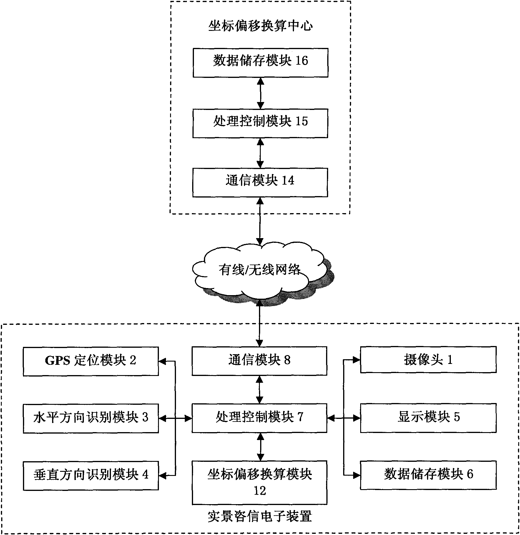
[0069] see Figure 1 to Figure 3 , an improved real-scene information system based on GPS positioning and direction recognition technology of the present invention mainly includes: a real-scene information information electronic device based on GPS positioning and direction recognition technology, a communication network and a database of points of interest; mainly in the original A coordinate offset conversion module 12 is added to the reality information electronic device.

[0070] Such as figure 1 As shown in , the improved real-view information electronic device based on GPS positioning and direction recognition technology mainly includes: camera 1, GPS positioning module 2, horizontal direction recognition module 3, vertical direction recognition module 4, display module 5, data The storage module 6, the coordinate offset conversi...


PUM


Abstract

The invention relates to a real-scene consulting system and a coordinate offset method based on GPS location and direction identification. The system comprises a real-scene consulting electronic device based on technology of GPS location and direction identification, a communication network and an interest point database. The real-scene consulting electronic device comprises a camera, a GPS location module, a horizontal and vertical direction identification module, a display module, a data storage module, a coordinate offset converting module and a treatment control module, wherein the treatment control module is connected with the other modules. The coordinate offset converting module can offset the accurate coordinate into the offset coordinate and correct the offset coordinate into the accurate coordinate. The coordinate offset method of the invention has the advantages of improving the searching and inquiring accuracy and precision of the surrounding interest points, improving the calculation accuracy and precision of the distance between the present position and the interest point, and improving the accuracy and the precision of the real-scene function. The invention can offset the coordinate and correct the coordinate to ensure that the present position and the position of the interest point are precisely marked in the real-scene observation and the map display.

Description

technical field [0001] The invention relates to a navigation and positioning system, in particular to a real-scene consulting system based on GPS positioning and direction recognition technology and an improved method for coordinate offset. Background technique [0002] In the real scene information system based on GPS positioning and direction recognition technology, the display of real scene information or the display of a two-dimensional planar map requires the geographical location of the client to be determined through traditional GPS technology, base station positioning technology and CDMA-based GPS positioning technology. Measurement, to provide real-time consulting services for judging the GPS map coordinates and the user's actual GPS coordinates. [0003] The real scene information system based on GPS positioning and direction recognition technology can dynamically combine the real scene (point of interest) collected by it with the description information about the ...

Claims


Application Information

Patent Timeline
IPC IPC(8): G06F17/30G01S19/42H04L29/06
Inventor 高翔厉敬东
Owner 上海易标信息科技有限公司
Why Eureka
Try Eureka