Inertial navigation level measurement method applied to airplane general assembly

A level measurement and general assembly technology, applied in the field of inertial navigation level measurement applied to aircraft general assembly, can solve the problems of poor reliability of measurement data, inhibition of measurement accuracy and measurement efficiency, and low degree of automation

Inactive Publication Date: 2010-10-13
ZHEJIANG UNIV
View PDF3 Cites 11 Cited by
  • Summary
  • Abstract
  • Description
  • Claims
  • Application Information

AI Technical Summary

Problems solved by technology

Over the years, my country's inertial navigation level measurement method still follows the traditional optical measurement method, with a low degree

Method used


Image

  • Inertial navigation level measurement method applied to airplane general assembly
  • Inertial navigation level measurement method applied to airplane general assembly
  • Inertial navigation level measurement method applied to airplane general assembly

Examples


Embodiment approach

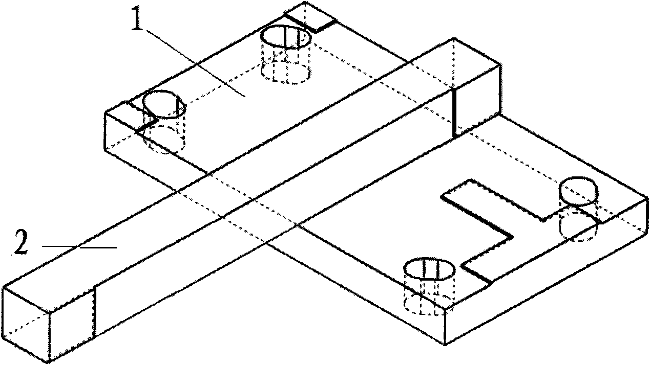
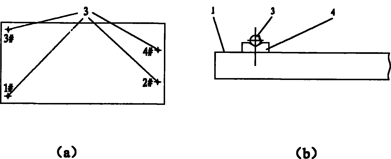
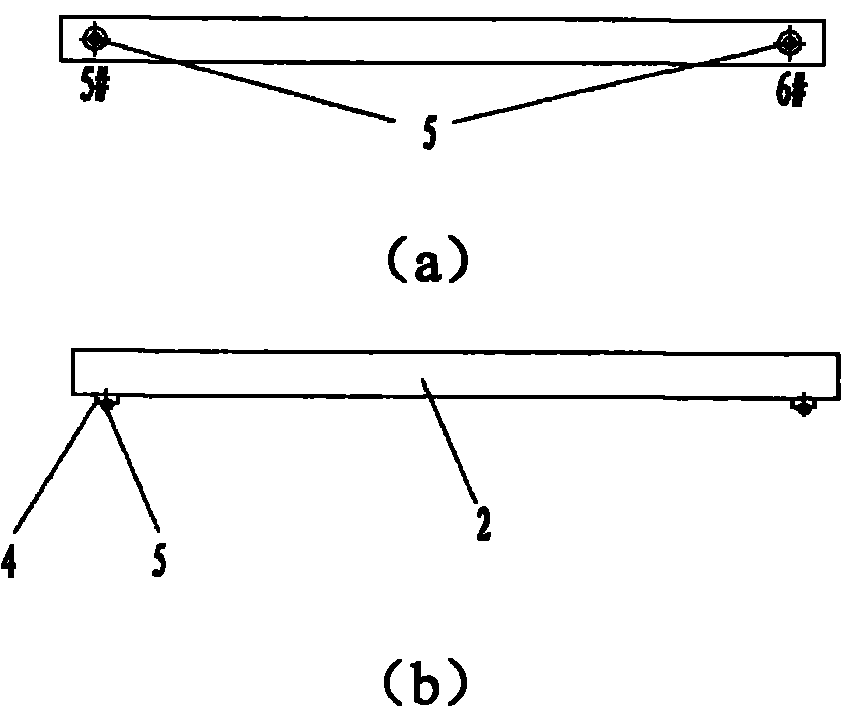
[0064] 1) Level the aircraft, that is, adjust the horizontal and longitudinal directions of the aircraft. The method is: arrange two measuring points symmetrically on the left and right wings of the aircraft. Two measurement points are arranged in the direction of the aircraft fuselage, and the height difference between the two points is within 0.5mm to achieve longitudinal leveling. Secondly, the measurement coordinate system of the laser tracker is the same as the assembly coordinate system of the aircraft general assembly station. Here, the laser The measurement coordinate system of the tracker refers to the spatial coordinate system automatically established by default after the laser tracker is turned on, while the assembly coordinate system of the aircraft general assembly site refers to the spatial coordinate system defined by the designer according to the layout of the aircraft general assembly on site. The two methods are: by measuring several public observation points...


PUM


Abstract

The invention discloses an inertial navigation level measurement method applied to airplane general assembly. The method comprises the following steps of: 1) leveling an airplane and unifying a measuring coordinate system of a laser tracking instrument with an assembling coordinate system of an airplane general assembly station; 2) measuring 2# and 12# measuring points by using the laser trackinginstrument and automatically building a symmetrical axis of the airplane by using a computer; 3) starting a measuring program and measuring a target point on an inertial navigation calibration template in a manually or automatically measuring mode; 4) calculating and graphically displaying horizontal deviation and course deviation of the inertial navigation calibration template, if the horizontaldeviation and the course deviation meet the requirement, finishing the inertial navigation level measurement, and if the horizontal deviation and the course deviation do not meet the requirement, turning to a step 5) to regulate continuously; and 5) according to the prompt of a computer, manually regulating the inertial navigation calibration template and repeating the steps 3) and 4) after regulating until the horizontal deviation and the course deviation meet the requirement. The method has the advantages of effectively improving measurement precision, greatly improving measurement efficiency and further improving the automation and integration levels of the airplane general assembly.

Description

technical field [0001] The invention relates to a measurement method, in particular to an inertial navigation level measurement method applied to aircraft general assembly. Background technique [0002] In modern advanced fighters, the inertial navigation system has become the core information source of navigation, flight control and fire control systems, directly affecting the completion of combat missions and flight safety. Ensuring the accurate installation of inertial navigation components is the premise and basis for its normal operation. Over the years, my country's inertial navigation level measurement method still follows the traditional optical measurement method, which has a low degree of automation and poor reliability of measurement data, which seriously inhibits the improvement of measurement accuracy and measurement efficiency. Contents of the invention [0003] The purpose of the present invention is to provide an inertial navigation level measurement metho...

Claims


Application Information

Patent Timeline
IPC IPC(8): G01C25/00G01C9/00
Inventor 李江雄边柯柯柯映林王青俞慈君曲巍崴宋西民孔翠萍任英武樊新田
Owner ZHEJIANG UNIV
Why Eureka
Try Eureka