Navigation-based method for generating interactive non-blocking three-dimensional topographic map

A non-occlusion, interactive technology, applied in the field of spatial information, which can solve problems such as difficult interactive visualization, terrain occlusion, etc.

Inactive Publication Date: 2011-01-19
BEIJING NORMAL UNIVERSITY
View PDF5 Cites 17 Cited by
  • Summary
  • Abstract
  • Description
  • Claims
  • Application Information

AI Technical Summary

Problems solved by technology

However, this kind of projection will cause terrain occlusion problems: the user's area of ​​interest is often occluded by objects closer to the viewpoint, especially in mountainous areas with large terrain fluctuations and cities with many buildings
Therefore, in 3D navigation, the existing methods are difficult to meet the needs of interactive visualization, and some of them cause large deformation of the panorama

Method used


Image

  • Navigation-based method for generating interactive non-blocking three-dimensional topographic map
  • Navigation-based method for generating interactive non-blocking three-dimensional topographic map
  • Navigation-based method for generating interactive non-blocking three-dimensional topographic map

Examples


Embodiment Construction

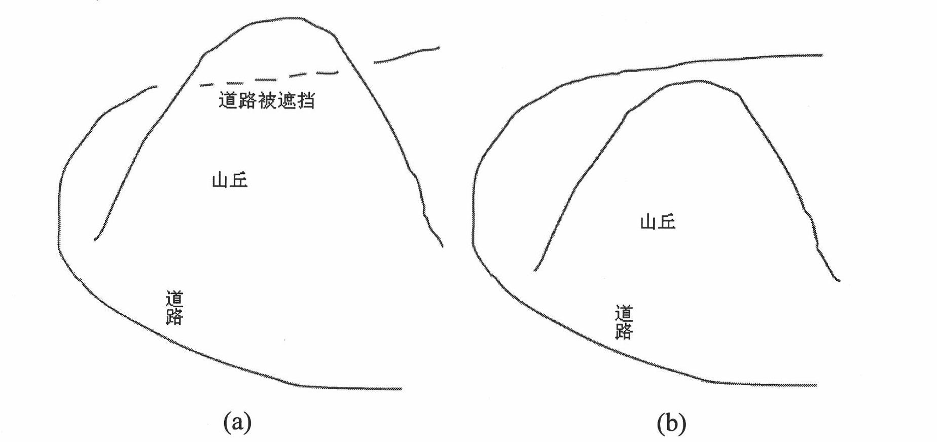
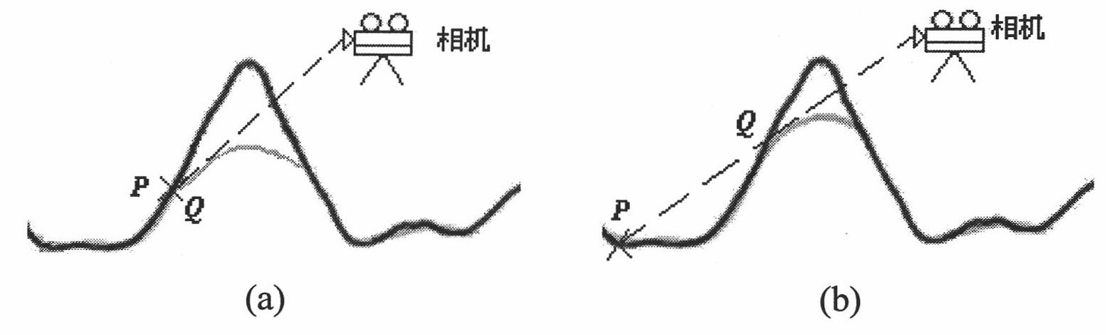
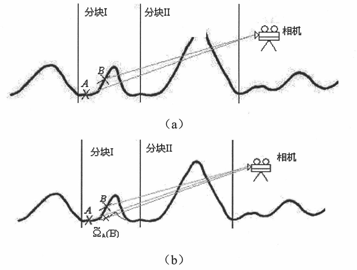
[0063] please see figure 1 , figure 2 , image 3 , Figure 4 , Figure 5 , Figure 6 Shown, the present invention a kind of generation method based on navigation interactive unoccluded three-dimensional topographic map, the specific steps of this method are implemented as follows:

[0064] Step 1: Divide the terrain into blocks according to the features of the terrain, and set the reference points on the features of interest to the user

[0065] (1) Terrain segmentation method—Using Morse theory to segment the terrain.

[0066] Morse theory is an effective tool for topological analysis of scalar fields. Assuming that f(x, y) is continuously derivable in the area D, for any point p, if the derivative of f in the x and y directions is 0, then p is a key point, that is, p is a maximum value point and a minimum value point Or saddle points, for terrain, correspond to peaks, valleys, or mountain passes, respectively.

[0067] If the determinant of the Hessian matrix at all...


PUM


Abstract

The invention relates to a navigation-based method for generating an interactive non-blocking three-dimensional topographic map, comprising three steps: 1, blocking terrain according to geomorphic features (such as raised mountains), setting reference points on the features in which a user is interested; 2, implementing sight tracking from features to view points, acquiring and calculating and updating deformation parameters in real time during the sight tracking course; and 3, reestablishing deformed terrain according to the deformation parameters. The non-blocking three-dimensional topographic map generated form the method can effectively eliminate the blocking on features the user interested in caused by complex terrain. The method takes view points, direction of observation, terrain and features the user interested in as input to directly deform a terrain model to generate the non-blocking three-dimensional topographic map. The method has good practical value and broad application prospect in the technical filed of space information.

Description

1. Technical field [0001] The invention relates to a method for generating an interactive unoccluded three-dimensional topographic map based on navigation, and belongs to the technical field of spatial information. 2. Background technology [0002] The virtual space environment based on 3D terrain has great application value in various commercial systems and scientific research fields. In navigation applications, platforms based on three-dimensional space environment navigation have greater advantages than traditional platforms that provide two-dimensional navigation maps. Because the 3D environment can make it easier for users to interpret, it hardly requires users to have the ability to interpret maps, so that users can more conveniently and quickly understand their current location, surrounding environment, and geographic information such as the location of the area of ​​interest. focus on tasks such as route finding, driving or travel decisions. [0003] At present, mo...

Claims


Application Information

Patent Timeline
Patent Type & Authority Applications(China)
IPC IPC(8): G06T17/05
Inventor 张立强邓浩
Owner BEIJING NORMAL UNIVERSITY
Why Eureka
Try Eureka