Global raster data storing method

A raster data, global technology, applied in the field of information storage, can solve the problems of difficult data organization and management, uneven distribution of pixel bottom surface position and size, the actual surface area of ​​data units, etc., to achieve the effect of easy organization and management, and reduce difficulty.

Inactive Publication Date: 2011-02-02
INST OF GEOGRAPHICAL SCI & NATURAL RESOURCE RES CAS
View PDF2 Cites 31 Cited by
  • Summary
  • Abstract
  • Description
  • Claims
  • Application Information

AI Technical Summary

Problems solved by technology

[0005] In order to solve the above-mentioned technical problems, an embodiment of the present invention provides a global raster data storage method to solve the problem of uneven distribution

Method used


Image

  • Global raster data storing method
  • Global raster data storing method
  • Global raster data storing method

Examples


Embodiment Construction

[0016] In order to enable those skilled in the art to better understand the technical solutions in the present invention, the following will clearly and completely describe the technical solutions in the embodiments of the present invention with reference to the accompanying drawings in the embodiments of the present invention. Obviously, the described The embodiments are only a part of the embodiments of the present invention, rather than all the embodiments. Based on the embodiments of the present invention, all other embodiments obtained by those of ordinary skill in the art shall fall within the protection scope of the present invention.

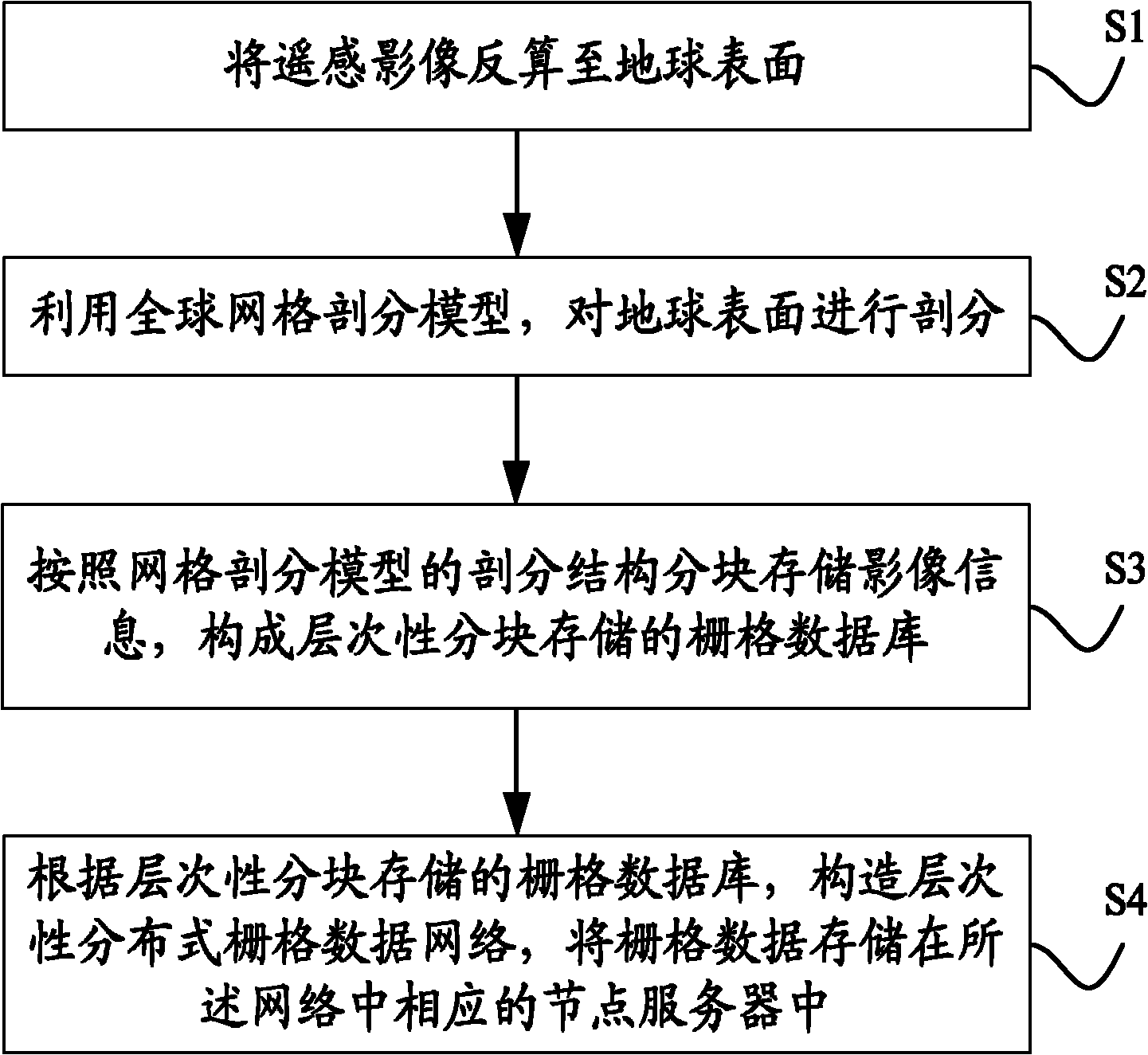
[0017] The present invention provides a global raster data storage method to solve the problems of uneven distribution of pixel bottom surface size and large difference in actual surface range corresponding to data units, and effectively reduce the difficulty of data organization and management.

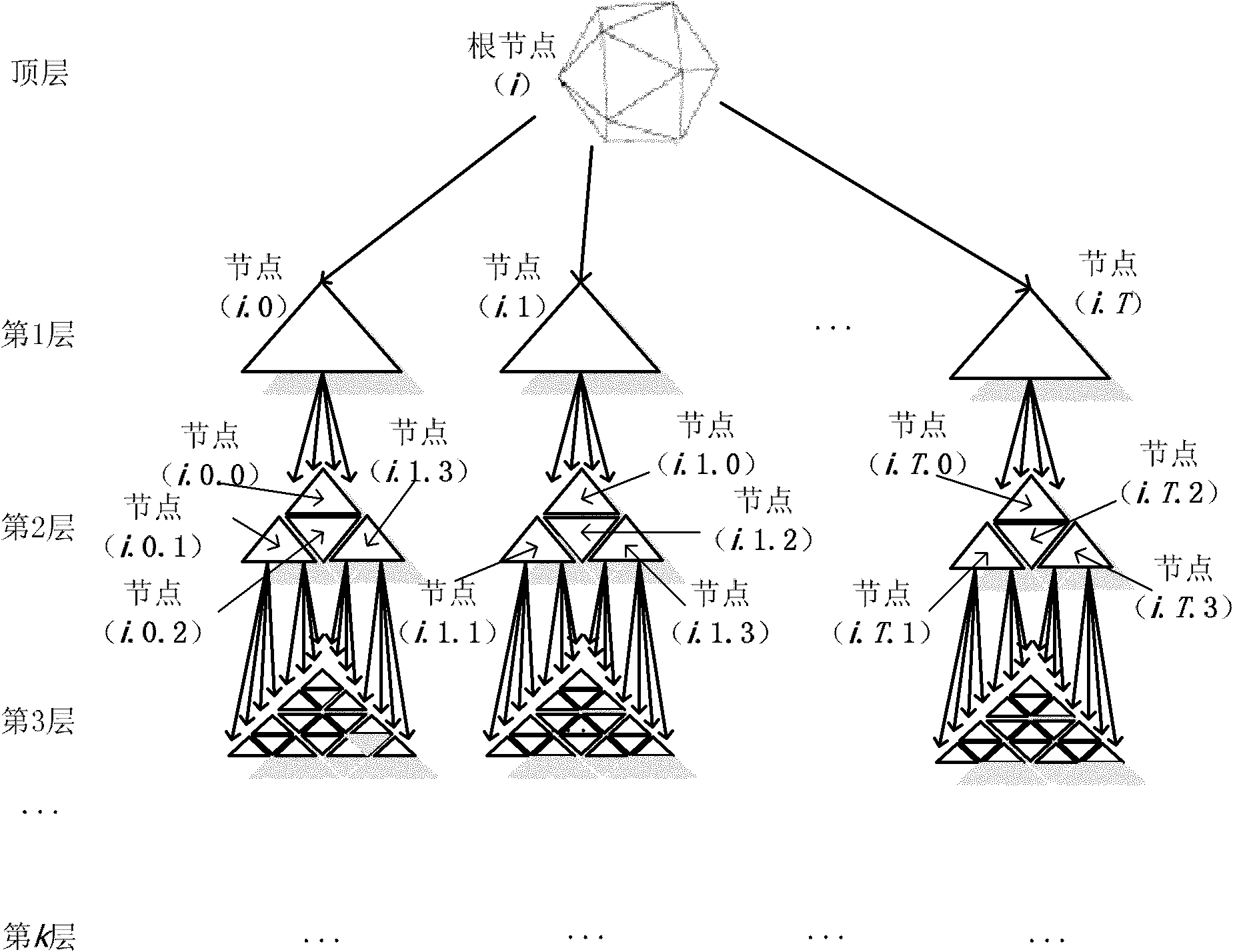
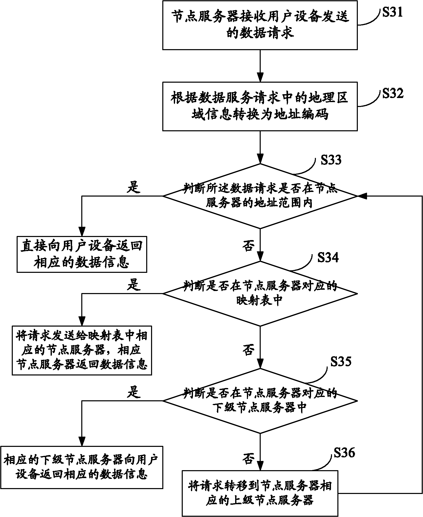
[0018] Such as figure 1 As shown, the global ...


PUM


Abstract

The invention discloses a global raster data storing method, which comprises the following steps of: reversely computing a remote sensing image to the earth surface; subdividing the earth surface by using a global raster subdivision model; storing the image information by blocks according to the subdivision structure of the raster subdivision model and constructing a hierarchical block-storage raster database; constructing a hierarchical block-storage raster data network according to the hierarchical block-storage raster database and storing the raster data into a corresponding node server ina network, wherein the hierarchical structure of the network corresponds to the hierarchical subdivision structure of the global raster subdivision model. In the invention, the space raster data are deployed into the corresponding node server in the network to form a hierarchical network topology structure which is easy to organize and manage, so that difficulties in data organization and management can be effectively reduced.

Description

Technical field [0001] The present invention relates to the technical field of information storage, in particular to a global raster data storage method. Background technique [0002] At present, geographic information system technology is facing challenges in the construction of massive spatial databases and the study of global or large regional issues. With the continuous launch of high-resolution sensors, remote sensing images with a resolution of up to 1 meter or even 0.6 meters have been put into the international commercial market. The remote sensing data received on the ground has gradually formed a global coverage of multiple resolutions, promoting multiple Internet releases. The emergence of massive global spatial data sets, such as global land and ocean elevation data (ETOPO5), GTOP30 elevation data, etc. [0003] Traditional spatial raster data is organized and managed by thematic hierarchical and sub-mapped frames. Spatial raster data is organized according to the map...

Claims


Application Information

Patent Timeline
IPC IPC(8): G06F17/30
Inventor 袁文庄大方袁武
Owner INST OF GEOGRAPHICAL SCI & NATURAL RESOURCE RES CAS
Why Eureka
Try Eureka