Method for acquiring surrounding road conditions by mobile terminal
A mobile terminal and road condition technology, which is applied to the arrangement of variable traffic indications, electrical components, transmission systems, etc., can solve the problems of road condition state color bar pause, long download delay, display, etc., and achieve data transmission flow reduction and processing speed The effect of improving and general ability
- Summary
- Abstract
- Description
- Claims
- Application Information
AI Technical Summary
Problems solved by technology
Method used
Image
Examples
Embodiment 1
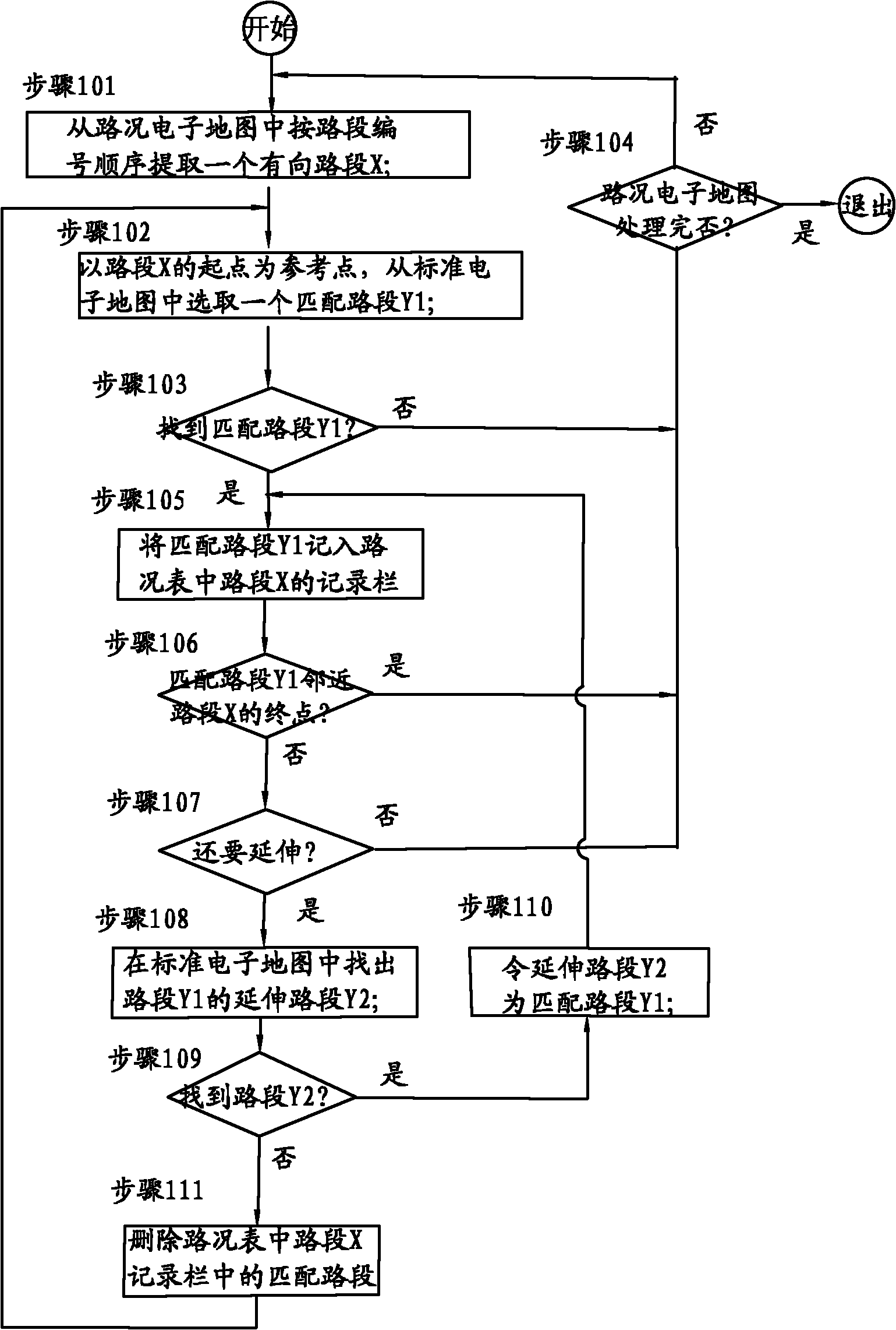
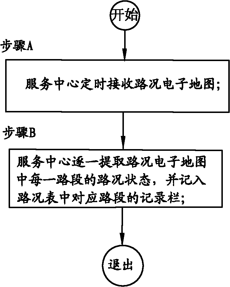
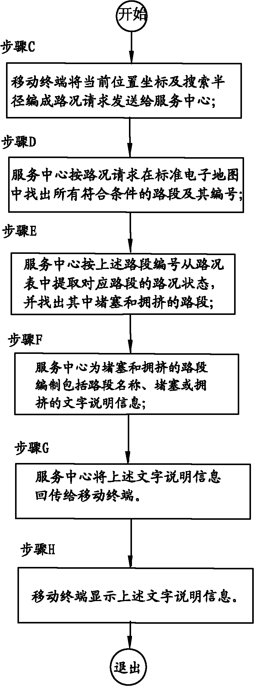
[0040]A simplified embodiment of the method for obtaining surrounding road conditions by a mobile terminal of the present invention is applicable to a region or a city. In this embodiment, the service center receives the road condition electronic map with real-time road condition information, and transfers the real-time road condition information to the road condition table. The road condition table is a road segment mapping table generated by the service center using its own standard electronic map service and the road condition electronic map. The service center responds to the requests of many mobile terminals through the wireless network, and provides them with real-time traffic service by using standard electronic maps and traffic tables. Each mobile terminal has the capability of GPS positioning or mobile communication base station positioning. Each road section in the standard electronic map used by the service center has its unique number and is attached with the name...
Embodiment 2
[0065] A preferred embodiment of the method for obtaining surrounding road conditions by a mobile terminal in the present invention is applicable to multiple cities. In this embodiment, the service center receives road condition electronic maps with real-time traffic condition information in multiple cities, and transfers the real-time traffic condition information to the corresponding city traffic condition table. The road condition table of each city is a road section mapping table generated by the service center using its own standard electronic map service and the city's traffic electronic map. The service center responds to the requests of many mobile terminals through the wireless network, and provides them with real-time traffic service by using standard electronic maps and traffic tables of multiple cities. Each mobile terminal is equipped with a standard electronic map, and has the ability to click on the standard electronic map for positioning or GPS positioning or m...
PUM
 Abstract
Description
Claims
Application Information
 - R&D
- Intellectual Property
- Life Sciences
- Materials
- Tech Scout
- Unparalleled Data Quality
- Higher Quality Content
- 60% Fewer Hallucinations
Browse by: Latest US Patents, China's latest patents, Technical Efficacy Thesaurus, Application Domain, Technology Topic, Popular Technical Reports.
© 2025 PatSnap. All rights reserved.Legal|Privacy policy|Modern Slavery Act Transparency Statement|Sitemap|About US| Contact US: help@patsnap.com


