Three-dimensional modeling method and system
A technology of three-dimensional model and construction method, applied in the field of GIS, can solve the problem of large amount of calculation of three-dimensional modeling data, and achieve the effect of reducing complexity and data volume
- Summary
- Abstract
- Description
- Claims
- Application Information
AI Technical Summary
Problems solved by technology
Method used
Image
Examples
Embodiment Construction
[0065] In order to make the above objects, features and advantages of the present invention more comprehensible, the present invention will be further described in detail below in conjunction with the accompanying drawings and specific embodiments.
[0066] Since in the case of a true earth display only part of the area is visible, some areas are outside the display window and some are on the back of the display. In this way, if these invisible places are still modeled, it is undoubtedly a waste of resources and a waste of modeling time. Therefore, the present invention divides the sphere of the earth into a plurality of regional blocks according to the principle of latitude and longitude, models the regional blocks to be displayed, and then stitches these displayed regional blocks to form a visually complete sphere.
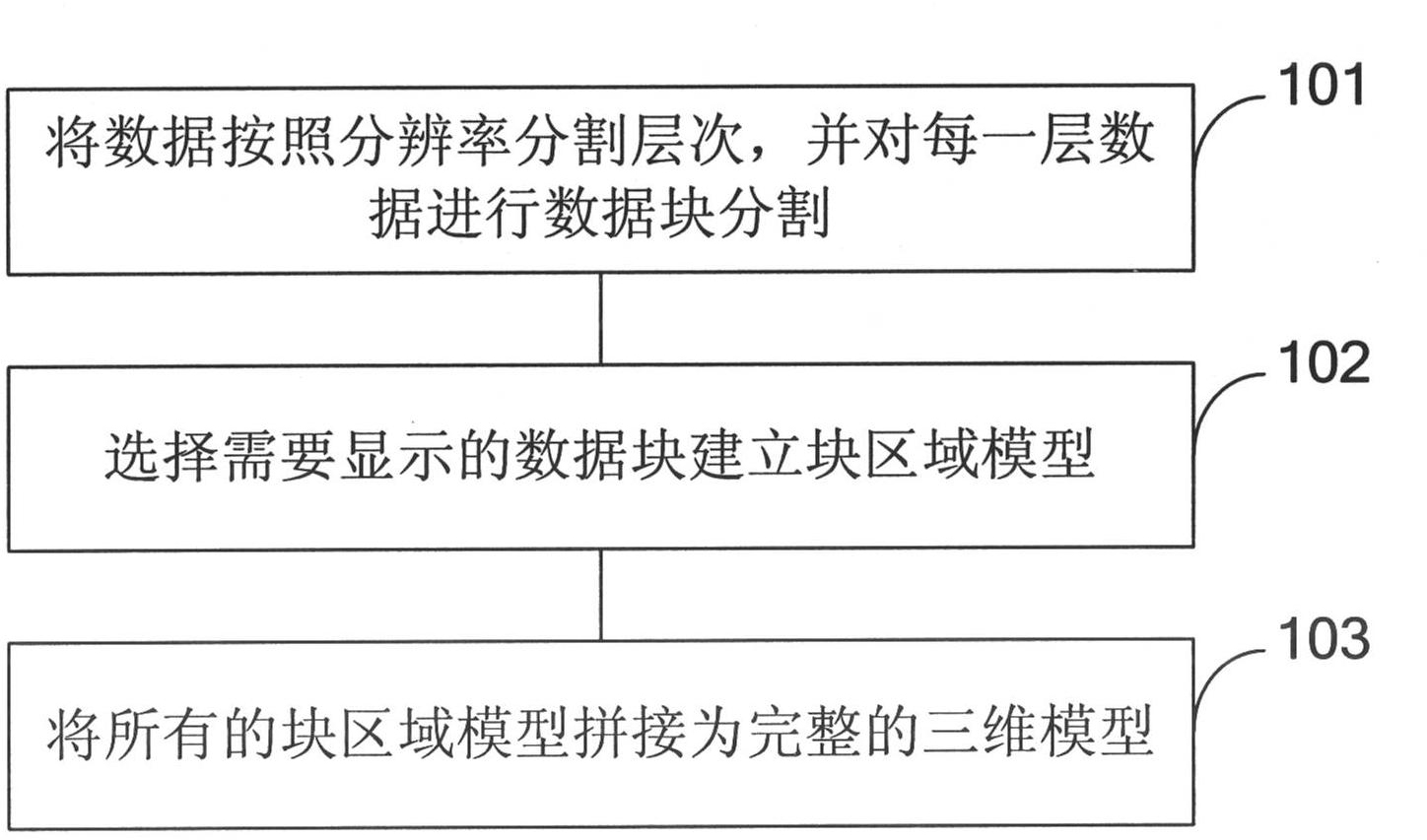
[0067] refer to figure 1 , shows a flowchart of a three-dimensional model construction method of the present invention.
[0068] Step 101, divide the data int...
PUM
 Abstract
Description
Claims
Application Information
 - R&D
- Intellectual Property
- Life Sciences
- Materials
- Tech Scout
- Unparalleled Data Quality
- Higher Quality Content
- 60% Fewer Hallucinations
Browse by: Latest US Patents, China's latest patents, Technical Efficacy Thesaurus, Application Domain, Technology Topic, Popular Technical Reports.
© 2025 PatSnap. All rights reserved.Legal|Privacy policy|Modern Slavery Act Transparency Statement|Sitemap|About US| Contact US: help@patsnap.com


